Understanding Fronts A 3 D grasp on fronts
- Slides: 50

Understanding Fronts A 3 -D grasp on fronts and frontal movements and cyclones

Air Masses ► An air mass is a defined as a large body of air with very similar characteristics. ► Generally speaking, air masses are generally defined by temperature and dewpoints (moisture parameters. ) ► Air masses are named based on the source region of the air mass itself

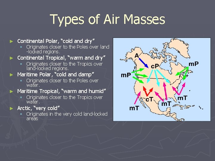
Types of Air Masses ► Continental Polar, “cold and dry” ► Continental Tropical, “warm and dry” ► Maritime Polar, “cold and damp” ► Maritime Tropical, “warm and humid” ► Arctic, “very cold” § Originates closer to the Poles over land -locked regions. § Originates closer to the Tropics over land-locked regions. § Originates closer to the Poles over water. § Originates closer to the Tropics over water. § Originates in the very cold land-locked areas

Analyzing Air Masses ► An air mass is most easily identified by comparing it to other air masses. ► Air masses can be modified with time, most notably by days of sunshine or lack thereof. ► Fronts are the dividing line between air masses so understanding air masses, means understanding where fronts are located.

What is a Front? ► Definition: A narrow transition zone, or boundary, between disparate synoptic scale air masses whose primary discontinuity is density. It is synoptic scale along the length of the front but mesoscale across the front itself. ► Commonly associated with. . § § § Moisture gradient Temperature gradient Wind shift Pressure Trough Convergent boundary

Rules for finding fronts Look for a strong temperature gradient. The front is located on the warm side of the sharpest gradient. ► Likewise, look for a strong dewpoint gradient. The front is located on the moist side of the sharpest gradient. ► Generally found in a pressure trough – look for three hour pressure changes. Fronts will show a decrease in pressure followed by a rapid increase in pressure after the frontal passage. ► Look for a sharp change in wind direction. A cyclonic shear in the wind direction usually indicates a frontal passage ► Check weather and cloud patterns that are usually associated with different kinds of fronts (more later on this. ) ►

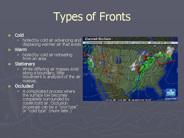
Types of Fronts ► Cold ► Warm ► Stationary ► Occluded § Noted by cold air advancing and displacing warmer air that exists. § Noted by cold air retreating from an area. § While differing air masses exist along a boundary, little movement is analyzed of the air masses. § A complicated process where the surface low becomes completely surrounded by cooler/cold air. Occlusion processes can be a “cool type” or “cold type” (more later. )

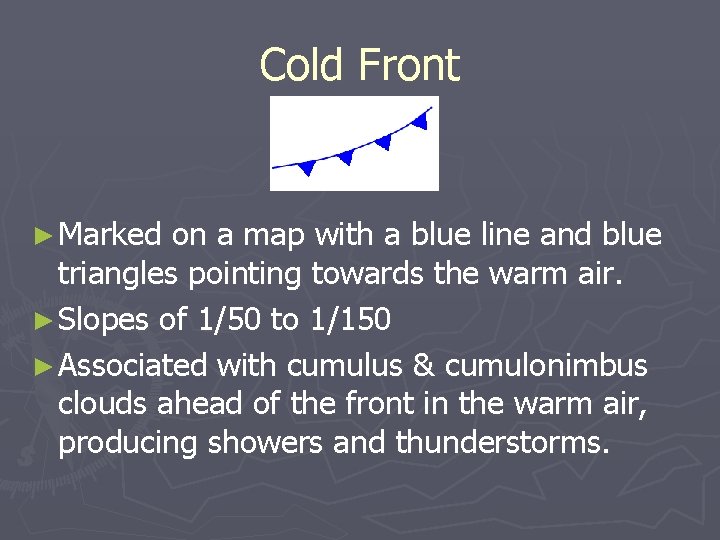
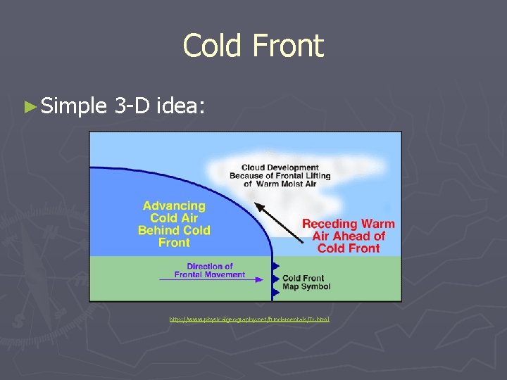
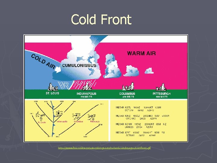
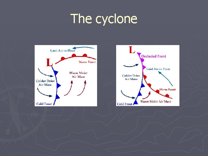
Cold Front ► Marked on a map with a blue line and blue triangles pointing towards the warm air. ► Slopes of 1/50 to 1/150 ► Associated with cumulus & cumulonimbus clouds ahead of the front in the warm air, producing showers and thunderstorms.

Cold Front ► Simple 3 -D idea: http: //www. physicalgeography. net/fundamentals/7 r. html

Cold Front http: //www. free-online-private-pilot-ground-school. com/images/cold-front. gif

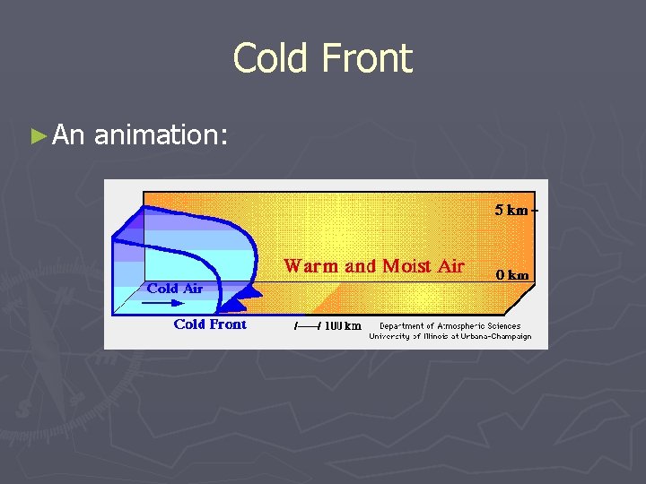
Cold Front ► An animation:

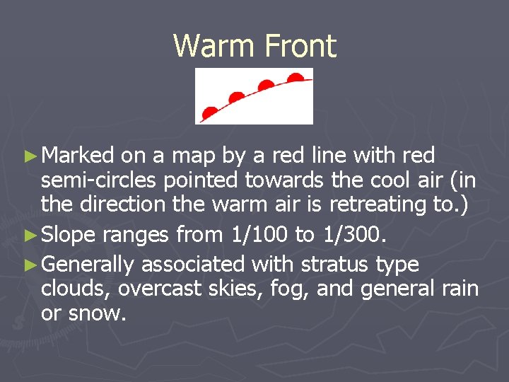
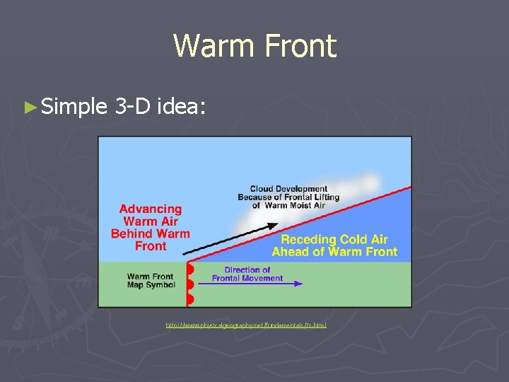
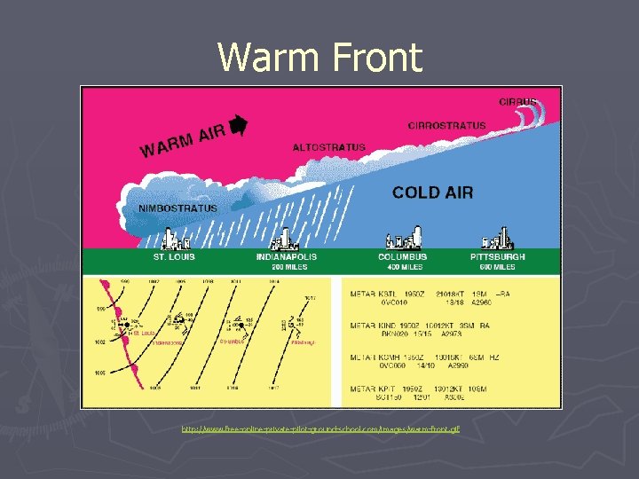
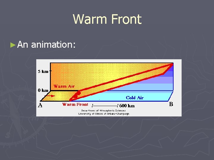
Warm Front ► Marked on a map by a red line with red semi-circles pointed towards the cool air (in the direction the warm air is retreating to. ) ► Slope ranges from 1/100 to 1/300. ► Generally associated with stratus type clouds, overcast skies, fog, and general rain or snow.

Warm Front ► Simple 3 -D idea: http: //www. physicalgeography. net/fundamentals/7 r. html

Warm Front http: //www. free-online-private-pilot-ground-school. com/images/warm-front. gif

Warm Front ► An animation:

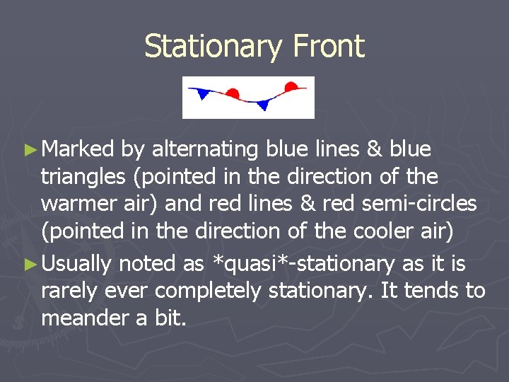
Stationary Front ► Marked by alternating blue lines & blue triangles (pointed in the direction of the warmer air) and red lines & red semi-circles (pointed in the direction of the cooler air) ► Usually noted as *quasi*-stationary as it is rarely ever completely stationary. It tends to meander a bit.

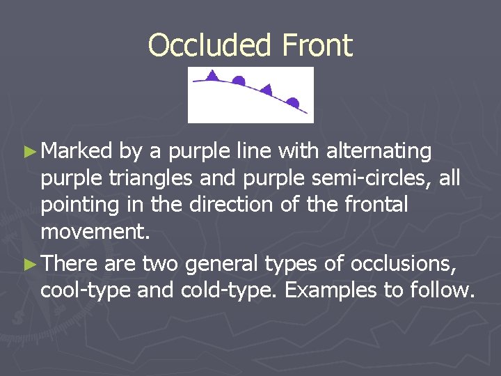
Occluded Front ► Marked by a purple line with alternating purple triangles and purple semi-circles, all pointing in the direction of the frontal movement. ► There are two general types of occlusions, cool-type and cold-type. Examples to follow.

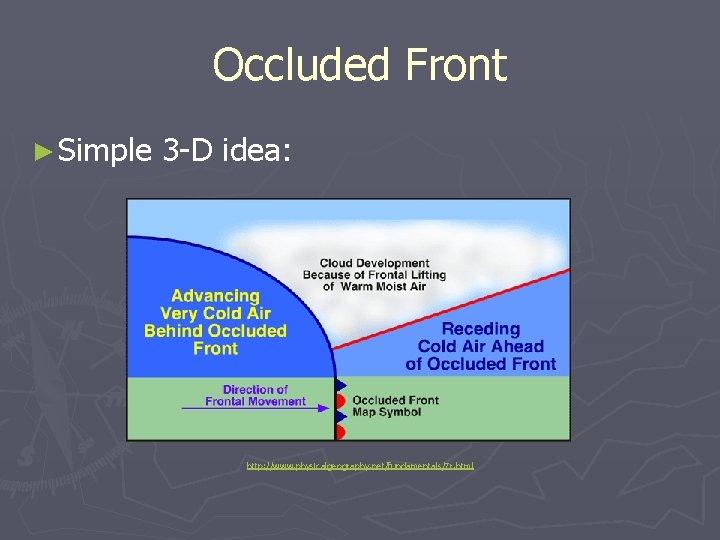
Occluded Front ► Simple 3 -D idea: http: //www. physicalgeography. net/fundamentals/7 r. html

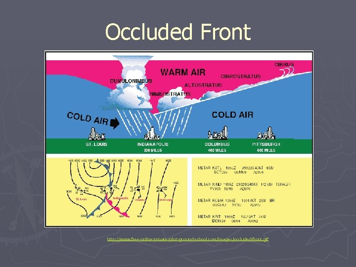
Occluded Front http: //www. free-online-private-pilot-ground-school. com/images/occluded-front. gif

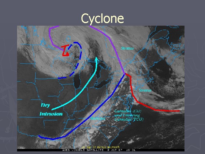
Cyclones: Putting it all together ► There are two types of cyclones, tropical/warm core and extratropical/cold core. ► Extratropical cyclones are characterized by having differing air masses frontal movements where tropical cyclones do not. ► We will concern ourselves with extratropical cyclones in this presentation.

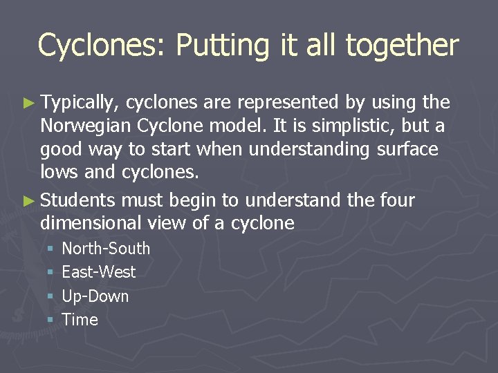
Cyclones: Putting it all together ► Typically, cyclones are represented by using the Norwegian Cyclone model. It is simplistic, but a good way to start when understanding surface lows and cyclones. ► Students must begin to understand the four dimensional view of a cyclone § § North-South East-West Up-Down Time

The cyclone

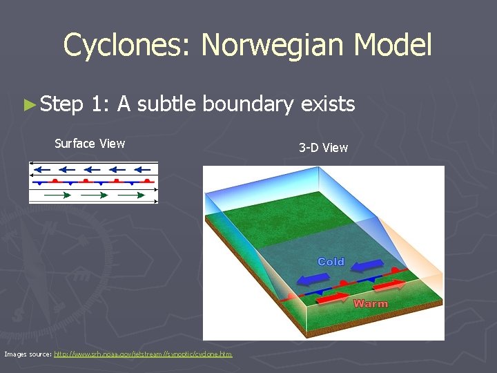
Cyclones: Norwegian Model ► Step 1: A subtle boundary exists Surface View Images source: http: //www. srh. noaa. gov/jetstream//synoptic/cyclone. htm 3 -D View

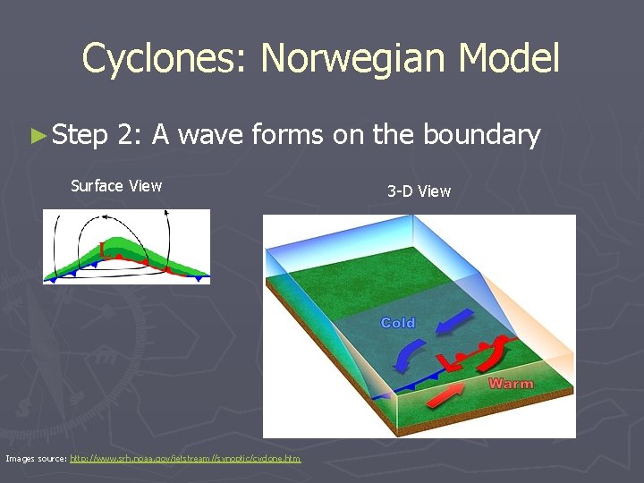
Cyclones: Norwegian Model ► Step 2: A wave forms on the boundary Surface View Images source: http: //www. srh. noaa. gov/jetstream//synoptic/cyclone. htm 3 -D View

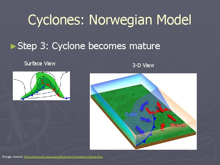
Cyclones: Norwegian Model ► Step 3: Cyclone becomes mature Surface View Images source: http: //www. srh. noaa. gov/jetstream//synoptic/cyclone. htm 3 -D View

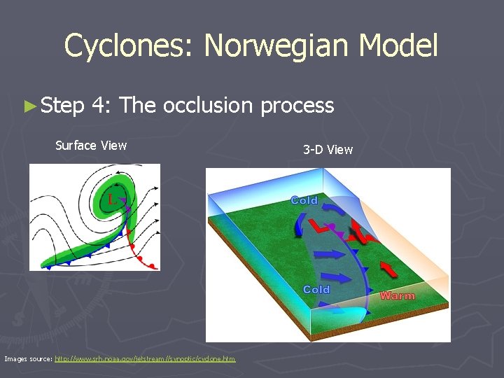
Cyclones: Norwegian Model ► Step 4: The occlusion process Surface View Images source: http: //www. srh. noaa. gov/jetstream//synoptic/cyclone. htm 3 -D View

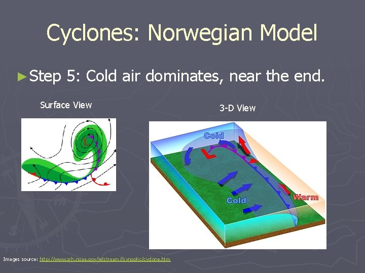
Cyclones: Norwegian Model ► Step 5: Cold air dominates, near the end. Surface View Images source: http: //www. srh. noaa. gov/jetstream//synoptic/cyclone. htm 3 -D View

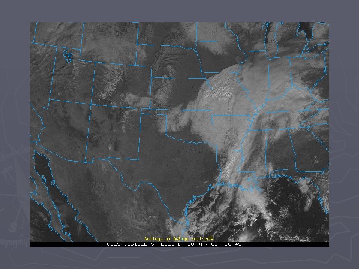
Cyclone: On satellite

Cyclone

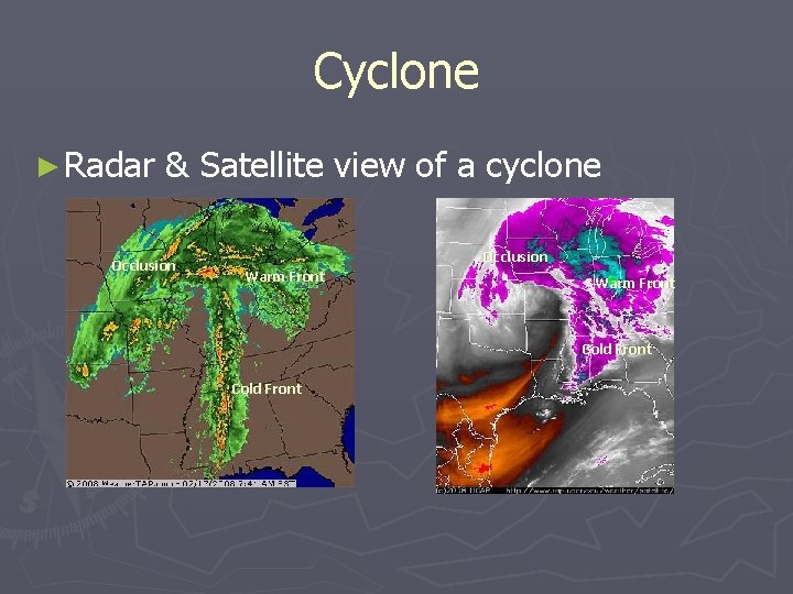
Cyclone ► Radar & Satellite view of a cyclone Occlusion Warm Front Cold Front

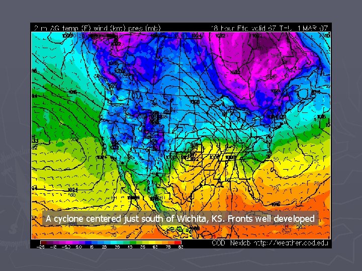
A cyclone centered just south of Wichita, KS. Fronts well developed

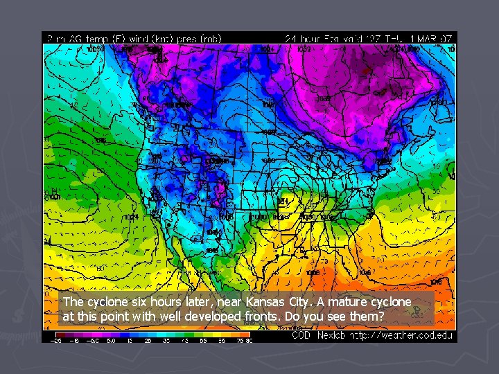
The cyclone six hours later, near Kansas City. A mature cyclone at this point with well developed fronts. Do you see them?

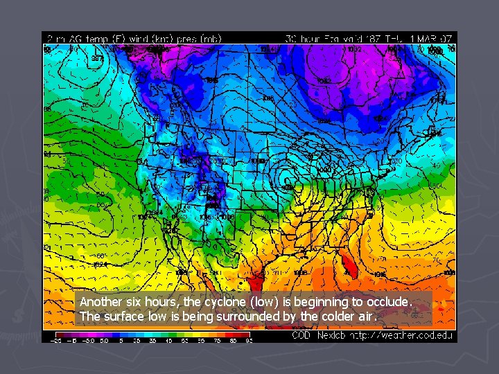
Another six hours, the cyclone (low) is beginning to occlude. The surface low is being surrounded by the colder air.

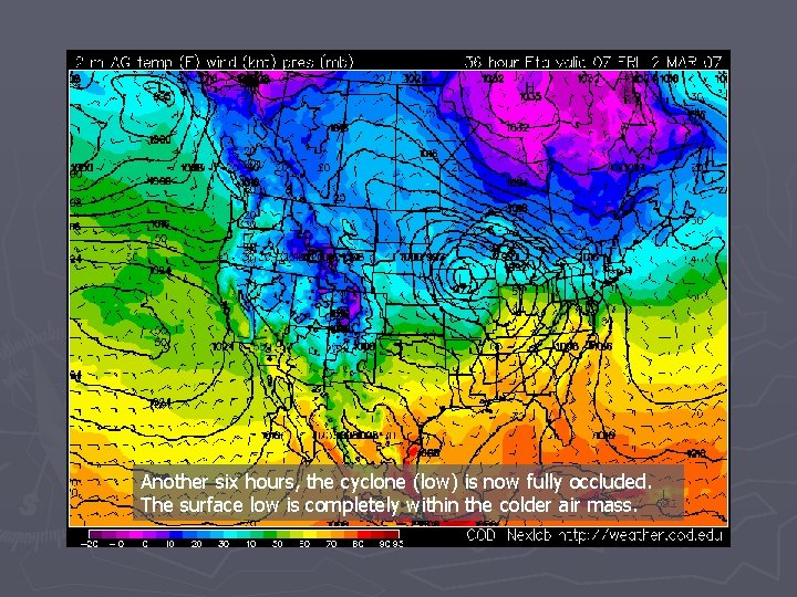
Another six hours, the cyclone (low) is now fully occluded. The surface low is completely within the colder air mass.

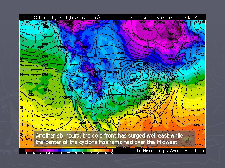
Another six hours, the cold front has surged well east while the center of the cyclone has remained over the Midwest.

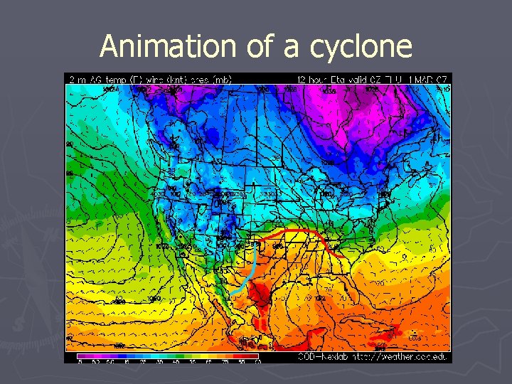
Animation of a cyclone

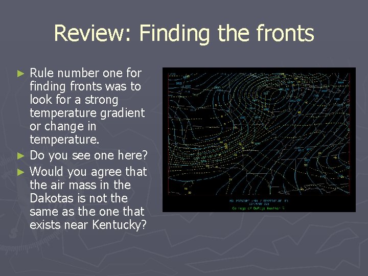
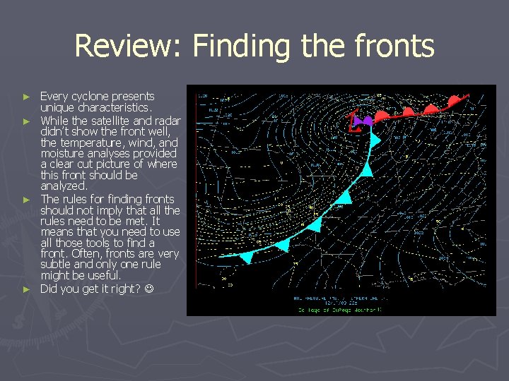
Review: Finding the fronts Rule number one for finding fronts was to look for a strong temperature gradient or change in temperature. ► Do you see one here? ► Would you agree that the air mass in the Dakotas is not the same as the one that exists near Kentucky? ►

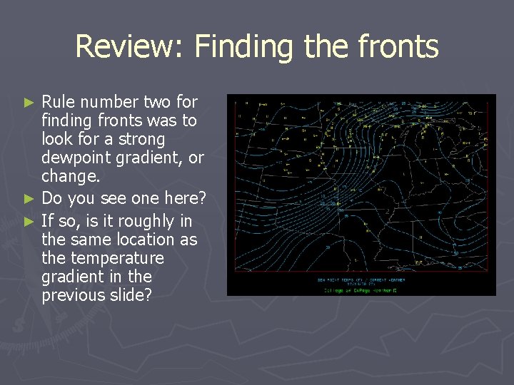
Review: Finding the fronts Rule number two for finding fronts was to look for a strong dewpoint gradient, or change. ► Do you see one here? ► If so, is it roughly in the same location as the temperature gradient in the previous slide? ►

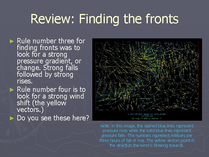
Review: Finding the fronts Rule number three for finding fronts was to look for a strong pressure gradient, or change. Strong falls followed by strong rises. ► Rule number four is to look for a strong wind shift (the yellow vectors. ) ► Do you see these here? ► Note: in this image, the dashed blue lines represent pressure rises while the solid blue lines represent pressure falls. The numbers represent millibars per three hours of fall or rise. The yellow vectors point in the direction the wind is blowing towards.

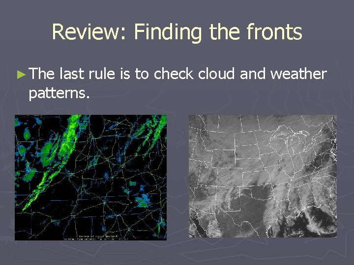
Review: Finding the fronts ► The last rule is to check cloud and weather patterns.

Review: Finding the fronts Every cyclone presents unique characteristics. ► While the satellite and radar didn’t show the front well, the temperature, wind, and moisture analyses provided a clear cut picture of where this front should be analyzed. ► The rules for finding fronts should not imply that all the rules need to be met. It means that you need to use all those tools to find a front. Often, fronts are very subtle and only one rule might be useful. ► Did you get it right? ►

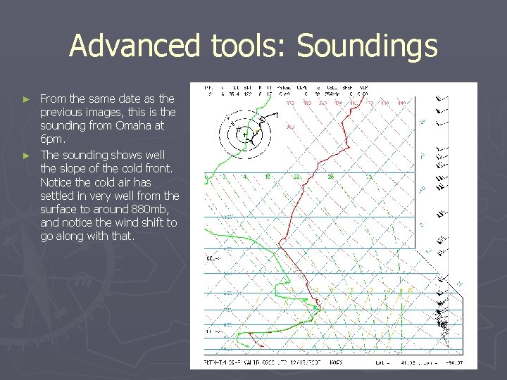
Advanced tools: Soundings From the same date as the previous images, this is the sounding from Omaha at 6 pm. ► The sounding shows well the slope of the cold front. Notice the cold air has settled in very well from the surface to around 880 mb, and notice the wind shift to go along with that. ►

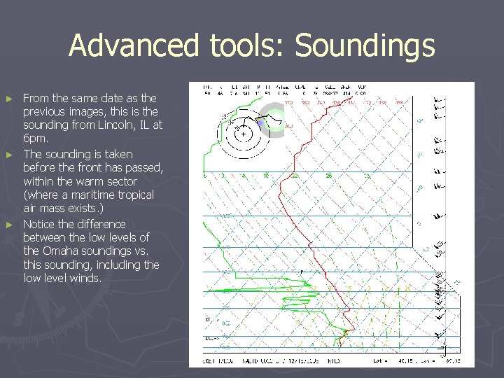
Advanced tools: Soundings From the same date as the previous images, this is the sounding from Lincoln, IL at 6 pm. ► The sounding is taken before the front has passed, within the warm sector (where a maritime tropical air mass exists. ) ► Notice the difference between the low levels of the Omaha soundings vs. this sounding, including the low level winds. ►

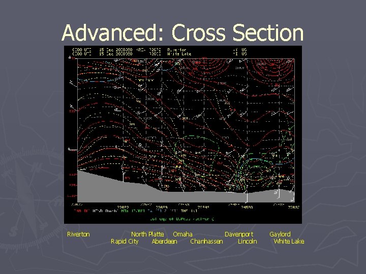
Advanced: Cross Section Riverton North Platte Omaha Davenport Rapid City Aberdeen Chanhassen Lincoln Gaylord White Lake

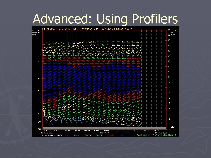
Advanced: Using Profilers

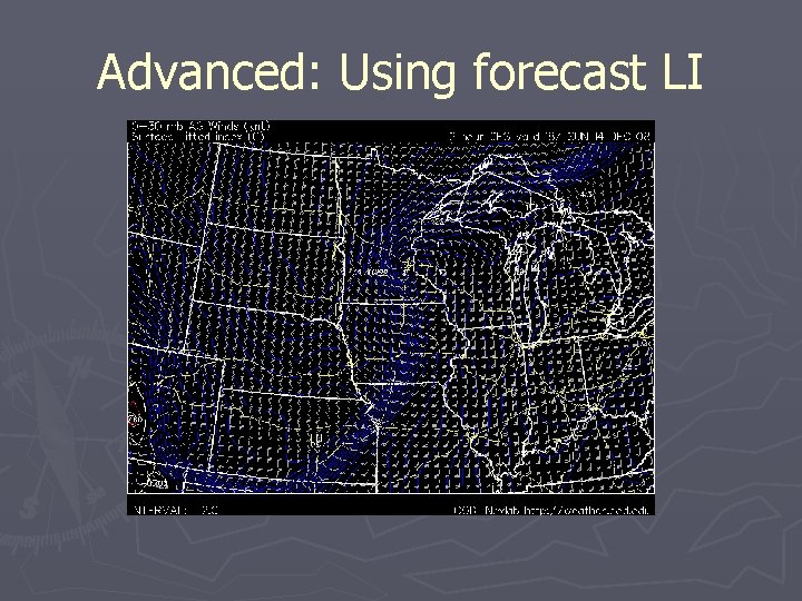
Advanced: Using forecast LI

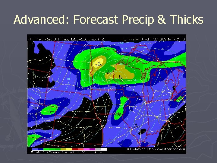
Advanced: Forecast Precip & Thicks

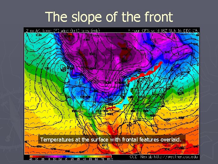
The slope of the front Temperatures at the surface with frontal features overlaid.

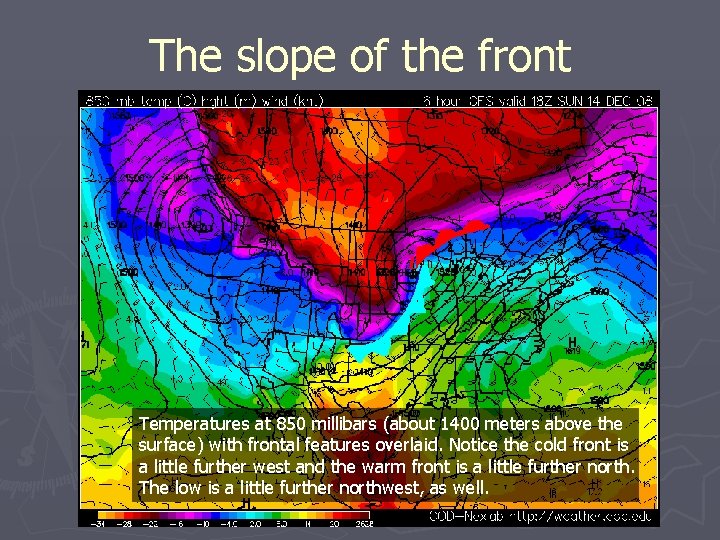
The slope of the front Temperatures at 850 millibars (about 1400 meters above the surface) with frontal features overlaid. Notice the cold front is a little further west and the warm front is a little further north. The low is a little further northwest, as well.

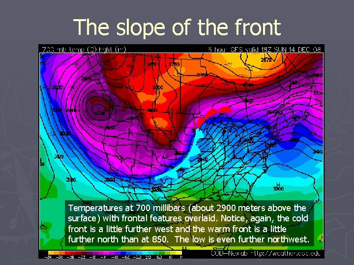
The slope of the front Temperatures at 700 millibars (about 2900 meters above the surface) with frontal features overlaid. Notice, again, the cold front is a little further west and the warm front is a little further north than at 850. The low is even further northwest.