UNCLASSIFIED Joint Typhoon Warning Center TDO Satellite Reconnaissance
- Slides: 13

UNCLASSIFIED Joint Typhoon Warning Center TDO Satellite Reconnaissance Requirements UNCLASSIFIED

UNCLASSIFIED TDO Sat Recon Reqmt’s • Purpose of TC Satellite Reconnaissance • Reconnaissance imagery requirements • Use of TC fixes in the warning process • Ways to improve fix usefulness UNCLASSIFIED

UNCLASSIFIED Purpose of TC Sat Recon To assist the Typhoon Duty Officer in determining the position and estimated intensity of the tropical cyclone at a point in time UNCLASSIFIED

UNCLASSIFIED Recon Imagery Requirements • Imagery used in support of JTWC warnings must: – Have sufficient resolution to discern the important meteorological features • </= 1. 5 km visible • </= 5 km infrared • </= 15 km microwave – Be precisely geo-navigated (each pixel tied to a specific lat/lon point relative to the earth’s surface) to provide accurate position information UNCLASSIFIED

UNCLASSIFIED Use in the Warning Process • The TDO has the following order of precedence: – Fixes within the warning window • 1 hour before to 1/2 hour after warning valid time • What does this mean EXACTLY? – For a 00 Z warning, use imagery from 23 Z to 0030 Z – For a 06 Z warning, use imagery from 05 Z to 0630 Z – For a 12 Z warning, use imagery from 11 Z to 1230 Z – For a 18 Z warning, use imagery from 17 Z to 1830 Z UNCLASSIFIED

UNCLASSIFIED Use in the Warning Process • TDO has the following order of precedence (continued) – NOTE: the imagery must be processed and available (in SDHS or SIDAS) for your fix in time to complete and transmit the fix NLT 30 minutes later • What does this mean EXACTLY? – For a 00 Z warning, send fix NLT 0100 Z – For a 06 Z warning, send fix NLT 0700 Z – For a 12 Z warning, send fix NLT 1300 Z – For a 18 Z warning, send fix NLT 1900 Z UNCLASSIFIED

UNCLASSIFIED Use in the Warning Process • TDO has the following order of precedence (continued) – Platform desirability (whether in or out of warning window): • • • DMSP high-res visible/infrared GMS-5 METEOSAT-5/7 NOAA All other METSAT sources (TRMM, etc) – Fixes outside the warning window UNCLASSIFIED

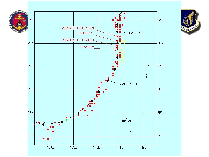
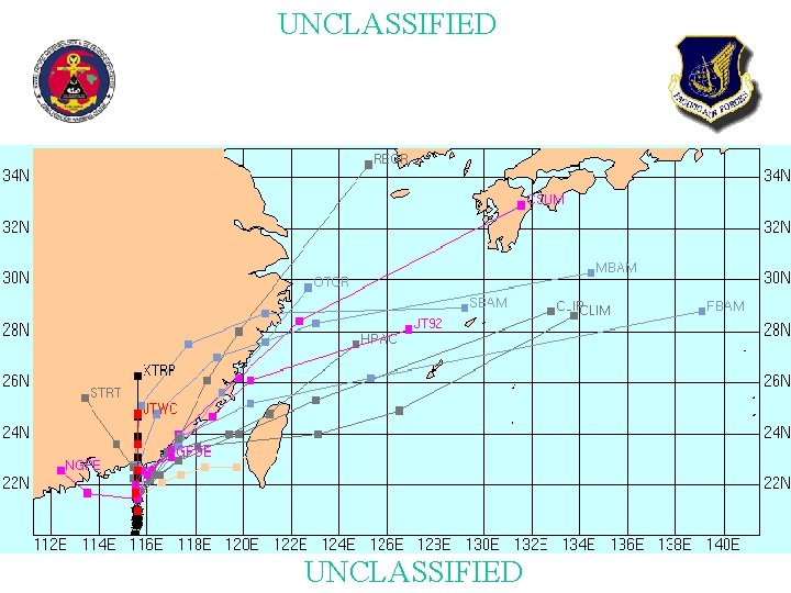
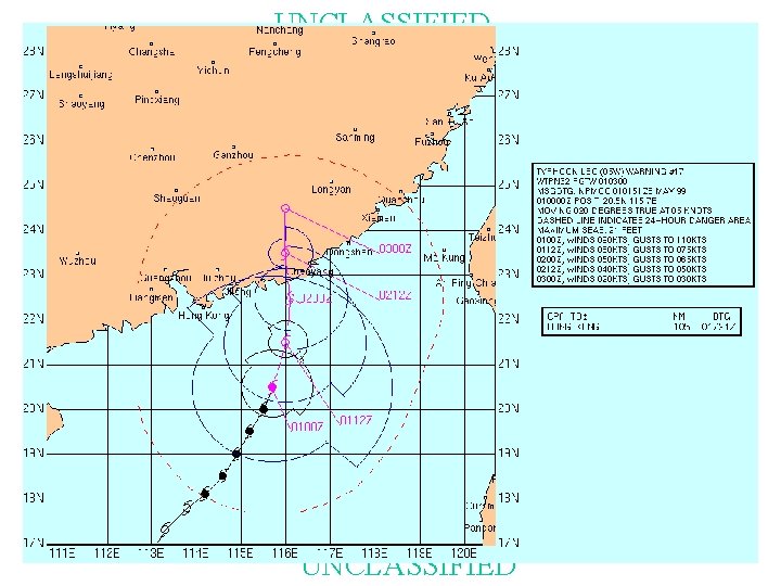
UNCLASSIFIED Use in the warning process, continued • Feeds in to – Objective best track – Synthetic vortex (bogus) insertion – Numerical model guidance (persistence) – Current warning position and intensity UNCLASSIFIED

UNCLASSIFIED

UNCLASSIFIED

UNCLASSIFIED

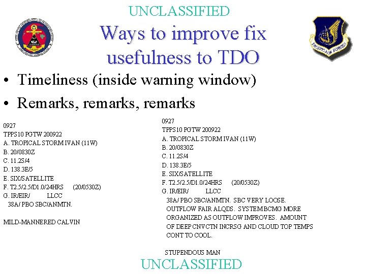
UNCLASSIFIED Ways to improve fix usefulness to TDO • Timeliness (inside warning window) • Remarks, remarks 0927 TPPS 10 PGTW 200922 A. TROPICAL STORM IVAN (11 W) B. 20/0830 Z C. 11. 2 S/4 D. 138. 3 E/5 E. SIX/SATELLITE F. T 2. 5/D 1. 0/24 HRS (20/0530 Z) G. IR/EIR/ LLCC 38 A/ PBO SBC/ANMTN. MILD-MANNERED CALVIN 0927 TPPS 10 PGTW 200922 A. TROPICAL STORM IVAN (11 W) B. 20/0830 Z C. 11. 2 S/4 D. 138. 3 E/5 E. SIX/SATELLITE F. T 2. 5/D 1. 0/24 HRS (20/0530 Z) G. IR/EIR/ LLCC 38 A/ PBO SBC/ANMTN. SBC VERY LOOSE. OUTFLOW FAIR ALQDS. SYSTEM BCMG MORE ORGANIZED AS OUTFLOW IMPROVES. AMOUNT OF DEEP CNVCTN INCRSG AND CLOUD TOP TEMPS CONT TO COOL. STUPENDOUS MAN UNCLASSIFIED

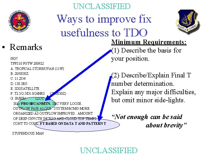
UNCLASSIFIED Ways to improve fix usefulness to TDO • Remarks 0927 TPPS 10 PGTW 200922 A. TROPICAL STORM IVAN (11 W) B. 20/0830 Z C. 11. 2 S/4 D. 138. 3 E/5 E. SIX/SATELLITE F. T 2. 5/D 1. 0/24 HRS (20/0830 Z) G. IR/EIR/ LLCC 38 A/ PBO SBC/ANMTN. SBC VERY LOOSE. OUTFLOW FAIR ALQDS. SYSTEM BCMG MORE ORGANIZED AS OUTFLOW IMPROVES. AMOUNT OF DEEP CNVCTN INCRSG AND CLOUD TOP TEMPS CONT TO COOL. FT BASED ON DATA T AND PATTERN T Minimum Requirements: (1) Describe the basis for your position. (2) Describe/Explain Final T number determination. Explain any major difficulties, but omit minor side-lights. “Not enough can be said about brevity” STUPENDOUS MAN UNCLASSIFIED