Types of Maps Political w Political maps show


- Slides: 16
Types of Maps
Political w Political maps show people have divided places on the Earth into countries, states, cities and other units for the purpose of governing them.
Political Maps w Usually colored by country or by state w Colors make it easy to compare size, shape, and location w Symbols make it easy to tell capitals from other cities w Political maps also name certain physical features, such as rivers and lakes
World Political Map
Physical Map w Physical maps show what the surface of the Earth looks like.
Physical Map w Colors that make natural patterns stand out w Colors stand for types of vegetation, mountain, and natural features w Names of big natural features are easy to see w Physical maps also include some political information, such as boundaries
Physical Maps w There are different types of physical maps. • Relief Maps – Show the difference in height between land • Elevation Maps – Show the elevation, or height above sea level.
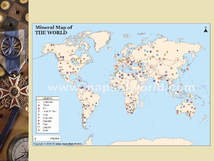
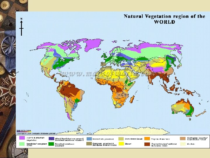
Special Purpose Maps These maps show many different things. Sometimes called Thematic Maps. Examples are: w Land form w Climate w Agricultural w Natural Resources w Population Density
Contour / Topographic Contour lines represent the elevation at that line. w Shows land elevation w Contour lines-one line for each major level of elevation w If lines are close together, surface is steep w If lines are far apart, surface is flat or rises slowly
Contour map
Topographic Map
Types of Maps 1. 2. 3. 4. 5. 6. This map represents a small area with lots of detail. It has contour lines as well as natural and man-made features. ________ This map uses colors to show height above sea level. ______________ These colorful maps show lines that people use to divide countries and states. They also show major cities. ___________ These maps show physical features on the Earth like rivers, mountains, and deserts. ______________ These maps show land is being used. For example, they might show which crops are being grown or what animals are being raised. _____________ These maps show climate regions. __________
Navigation Maps w Road or street maps w Navigation/GPS w Nautical Charts
Historical Maps w Shows how a historical event affected an area