Types of Maps Physical maps The maps in


- Slides: 17
Types of Maps
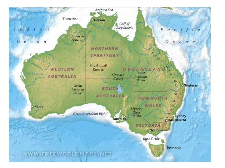
Physical maps • The maps in an atlas are often labelled with physical (that is, natural) features. These maps show features such as rivers, mountains, plains and lakes
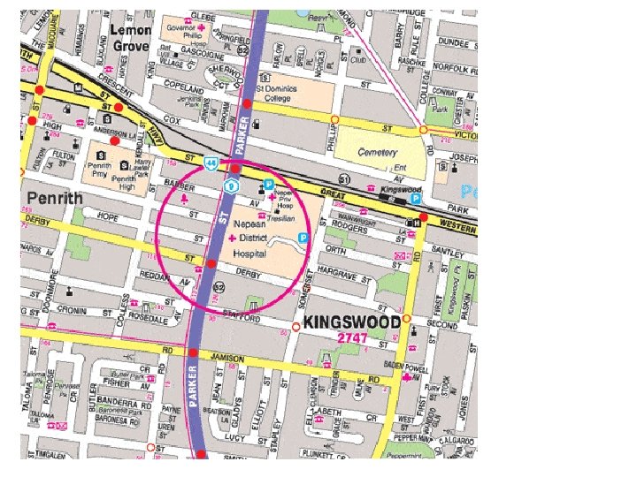
Street maps: • Show parts of a city or town • Show features such as schools, religious buildings, and major landmarks • Grid lines are drawn over street maps so that the location of features can be easily recorded and found
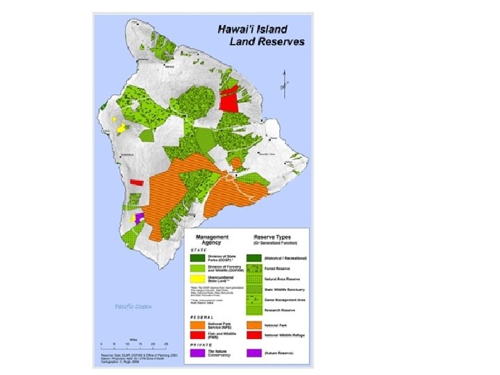
Thematic maps: • Atlases contain maps that are intended to illustrate particular themes • May show annual rainfall, ethnic groups or the oil resources of a region or the whole world
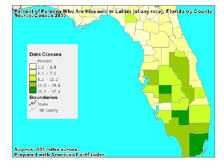
Choropleth maps: • Use shadings or colour to show the average density or concentration of a particular feature in an area. • Some of the many features choropleth maps can show include: – Differences in a continent’s population density – Percentage of a city’s population born overseas – Access to safe water throughout the world
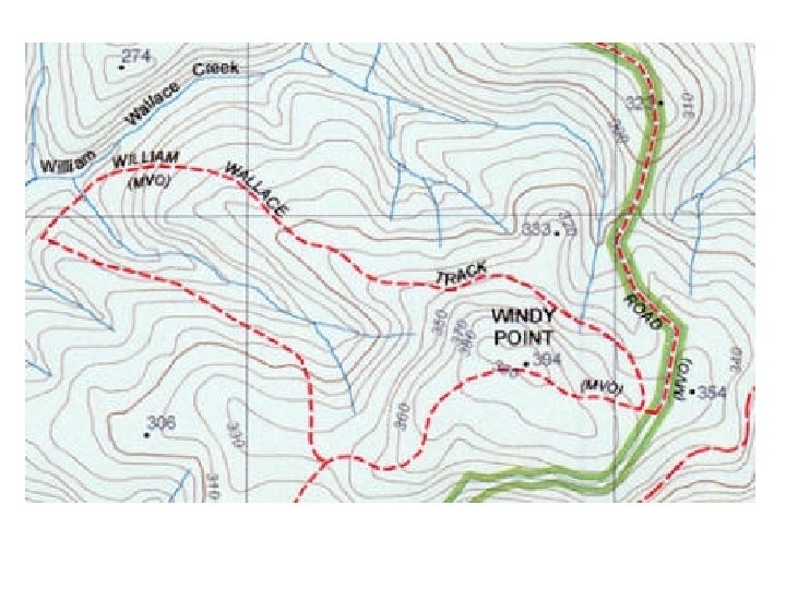
Topographic maps: • Show natural features of an area: the height and slope of the land the location of rivers, wetlands and vegetation • The pattern of the contours provides information about the shape of the land • Contour intervals show the difference in elevation represented by each contour line • Topographic maps also show human features such as transport links, towns and farmhouses
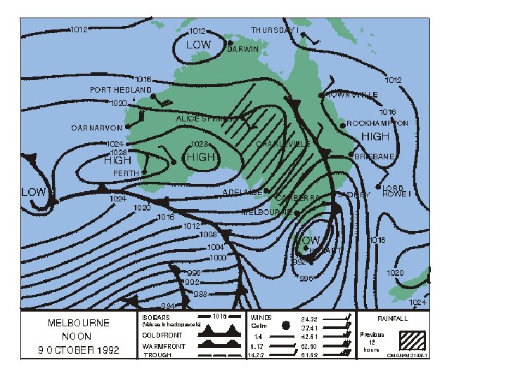
Weather maps: • Display the weather condition over particular areas of the earth at a stated time • Show air pressure, wind direction and strength, and rainfall (if any) in the previous twenty-four hours • Allow predictions of future weather to be made
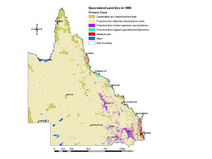
Landuse maps: • Show human activities/ how humans use the land, in a particular area
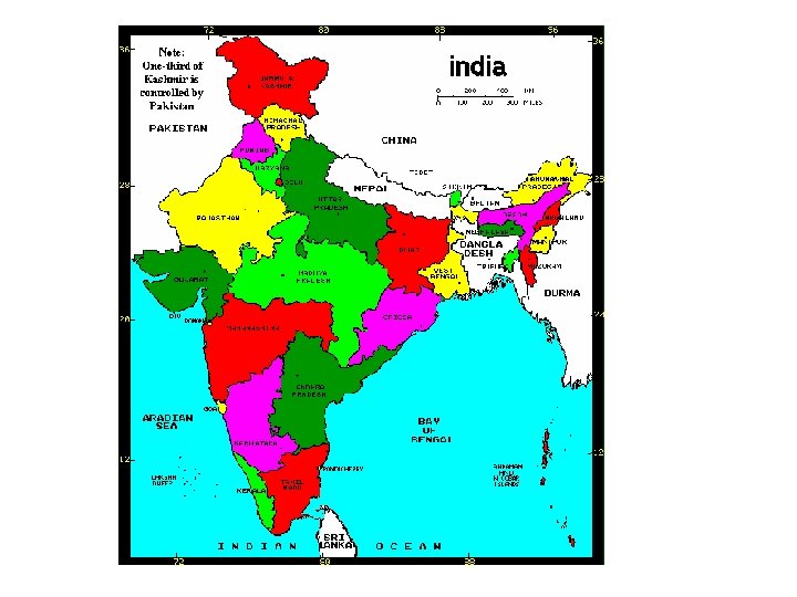
Political maps: • Used in the study of political areas such as countries and local government areas • Political maps can usually be identified by the following specific features. – Political areas are usually shaded in different colours – Name of each political area is given – Boundaries of political areas are given a distinctive colour or symbol, such as a red line – Names of places where administration is based are shown