Types of maps Mindmap 1 Eight types of


- Slides: 22
Types of maps
Mindmap 1 Eight types of maps and their uses in tourism 2 Electronic maps (4 types) 3 Other ICT in tourism (Information Communication Technology)
Maps show the following A map usually has a title which describes what the map show. The places on the map, such as names of towns and cities are usually labelled. Lines of latitude and longitude give the position of the area relative to the globe The scale tells you how many centimetres on the ground are represented by one centimetre on the map. The scale also gives you an idea of the size of the area that is shown
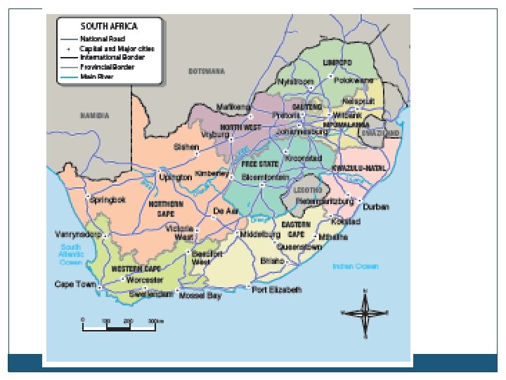
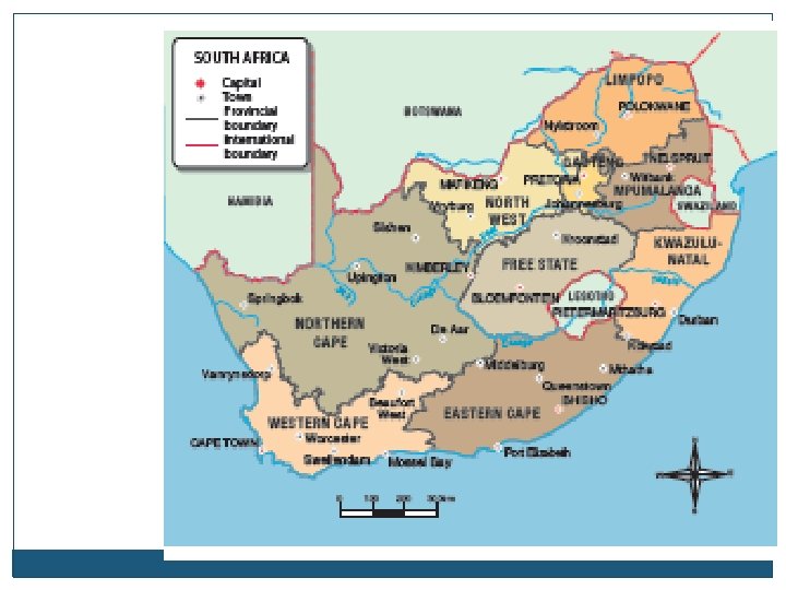
1. 1 General reference maps Cover an area such as a continent or country Include maps that focus on a specific theme in a specific are e. g. population distribution in SA Uses: Valuable source of general information about an area to tourists Information may features such as roads, railway, dams. Type of map Example Explanation Uses and value in Tourism General Reference maps South Africa Map showing a specific theme of an area Tourist can get a general idea of where the county or area is located on the map / general information
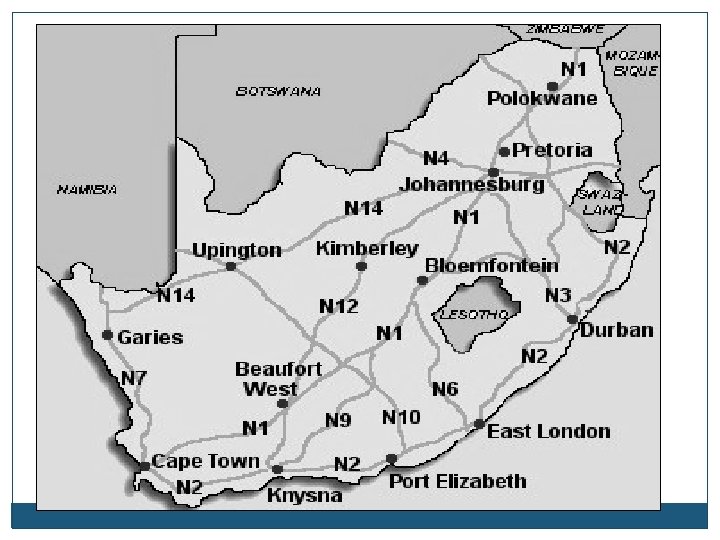
1. 2 Road maps Useful maps for tourists because they indicate the roads that connect towns and cities. Indicate distance between towns and cities Useful: easy to work out the time between destinations Type of map Example Explanation Uses and value in Tourism Road maps Roads leading to Kimberley Give details regarding roads leading to a specific city/ area Tourists can work out the travelling time and the route they want to follow / distance between cities
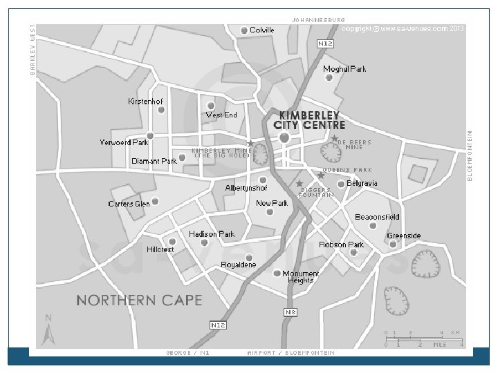
1. 3 Street maps Details regarding street plans of a specific town Show features like tourist attractions, hotels, shopping areas Useful to tourists for finding their way around the town Type of map Example Explanation Uses and value in Tourism Street maps Streets in Kimberley city centre Give details regarding street plans for a specific city and the attractions in the city It is easier to find their way around the areas and to allocate specific attractions in the area. / show where is he hotel
1. 4 Political maps These maps show the location of the borders of countries, states and provinces Help tourists who plan to travel across borders, show where the destinations are located in relation to each other. Type of map Example Explanation Uses and value in Tourism Political maps Southern African map Show locations and borders of countries , states , provinces Tourist can plan their routes if they want to cross borders and find the gateways
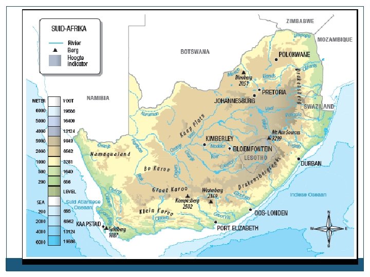
1. 5 Physical maps Show natural and man-made features of an area. Include climate regions, mountains, vegetation and rivers. Use different colours to show the relief. Type of map Example Explanation Uses and value in Tourism Physical maps Map of SA showing all the rivers Show natural and manmade physical features, e. g. climate regions, vegetation and rivers, different colours are used. Tourists can see whether they are crossing a mountain or river, darker colours on the map can show the height above sea level. They can see the climate for the region and will know what to pack for the trip
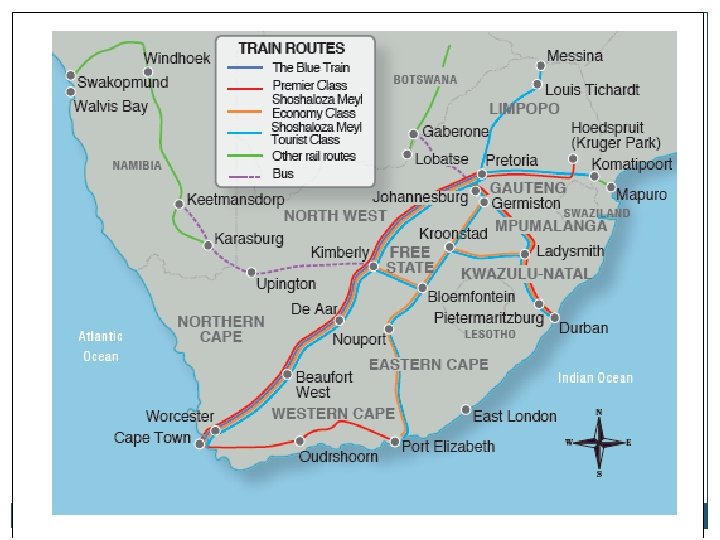
1. 6 Specialist maps Show specific, specialised information such as climate or the location of airports. The tourists use these maps to find information regarding their destinations Type of map Example Specialist Map of the s maps train routes in SA Explanation Uses and value in Tourism Show specific information e. g. communication, airlines, climate Tourists can use these maps to find specific information regarding their trip e. g. where to find the airports
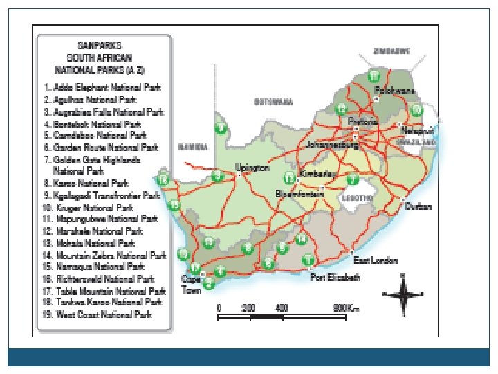
1. 7 Tourist information maps Specific information regarding an area Show features like national parks, World Heritage sites, shops etc. Type of map Example Explanation Uses and value in Tourism Tourist information maps Map of Mpumalanga showing national parks and heritage sites Maps containing specific information about an area like restaurants, attractions It is helpful to tourists to see where is what in the specific area
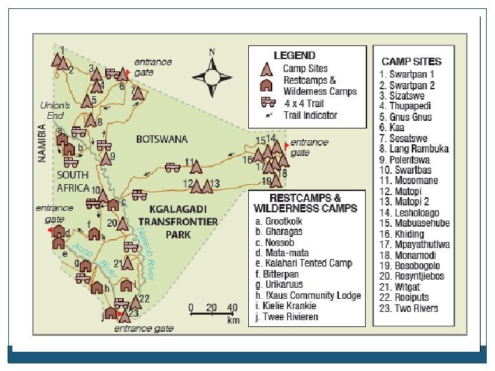
1. 8 Tourist attraction maps Maps focus on an specific area Usually a meander map, include details Type of map Example Explanation Uses and value in Tourism Tourist attraction maps Map of a specific attraction e. g. Gold Reef City map These maps focus specifically on the attraction Gives you specific information about the attraction and where to find what at the attraction, the layout and the facilities.
Where do we find these maps? Visitors Information centres, Tourists information centres, Accommodation establishments like hotels, The AA, travel agents, Travel guide books, Travel magazines, Atlases, Tourists destination at reception offices or information counters
Electronic maps: Maps that are available on electronic devices and such as computers, smart phones, tablets or laptops Information Communication Technology (ICT): all the communication devise that provide information and help with communication
Type of map Example Explanation Uses and value in Tourism Electronic maps - GPS maps e. g. Tom maps The GPS receives data sent from satellites and then use the data to generate a map using the latitude and longitude lines. Useful to tourist who are travelling independently by car or hiring a car. You can see the exact picture of an area or see the street view of a place. You can easily follow the directions shown on a GPS, many places gives their GPS coordinates as their location. Electronic maps – Google Earth – updated instantly and can be accessed on computer, smart phone or tablet It is an internet map that show you the satellite image of anything on the earth/ globe You can find any place on earth before you travel to the place Electronic maps – Google Street View It is part of the google maps and you can see the exact picture of the area or building as if you are walking next to the building This is a very nice tool to view and compare different places. Electronic maps – Google Street maps It is part of the google maps and offer street maps and route planners f or tourists You can use this tool to ask for directions from your position to the attraction Interactive maps Map you find on a website or at an airport for example: www. saexplorer. co. za The tourist can use zoom in on a map and get more information on the map, the accommodation or attractions in a area become clickable and then provide more information Tourists will get more information and can zoom in as much as they like to see the area they are looking for.