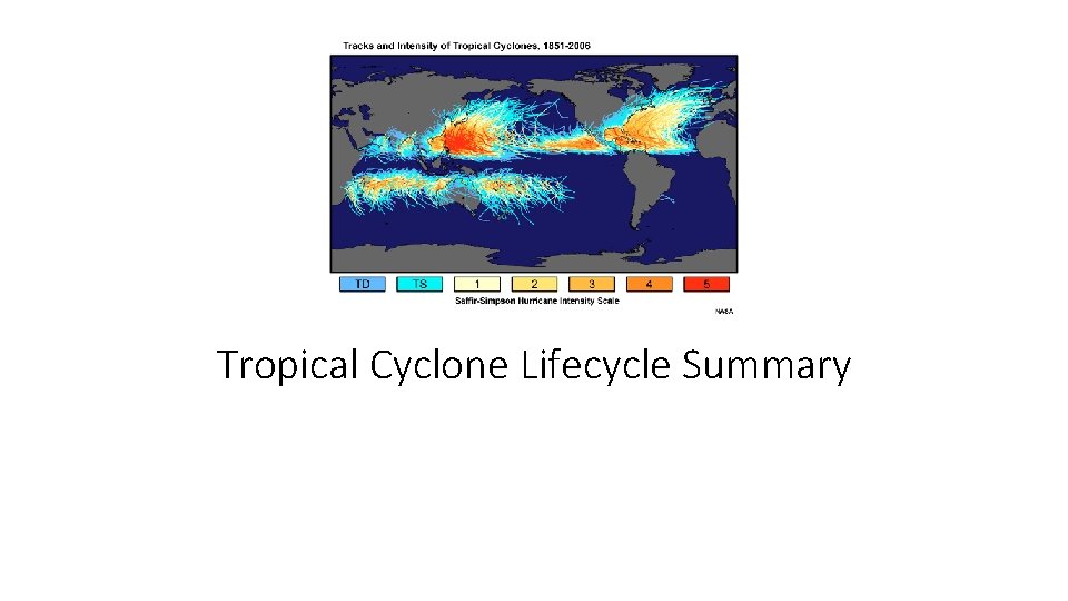
Tropical Cyclone Lifecycle Summary http glossary ametsoc orgwikiTropicalcyclone

- Slides: 25

Tropical Cyclone Lifecycle Summary

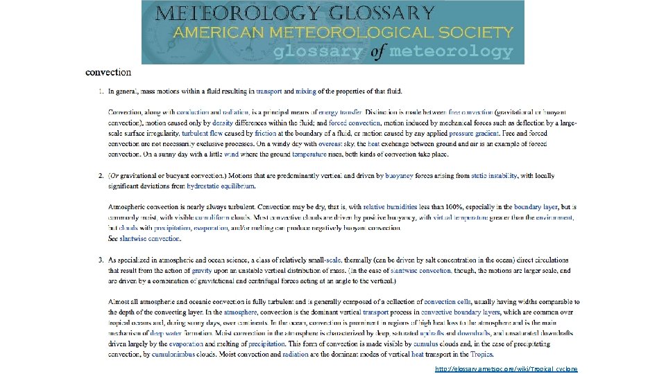
http: //glossary. ametsoc. org/wiki/Tropical_cyclone

http: //glossary. ametsoc. org/wiki/Tropical_cyclone

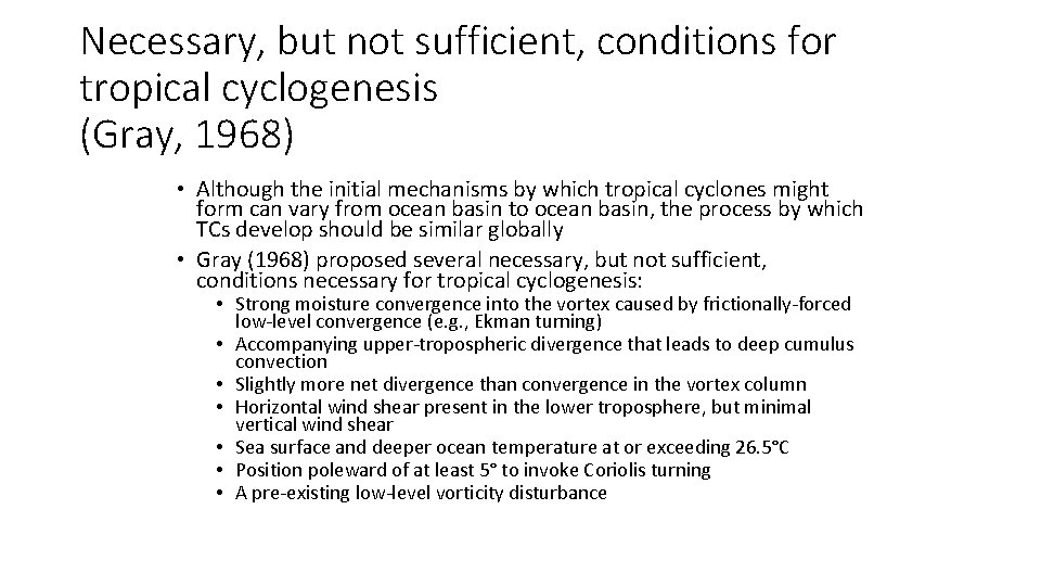
Necessary, but not sufficient, conditions for tropical cyclogenesis (Gray, 1968) • Although the initial mechanisms by which tropical cyclones might form can vary from ocean basin to ocean basin, the process by which TCs develop should be similar globally • Gray (1968) proposed several necessary, but not sufficient, conditions necessary for tropical cyclogenesis: • Strong moisture convergence into the vortex caused by frictionally-forced low-level convergence (e. g. , Ekman turning) • Accompanying upper-tropospheric divergence that leads to deep cumulus convection • Slightly more net divergence than convergence in the vortex column • Horizontal wind shear present in the lower troposphere, but minimal vertical wind shear • Sea surface and deeper ocean temperature at or exceeding 26. 5°C • Position poleward of at least 5° to invoke Coriolis turning • A pre-existing low-level vorticity disturbance

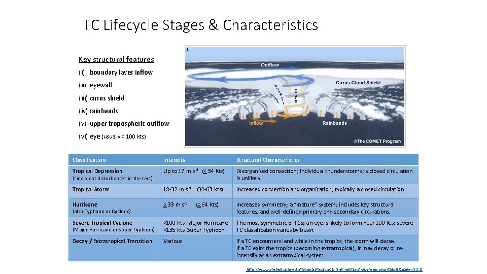
TC Lifecycle Stages & Characteristics Key structural features (i) boundary layer inflow (ii) eyewall (iii) cirrus shield (iv) rainbands (v) upper tropospheric outflow (vi) eye (usually > 100 kts) Classification Intensity Structural Characteristics Tropical Depression Up to 17 m s-1 (< 34 kts) Disorganized convection; Individual thunderstorms; a closed circulation is unlikely Tropical Storm 18 -32 m s-1 (34 -63 kts) Increased convection and organization; typically a closed circulation Hurricane > 33 m s-1 (> 64 kts) Increased symmetry; a “mature” system; includes key structural features, and well-defined primary and secondary circulations. Severe Tropical Cyclone (Major Hurricane or Super Typhoon) >100 kts Major Hurricane >135 kts Super Typhoon The most symmetric of TCs; an eye is likely to form near 100 kts; severe TC classification varies by basin. Decay / Extratropical Transition Various If a TC encounters land while in the tropics, the storm will decay. If a TC exits the tropics (becoming extratropical), it may decay or reintensify as an extratropical system. (“incipient disturbance” in the text) (also Typhoon or Cyclone) http: //www. meted. ucar. edu/tropical/textbook_2 nd_edition/navmenu. php? tab=9&page=2. 1. 0

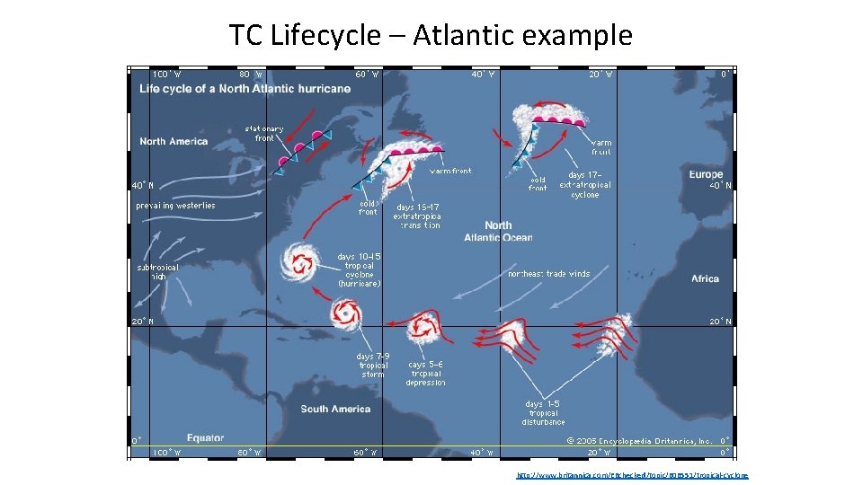
TC Lifecycle – Atlantic example http: //www. britannica. com/EBchecked/topic/606551/tropical-cyclone

8. 2. 2. 1 Incipient Disturbance 1. Definition, Structure, and Characteristics 2. Necessary (but not sufficient) conditions for TC Formation 3. Upscale Development 4. Formation Mechanisms by Region

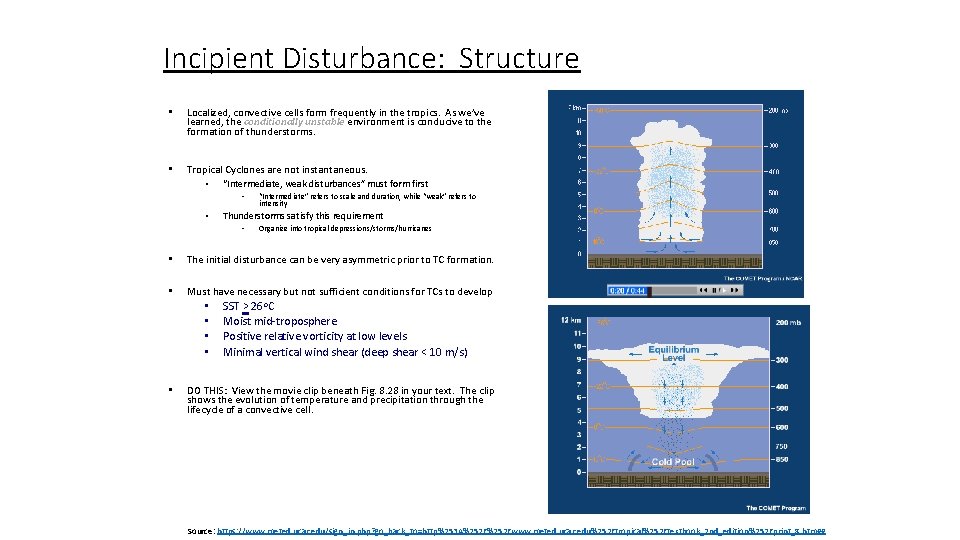
Incipient Disturbance: Structure • Localized, convective cells form frequently in the tropics. As we’ve learned, the conditionally unstable environment is conducive to the formation of thunderstorms. • Tropical Cyclones are not instantaneous. • “Intermediate, weak disturbances” must form first • • “Intermediate” refers to scale and duration, while “weak” refers to intensity Thunderstorms satisfy this requirement • Organize into tropical depressions/storms/hurricanes • The initial disturbance can be very asymmetric prior to TC formation. • Must have necessary but not sufficient conditions for TCs to develop • • • SST > 26 o. C Moist mid-troposphere Positive relative vorticity at low levels Minimal vertical wind shear (deep shear < 10 m/s) DO THIS: View the movie clip beneath Fig. 8. 28 in your text. The clip shows the evolution of temperature and precipitation through the lifecycle of a convective cell. Source: https: //www. meted. ucar. edu/sign_in. php? go_back_to=http%253 A%252 Fwww. meted. ucar. edu%252 Ftropical%252 Ftextbook_2 nd_edition%252 Fprint_8. htm##

Necessary (but not sufficient*) conditions for Tropical Cyclone formation • SST > 26 o. C • • The ocean provides heat (sensible heat flux) and moisture (latent heat flux) to the atmosphere immediately above the surface of the ocean. This warm air right above the surface is then less dense than the surrounding air, and therefore rises – releasing the latent heat as the parcel cools and the moisture condenses into clouds • Moist mid-troposphere • • Tall towers of deep convective clouds will only develop if moisture extends vertically into the atmosphere. If rising warm, moist air from just above the sea surface runs into a layer of dry air (such as the Saharan Air Layer), the lapse rate will change (from moist to dry) and the parcel will be much more apt to become neutral (i. e. and stop rising) or stable (and sink), and the convection will cease. However, if the column is moist, parcels will still continue to rise developing deep towers of spinning the atmosphere. • Positive relative vorticity at low levels • This circulation (CCW in the NH) is indicative of an area of low pressure and is conducive to formation for two reasons: • • 1. There will be convergence into the low that results in upward vertical motion and convection (as long as moisture remains in the column). 2. The vorticity allows the individual convective towers to merge as they spin inward (slightly) toward the center, forming a ring of convection around the low pressure center. • Minimal vertical wind shear (deep shear < 10 m/s) • Strong TCs are symmetric horizontally and they are stacked vertically • • • Horizontal: Think of the “fat tire” or “donut” appearance of a strong hurricane or typhoon from a satellite perspective. The eyewall is evident as a thick ring of bright white (i. e. very tall) clouds, indicating very deep convection, . Winds here also nearly symmetric about the storm center. Vertical: The storm stands upright, and the strongest winds exist at the surface. . In regions of vertical wind shear, upper-level and lower-level winds are not identical. They can be different speeds, different directions, or both. Frequently, the upper-level winds are faster than the lower-level winds and the storm tilts over. The vertical integrity of the vertical columns is then disrupted and the columns dry out, reducing nearby convection. • * All conditions must be present simultaneously before tropical cyclogenesis can occur ; HOWEVER, even if they are all present simultaneously, tropical cyclogenesis may not occur… (from Gray 1969)

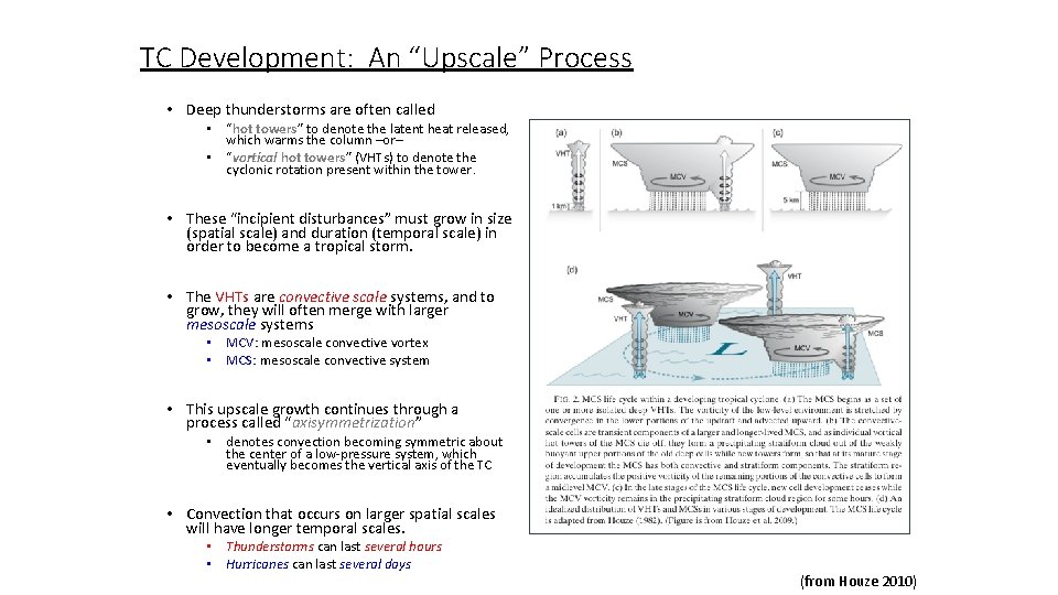
TC Development: An “Upscale” Process • Deep thunderstorms are often called • “hot towers” to denote the latent heat released, which warms the column –or– • “vortical hot towers” (VHTs) to denote the cyclonic rotation present within the tower. • These “incipient disturbances” must grow in size (spatial scale) and duration (temporal scale) in order to become a tropical storm. • The VHTs are convective scale systems, and to grow, they will often merge with larger mesoscale systems • MCV: mesoscale convective vortex • MCS: mesoscale convective system • This upscale growth continues through a process called “axisymmetrization” • denotes convection becoming symmetric about the center of a low-pressure system, which eventually becomes the vertical axis of the TC • Convection that occurs on larger spatial scales will have longer temporal scales. • Thunderstorms can last several hours • Hurricanes can last several days (from Houze 2010)

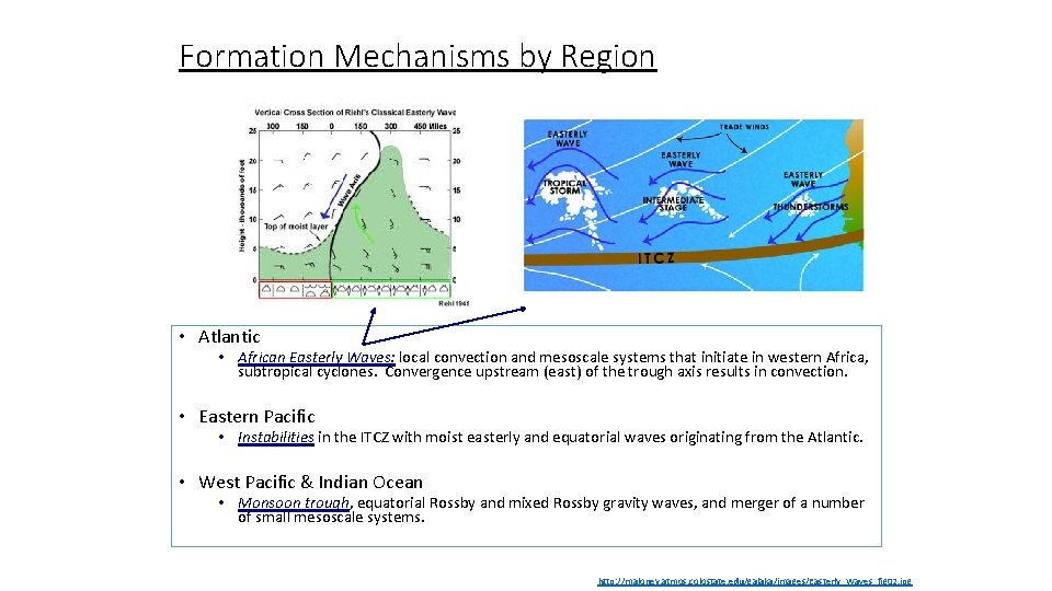
Formation Mechanisms by Region • Atlantic • African Easterly Waves: local convection and mesoscale systems that initiate in western Africa, subtropical cyclones. Convergence upstream (east) of the trough axis results in convection. • Eastern Pacific • Instabilities in the ITCZ with moist easterly and equatorial waves originating from the Atlantic. • West Pacific & Indian Ocean • Monsoon trough, equatorial Rossby and mixed Rossby gravity waves, and merger of a number of small mesoscale systems. http: //maloney. atmos. colostate. edu/galaka/images/Easterly_Waves_fig 02. jpg

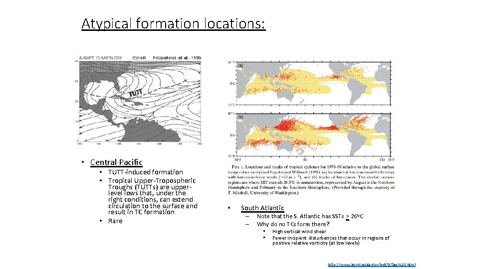
Atypical formation locations: • Central Pacific • TUTT-induced formation • Tropical Upper-Tropospheric Troughs (TUTTs) are upperlevel lows that, under the right conditions, can extend circulation to the surface and result in TC formation • Rare • South Atlantic – – Note that the S. Atlantic has SSTs > 26 o. C Why do no TCs form there? • • High vertical wind shear Fewer incipient disturbances that occur in regions of positive relative vorticity (at low levels) http: //www. aoml. noaa. gov/hrd/tcfaq/A 10. html

8. 2. 2. 2 Tropical Storm 1. > 34 kts 2. Self-sustaining 3. Satellite characteristics (organization)

Intensity • Becomes a tropical storm once it is self-sustaining • No longer requires external forcing • Can withstand the loss of one or more of the necessary but not sufficient conditions for TC formation • Intensity is based on peak surface wind speed. • Warm waters increase energy • Evaporation + heat transfer moistens the tropical storm boundary layer

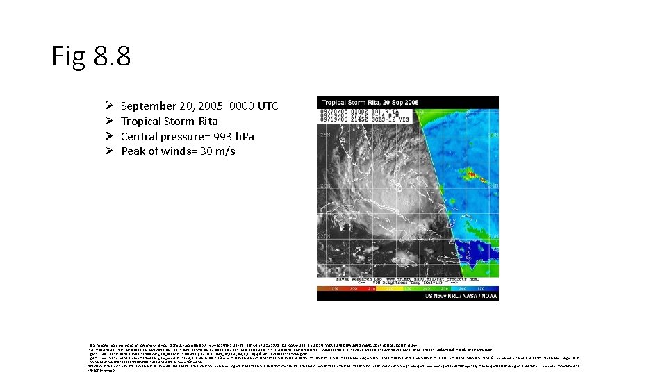
Fig 8. 8 Ø Ø September 20, 2005 0000 UTC Tropical Storm Rita Central pressure= 993 h. Pa Peak of winds= 30 m/s https: //images. search. yahoo. com/images/view; _ylt=Awr. B 8 pfm. RGp. Uq. Ac. A 35 q. Jzbk. F; _ylu=X 3 o. DMTIybn. U 3 b. DYz. BHNl. Yw. Nzcg. Rzb. Gs. Da. W 1 n. BG 9 p. ZAMw. MDU 2 Nm. Mz. ODMz. Yj. Y 0 Mz. Vi. Mz. E 1 OWM 4 NDc 4 Yjli. NGU 1 Zg. Rnc. G 9 z. Az. UEa. XQDYmlu. Zw-? back=https%3 A%2 F%2 Fimages. search. yahoo. com%2 Fsearch%2 Fimages%3 Fp%3 Dcombined%2 Binfrared%2 Band%2 BSSM%252 FI%2 Bsatellite%2 Bimages%2 Bof%2 BTropical%2 BRita%26 fr%3 Dyfp-t-703%26 fr 2%3 Dpiv-web%26 tab%3 Dorganic%26 ri%3 D 5&w=350&h=394&imgurl=www. goesr. gov%2 Fusers%2 Fcomet%2 Ftropical%2 Ftextbook_2 nd_edition%2 Fmedia%2 Fgraphics%2 F 2005_20_sept_rita_ir_ssmi. jpg&rurl=http%3 A%2 F%2 Fwww. goesr. gov%2 Fusers%2 Fcomet%2 Ftropical%2 Ftextbook_2 nd_edition%2 Fprint_8. htm&size=91. 6 KB&name=%3 Cb%3 Einfrared%3 C%2 Fb%3 E+%3 Cb%3 Eand+SSM%2 FI%3 C%2 Fb%3 E+%3 Cb%3 Esatellite+images%3 C%2 Fb%3 E+%3 Cb%3 Eof+Tropical%3 C%2 Fb%3 E+Storm+%3 Cb%3 ERita%3 C%2 Fb%3 E&p=combined+infrared+and+SSM%2 FI+satellite+images+of+T ropical+Rita&oid=00566 c 3833 b 6435 b 3159 c 8478 b 9 b 4 e 5 f&fr 2=piv-web&fr=yfp-t 703&tt=%3 Cb%3 Einfrared%3 C%2 Fb%3 E+%3 Cb%3 Eand+SSM%2 FI%3 C%2 Fb%3 E+%3 Cb%3 Esatellite+images%3 C%2 Fb%3 E+%3 Cb%3 Eof+Tropical%3 C%2 Fb%3 E+Storm+%3 Cb%3 ERita%3 C%2 Fb%3 E&b=0&ni=21&no=5&ts=&tab=organic&sigr=12 b 4 vvnke&sigb=14 pp 6 tp 7 t&sigi=135 g 6 p 2 or&sigt=12 t 3 d 4 l 1 v&sign=12 t 3 d 4 l 1 v&. crumb=ku/9 yhp. Abxo&fr=yfp-t -703&fr 2=piv-web

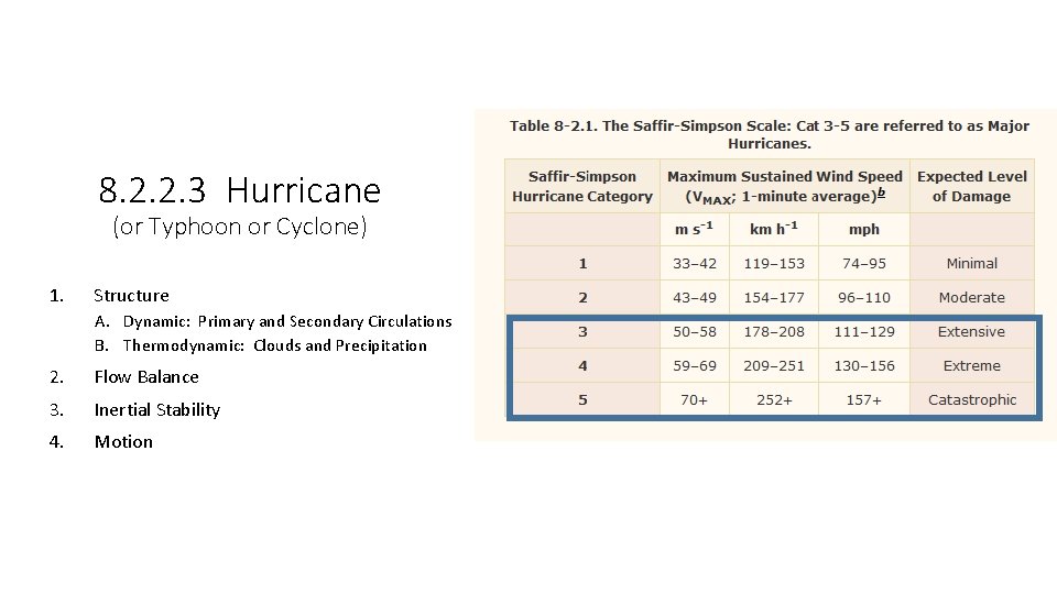
8. 2. 2. 3 Hurricane (or Typhoon or Cyclone) 1. Structure A. Dynamic: Primary and Secondary Circulations B. Thermodynamic: Clouds and Precipitation 2. Flow Balance 3. Inertial Stability 4. Motion

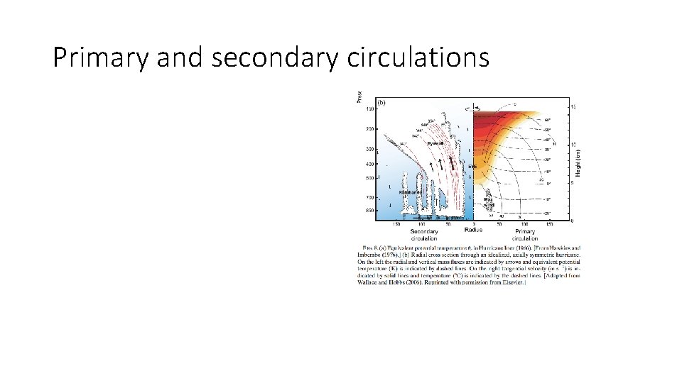
Primary and secondary circulations

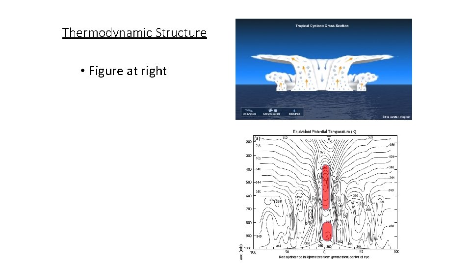
Thermodynamic Structure • Figure at right

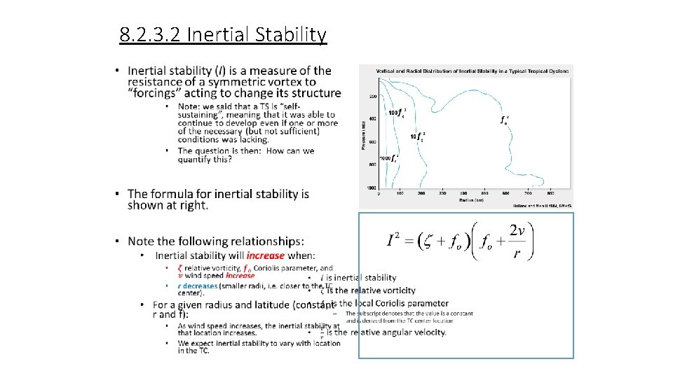
8. 2. 3. 2 Inertial Stability •

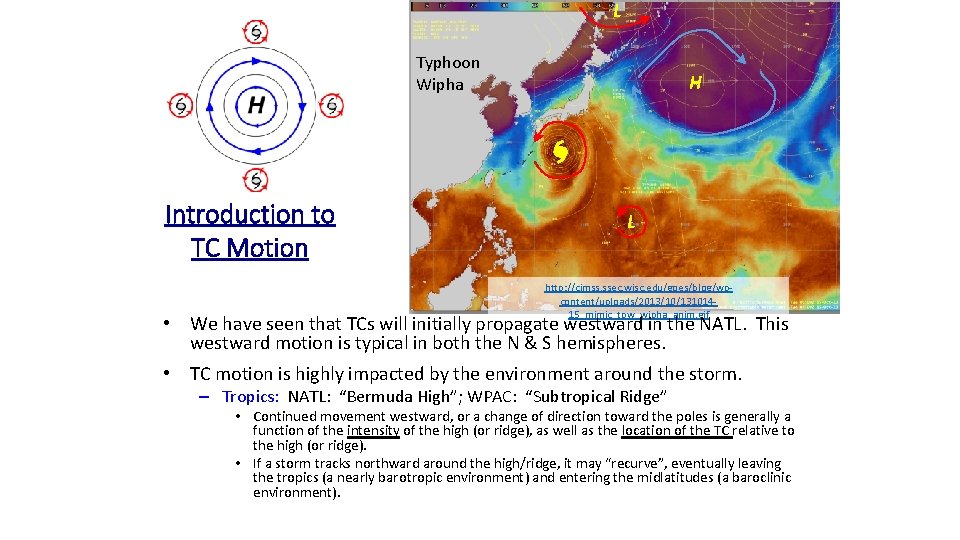
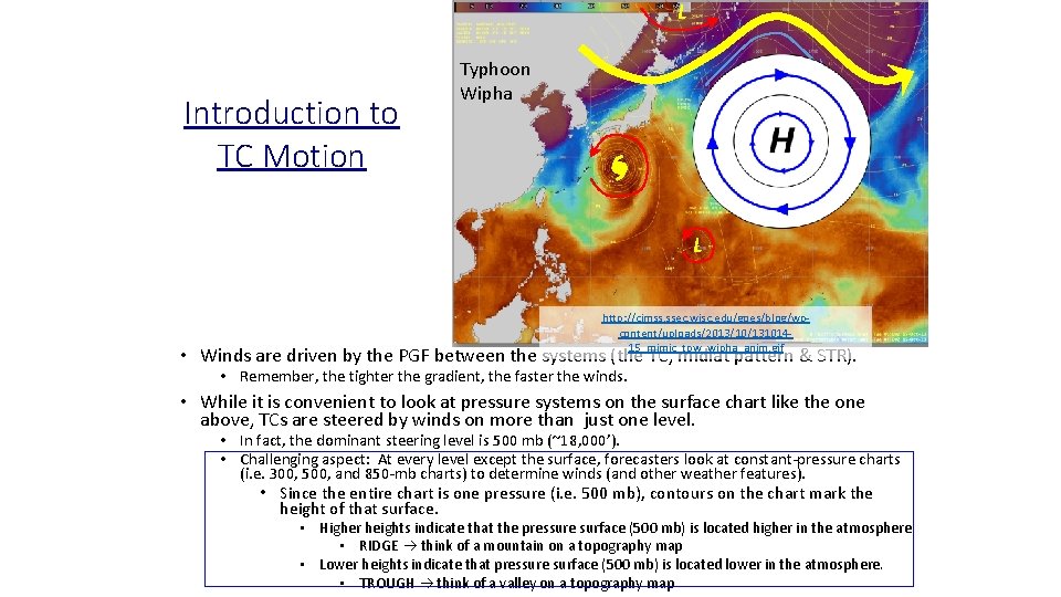
L Typhoon Wipha Introduction to TC Motion H L http: //cimss. ssec. wisc. edu/goes/blog/wpcontent/uploads/2013/10/13101415_mimic_tpw_wipha_anim. gif • We have seen that TCs will initially propagate westward in the NATL. This westward motion is typical in both the N & S hemispheres. • TC motion is highly impacted by the environment around the storm. – Tropics: NATL: “Bermuda High”; WPAC: “Subtropical Ridge” • Continued movement westward, or a change of direction toward the poles is generally a function of the intensity of the high (or ridge), as well as the location of the TC relative to the high (or ridge). • If a storm tracks northward around the high/ridge, it may “recurve”, eventually leaving the tropics (a nearly barotropic environment) and entering the midlatitudes (a baroclinic environment).

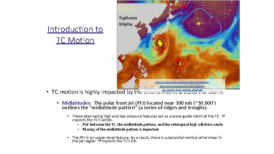
L Introduction to TC Motion Typhoon Wipha H L http: //cimss. ssec. wisc. edu/goes/blog/wpcontent/uploads/2013/10/13101415_mimic_tpw_wipha_anim. gif • TC motion is highly impacted by the environment around the storm • Midlatitudes: The polar front jet (PFJ) located near 300 mb (~30, 000’) outlines the “midlatitude pattern” (a series of ridges and troughs). • These alternating high and low pressure features act as a wave guide north of the TC impacts the TC’s winds. • PGF between the TC, the midlatitude pattern, and the subtropical high will drive winds. • Phasing of the midlatitude pattern is important • The PFJ is an upper-level feature. As a result, there is substantial vertical wind shear in the jet region impacts the TC’s tilt.

L Introduction to TC Motion Typhoon Wipha H L http: //cimss. ssec. wisc. edu/goes/blog/wpcontent/uploads/2013/10/13101415_mimic_tpw_wipha_anim. gif • Winds are driven by the PGF between the systems (the TC, midlat pattern & STR). • Remember, the tighter the gradient, the faster the winds. • While it is convenient to look at pressure systems on the surface chart like the one above, TCs are steered by winds on more than just one level. • In fact, the dominant steering level is 500 mb (~18, 000’). • Challenging aspect: At every level except the surface, forecasters look at constant-pressure charts (i. e. 300, 500, and 850 -mb charts) to determine winds (and other weather features). • Since the entire chart is one pressure (i. e. 500 mb), contours on the chart mark the height of that surface. • Higher heights indicate that the pressure surface (500 mb) is located higher in the atmosphere. • RIDGE think of a mountain on a topography map • Lower heights indicate that pressure surface (500 mb) is located lower in the atmosphere. • TROUGH think of a valley on a topography map

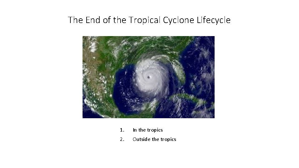
The End of the Tropical Cyclone Lifecycle 1. In the tropics 2. Outside the tropics

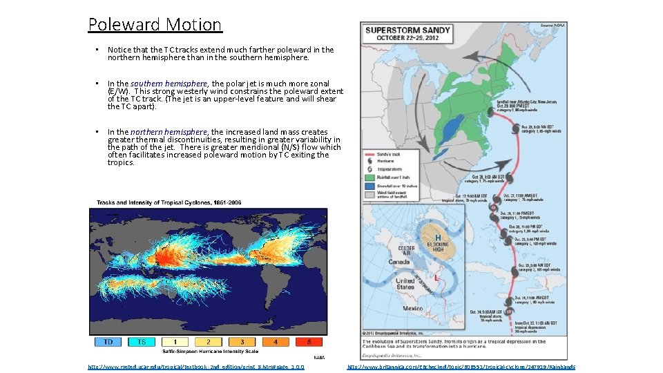
Poleward Motion • Notice that the TC tracks extend much farther poleward in the northern hemisphere than in the southern hemisphere. • In the southern hemisphere, the polar jet is much more zonal (E/W). This strong westerly wind constrains the poleward extent of the TC track. (The jet is an upper-level feature and will shear the TC apart). • In the northern hemisphere, the increased land mass creates greater thermal discontinuities, resulting in greater variability in the path of the jet. There is greater meridional (N/S) flow which often facilitates increased poleward motion by TC exiting the tropics. http: //www. meted. ucar. edu/tropical/textbook_2 nd_edition/print_8. htm#page_1. 0. 0 http: //www. britannica. com/EBchecked/topic/606551/tropical-cyclone/247919/Rainbands

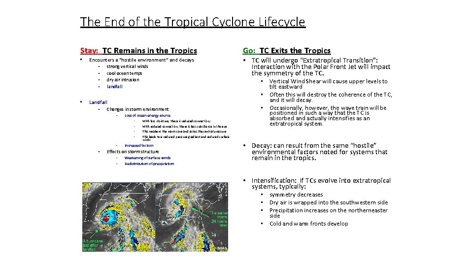
The End of the Tropical Cyclone Lifecycle Stay: TC Remains in the Tropics • • Encounters a “hostile environment” and decays • strong vertical winds • cool ocean temps • dry air intrusion • landfall Landfall • Changes in storm environment • Loss of ocean energy source • • • With less moisture, there is reduced convection; With reduced convection, there is less subsidence in the eye • TC will undergo “Extratropical Transition”: Interaction with the Polar Front Jet will impact the symmetry of the TC. • Vertical Wind Shear will cause upper levels to tilt eastward • Often this will destroy the coherence of the TC, and it will decay. • Occasionally, however, the wave train will be positioned in such a way that the TC is absorbed and actually intensifies as an extratropical system. This weakens the warm core and raises the central pressure This leads to a reduced pressure gradient and reduced surface winds Increased friction Effects on storm structure • • Go: TC Exits the Tropics Weakening of surface winds Redistribution of precipitation • Decay: can result from the same “hostile” environmental factors noted for systems that remain in the tropics. • Intensification: If TCs evolve into extratropical systems, typically: • symmetry decreases • Dry air is wrapped into the southwestern side • Precipitation increases on the northerneaster side • Cold and warm fronts develop