Total Station Surveying Total Station The total station


 Distance measuring Instrument(EDM) (ii) An angle measuring Instrument(Theodolite) (iii)")


 Selecting")
 Creating a new Job file b) Opening")
- Slides: 22
Total Station Surveying
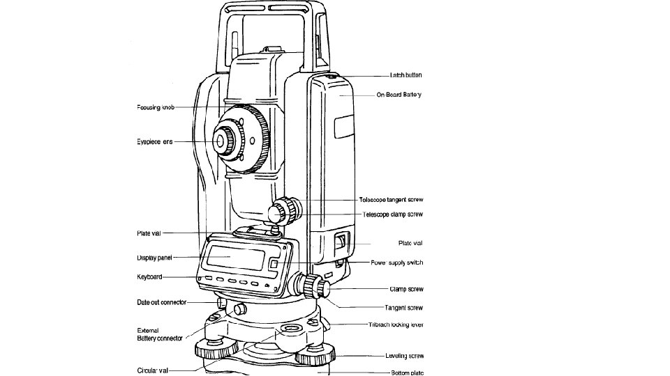
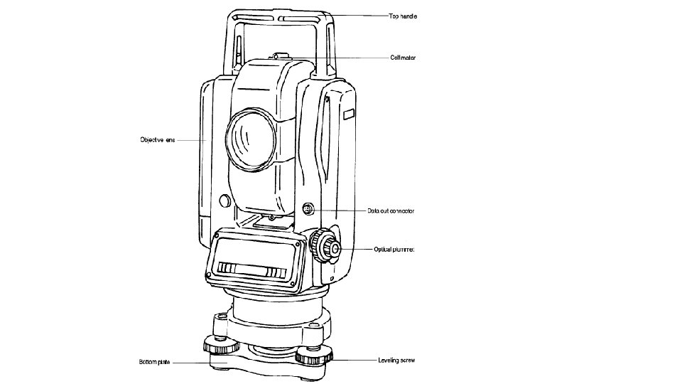
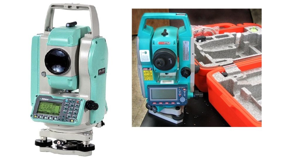
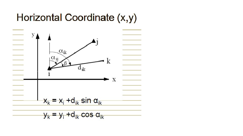
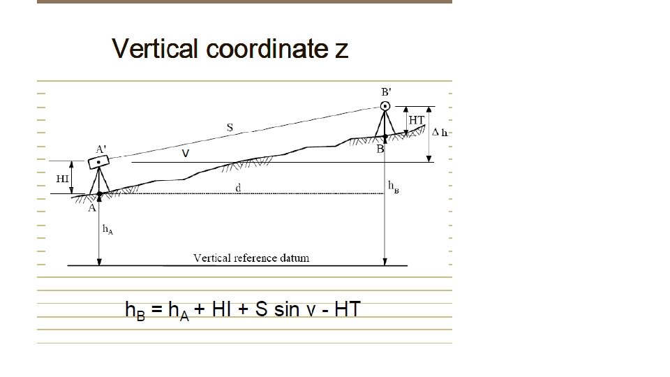
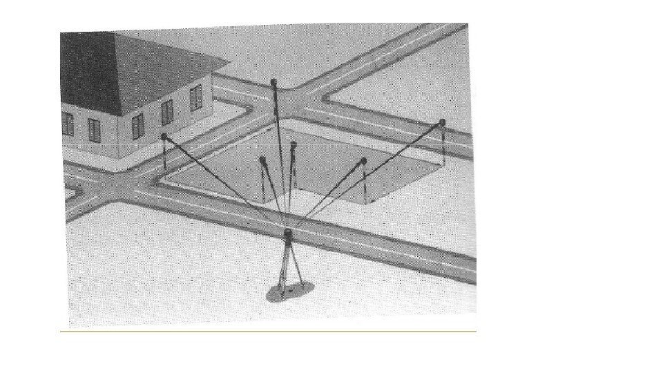
Total Station: The total station otherwise known as electronic tacheometer is an instrument used in surveying which is capable of measuring angles and distances electronically The total station is operated using a multi – function key board which is connected to a micro – processor built into the instrument. The micro processor not only controls both the angle and distance measuring systems but also used as a small computer that can electronically calculate slope corrections, vertical components, and rectangular co – ordinates and in some cases, can also store observations directly using an internal memory.
Basic Principle:
• Prism reflector: It is a combination of ranging rod, staff and optical cuboidal mirror. having 2/3 lifts with 5 cms interval graduations. adjustable height from 1. 5 m to 3. 75 m. More number of prisms, will give more accuracy.
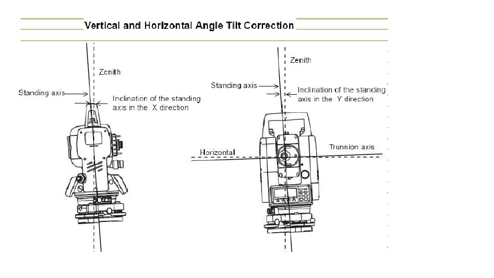
Components of Total Station: (i) Distance measuring Instrument(EDM) (ii) An angle measuring Instrument(Theodolite) (iii) A simple microprocessor. A typical Total Station has the following Characters. i) Graphic Display ii) Dual axis compensation iii) Levelling and Centering iv) Storage v) Friction clutch and endless drive vi) Guide light or Lumiguide tracking light vii) Measurement modes viii) Automatic target recognition(ATR)
Functions of T. S: 1. It simultaneously measures angles & distances and Record 2. Correcting the measured distance with: 1. 2. 3. 4. 5. Prism constant Atmospheric Pr. Temperature Curvature of earth Refraction correction 3. Computing the point elevation 4. Computing the coordinates of every point 5. Remote elevation measurement 6. Remote distance measurement 7. Area calculations 8. Data Transferring facility from instrument to S/W and S/W instrument 9. Format of conversion of units to
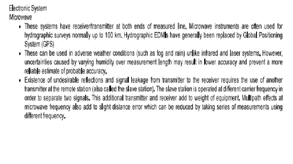
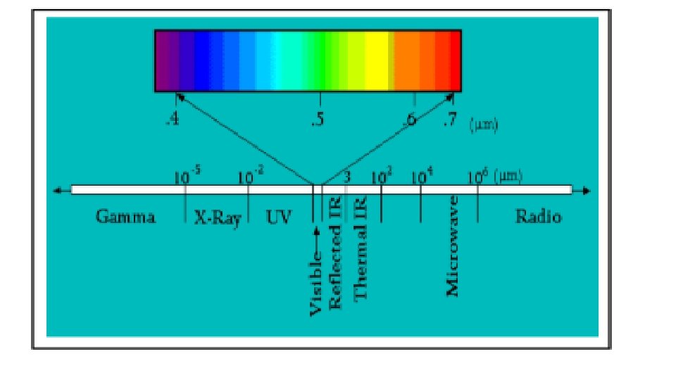
Classification: Based on 1. Wavelength used 2. Working Range 3. Achievable accuracy Classification Based on the Wavelength used: 1. Electro Optical a. Laser (0. 4 -0. 7µm) b. Infrared (0. 9µm) 2. Electronic-Microwave
Measuring Principle: Usually the measuring wave is used along with the carrier wave due to its poor propagation. Hence the propagation will be done by frequency and amplitude modulation. The measurement of propagation can be done by following techniques:
Phase Difference method:
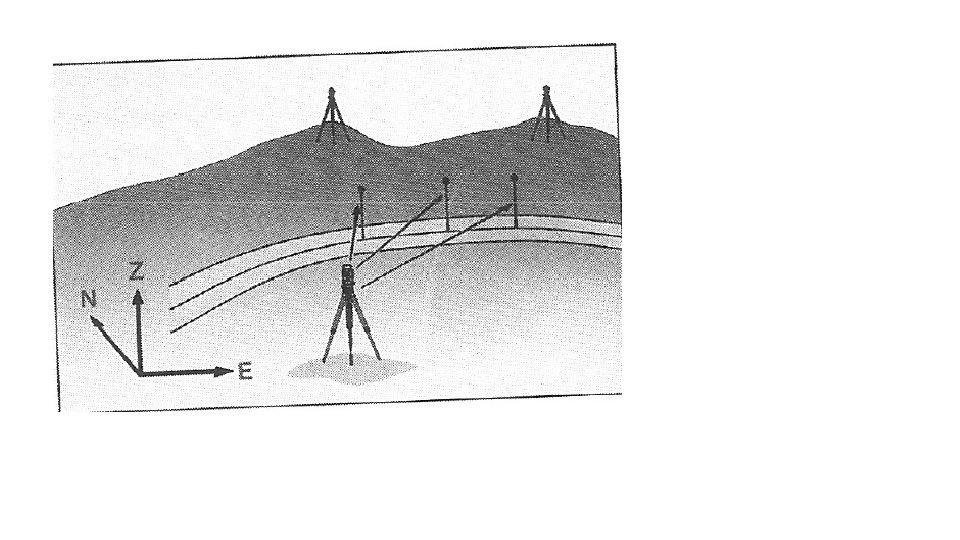
• Application of Total station: 1. Updating mapping 2. Topographic survey 3. Hydrographic survey 4. Cadastral survey 5. Project construction survey 6. 7. Road, Rail Survey Mining survey
Operations involved while using Total Stations : 1. Establishing the site Datum: a) Selecting the site Datum b) Establishing North 2. Setting up the Total station: a) Placing and leveling Tripod on Datum b) Placing and leveling the Gun on Tripod c) Linking the data connector to Gun 3. Data collector options and setting a) Main menu b) Basic setting
4. Creating and Operating Job files: a) Creating a new Job file b) Opening an existing file 5. Shooting points a) Identifying the important points to shoot b) shooting points c) Shooting additional points d) Noting the special features 6. Post Processing – Data down loading, conversion 7. Plotting/Map generation.