Topography and the Water Cycle Topography The study


 � Contour lines")


- Slides: 14
Topography and the Water Cycle
Topography The study of or the making of detailed maps for a particular area � The focus is on landforms and elevation (height) � May include human features � “topo” means “local” or “place” �
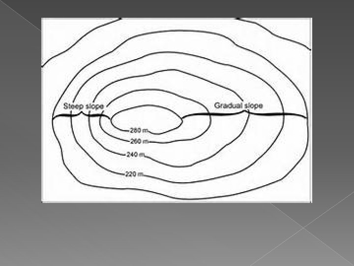
� Topography and Water Land features determine the direction and flow rate at which water will flow � Direction = water moves downhill � Flow Rate (speed) › Gradual slope = slow moving › Steep slope = fast moving �
� Watershed Area where all the water drains to � A small watershed will feed into a larger watershed � › Example: › Tuscarawas River is a watershed that feeds into the Ohio River watershed, which feeds into the Mississippi River watershed, which feeds into the Gulf of Mexico
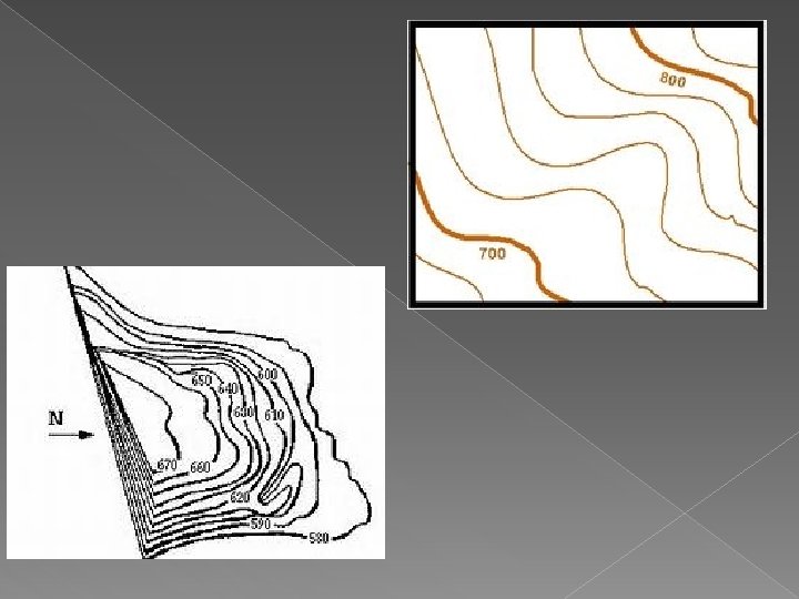
� Topographic Maps � Use lines and symbols to turn our 3 D world into a 2 dimensional drawing
� Topographic Lines Contour Lines represent elevation (height above sea level) � Contour lines never cross each other and never touch � Elevation of a contour line is always the same �
� Topographic Lines � Index Lines have the elevation above sea level on it
� Topographic Lines � Interval Lines are contour lines without the elevation
� Topographic Lines � Contour Interval the elevation difference between each contour line What is the contour interval on this map? The interval on this map is 10.
Complete this topographic map. Contour interval is 10 meters. Fill in the circles with the appropriate number for each index line. Hint: The index lines that have small dashes attached to them show a decline in elevation. In order, top to bottom, the answers are: 50 meters 90 meters 50 meters 20 meters
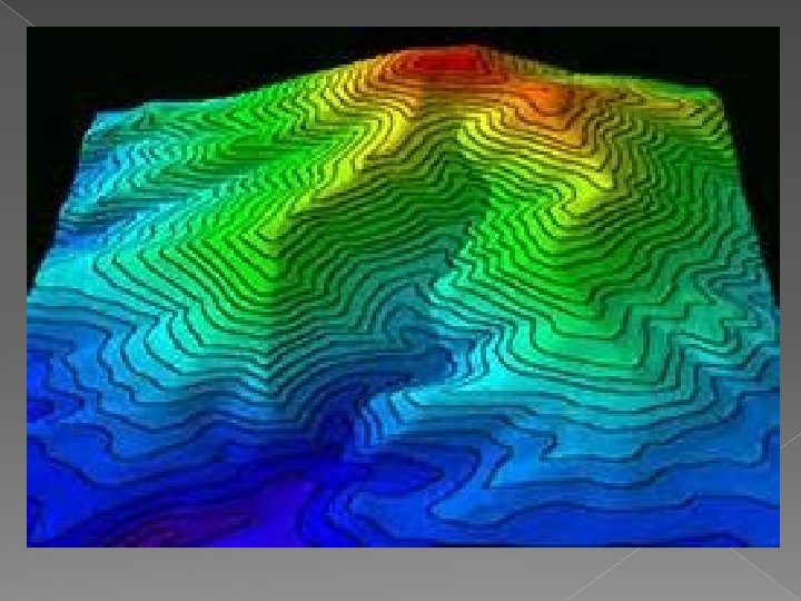
� What kind of landform may this be? � Volcano