Topographic Maps Imagery Satellites High above Earth use

Topographic Maps

Imagery • Satellites: High above Earth use sensors and cameras to gather data about Earth’s landforms and resources.
 from the data satellites receive – Scientist identify")
Imagery • Computers: create images (pictures) from the data satellites receive – Scientist identify specific features by the combination of colors and shapes that the feature makes on the satellite image.

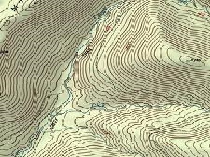
Geologic features shown for SC 1. 2. 3. 4. 5. 6. Mountains River and tributary flow Lakes Farmland Forests Bays and coastal features

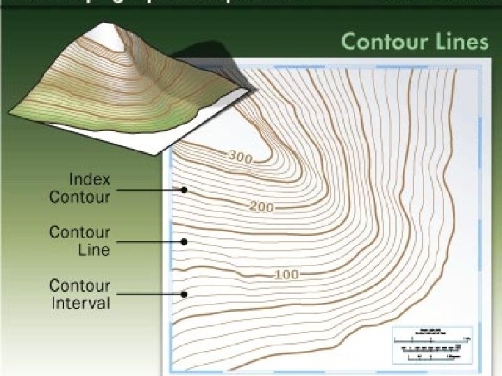
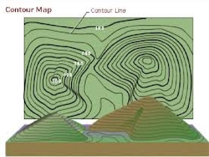
Topographic Maps • Maps that use symbols to portray the land as if viewed from above. – Provide info on elevation and slope of the ground surface – Provide location of roads, buildings, swamps and other features (natural AND man-made)

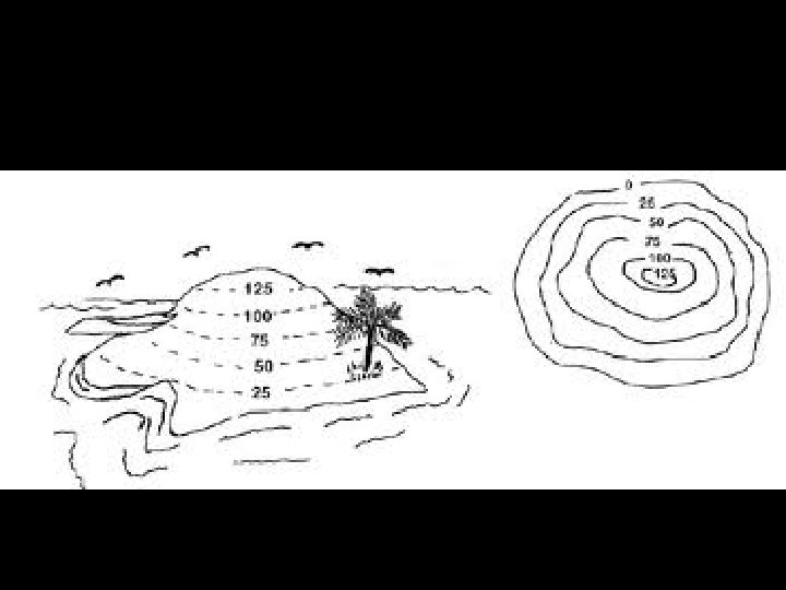
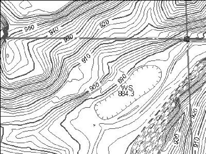
Contour • Contour lines- connect points of equal elevation. • Contour intervals- the change in elevation from contour line to contour line. – The contour interval on a map is ALWAYS the same • Contour Index- the “legend” from DARK LINE TO DARK LINE. The same throughout the entire map.

Why do we need topographic maps? • Businesses use them to help decide where to build new stores, house, or factories • Governments use them to help decide where to build public buildings • People use them to plan backpacking or biking trips.

Make your own What you need: A lump of clay or Play-Doh® about the size of a coffee mug. Piece of cardboard or large tile on which to work the clay Piece of dental floss, about 2 feet (around 60 centimeters) long Ruler Piece of plain, white paper Long pencil 2 toothpicks

What to do: • Put the lump of clay on the cardboard and shape a mountain about 4 inches high. Making the map is more fun if you make your mountain a little lop -sided or oddly shaped. However, the mountain should be flat on the bottom. • Use the long pencil to poke two holes straight down through the center of the mountain. Make sure your two holes go all the way through

What to do: • With the ruler, measure down about 1 inch (2. 5 centimeters) from the top of the mountain and make a little dent mark with the pencil. Make two more dent marks lower down on the mountain about 1 inch apart. Or, without using the ruler, just make three marks to divide your mountain into four slices all about the same thickness.

What to do: • Stretch the dental floss until it is taut, wrapping the ends around your fingers so you have a good grip on it. Use the dental floss to cut through the mountain at top-most mark you made. Hold the floss as horizontal (level with the table or floor) as you can.

What to do: • Remove this clay slice and place it on the paper. Use the pencil to carefully trace around it. Push the pencil through one of the holes in the clay and make a dot on the paper; do the same with the other hole. Put the slice aside, but don't squash it. You'll need it again later.

What to do: • Cut a second slice at your next mark down from the top. Lay the second slice over the tracing of the first one, being careful to place the holes in the second sick over the dots on the paper. • To line up the holes, poke the two toothpicks through the holes in the slice and line them up with the two dots on the paper. Carefully trace around the second slice. Your tracing will form a circle outside the tracing of the first slice. • (If you have "outcroppings" on your mountain, the second circle could cross into the area of the first circle).

What to do: • Cut another slice at the next mark down. Line up the holes with the dots and trace it as you did before. Finally, place the bottom slice on the paper, line up the holes, and trace it. • Stack the slices back up in order on the cardboard. Be sure the holes line up. • Admire your topo map!
- Slides: 20