TOPIC 1 TECTONIC PROCESSES AND HAZARDS Lesson 22
")

")


")


 (Since")


 • 1. Increase in minor extrusive activity • Increase in")


 •")

- Slides: 33
TOPIC 1: TECTONIC PROCESSES AND HAZARDS (Lesson 22)
ENQUIRY QUESTION 3: • How successful is the management of tectonic hazards and disasters?
H/W : TASK 4 • Read the information (Hodder page 90 in this booklet) about two recent tectonic mega disasters : • 1) 2010 Eyafjallajokull Icelandic eruption and • 2) 2011 Japanease Tokoku Earthquake/ tsunami. • Compare and contrast the economic and human impacts which occurred as a result of each event. ( 8 marks) • • Tips: Compare – what are the similarities? Contrast – what are the differences? DON’T talk all about one event then the other- compare and contrast facts from each event as you go…
COMMENTS FROM MARKING HOMEWORK • 1. The focus of this response was that both events were MEGADISASTERS but hardly anyone referred to them as such! • 2. People who did the best were the ones who separated human(social) and economic impacts into two separate paragraphs. ‘The human / economic impacts were…. ’ They then continued to compare and contrast points about the Icelandic volcano and Japanese tsunami within individual paragraphs. • IT IS NOT SUFFICIENT TO WRITE ALL ABOUT ONE EXAMPLE THEN ALL ABOUT THE OTHER WITH JUST THE WORD ‘WHEREAS’ IN BETWEEN! • 3. Both Japan and Iceland are DEVELOPED COUNTRIES!!! • 4. The better answers included key terms e. g. In Japan the fact that most of the victims were 60 yrs + meant that they were an extremely vulnerable sector of society who were least resilient whereas the relatively isolated location of the Icelandic volcano meant that population density was low and risk also low. • 5. It was good to see some people using comparisons between the LARGE AREAL EXTENT of both tectonic events. Using key terms will ALWAYS IMPRESS EXAMINERS! • 6. Be careful not to ‘assume’ knowledge e. g. you needed to say that it was the ash cloud which interfered with the planes engines which then led to flight cancellations etc. .
Last lesson’s objectives • To understand what a hazard hotspot /multiple hazard zone is • To analyse the global distribution of multiple hazards on maps • To look at the Philippines as an example • To compare the Philippines with California , USA
CASE STUDY- PHILIPPINES MULTIPLE HAZARD ZONE
HAND IN/CHECK TASKS- Complete the following… 1. Read ‘Multiple hazard zones’ section on the Philippines. Answer the following questions in the ‘Over to you’ section : • 2, 3, 4, 5 • 2. Read the information on table 3. 5 p. 34 ‘Comparing the Philippines and California – classic multiple – hazard geography and make your own summary notes. • 3. Read Geo Fact File ‘Hazard Hot spots and the human response’. Answer as many of the focus questions at the end as you can : • ALL OF YOU should be able to do questions 1, and 2 a) • MOST OF YOU should be able to do questions 2 b) 2 c) and 3 a) • SOME OF YOU should be able to do question 3 b
Today’s lesson objectives part 1 : • To know the difference between predicting and forecasting hazard events • What prediction methods are currently in place?
Today’s Specification content • 1. 8 Theoretical frameworks can be used to understand the prediction, impact and management of tectonic hazards • a) Prediction and forecasting (‘Players’: role of scientists) accuracy depend on the type and location of the tectonic hazard.
WHITEBOARD PAIRED THINKING • Write down as many different ways as you can think of as to how governments and scientists can PREDICT tectonic hazards. • What is the difference between PREDICTING and FORECASTING tectonic hazards?
See booklet p. 47 -51 • Seismic records • • Remote sensing Radon gas emissions Ground water PREDICTING TECTONIC HAZARDS Strange animal behaviour increase in seismic activity. .
The difference between prediction and forecasting? • Predicting tectonic hazards means trying to accurately work out WHEN AND WHERE earthquakes or volcanoes are likely to happen. • Forecasting tectonic hazards, however, is based on a STATISTICAL LIKELIHOOD of a tectonic event happening at a particular location.
Can earthquakes be prevented?
Earthquake Prevention? • This is almost impossible as they occur with very little warning • 10, 000 tremors a year but only 20 -50 cause real damage • There have been attempts to lubricate plate movement to prevent sticking and the build up of energy which precipitates a quake e. g. with water and oil but to no avail!
Can earthquakes be predicted? • http: //www. bbc. co. uk/news/science-environment-3832 • (Recent BBC news item on earth surface • warping Dec 15 th 2016) • http: //www. bbc. co. uk/news/science-environment-38349755 • ( new phone app to record earthquakes takes off- Dec 17 2016) • https: //www. youtube. com/watch? v=g. FB-qpi. Kccs • ( can earthquakes be predicted? )
How can we limit earthquake damage? predict plan a tiltmeter can check any movement within the rocks protect water levels can rise in wells and lakes because of cracks in the rock predict foreshocks before the main quake can be detected by a seismometer animals can act strangely before the earthquake
Earthquake Prediction • Currently NO RELIABLE WAY to accurately predict when an earthquake will occur, though scientists can indicate where they are LIKELY TO OCCUR. • Methods to try to detect an imminent earthquake include: • Seismic records • Radon gas emissions • Ground water • Remote sensing • Ground surveying • Strange animal behaviour
TASK 1: • Complete information sheets on Earthquake management: Prediction • (p. 48 -49)
Task 2: Earthquake risk can be forecast… • Read then make notes from Hodder p. 93 in booklet
Task 3: The current science behind earthquake prediction… • Read then make notes from Hodder p. 93 in booklet
VOLCANO MANAGEMENT Soufriere Hills volcano, Montserrat
Why manage volcanoes? 500 MILL people live in their shadows… Between 50 -70 erupt on land EVERY YEAR… Many deaths occur as a result of volcanic hazards(estimated 26, 000 deaths between 1980 -1990) Human activities are adversely affected e. g crops destroyed, Cattle die from inhaling ash, engines ruined from ash, cars affected….
Managing volcanoes….
• CAN VOLCANOES BE PREDICTED?
Mt St Helens, USA Eruption 1980 Before and during (notice the side bulge) (Since 1980 scientists have correctly predicted 19/22 eruptions. . )
Mt. St. Helens May 1980 New lava dome beginning to form After the Eruption of May 1980
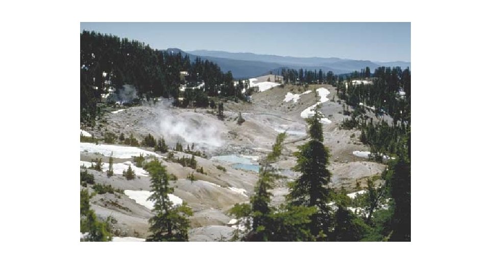
WARNING SIGNS… Close-up view of the solfatara at Ijen, Indonesia with fumarole temperature of more than 220°C.
WARNING SIGNS!! (P. 52) • 1. Increase in minor extrusive activity • Increase in thermal activity leads to a change in fumarolic activity- temp of hot springs and geysers become more frequent and vigorous. • There may also be an increase in the amount of steam issuing from an existing crater. Sometimes( e. g. with many Hawaiian volcanoes- a lava lake starts to develop inside the crater. . )
• 2. Increase in volcanic gases: e. g Sulphur dioxide. It was due to this that a 24 hr warning was given of the pending Mt Pinatubo eruption in the Philippines in 1991… • 3. Increase in frequency and severity of previous eruptions: allows evacuation • 4. Increase in seismic activity
VOLCANO PREDICTION METHODS
Methods of Prediction: ( see diagram p. 53 - add notes around it) • 1 Remote sensing: satellites with infra red detectors can monitor heat signals from volcanoes , suggesting that magma is rising towards the surface( e. g. Popacatapetal eruption, Mexico was monitored in this way) • 2. Seismicity: Frequently , minor earthquakes can indicate an oncoming volcano. ‘Harmonic tremors’ may occur- i. e. a narrow band of nearly continuous vibrations dominated by a single frequency ( e. g. prior to Mt. St. Helens erupted in USA 1982) • 3. Geophysical: Levelling surveys are undertaken ( e. g Mt Vesuvius, Italy) • 4. Hydrology: Water often rises to the surface prior to an eruption • 5. Gas: Increase in gases prior to an eruption e. g. Sulphur dioxide • 6. Ground deformation: Tiltmeters are used to measure ‘bulges’ which may occur as the ground upswells prior to an eruption. e. g. Mt St Helen’s bulge was naked to the human eye
Have we met our lesson objectives? : • To know the difference between predicting and forecasting hazard events • What prediction methods are currently in place? • ON A CARD WRITE DOWN 3 MAIN POINTS THAT YOU HAVE LEARNT FROM TODAY’S LESSON