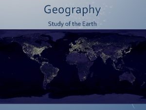
TOOLS OF GEOGRAPHY Geography The Study of Earth


- Slides: 31

TOOLS OF GEOGRAPHY

Geography: The Study of Earth 1. 1 • The study of the human and nonhuman features of Earth, our home. GEOGRAPHY

CARDINAL DIRECTIONS • Cardinal directions are North, South, East, and West. (N, S, E, W)

INTERMEDIATE DIRECTIONS • Intermediate directions lie between the cardinal directions. (NE, SE, NW, SW)

SPHERE A round-shaped body

LATITUDE • Is the distance measured in degrees north or south of the Equator. • Lines of latitude run east to west.

DEGREES Are units that measure angles(º)

MINUTES • Smaller units of measure for measuring longitude and latitude. (΄) Coordinates for Southaven, MS Latitude: 34° 59′ N Longitude: 90° 00′ W

EQUATOR • The imaginary line that divides the Earth into the Northern and Southern Hemisphere. • The Equator is also known as the 0º degree latitude line.

HEMISPHERE Each half of the Earth. Northern and Southern Hemisphere Eastern and Western Hemisphere

PRIME MERIDIAN • The imaginary line that divides the Earth into the Eastern and Western Hemisphere. • The Prime Meridian is known as the 0º line of longitude.

LONGITUDE • Is the distance measured in degrees east or west of the Prime Meridian. • Lines of longitude run North and South.

Geography’s Five Themes 1. 2 1. The five themes of geography are location, place, region, movement, and human-environment interaction. 2. Geographers answer 2 basic questions: 1. Where are things located? 2. Why are they there?

Location – where something is. *Absolute location – describes a place’s exact position on Earth in terms of longitude and latitude Ex: Mississippi is 32° 35’N, 89° 39’W Ex: Southaven is 34° N, 90° W *Relative location – the location of a place relative to another place. Ex: Southaven is about 196 miles N of Jackson

Place – refers to the mix of human and nonhuman features at a given location. Ex: hilly, wet, on a river, major city Region – an area with at least one unifying physical or human feature Ex: climate, landforms, population, or history. Movement – explores how people, goods, and ideas get from one place to another. Ex: food, fuel, and other basic goods.

Human-Environment Interaction considers how people affect their environment, or their natural surroundings, and how their environment affects them. Ex: The movement of water from the Potomac River into Washington’s water system.

Ways to Show Earth’s Surface 1. 3 Scale the area a given space on the map corresponds to in the real world. EX. One inch on a globe might correspond to 600 miles on Earth’s surface

aerial photographs photographic images of Earth’s surface taken from the air. satellite images pictures of Earth’s surface taken from a satellite in orbit.

DISTORTION The loss of accuracy in the size or position of objects on a map.

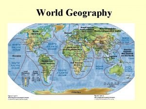
PROJECTIONS Ways to map Earth on a flat surface.

THE EQUAL-AREA PROJECTION An equal-area map shows the correct size of landmasses. However, their shapes are distorted.

THE MERCATOR PROJECTION The Mercator projection shows correct shapes and directions, but not true distances or sizes. Mercator maps make areas near the poles look bigger than they are.

THE ROBINSON PROJECTION The Robinson Projection shows nearly the correct size and shape of most land areas. Distortions are seen in areas around the edges of the map.

Under Standing Maps 1. 4 KEY Map key explains the symbols and shading on the map.

LOCATOR MAP The locator map shows a larger area than the main map. It shows where the area on the map is located within this larger area. Locator Map

SCALE BAR A scale bar shows how much space on the map represents a given distance on the land.

COMPASS ROSE A diagram of a compass showing direction. Compass rose

Types of Maps 1. 5 PHYSICAL MAP Physical maps show physical, or natural features.

ELEVATION Elevation is the height above sea level.

SPECIAL PURPOSE MAP Special-purpose maps show the location or distribution of human or physical features.

POLITICAL MAP Political maps show political units, such as countries or states.
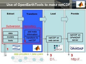
 Open earth tools
 Cutting tools in sewing with pictures and meaning
 Hình ảnh bộ gõ cơ thể búng tay
 Slidetodoc
 Bổ thể
 Tỉ lệ cơ thể trẻ em
 Chó sói
 Tư thế worms-breton
 Alleluia hat len nguoi oi
 Môn thể thao bắt đầu bằng từ đua
 Thế nào là hệ số cao nhất
 Các châu lục và đại dương trên thế giới
 Cong thức tính động năng
 Trời xanh đây là của chúng ta thể thơ
 Mật thư tọa độ 5x5
 Phép trừ bù
 Phản ứng thế ankan
 Các châu lục và đại dương trên thế giới
 Thơ thất ngôn tứ tuyệt đường luật
 Quá trình desamine hóa có thể tạo ra
 Một số thể thơ truyền thống
 Cái miệng bé xinh thế chỉ nói điều hay thôi
 Vẽ hình chiếu vuông góc của vật thể sau
 Nguyên nhân của sự mỏi cơ sinh 8
 đặc điểm cơ thể của người tối cổ
 Thế nào là giọng cùng tên? *
 Vẽ hình chiếu đứng bằng cạnh của vật thể
 Tia chieu sa te
 Thẻ vin
 đại từ thay thế
 điện thế nghỉ
 Tư thế ngồi viết
