Three party seminar March 25 28 2014 Target


- Slides: 18
Three party seminar, - March 25 -28 2014 Target group for an. Nuuk ASDI Arctic Spatial Data Infra Structure – Arctic SDI - Nuuk 25 -28. March 2014 SIDE 1
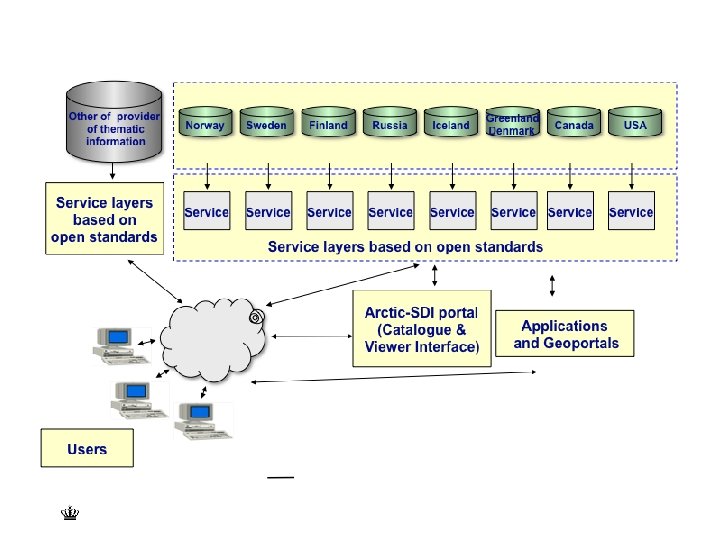
Arctic SDI A cooperation between the mapping agencies of: • Canada • • • Denmark including Greenland Faroe island Finland Iceland Russia Sweden USA Arctic SDI - Nuuk 25 -28. March 2014 SIDE 2
Arctic SDI • 1/6 of the earth´s landmass • More than 30 million km 2 • 8 countries • 24 hours all time zones Arctic SDI - Nuuk 25 -28. March 2014 SIDE 3
Aim and vision of Arctic SDI • Artic SDI will provide access to geo-referenced thematic data over the Artic which means that the data can be related to a reference map across borders of the artic countries Arctic SDI - Nuuk 25 -28. March 2014 SIDE 4
User groups for an Arctic SDI • The Artic Council Working Groups: - Arctic Contaminants Action Program (ACAP) - Artic Monitoring and Assesment Programme (AMAP) - Conservation of Artic Flora and Fauna (CAFF) - Emergency Prevention, Preparedness and Response (EPPR) - Protection of the Artic Marine Environment (PAME) - Sustainable Development Working Group (SDWG) • Research institutions • Government and governmental authorities • Citicens including NGOs • Private Enterprises and business Arctic SDI - Nuuk 25 -28. March 2014 SIDE 5
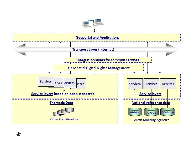
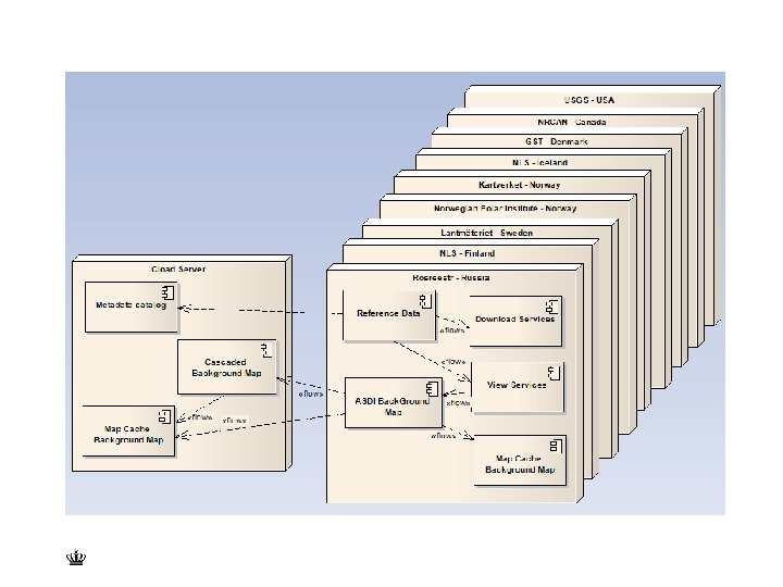
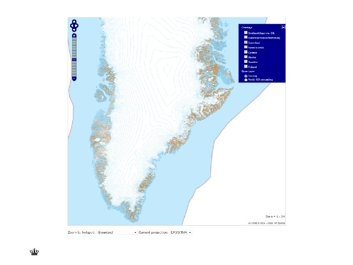
Main content of the Artic SDI The Artic SDI is an infrastructure that provides a web portal with easy access to: • Reference data as a Web Map Service • Thematic data (birds, icecover, ship routes, land cover change, flora etc. ) • A searchable metadata-catalogue Arctic SDI - Nuuk 25 -28. March 2014 SIDE 6
Use of the Artic SDI • Research • Planning • Political processes • Public administration and management • Emergency prevention • Business development Arctic SDI - Nuuk 25 -28. March 2014 SIDE 7
Arctic SDI Board National Contact Points CAN ALL Secretariat CAN DEN SWE Canada Denmark Finland Iceland Norway Russia Sweden USA Communication NOR SWE CAN Strategy 2015 -2022 USA DEN FIN ALL Operational Policies DEN USA CAN Technical Working Group Cloud & Cascading Service Geoportal SWE NOR FIN Lead Countries FIN NOR SWE Supporting Countries ALL Activities
Activities and division of work Activity Lead country Secretariat for the chair of the board and chair of the national contact point Canada Communication, website ect. Norway Tecnical working group Sweden Development of legal/adm. operational policies Denmark Development of Arctic SDI strategy 2015 -2010 USA Establish and operate Arctic SDI Web Map Service Norway Artic SDI Web Portal for reference map and thematic data – including the CAFF-data Finland Arctic SDI - Nuuk 25 -28. March 2014 SIDE 9
Implementation Ultimo 2014: • Web portal • Web map service • CAFF thematic data Arctic SDI - Nuuk 25 -28. March 2014 SIDE 10
Arctic SDI - Nuuk 25 -28. March 2014 SIDE 11
ISO 19115 / INSPIRE architecture Application and Geoportals Service Bus Rights Management Layer Service Layer Data Sources Registry Service Registers Discovery Service Metadata Data Set Metadata View Service Download Service Spatial Data Set Transf. Service Invoke. SD Service
Different levels Building on OGC standards 1. Discovery HTML 5 Geo. Networks 2. View WMS, WMTS Geo. Server, Mapserver 3. Download WFS, WCS Geo. Server, Mapserver 4. Transform WPS ? ? ? 5. Invoke