THIRD REGIONAL TECHNICAL MEETING Pretoria South Africa 20
 20 October 2014 Socio-economic and Environmental Assessment")


 There are 9")


- Slides: 23
THIRD REGIONAL TECHNICAL MEETING (Pretoria, South Africa) 20 October 2014 Socio-economic and Environmental Assessment for Namibia Don Muroua 20 October 2014 Pretoria
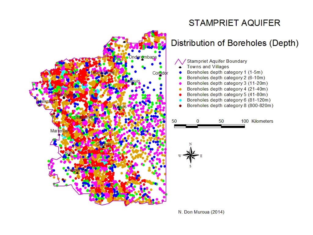
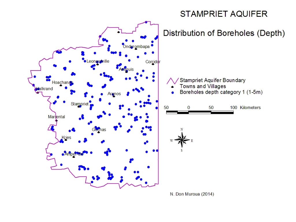
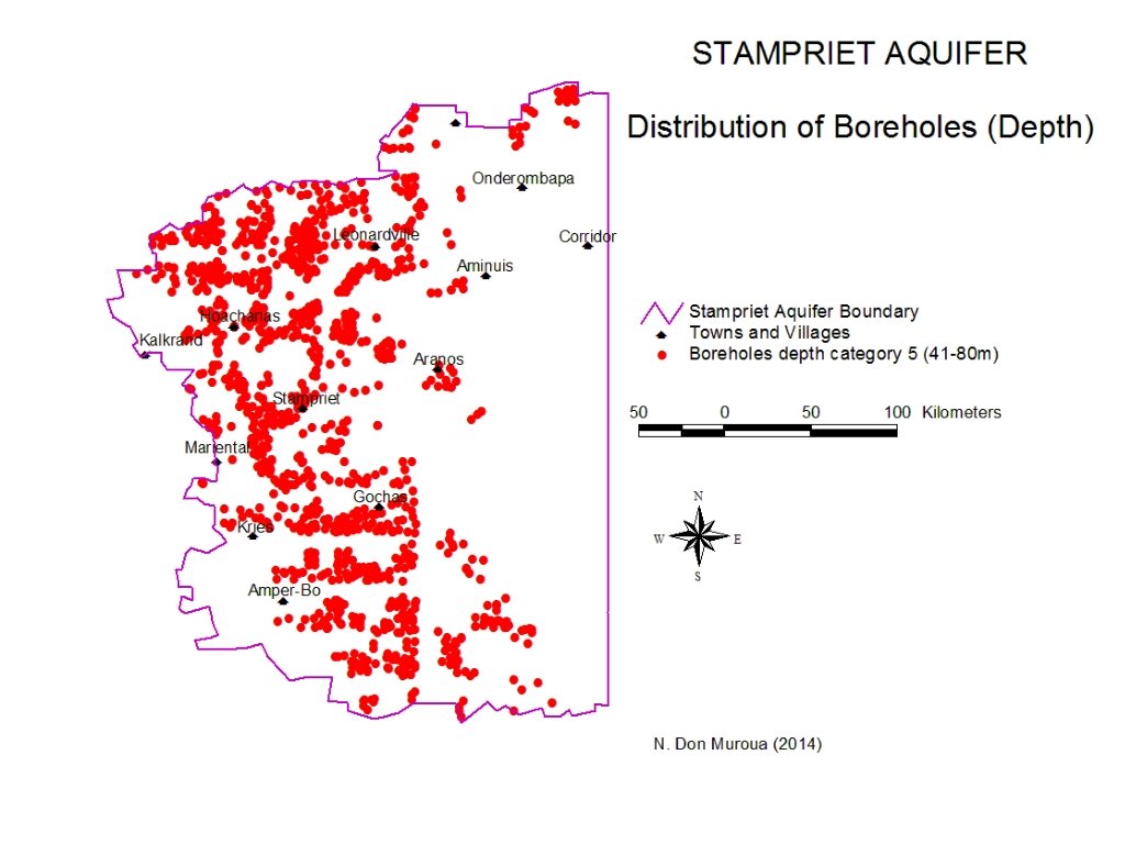
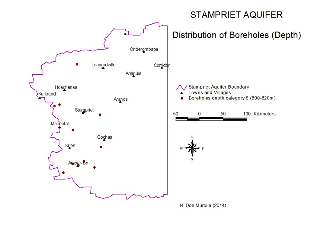
Environmental aspects Parameters and Variables D. 1 Suitability for human 1. There about 3868 boreholes and wells in the Stampriet Aquifer which vary in depth from 1 m deep to 818 m deep. In consumption (natural general, the most common depth for boreholes is between groundwater quality 2. 3. 4. 5. 6. 7. 1 m to 114 m deep. The only boreholes deeper than 114 m deep are staring from 800 m deep to 818 m deep, and they are only 12 of them. According to the World Health Organisation, portable water with TDS value between 0 to 600 mg/l is considered very good, while TDS value of between 601 mg/l to 1000 mg/l is considered good enough for drinking. Higher concentration is considered not good for drinking. Stampriet Aquifer, 30% (1149) of the boreholes yield water with TDS value of 600 mg/l and lower. 33% (1264) of the boreholes produce water with a TDS value of between 601 mg/l to 1000 mg/l. While 37% (1455) of the remaining boreholes produce water with TDS value of more than 1001 mg/l, hence not suitable for drinking. The general depth of these boreholes are between 1 m to 112 m. Place for text The high concentration of natural contaminates correlate with higher TDS concentrations in the Stampriet Aquifer
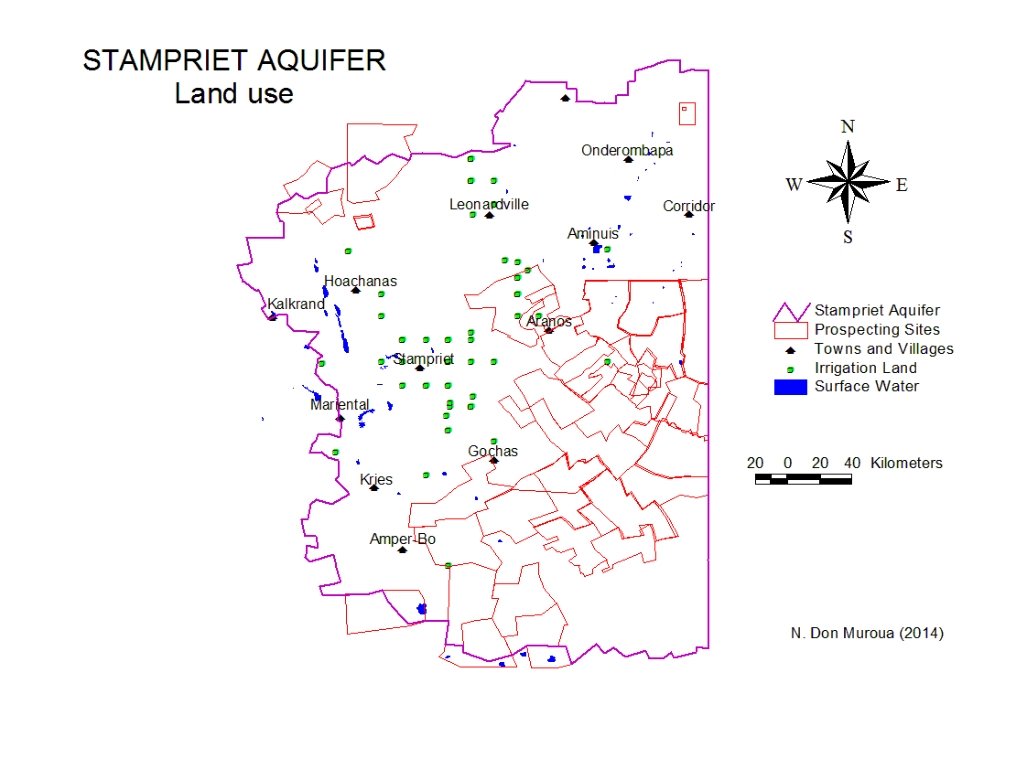
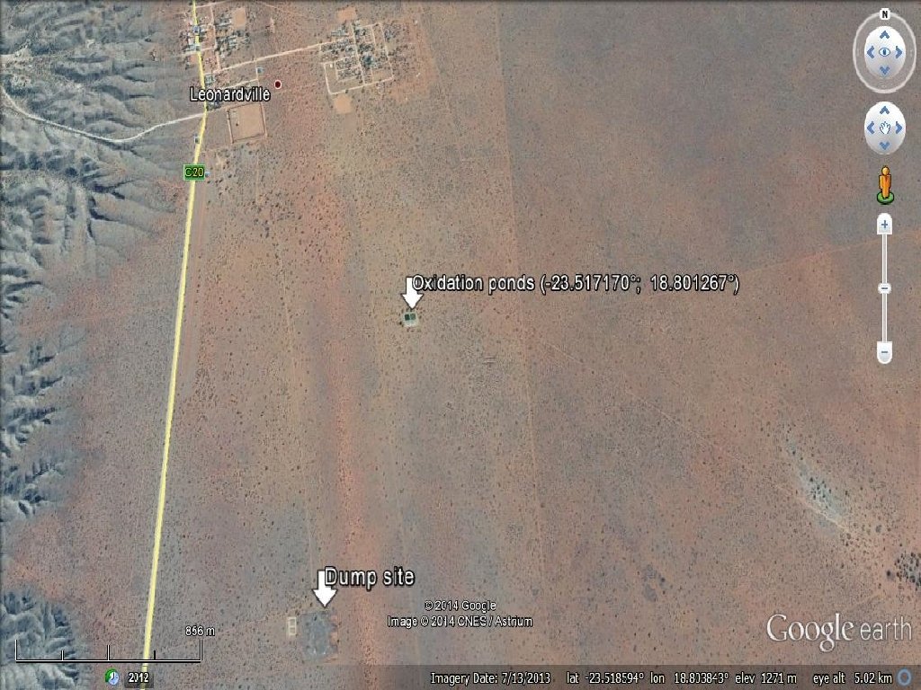
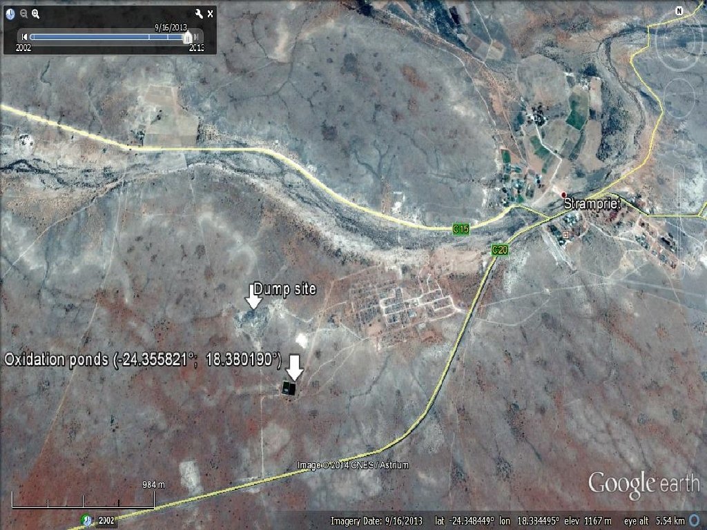
Environmental aspects Parameters and Variables D. 2 Groundwater pollution 1. If we consider that Mariental is outside the Stampriet Aquifer, than we can conclude that there are no major polluting industries in the Aquifer. The main pollutants can be oxidation ponds, septic tanks, landfills and irrigation fields. 2. All the main towns and settlements such as Aminuis, Stampriet, Aranos, Leonardville, Gochas, Hoachanas, Onderombapa, and Kalkveld are serviced with oxidation ponds, while Aranos and Leonardville also use septic tanks. This could be a common mix use in all major developing towns and villages. 3. Localised groundwater pollution is expected in the urban centers but only in the superficial layers. This pollution can leach to lower Aquifer layers during the above average rainfall seasons. It is also important to note that most of the boreholes found within these urban centers are those with at least 41 m depth. It is not clear if this depth indicated water level or the actual depth of the borehole. I will need to look into this matter. 4. Except for septic tanks, landfills and oxidation ponds, groundwater pollution can occur as a result of using fertilizers and pesticides. Irrigation lands pose the most significant threat to the Aquifers water Place for text quality. The irrigated areas/plots are not continuous but scattered on different farms and hence this situation reduces the significance to broader Aquifer pollution. 5. Mining is currently not taking place, but prospecting and exploration is. These activities do not pose any significant threat to the Aquifer.
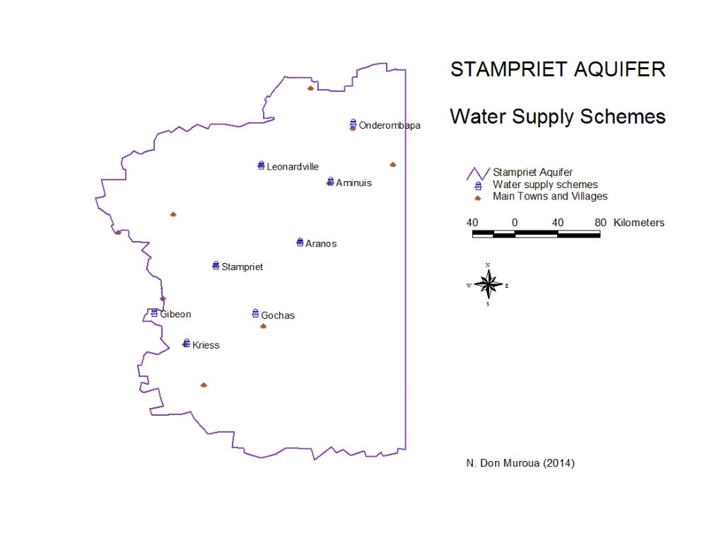
Environmental aspects Parameters and Variables D. 3 Solid Waste and waste water control 1. According to the information from Nam. Water, there are 8 water supply schemes within the Stampriet Aquifer. These are, Leonardville, Aminuis, Gibeon, Gochas, Kriess, Stampriet, Aranos and Onderombapa. These schemes are located within their respective townlands. Hoachanas has its own borehole for which the settlement is responsible for and is getting its water from. 2. Data selected for the water supply schemes is between May 2013 to April 2014. More data is available though. There is a need to confirm whether Kalkrand Mariental are part of the Stampriet Aquifer or not. Hence data for these places were not presented or collected. 3. I could not secure data on the amount of wastewater being generated, thus the rule of thumb used by the Civil Engineers was used, that on average, 80% of water used in a household becomes wastewater. The Table below textplaces in the aquifer area has sewage also. Place showsfor which ponds, septic/conservancy tanks, dumping sites and how much wastewater is generated based on the rule of thumb.
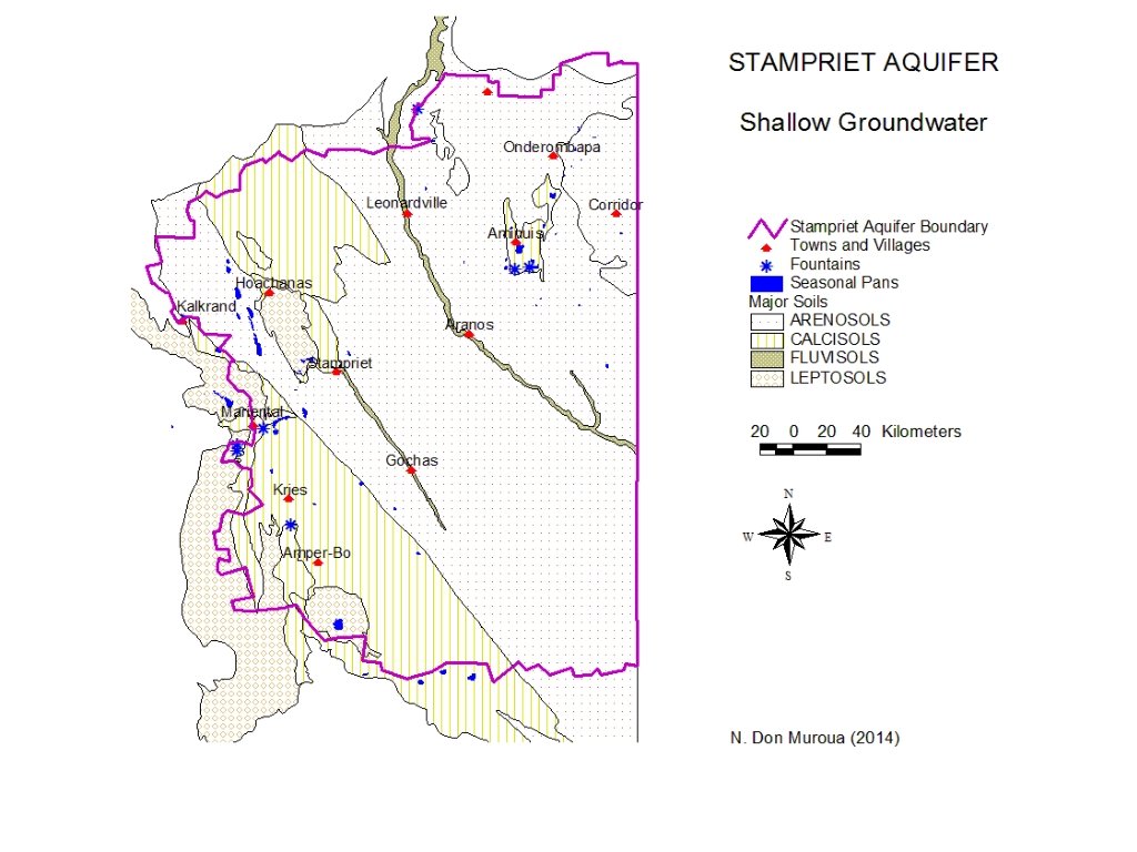
Environmental aspects Parameters and Variables D. 4 Shallow groundwater 1. According to the information secured, there are six table fountains in the Stampriet Aquifer. This does not necessarily mean that they are all active and with water. The fountains are usually small and do not support important habitats and wildlife. Visiting some of these sites might be necessary to quantify and quality their importance. 2. The alluvial aquifer within the ephemeral rivers such as the Nossob, supports a variety of vegetation communities. Some of this river vegetation is encroached by the alien invasive Prosopis spp native from the America. Many farmers have reported this encroachment to lower the water table within the alluvial aquifer. Place for text
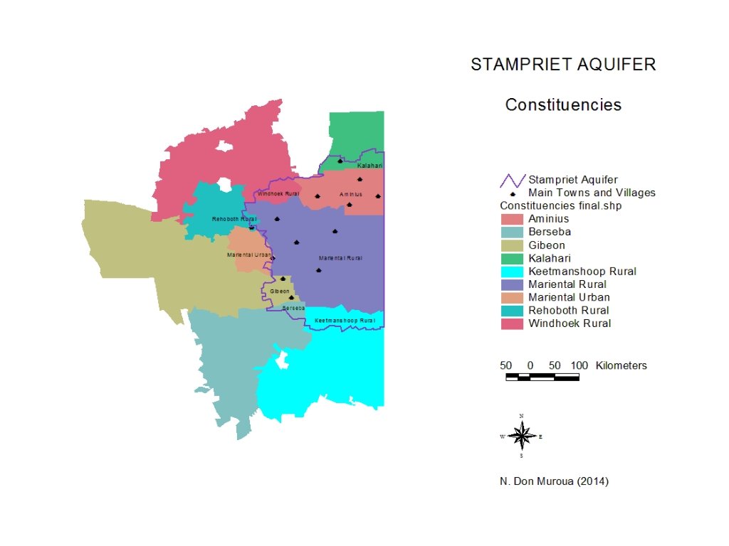
Socio-economic aspects Parameters and Variables E. 1 Population (total and density) There are 9 constituencies covering the Stampriet Aquifer. The most important once are the Mariental rural and Aminuis Constituencies. These two constituencies are found only in the Stampriet Aquifer, making the Mariental Rural the largest in area and population. The two constituencies cover at least 80% of the aquifer area. 2. 2 km² /person or Place for text 0. 5 people per km²
Socio-economic aspects Parameters and Variables E. 2 Groundwater abstraction (Total volume and per groundwater use) Nam. Water Local Authorities Other Institutions, e. g. Stampriet Water/Irrigation Committee E. 3 Fresh water abstraction (Total and per type of use) No fresh water abstracted, especially when Mariental is excluded E. 4 Dependence of industry and agriculture on groundwater No industries, especially when Mariental is excluded Nam. Water Veterinary Services Other Institutions, e. g. Stampriet Water/Irrigation Committee and Farmers Place for text Unions
Socio-economic aspects Parameters and Variables E. 5 Percentage of population covered by public water supply Local Authorities Regional Council E. 6 Percentage of population covered by public water supply sanitation Local Authorities Regional Council Gender 1. Give the percentage of rural and urban population in the aquifer's area. 2. What is the population annual growth rate? 3. Give the percentage of farms run by females. 4. Give the percentage of cultivated area run by females. 5. Give the percentage of the average size of farms run by females compared to those of males.
Place for text THANK YOU Place for text