The World Ocean Floor Ocean Thematic Layers Graphics


- Slides: 22
The World Ocean Floor
Ocean Thematic Layers Graphics courtesy of Joe Breman, ESRI
Fishing Patterns 1998 -’ 99 Pre-Footrope Regulation Tows 1998 -1999 Reference Site 2 Trawl Patterns – Rocky Habitat By Or. St grad student Marlene Bellman
Fishing Patterns, 2000 -’ 01 Post-Footrope Regulation Tows 2000 -2001 Reference Site 2 Trawl Patterns – Rocky Habitat By Or. St grad student Marlene Bellman
Marine Sanctuary Exploration
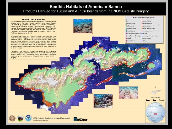
Map courtesy of the National Park of American Samoa
Artwork by Jayne Doucette, Woods Hole Oceanographic Institution
Samoan Reefs: Some Major Issues • Natural & human impacts – Crown-of-thorns invasion, hurricanes – Illegal fishing, sewage outfall • Largely unexplored below depths of ~3060 m – no comprehensive documentation of the plants, animals, and submarine topography. • Very little known of shelf-edge (50 -120 m deep) coral reef habitats throughout the world
Multibeam Surveys, 2001 and 2002 Revelle Tracks November 2002 Multibeam Survey 2001 Multibeam Survey By Or. St grad student Emily Lundblad
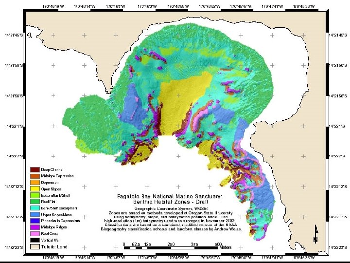
Fagatele Bay National Marine Sanctuary
GIS Terrain Analysis, w/ visual surveys, and IKONOS classification By Or. St grad student Emily Lundblad
Benthic Habitat Accuracy Assessment
http: //dusk. geo. orst. edu/djl/samoa
http: //dusk. geo. orst. edu/djl/samoa
www. coastalatlas. net
Cross Functions: Retrieve & Map
Maps For users who want landscape/seascape context Prepared Maps Custom Maps Detailed Information Personal Output
Cross Functions: Regions, Issues
Cross Functions: Specific Tools