The Weather Fronts Mountains Heat Capacity Latent Heat


- Slides: 40

“The Weather” Fronts Mountains Heat Capacity Latent Heat

Clouds and Rain Warm air holds more moisture than cold air. As warm air rises, it cools and cannot hold moisture Cloud formation and precipitation is determined ultimately by the vertical movement of air. Upward motion enhances cloud formation Cloud formation leads to rainfall.

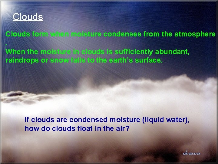
Clouds form when moisture condenses from the atmosphere. When the moisture in clouds is sufficiently abundant, raindrops or snow falls to the earth’s surface. If clouds are condensed moisture (liquid water), how do clouds float in the air?

How do Clouds Float? Updrafts Evaporation Terminal Velocity Size: 10 micons Velocity: 0. 3 cm/sec or 10 meters/hr ETA: 350 hours (3500 m or 10, 500 ft) 120 to 200 mph It takes about 15 million cloud droplets to form the typical raindrop

Precipitation: Rainfall

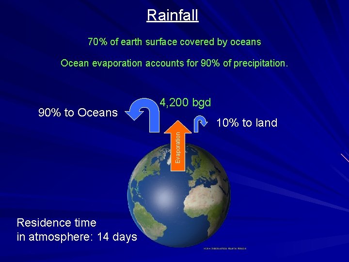
Rainfall 70% of earth surface covered by oceans Ocean evaporation accounts for 90% of precipitation. 10% to land Evaporation 90% to Oceans 4, 200 bgd Residence time in atmosphere: 14 days

Rainfall and Rainfall Types Frontal Orographic Convective

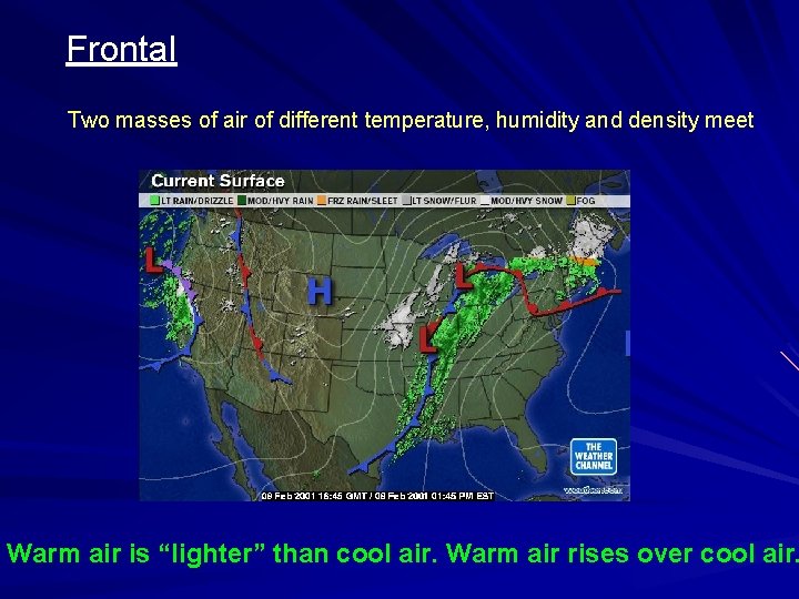
Frontal Two masses of air of different temperature, humidity and density meet Warm air is “lighter” than cool air. Warm air rises over cool air.

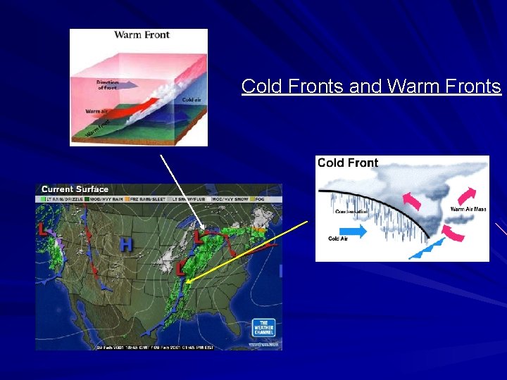
Cold Fronts and Warm Fronts

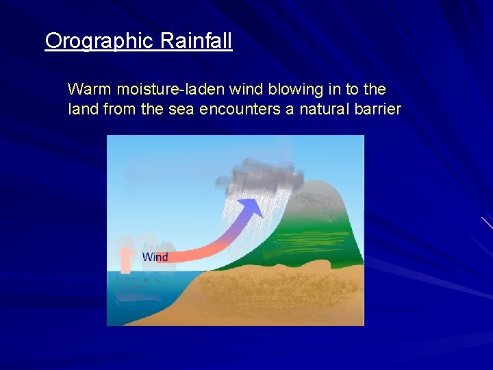
Orographic Rainfall Warm moisture-laden wind blowing in to the land from the sea encounters a natural barrier

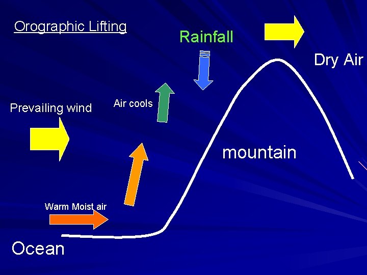
Orographic Lifting Rainfall Dry Air Prevailing wind Air cools mountain Warm Moist air Ocean

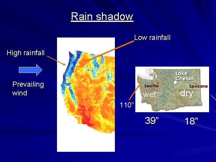
Rain shadow Low rainfall High rainfall Prevailing wind wet dry 110” 39” 18”

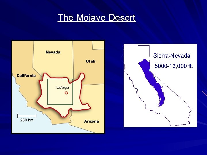
The Mojave Desert Sierra-Nevada 5000 -13, 000 ft.

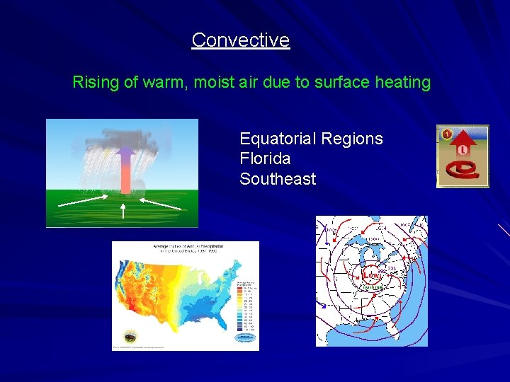
Convective Rising of warm, moist air due to surface heating Equatorial Regions Florida Southeast

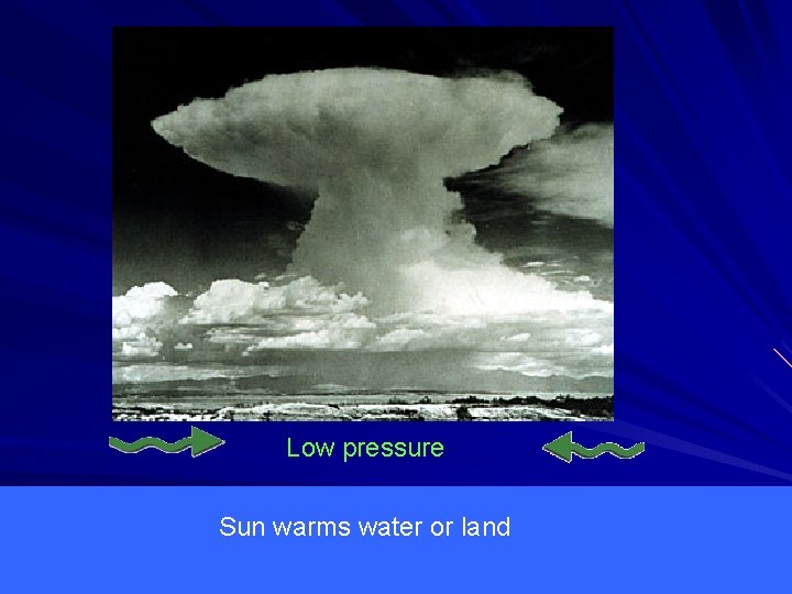
cools Low pressure Sun warms water or land

Hurricanes are Convective Storms High Amounts of Solar Heating Moist Air When? Where?

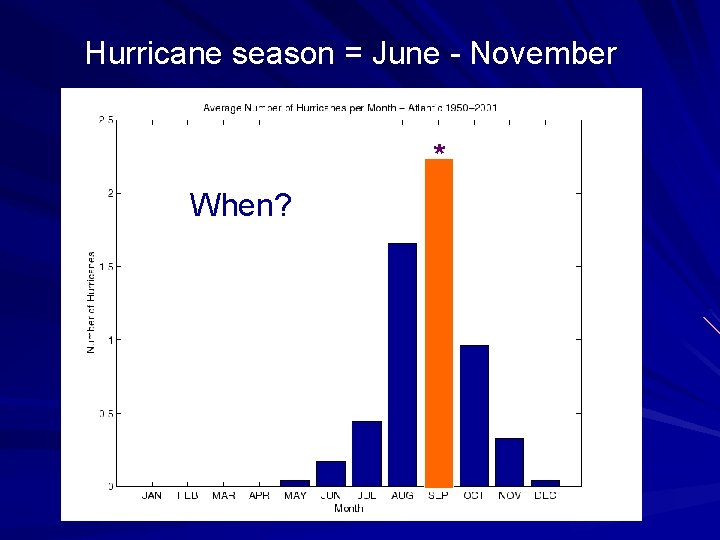
Hurricane season = June - November * When?

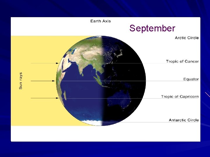
June September 23. 26 o

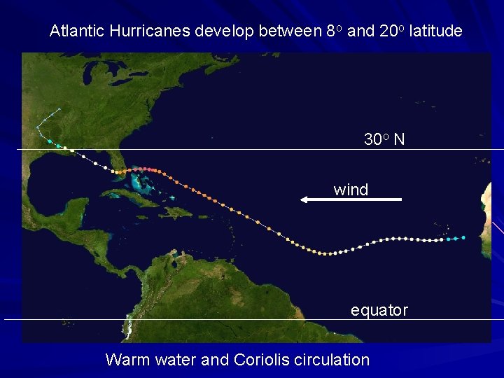
Atlantic Hurricanes develop between 8 o and 20 o latitude 30 o N wind equator Warm water and Coriolis circulation

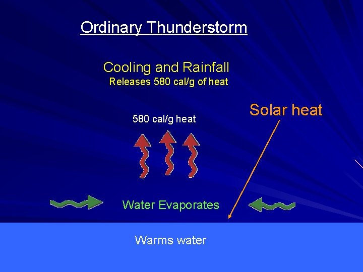
Ordinary Thunderstorm Cooling and Rainfall Releases 580 cal/g of heat 580 cal/g heat Water Evaporates Warms water Solar heat

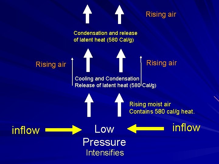
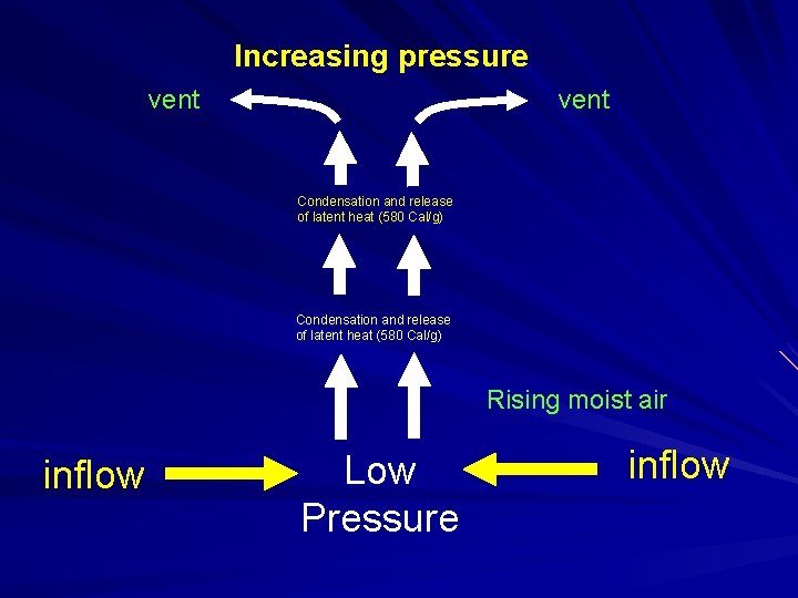
Rising air Condensation and release of latent heat (580 Cal/g) Rising air Cooling and Condensation Release of latent heat (580 Cal/g) Rising moist air Contains 580 cal/g heat. inflow Low Pressure Intensifies inflow

Increasing pressure vent Condensation and release of latent heat (580 Cal/g) Rising moist air inflow Low Pressure inflow

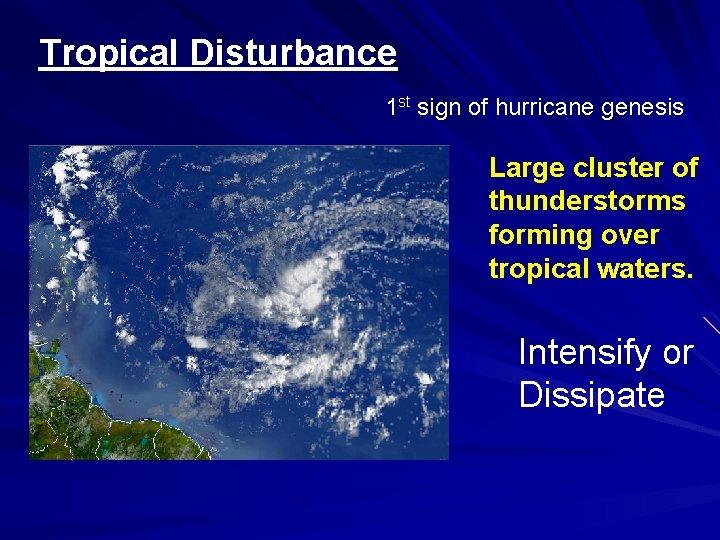
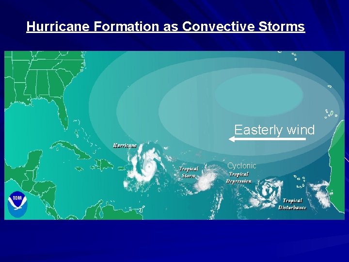
Tropical Disturbance 1 st sign of hurricane genesis Large cluster of thunderstorms forming over tropical waters. Intensify or Dissipate

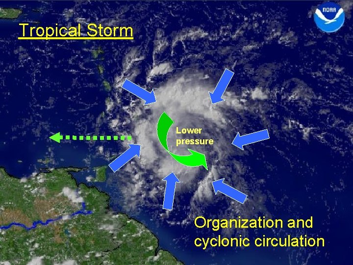
Tropical Storm Lower pressure Organization and cyclonic circulation

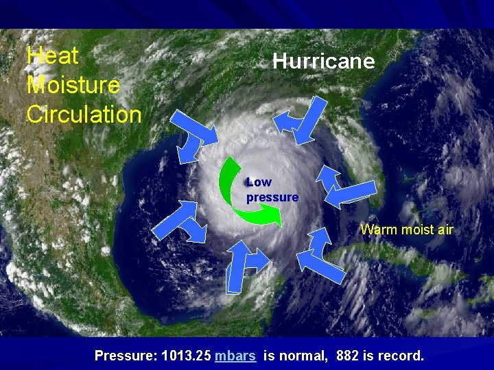
Heat Moisture Circulation Hurricane Low pressure Warm moist air Pressure: 1013. 25 mbars is normal, 882 is record.

Hurricane Formation as Convective Storms Easterly wind Cyclonic

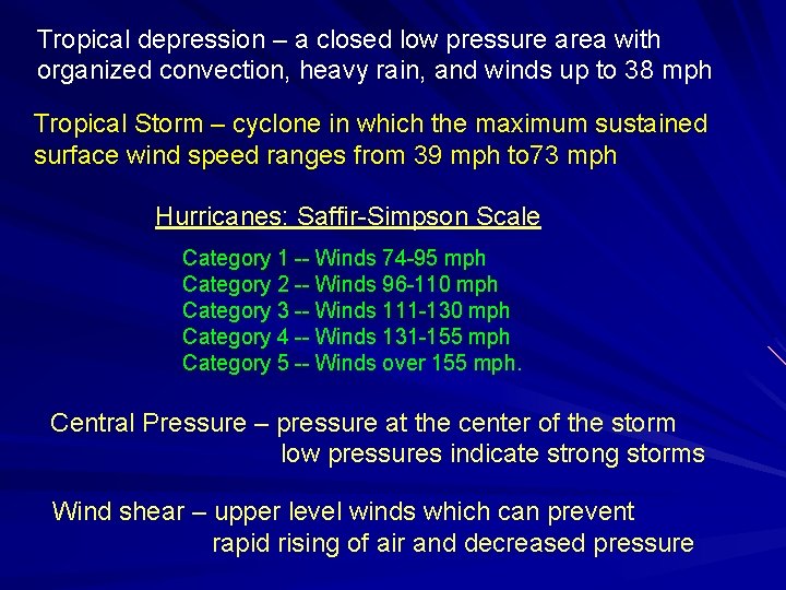
Tropical depression – a closed low pressure area with organized convection, heavy rain, and winds up to 38 mph Tropical Storm – cyclone in which the maximum sustained surface wind speed ranges from 39 mph to 73 mph Hurricanes: Saffir-Simpson Scale Category 1 -- Winds 74 -95 mph Category 2 -- Winds 96 -110 mph Category 3 -- Winds 111 -130 mph Category 4 -- Winds 131 -155 mph Category 5 -- Winds over 155 mph. Central Pressure – pressure at the center of the storm low pressures indicate strong storms Wind shear – upper level winds which can prevent rapid rising of air and decreased pressure

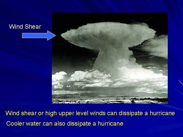
Wind Shear Wind shear or high upper level winds can dissipate a hurricane Cooler water can also dissipate a hurricane

Extra Credit Question: Identify the 3 types of rainfall discussed. Answer on the back of the lecture question sheet (You may use your notes)

Other Extreme Weather

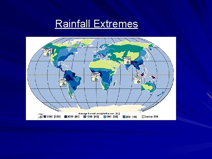
Rainfall Extremes <10 in

Records HIGHEST AVERAGE ANNUAL RAINFALL Tutunendo, Colombia - 463. 4 inches (38. 6 ft) HIGHEST IN ONE YEAR Cherrapunji, India 1, 042 inches (86. 8 ft) HIGHEST IN 24 HOURS Fac, La Reunion Island 72 inches (6 ft)

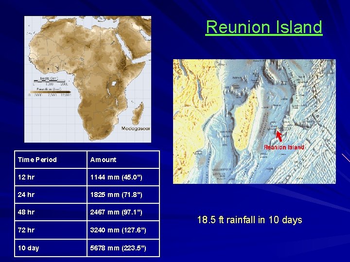
Reunion Island Time Period Amount 12 hr 1144 mm (45. 0") 24 hr 1825 mm (71. 8") 48 hr 2467 mm (97. 1") 72 hr 3240 mm (127. 6") 10 day 5678 mm (223. 5") 18. 5 ft rainfall in 10 days

Driest Weather

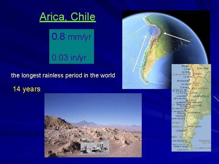
Arica, Chile 0. 8 mm/yr 0. 03 in/yr the longest rainless period in the world 14 years Cool water

U. S. Weather

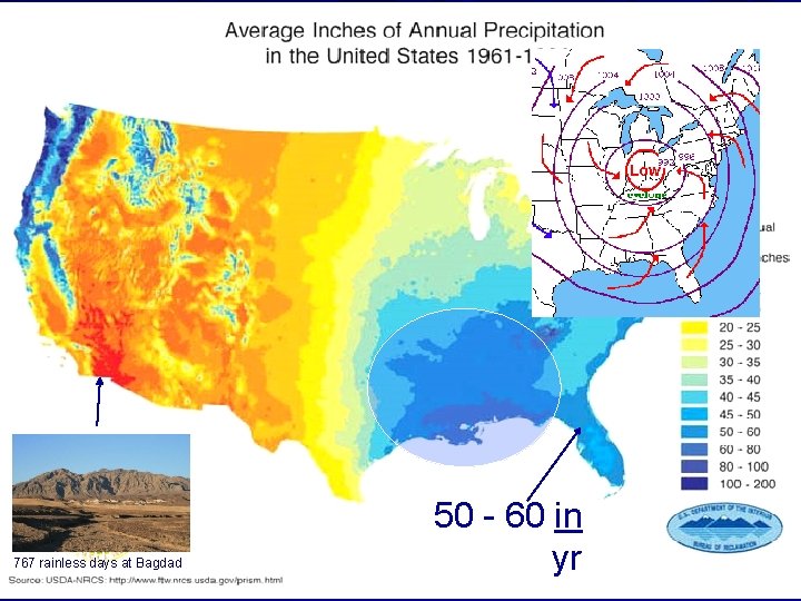
Phoenix 7. 6 in Chicago 36 NYC 41 Miami 59 767 rainless days at Bagdad 50 - 60 in yr

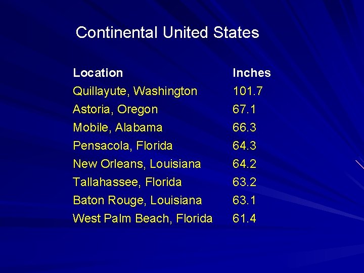
Continental United States Location Quillayute, Washington Astoria, Oregon Mobile, Alabama Inches 101. 7 67. 1 66. 3 Pensacola, Florida New Orleans, Louisiana Tallahassee, Florida Baton Rouge, Louisiana West Palm Beach, Florida 64. 3 64. 2 63. 1 61. 4

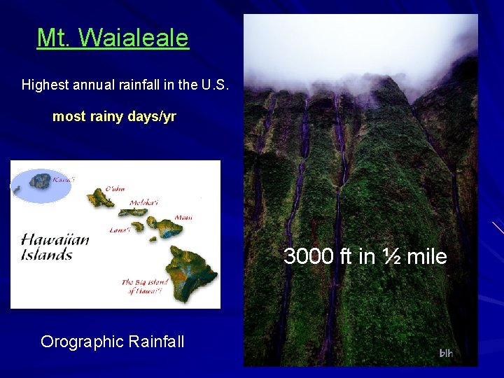
Mt. Waialeale Highest annual rainfall in the U. S. most rainy days/yr 3000 ft in ½ mile Orographic Rainfall

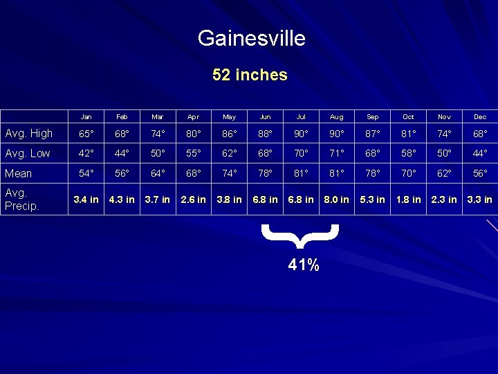
Gainesville 52 inches Jan Feb Mar Apr May Jun Jul Aug Sep Oct Nov Dec Avg. High 65° 68° 74° 80° 86° 88° 90° 87° 81° 74° 68° Avg. Low 42° 44° 50° 55° 62° 68° 70° 71° 68° 50° 44° Mean 54° 56° 64° 68° 74° 78° 81° 78° 70° 62° 56° 3. 4 in 4. 3 in 3. 7 in 2. 6 in 3. 8 in 6. 8 in 8. 0 in 5. 3 in 1. 8 in 2. 3 in 3. 3 in Avg. Precip. } 41%