The South American Monsoon System Recent Evolution and
- Slides: 16

The South American Monsoon System: Recent Evolution and Current Status Update prepared by Climate Prediction Center / NCEP 9 May 2010 For more information, visit: http: //www. cpc. ncep. noaa. gov/products/Global_Monsoons/American_Monsoons

Outline • Highlights • Recent Evolution and Current Conditions • NCEP/GFS Model Forecasts • Climatology

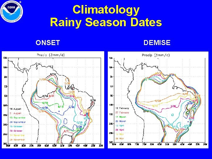
Highlights • The rainy season in Central Brazil (monsoon region) ended in early April. • During the next 7 days (week 1), the GFS predicts below-average rainfall over a large area of South America (from Ecuador extending southward across southwestern Amazon basin, Peru, Bolivia, Paraguay, southern Brazil, and Uruguay). For the following week (week 2) the drier-than-average conditions are predicted to shift northward over central and northeastern Brazil.

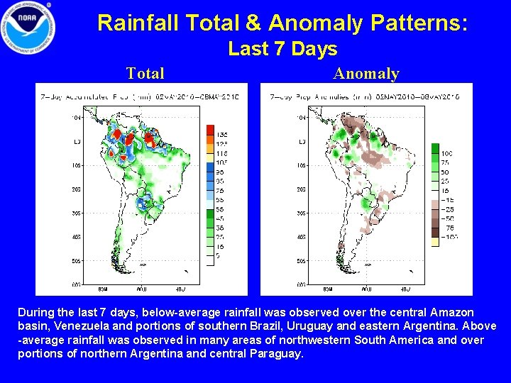
Rainfall Total & Anomaly Patterns: Last 7 Days Total Anomaly During the last 7 days, below-average rainfall was observed over the central Amazon basin, Venezuela and portions of southern Brazil, Uruguay and eastern Argentina. Above -average rainfall was observed in many areas of northwestern South America and over portions of northern Argentina and central Paraguay.

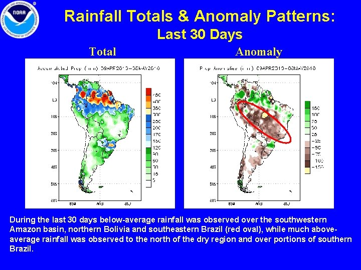
Rainfall Totals & Anomaly Patterns: Last 30 Days Total Anomaly During the last 30 days below-average rainfall was observed over the southwestern Amazon basin, northern Bolivia and southeastern Brazil (red oval), while much aboveaverage rainfall was observed to the north of the dry region and over portions of southern Brazil.

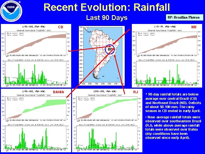
Recent Evolution: Rainfall Last 90 Days BP: Brazilian Plateau CB NB BP BAHIA RJ • 90 -day rainfall totals are belowaverage over central Brazil (CB) and Northeast Brazil (NB). Deficits of about 50 -100 mm. The rainy season in CB ended in early April. • Near-average rainfall totals were observed over southeastern Brazil (RJ), while above-average rainfall totals were observed over Bahia (dry conditions have been observed since early April).

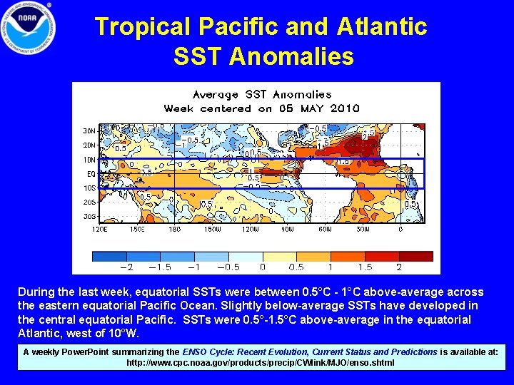
Tropical Pacific and Atlantic SST Anomalies During the last week, equatorial SSTs were between 0. 5°C - 1°C above-average across the eastern equatorial Pacific Ocean. Slightly below-average SSTs have developed in the central equatorial Pacific. SSTs were 0. 5°-1. 5°C above-average in the equatorial Atlantic, west of 10°W. A weekly Power. Point summarizing the ENSO Cycle: Recent Evolution, Current Status and Predictions is available at: http: //www. cpc. noaa. gov/products/precip/CWlink/MJO/enso. shtml

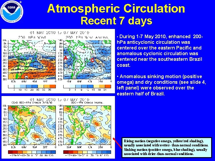
Atmospheric Circulation Recent 7 days • During 1 -7 May 2010, enhanced 200 - A C h. Pa anticyclonic circulation was centered over the eastern Pacific and anomalous cyclonic circulation was centered near the southeastern Brazil coast. • Anomalous sinking motion (positive omega) and dry conditions (see slide 4, left panel) were observed over the eastern half of Brazil. Rising motion (negative omega, yellow/red shading), usually associated with wetter- than-normal conditions. Sinking motion (positive omega, blue shading), usually associated with drier-than-normal conditions.

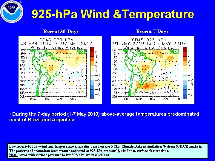
925 -h. Pa Wind &Temperature Recent 30 Days Recent 7 Days • During the 7 -day period (1 -7 May 2010) above-average temperatures predominated most of Brazil and Argentina. Low-level (~600 m) wind and temperature anomalies based on the NCEP Climate Data Assimilation Systems (CDAS) analysis. The patterns of anomalous temperature and wind at 925 -h. Pa are usually similar to surface observations. Note: Areas with surface pressure below 925 -h. Pa are masked out.

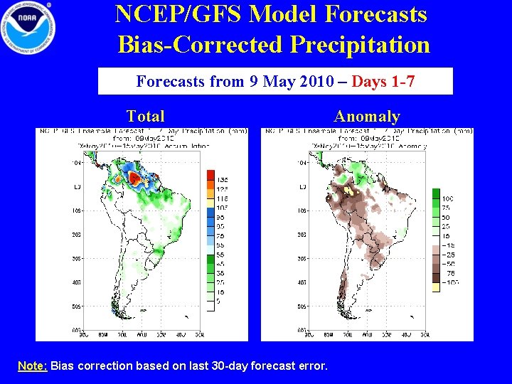
NCEP/GFS Model Forecasts Bias-Corrected Precipitation Forecasts from 9 May 2010 – Days 1 -7 Total Note: Bias correction based on last 30 -day forecast error. Anomaly

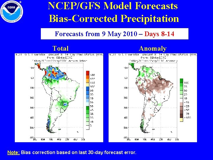
NCEP/GFS Model Forecasts Bias-Corrected Precipitation Forecasts from 9 May 2010 – Days 8 -14 Total Note: Bias correction based on last 30 -day forecast error. Anomaly

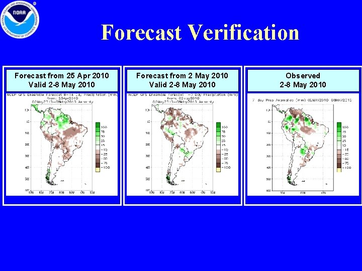
NCEP/GFS MODEL FORECASTS • For Days 1 -7 (9 -15 May), below-average rainfall is predicted from Ecuador extending southward across the southwestern Amazon basin, Peru, Bolivia, Paraguay, southern Brazil, and Uruguay. Above-average rainfall is predicted over Venezuela. • For Days 8 -14 (16 -22 May), dry conditions are predicted to dominate a larger area of South America (most of the area 1°N 17°S; 80°W-35°W), while above-average rainfall is predicted to the north of the dry region. NOTE: See forecast verification in the next slide.

Forecast Verification Forecast from 25 Apr 2010 Valid 2 -8 May 2010 Forecast from 2 May 2010 Valid 2 -8 May 2010 Observed 2 -8 May 2010

Climatology Rainy Season Dates ONSET DEMISE

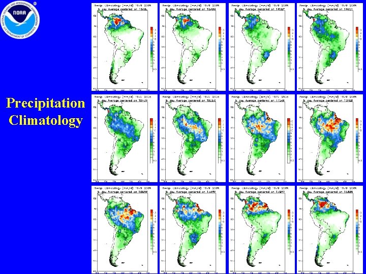
Precipitation Climatology

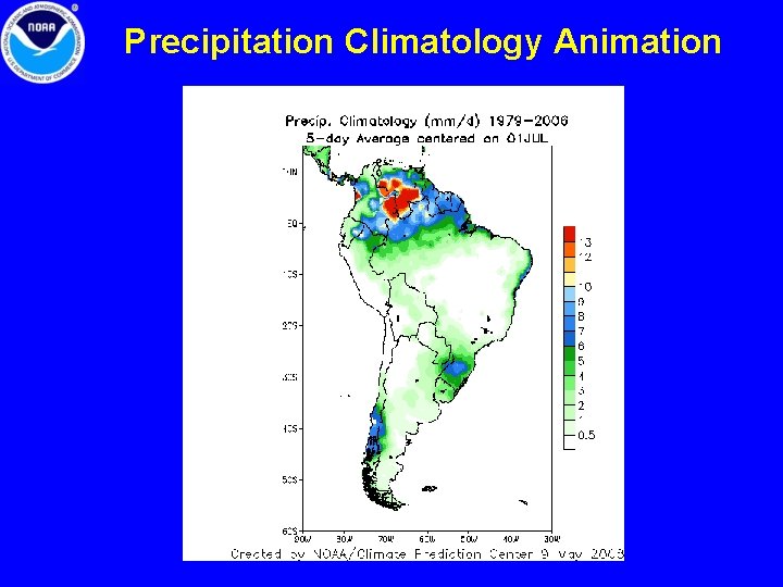
Precipitation Climatology Animation