The South American Monsoon System Recent Evolution and
- Slides: 15

The South American Monsoon System: Recent Evolution and Current Status Update prepared by Climate Prediction Center / NCEP 01 April 2019 For more information, visit: http: //www. cpc. ncep. noaa. gov/products/Global_Monsoons/American_Monsoons

Outline • Highlights • Recent Evolution and Current Conditions • NCEP/GFS Model Forecasts • Climatology

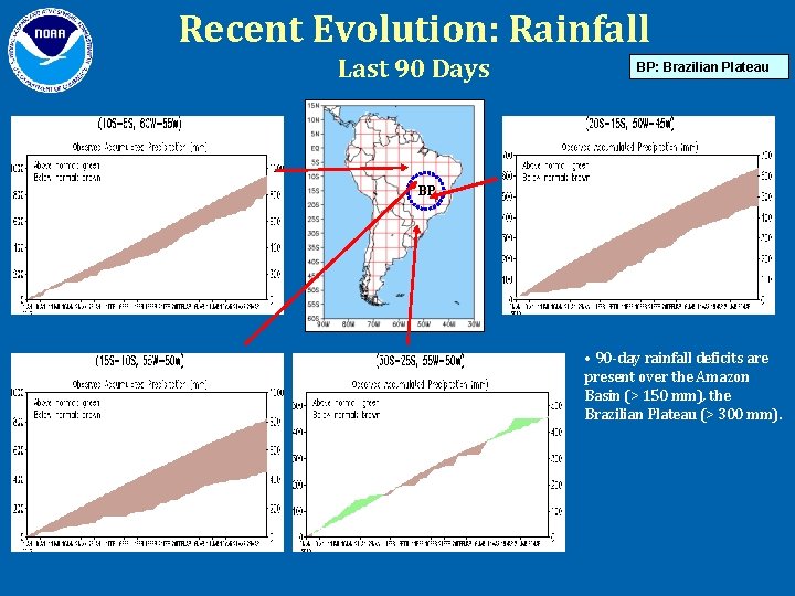
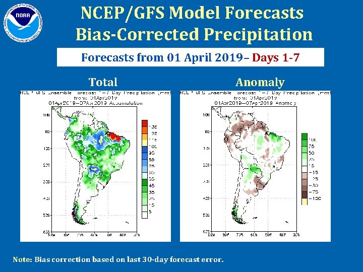
Highlights • Long-term rainfall deficits are present over the Amazon Basin and the Brazilian Plateau. • During the last 7 days, below-average precipitation was observed over much of southern Brazil, Uruguay, eastern Argentina, southern Chile, Paraguay, northern Bolivia, western Ecuador and eastern Colombia. Above-average precipitation was observed over portions of eastern and northwestern Brazil, northern Peru and central Colombia. • For Days 1 -7 (01 – 07 April 2019), below-average precipitation is predicted over much of northwestern South America, southern Brazil, Uruguay and central Argentina. Above-average precipitation is predicted for portions of northeastern Brazil, Paraguay, northern Argentina and Bolivia.

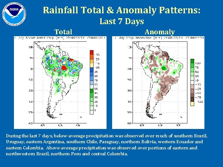
Rainfall Total & Anomaly Patterns: Last 7 Days Total Anomaly During the last 7 days, below-average precipitation was observed over much of southern Brazil, Uruguay, eastern Argentina, southern Chile, Paraguay, northern Bolivia, western Ecuador and eastern Colombia. Above-average precipitation was observed over portions of eastern and northwestern Brazil, northern Peru and central Colombia.

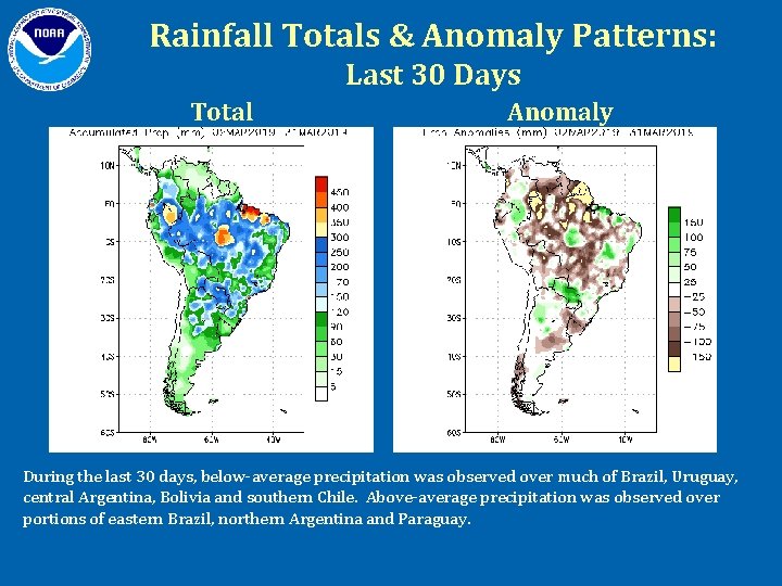
Rainfall Totals & Anomaly Patterns: Last 30 Days Total Anomaly During the last 30 days, below-average precipitation was observed over much of Brazil, Uruguay, central Argentina, Bolivia and southern Chile. Above-average precipitation was observed over portions of eastern Brazil, northern Argentina and Paraguay.

Recent Evolution: Rainfall Last 90 Days BP: Brazilian Plateau BP • 90 -day rainfall deficits are present over the Amazon Basin (> 150 mm), the Brazilian Plateau (> 300 mm).

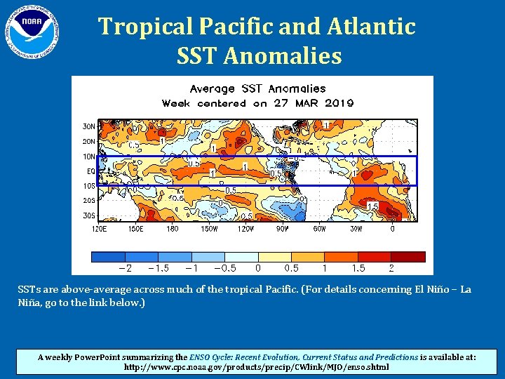
Tropical Pacific and Atlantic SST Anomalies SSTs are above-average across much of the tropical Pacific. (For details concerning El Niño – La Niña, go to the link below. ) A weekly Power. Point summarizing the ENSO Cycle: Recent Evolution, Current Status and Predictions is available at: http: //www. cpc. noaa. gov/products/precip/CWlink/MJO/enso. shtml

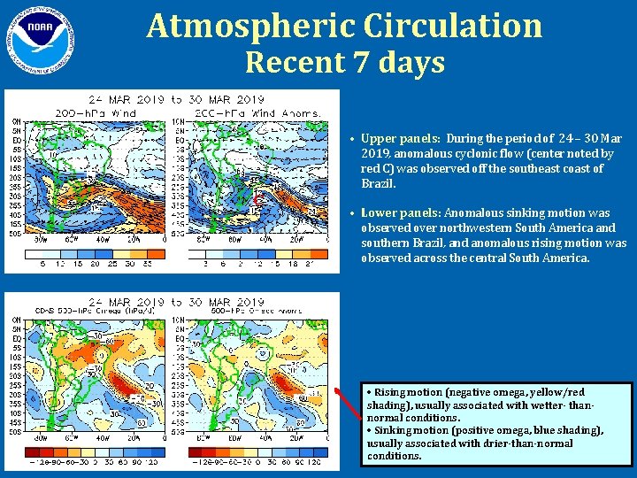
Atmospheric Circulation Recent 7 days • Upper panels: During the period of 24 – 30 Mar 2019, anomalous cyclonic flow (center noted by red C) was observed off the southeast coast of Brazil. C • Lower panels: Anomalous sinking motion was observed over northwestern South America and southern Brazil, and anomalous rising motion was observed across the central South America. • Rising motion (negative omega, yellow/red shading), usually associated with wetter- thannormal conditions. • Sinking motion (positive omega, blue shading), usually associated with drier-than-normal conditions.

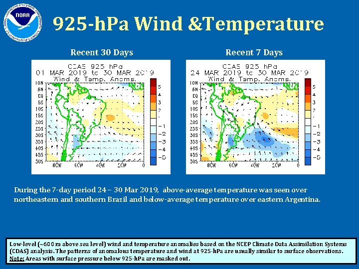
925 -h. Pa Wind &Temperature Recent 30 Days Recent 7 Days During the 7 -day period 24 – 30 Mar 2019, above-average temperature was seen over northeastern and southern Brazil and below-average temperature over eastern Argentina. Low-level (~600 m above sea level) wind and temperature anomalies based on the NCEP Climate Data Assimilation Systems (CDAS) analysis. The patterns of anomalous temperature and wind at 925 -h. Pa are usually similar to surface observations. Note: Areas with surface pressure below 925 -h. Pa are masked out.

NCEP/GFS Model Forecasts Bias-Corrected Precipitation Forecasts from 01 April 2019– Days 1 -7 Total Note: Bias correction based on last 30 -day forecast error. Anomaly

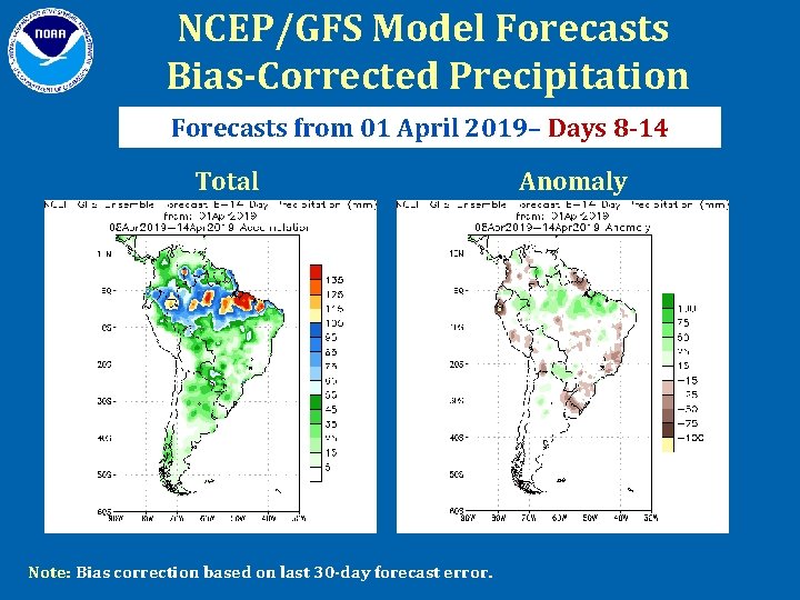
NCEP/GFS Model Forecasts Bias-Corrected Precipitation Forecasts from 01 April 2019– Days 8 -14 Total Note: Bias correction based on last 30 -day forecast error. Anomaly

NCEP/GFS MODEL FORECASTS • For Days 1 -7 (01 – 07 April 2019), below-average precipitation is predicted over much of northwestern South America, southern Brazil, Uruguay and central Argentina. Above-average precipitation is predicted for portions of northeastern Brazil, Paraguay, northern Argentina and Bolivia. • For Days 8 -14 (08 – 14 April 2019), below-average precipitation is predicted over portions of central and southern Brazil, Uruguay, southern Bolivia, southern Peru, southern Ecuador and western Colombia. Aboveaverage precipitation is predicted for much of northern Brazil, Paraguay, northeastern Peru and northern Ecuador.

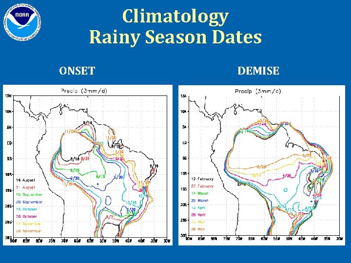
Climatology Rainy Season Dates ONSET DEMISE

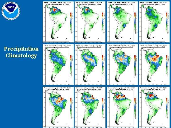
Precipitation Climatology

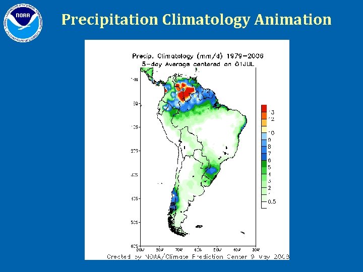
Precipitation Climatology Animation