The South American Monsoon System Recent Evolution and
- Slides: 12

The South American Monsoon System: Recent Evolution and Current Status Update prepared by Climate Prediction Center / NCEP 31 January 2011 For more information, visit: http: //www. cpc. ncep. noaa. gov/products/Global_Monsoons/American_Monsoons

Outline • Highlights • Recent Evolution and Current Conditions • NCEP/GFS Model Forecasts • Climatology

Highlights • During the last 7 days, below-average rainfall was observed over southern Brazil, southern Bolivia, part of Paraguay, and part of northern South America. Above-average rainfall was observed over northern Brazil, part of Peru, and northern Argentina (near 30 S). • Products of week-1 and week-2 predictions by the NCEP GFS are not available due to a technical problem.

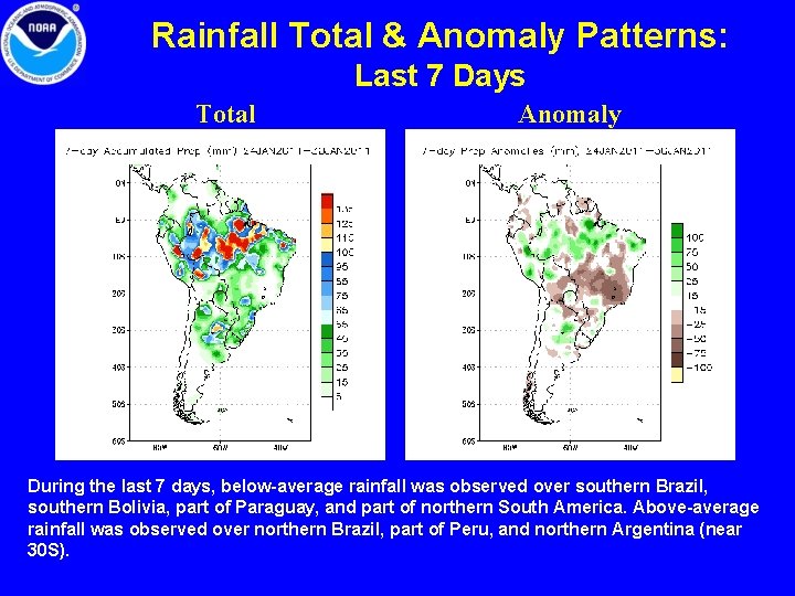
Rainfall Total & Anomaly Patterns: Last 7 Days Total Anomaly During the last 7 days, below-average rainfall was observed over southern Brazil, southern Bolivia, part of Paraguay, and part of northern South America. Above-average rainfall was observed over northern Brazil, part of Peru, and northern Argentina (near 30 S).

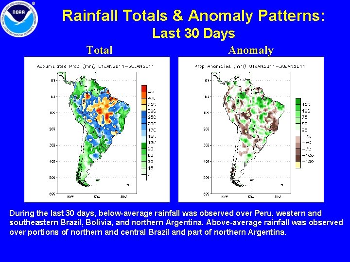
Rainfall Totals & Anomaly Patterns: Last 30 Days Total Anomaly During the last 30 days, below-average rainfall was observed over Peru, western and southeastern Brazil, Bolivia, and northern Argentina. Above-average rainfall was observed over portions of northern and central Brazil and part of northern Argentina.

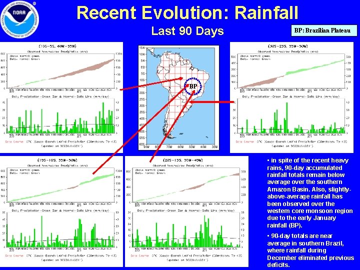
Recent Evolution: Rainfall Last 90 Days BP: Brazilian Plateau BP • in spite of the recent heavy rains, 90 -day accumulated rainfall totals remain below average over the southern Amazon Basin. Also, slightlyabove-average rainfall has been observed over the western core monsoon region due to the early January rainfall (BP). • 90 -day totals are near average in southern Brazil, where rainfall during December eliminated previous deficits.

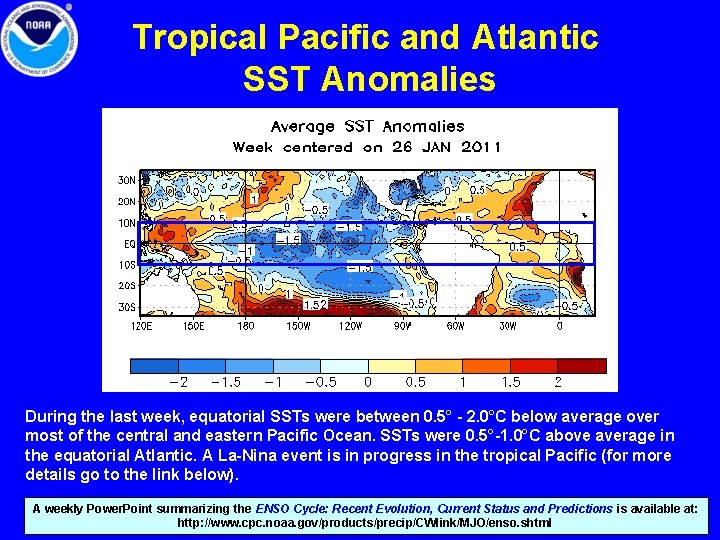
Tropical Pacific and Atlantic SST Anomalies During the last week, equatorial SSTs were between 0. 5° - 2. 0°C below average over most of the central and eastern Pacific Ocean. SSTs were 0. 5°-1. 0°C above average in the equatorial Atlantic. A La-Nina event is in progress in the tropical Pacific (for more details go to the link below). A weekly Power. Point summarizing the ENSO Cycle: Recent Evolution, Current Status and Predictions is available at: http: //www. cpc. noaa. gov/products/precip/CWlink/MJO/enso. shtml

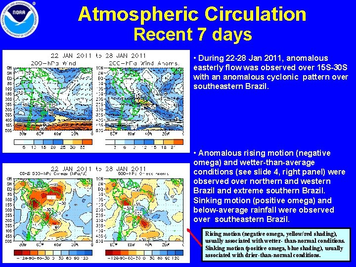
Atmospheric Circulation Recent 7 days • During 22 -28 Jan 2011, anomalous easterly flow was observed over 15 S-30 S with an anomalous cyclonic pattern over southeastern Brazil. • Anomalous rising motion (negative omega) and wetter-than-average conditions (see slide 4, right panel) were observed over northern and western Brazil and extreme southern Brazil. Sinking motion (positive omega) and below-average rainfall were observed over southeastern Brazil. Rising motion (negative omega, yellow/red shading), usually associated with wetter- than-normal conditions. Sinking motion (positive omega, blue shading), usually associated with drier-than-normal conditions.

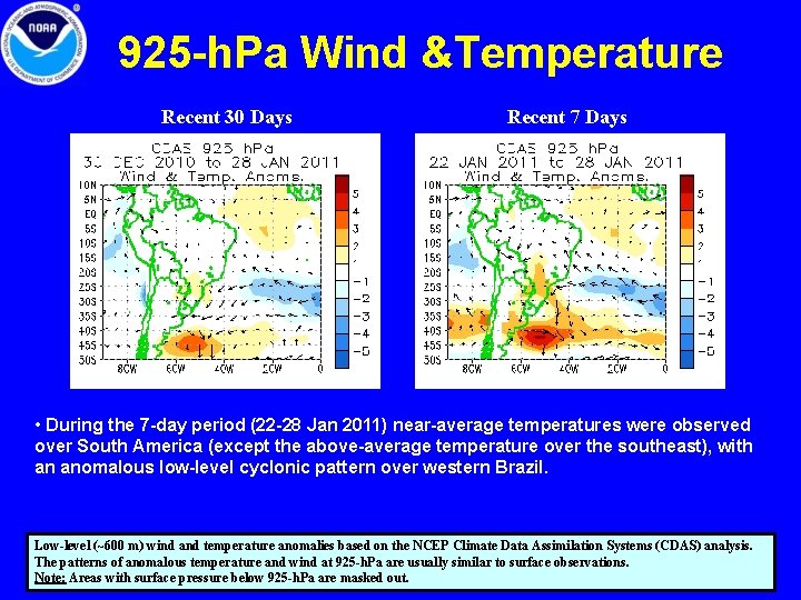
925 -h. Pa Wind &Temperature Recent 30 Days Recent 7 Days • During the 7 -day period (22 -28 Jan 2011) near-average temperatures were observed over South America (except the above-average temperature over the southeast), with an anomalous low-level cyclonic pattern over western Brazil. Low-level (~600 m) wind and temperature anomalies based on the NCEP Climate Data Assimilation Systems (CDAS) analysis. The patterns of anomalous temperature and wind at 925 -h. Pa are usually similar to surface observations. Note: Areas with surface pressure below 925 -h. Pa are masked out.

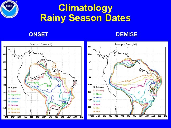
Climatology Rainy Season Dates ONSET DEMISE

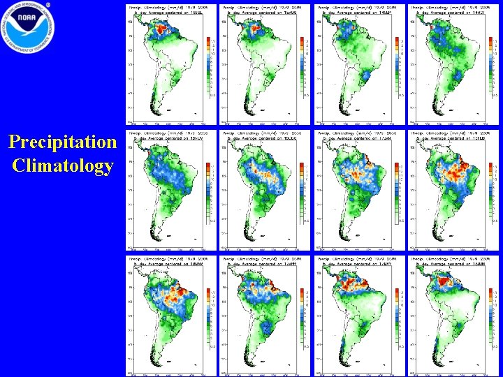
Precipitation Climatology

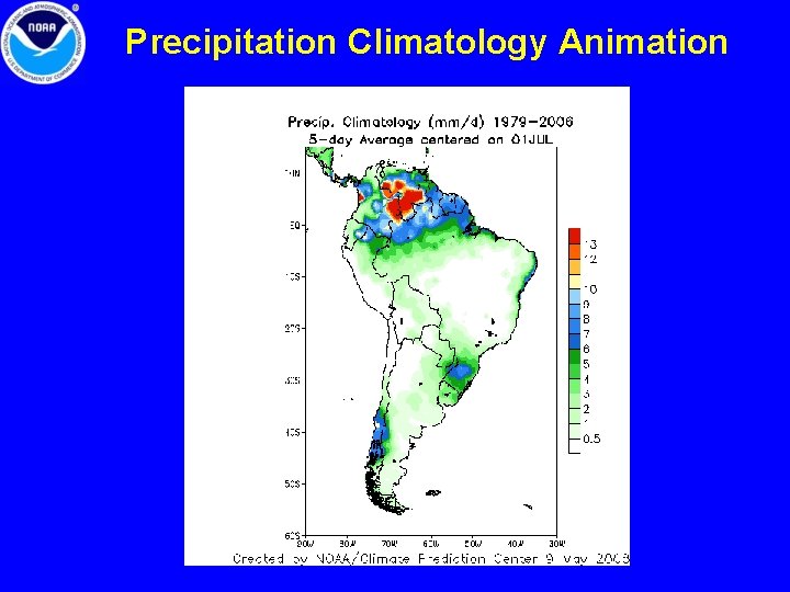
Precipitation Climatology Animation