The Ocean Floor Studying the Ocean Floor Sonar


- Slides: 28
The Ocean Floor
Studying the Ocean Floor Sonar- used on ocean surface Satellite- Seasat and Geosat- used in space Plumb Line - A line from which a weight is suspended to determine verticality or depth. Tow Fish – Side-scanning sonar
Sonar Sound Navigation and Ranging Scientists send sound waves to the bottom of the ocean by ship. The sound waves bounce off the ocean floor and return to the ship. The deeper the ocean , the longer it takes for the sound waves to return.
Seasat Satellites send images to Earth that measure direction and speed of ocean waves Seasat-1978
The Ocean Floor Continental shelf Continental slope Continental rise Abyssal Plain Mid-ocean ridge Rift valley /Canyon Ocean trench Seamounts Trench
Continental shelf A Continental slope B Continental rise C Abyssal Plain E Mid-ocean ridge F Rift valley F Ocean trench H Seamounts D/G AA BC D E F G H
Continental Margin Made up of: n n n Continental shelf Continental slope Continental rise
Continental Shelf Begins at the shoreline Continues until the ocean floor starts to slope Depth can reach about 200 meters
Continental Slope Begins at edge of continental shelf Continues down to the flat part of the ocean floor Ranges between 200 meters to about 4000 meters
Continental Rise Base of continental slope Made of large piles of sediment
Deep Ocean Basin Made up of: n n n Abyssal plain Mid-ocean ridge Rift valleys Seamounts Ocean trenches
Abyssal Plain Large, flat area of the ocean floor Covered in mud and remains of tiny marine organisms Average depth 4000 meters Abyssal Plain
Mid-Ocean Ridge Underwater mountain ranges Form where tectonic plates pull apart Rising magma between the plates creates the ridge
Mid-Ocean Ridge
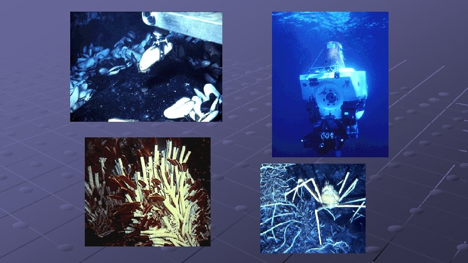
Rift Valley Zone between the plates In the rift valley, which can be 15 to 30 miles (24 to 48 kilometers) wide, new oceanic crust is being made, which means lots of seismic activity is happening. Hydrothermal vents were discovered in rift valleys.
Rift Valley
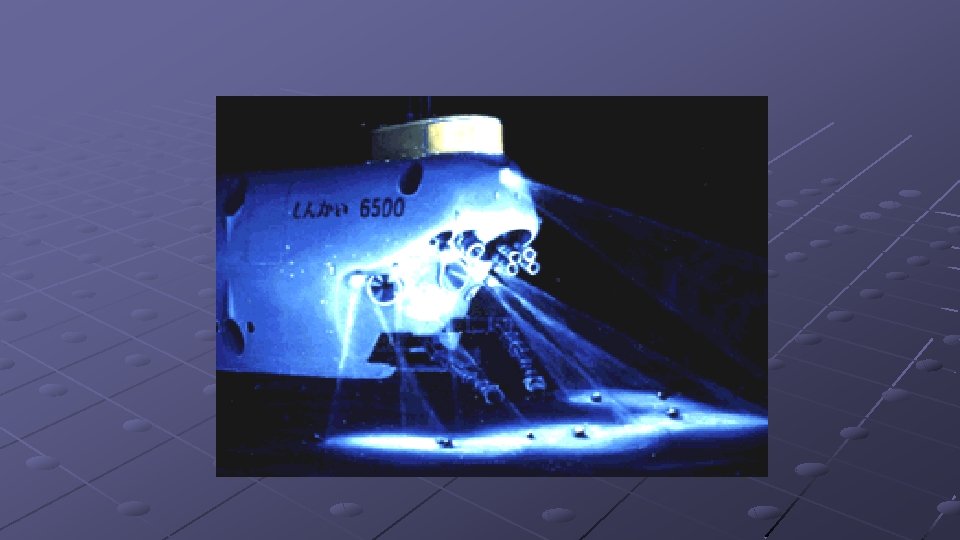
Ocean Trench Huge cracks on ocean floor Created by oceanic plate pushing beneath continental plate or another oceanic plate Deep-sea trenches are the deepest parts of the ocean. The deepest one, the Marianas Trench in the South Pacific Ocean, is more than 35, 000 feet (10, 668 meters), or almost 6. 6 miles (10. 6 kilometers) deep. A Navy-owned submarine, the Trieste, still holds the record for diving to the bottom of the deepest part of the Marianas Trench, the Challenger Deep, on January 23, 1960.
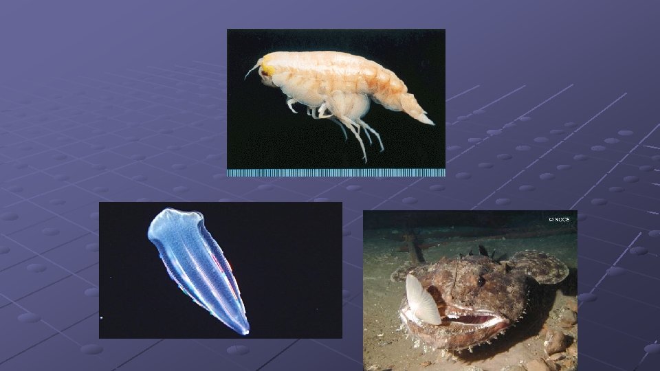
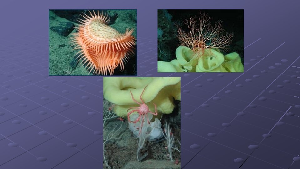
Bioluminescence Scientists estimate that 90 percent of deep-sea species are bioluminescent. Bioluminescence is the production of visible light by living organisms.
Seamounts Mountains of volcanic material Formed when magma pushes it way through or between tectonic plates If seamounts build up they can become volcanic islands; Example: Hawaiian Islands Seamounts are usually 25 miles (40 kilometers) in diameter and can be 10, 000 to 15, 000 feet (3000 to 4500 meters) tall. Hawaii island formation
Seamounts Less than 0. 1 percent of the world's seamounts have been explored to learn what species live on them, but many of the species that have been found so far are new to science. It has been estimated that more than 30, 000 seamounts reaching more than 1, 000 meters tall are found in the Pacific Ocean. Approximately 800 are in the Atlantic Ocean, and an unknown number exist in the Indian Ocean. They usually have volcanic origins.
Alvin, the world's first deep-sea submersible Three-person, self-propelling capsule-like submarine nearly eight meters long. Alvin has an operational maximum depth of about 4, 000 meters.
Study Questions 1. The Hawaiian Islands form from what type of ocean feature? 2. Where is pressure the greatest or the most intense? 3. What is sonar? 4. Underwater mountain range? 5. Underwater volcano? 6. Feature of the ocean that is at the edge of a continent? 7. Production of visible light by an organism? 8. Besides organisms in the ocean, what other organism can you think of that produces visible light? 9. The flat part of the ocean floor? 10. What makes up the continental margin? 11. What makes up the deep ocean basin? 12. Where do tectonic plates pull apart or move away from each other? 13. Deepest part of the ocean?
Assignment – Due SUNDAY 10/4 before MIDNIGHT Directions: Draw and label the following sea floor features, using detail and colors. Upload your picture to Focus. Continental shelf Continental slope Continental rise Abyssal Plain Mid-ocean ridge Rift valley /Canyon Ocean trench Seamounts Trench
The Ocean Floor The continents lie on the continental plates. The edges of these plates are under water, and they form the continental shelves. These shelves slope outward very gently towards the ocean depths. In some places these shelves go out a long way, up to 900 miles: In other places the shelves are much narrower. These shelves are fairly smooth because debris from the land is falling onto them from the water. This debris contains nutrients washed down from the land, and these nutrients, plus the shallow water, contribute to the abundance of life forms near the continents. Where the continental shelves end, there is a steep drop downwards. This is called the continental slope. It plunges down into the dark, cold waters of the ocean. At the bottom of the continental slope there is a an area that slopes gradually downward to blend into the abyssal plain. This is the bottom of the ocean as we think of it. The ocean floor seems like a different world. There is no sun light down here. The water is very cold. The pressure of the weight of miles of water above this area would easily crush a submarine. Tiny flecks of material from the sunlit world float downward and eventually settle on the bottom. There is almost nothing to eat, and the animals that live here are few and far between. There are many different kinds of animals, but they are small and widely scattered. They are able to survive on very little. However, it is not all silence and darkness here. The earth's crust is thinnest in the ocean basins, and volcanic eruptions are part of this environment. Here and there isolated peaks called sea mounts rise above the flat abyssal plain. However, the most active part of deep ocean geology occurs in the deep sea trenches, where the ocean floor is spreading apart. Lava comes up through the fissures, building up mountains and deep sea vents, called smokers. The constantly up-welling lava pushes the sea floor away from the trenches and out towards the continents. When the sea floor reaches the continental plates, it subducts, or slides underneath them, carrying the cold rocky floor back into the hot mantle of the earth.