The Norwegian Cyclone Model Cyclone a center of

- Slides: 7

The Norwegian Cyclone Model § § § Cyclone: a center of low pressure Norwegian: a person from Norway(!) Model: a 3 -dimentional picture (of a typical midlatitude cyclone) § History – Espy vs Loomis (pure convergence vs. pure rotation) – Battle terminology (~1920) – Primary information source was surface weather observations: they did all this without satellites, radar and only a very few weather balloons

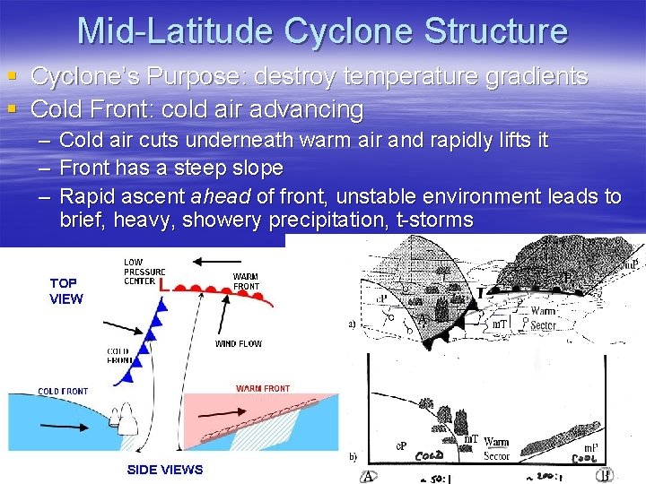
Mid-Latitude Cyclone Structure § Cyclone’s Purpose: destroy temperature gradients § Cold Front: cold air advancing – – – Cold air cuts underneath warm air and rapidly lifts it Front has a steep slope Rapid ascent ahead of front, unstable environment leads to brief, heavy, showery precipitation, t-storms

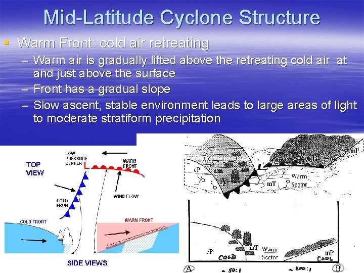
Mid-Latitude Cyclone Structure § Warm Front: cold air retreating – Warm air is gradually lifted above the retreating cold air at and just above the surface – Front has a gradual slope – Slow ascent, stable environment leads to large areas of light to moderate stratiform precipitation

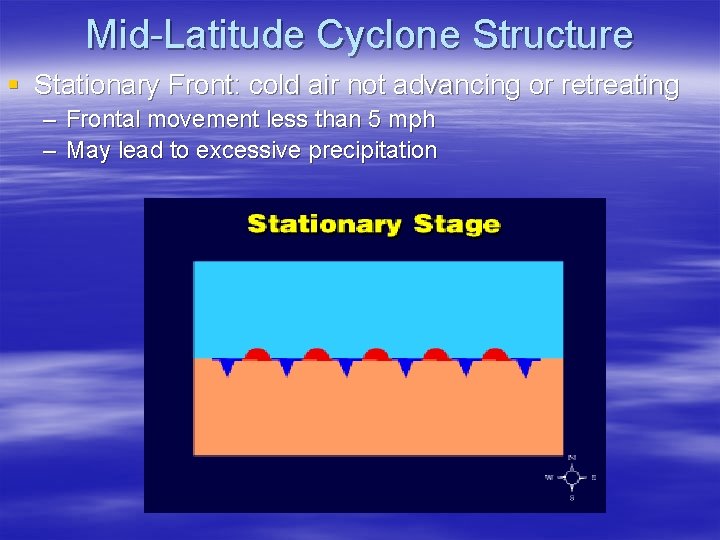
Mid-Latitude Cyclone Structure § Stationary Front: cold air not advancing or retreating – Frontal movement less than 5 mph – May lead to excessive precipitation

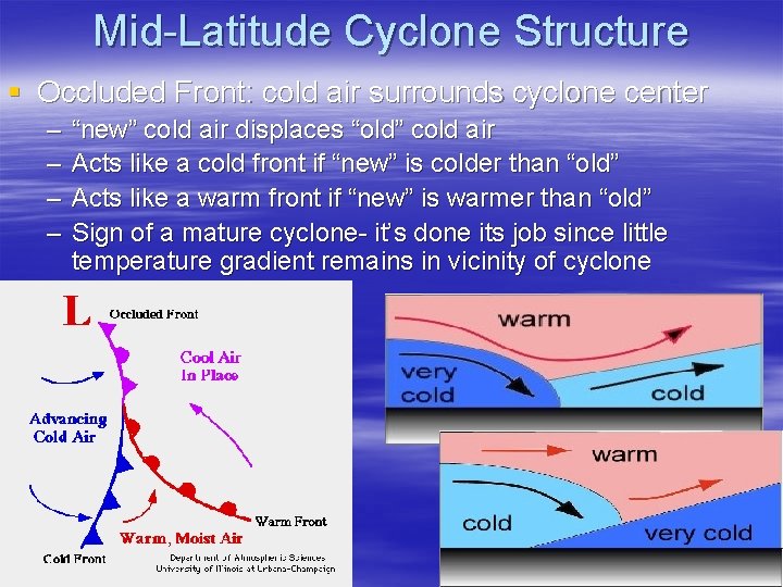
Mid-Latitude Cyclone Structure § Occluded Front: cold air surrounds cyclone center – – “new” cold air displaces “old” cold air Acts like a cold front if “new” is colder than “old” Acts like a warm front if “new” is warmer than “old” Sign of a mature cyclone- it’s done its job since little temperature gradient remains in vicinity of cyclone

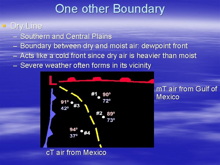
One other Boundary § Dry Line – – Southern and Central Plains Boundary between dry and moist air: dewpoint front Acts like a cold front since dry air is heavier than moist Severe weather often forms in its vicinity m. T air from Gulf of Mexico c. T air from Mexico

Key Figures § 3. 21, 13. 2