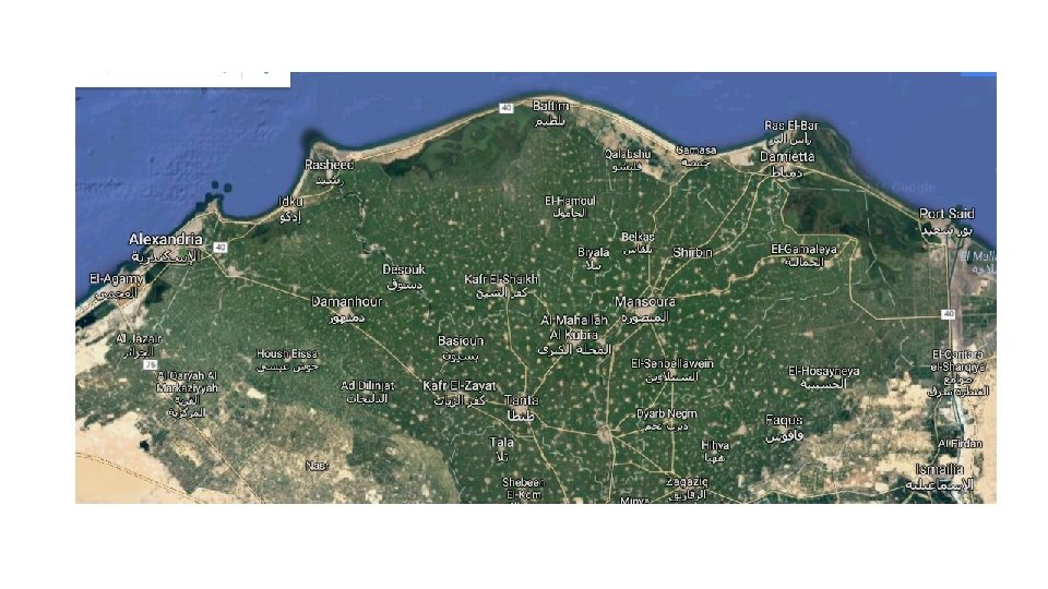
The Nile Delta 1 Shade blue three lakes

The Nile Delta 1. Shade blue three lakes 2. Label Abu Quir Bay Rosetta Promontory Burullus headland Gamasa Damieta Promontory
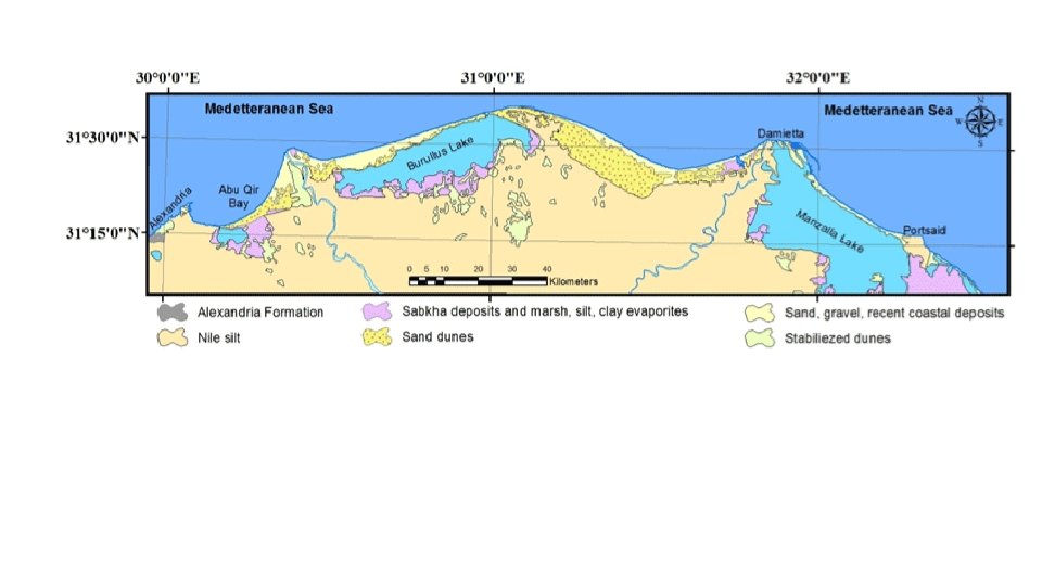

Label map Areas of erosion and deposition Add colour – barrier islands, sand dunes, salt marsh / clay deposits, Alexandria formation, lagoons Complete fact file using textbook 2 nd lesson – sketch coastline Maps from Landform Systems – describe long term changes Short term changes – role of humans
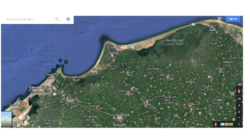

Alexandria Carbonate Ridge – sedimentary rock

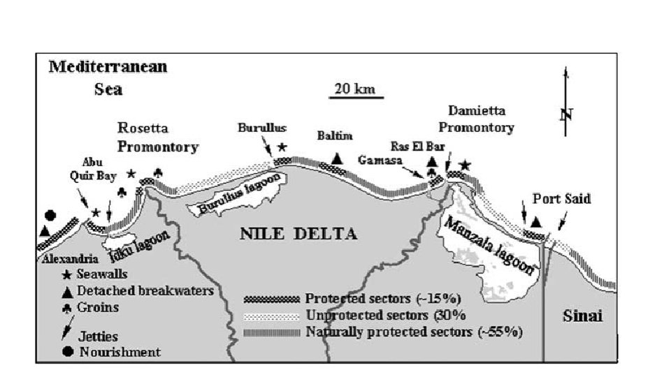
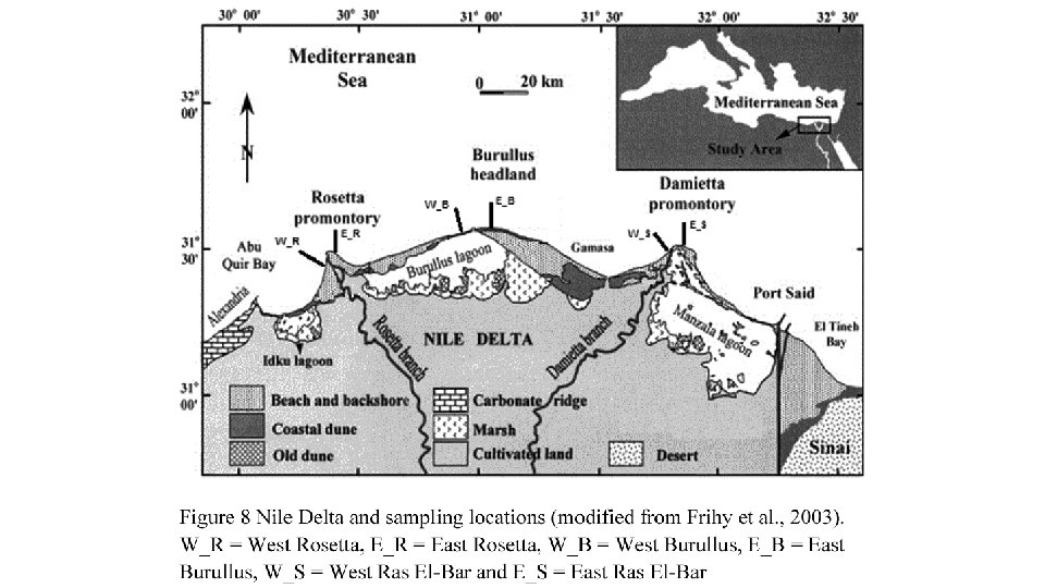
Abu Quir Bay Industrial area – 22 factories covering canning, textiles, paper manufacture and fertilisers Water pollution is a major problem 3 ancient submerged cities in the bay Lake Idku

Rosetta Promontory Mouth of the River Nile
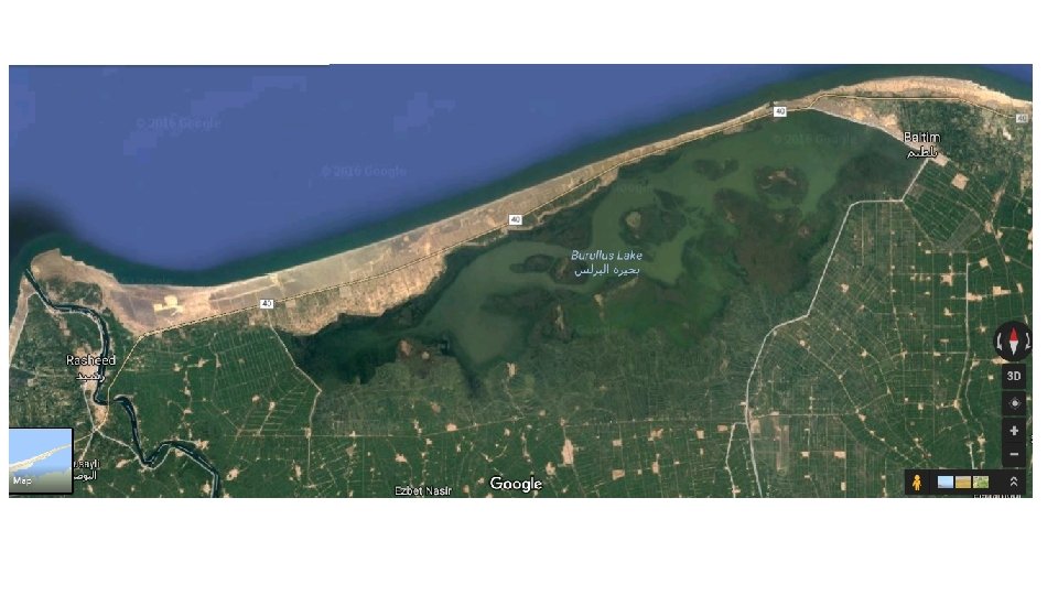

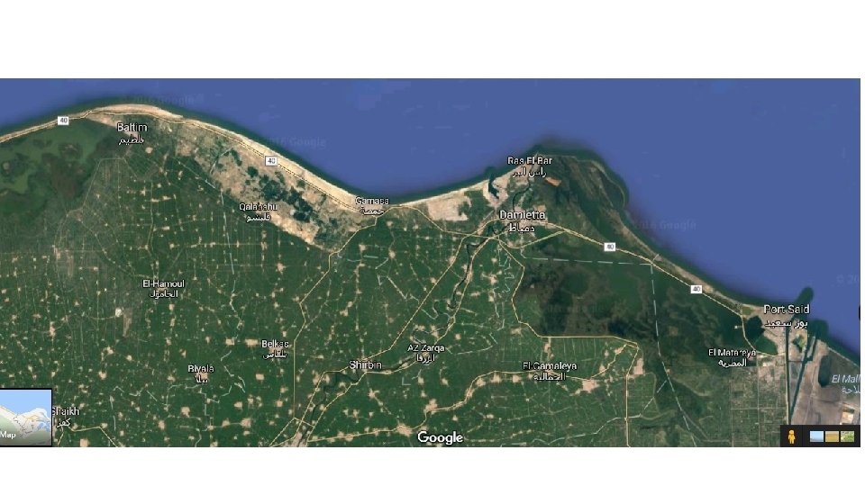
Gamasa

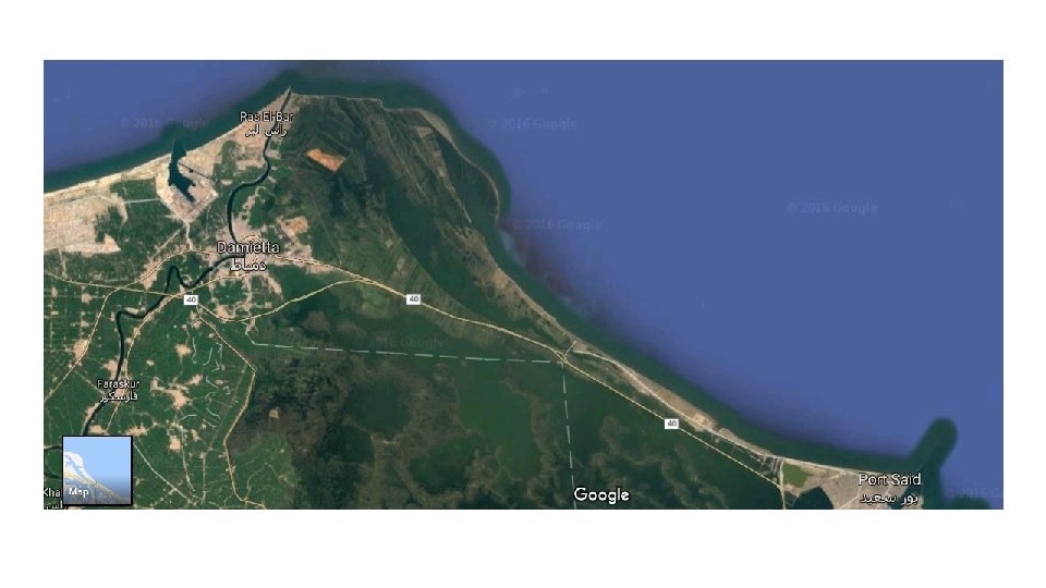
Lake Manzilah Raz El Bar

How are landforms interrelated?

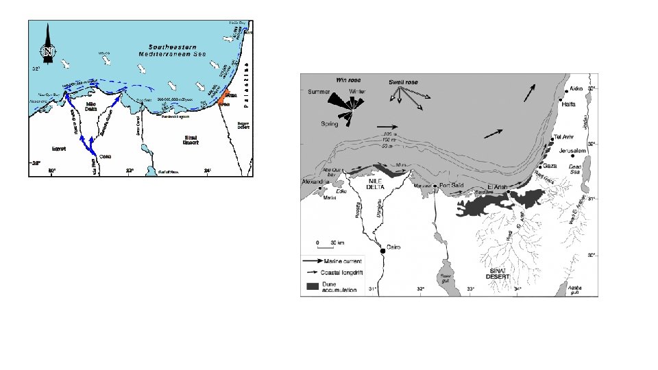
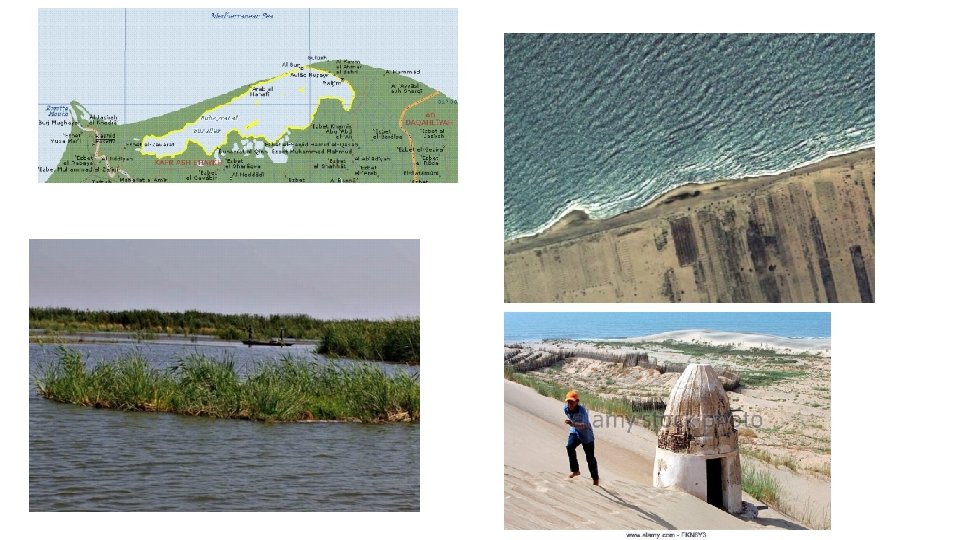
Rosetta promontory - result of deposition where the Nile enters the Mediterranean. NW winds mean that the promontory is exposed to incoming waves = erosion Longshore drift and ocean currents carry eroded sediment to the east along the outer edge of the Delta Leads to deposition. In the past = growth of the spits / bars across the Burullus lagoon. Today – the NW facing beaches are being eroded again (lack of sediment from the Nile means erosion exceeds deposition. This sediment is moved and deposited in the more sheltered water around Gamasa.
")
Similar situation around the Damietta Promontory: Built up by deposition of fluvial sediment (alluvium) by the Nile Eroded as faces the NW winds Material transferred east to build up the spits / bars across the Manzala lagoon – although now eroding. Along the whole coast line, on shore winds have blown sand inland to create the sand dunes Growth of spits and bars has created sheltered water and allowed salt marshes to form

Changes over time Sea level rises have reduced the delta’s size over the last 4000 years Number of distributaries has reduced from 7 to 2 Lagoons and salt marshes have decreased in area Deposition used to dominate – the Rosetta and Damietta promontories have extended northwards into the Med sea over the past 4000 years • Eastwards LSD and deposition to the east of the two main Nile branches has lead to the build up / growth of spits and bars which enclose the Burullus and Manzala lagoons. • Today, the balance of processes has changed – erosion is now dominate due to: • Aswan Dam has reduced the supply of sediment to delta – sediment in the Nile is now trapped behind the dam • Sea level rise means the coastal edge (? ? frontal plain) is being eroded • Increased use / installation of coastal defences e. g. Rosetta promontory • Increased erosion being seen on the seaward edge of the spits / bars surrounding the Burullus and Manzala lagoons. • •

Summary of Key Factors Factor North Yorkshire Nile Delta Waves Very important Wind Very important Geology Very important Less significant Tides Quite important Ocean Currents Not important Quite important
- Slides: 22