The NHC perspective on TC wind radii analysis
- Slides: 9

The NHC perspective on TC wind radii analysis and forecasting: An exercise in uncertainty Michael J. Brennan National Hurricane Center 2012 CSTAR Workshop 16 November 2012

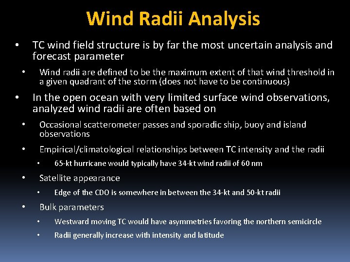
Wind Radii Analysis TC wind field structure is by far the most uncertain analysis and forecast parameter • • Wind radii are defined to be the maximum extent of that wind threshold in a given quadrant of the storm (does not have to be continuous) In the open ocean with very limited surface wind observations, analyzed wind radii are often based on • • Occasional scatterometer passes and sporadic ship, buoy and island observations • Empirical/climatological relationships between TC intensity and the radii • • Satellite appearance • • 65 -kt hurricane would typically have 34 -kt wind radii of 60 nm Edge of the CDO is somewhere in between the 34 -kt and 50 -kt radii Bulk parameters • Westward moving TC would have asymmetries favoring the northern semicircle • Radii generally increase with intensity and latitude

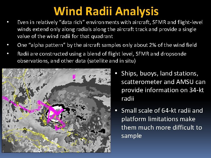
Wind Radii Analysis • • • Even in relatively “data rich” environments with aircraft, SFMR and flight-level winds extend only along radials along the aircraft track and provide a single value of the wind radii for that quadrant One “alpha pattern” by the aircraft samples only about 2% of the wind field Radii are constructed using a blend of flight level, SFMR and dropsonde observations, and other data (satellite and in situ) • Ships, buoys, land stations, scatterometer and AMSU can provide information on 34 -kt radii • Small scale of 64 -kt radii and platform limitations make them much more difficult to sample

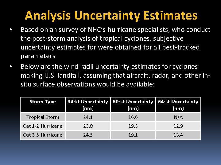
Analysis Uncertainty Estimates • • Based on an survey of NHC’s hurricane specialists, who conduct the post-storm analysis of tropical cyclones, subjective uncertainty estimates for were obtained for all best-tracked parameters Below are the wind radii uncertainty estimates for cyclones making U. S. landfall, assuming that aircraft, radar, and other insitu surface observations would be available: Storm Type 34 -kt Uncertainty 50 -kt Uncertainty 64 -kt Uncertainty (nm) Tropical Storm 24. 1 16. 6 N/A Cat 1 -2 Hurricane 23. 8 19. 3 12. 9 Cat 3 -5 Hurricane 24. 5 19. 1 13. 4

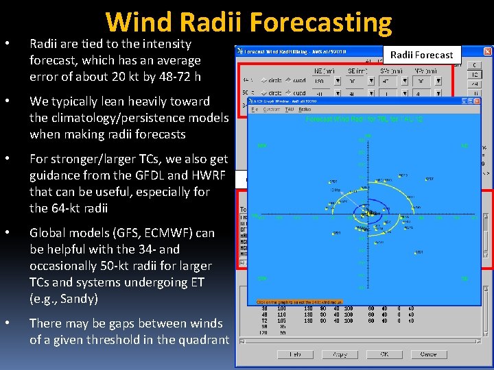
Wind Radii Forecasting • Radii are tied to the intensity forecast, which has an average error of about 20 kt by 48 -72 h • We typically lean heavily toward the climatology/persistence models when making radii forecasts • For stronger/larger TCs, we also get guidance from the GFDL and HWRF that can be useful, especially for the 64 -kt radii • Global models (GFS, ECMWF) can be helpful with the 34 - and occasionally 50 -kt radii for larger TCs and systems undergoing ET (e. g. , Sandy) • There may be gaps between winds of a given threshold in the quadrant Radii Forecast Guidance

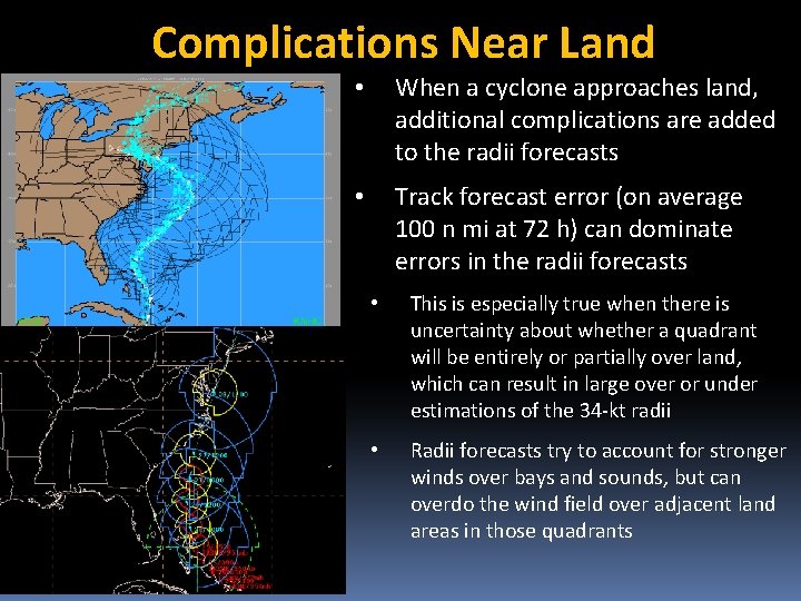
Complications Near Land • When a cyclone approaches land, additional complications are added to the radii forecasts • Track forecast error (on average 100 n mi at 72 h) can dominate errors in the radii forecasts • This is especially true when there is uncertainty about whether a quadrant will be entirely or partially over land, which can result in large over or under estimations of the 34 -kt radii • Radii forecasts try to account for stronger winds over bays and sounds, but can overdo the wind field over adjacent land areas in those quadrants

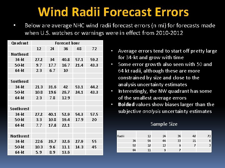
Wind Radii Forecast Errors • Below are average NHC wind radii forecast errors (n mi) forecasts made when U. S. watches or warnings were in effect from 2010 -2012 Quadrant 12 Forecast hour 24 36 48 72 Northeast 34 -kt 50 -kt 64 -kt 27. 2 9. 7 2. 3 34 17. 7 6. 7 40. 8 16. 7 10 57. 1 21. 4 59. 2 43. 3 Southeast 34 -kt 50 -kt 64 -kt 21. 3 10. 8 2. 3 31. 6 19. 6 7. 8 42 26. 7 12. 9 53. 1 24. 1 44. 2 43. 3 Southwest 34 -kt 50 -kt 64 -kt 27. 2 3. 3 7. 7 40. 1 10. 8 17. 8 52. 9 19. 4 22. 1 54. 3 17. 9 57. 5 20 Northwest 34 -kt 50 -kt 64 -kt • Average errors tend to start off pretty large for 34 -kt and grow with time • Some error growth also seen with 50 and 64 kt radii, although these are more constrained by size and close to the analysis uncertainty estimates • Interestingly, the NW quadrant has some of the smallest average errors • Bolded values show biases larger than the subjective analysis uncertainty estimates Sample Size Radii 22. 6 10. 3 5. 9 26. 7 9. 6 8. 9 32. 6 11. 1 13. 6 27. 9 14. 3 55 45 34 50 64 12 54 18 11 24 44 13 9 36 33 9 7 48 21 7 72 6 3

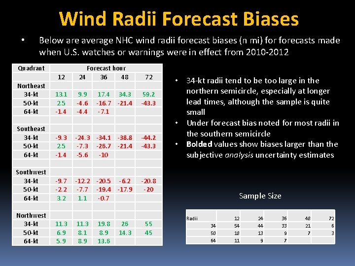
Wind Radii Forecast Biases • Below are average NHC wind radii forecast biases (n mi) forecasts made when U. S. watches or warnings were in effect from 2010 -2012 Quadrant 12 Forecast hour 24 36 48 72 Northeast 34 -kt 50 -kt 64 -kt 13. 1 2. 5 -1. 4 9. 9 -4. 6 -4. 4 17. 4 34. 3 -16. 7 -21. 4 -7. 1 59. 2 -43. 3 Southeast 34 -kt 50 -kt 64 -kt -9. 3 2. 5 -1. 4 -24. 3 -34. 1 -38. 8 -7. 3 -26. 7 -21. 4 -5. 6 -10 -44. 2 -43. 3 Southwest 34 -kt 50 -kt 64 -kt -9. 7 -2. 2 3. 2 -12. 2 -20. 5 -6. 2 -7. 7 -19. 4 -17. 9 1. 1 -0. 7 -20. 8 -20 Northwest 34 -kt 50 -kt 64 -kt 11. 3 6. 9 5. 9 11. 3 8. 1 8. 9 19. 8 8. 9 13. 6 26 14. 3 55 45 • 34 -kt radii tend to be too large in the northern semicircle, especially at longer lead times, although the sample is quite small • Under forecast bias noted for most radii in the southern semicircle • Bolded values show biases larger than the subjective analysis uncertainty estimates Sample Size Radii 34 50 64 12 54 18 11 24 44 13 9 36 33 9 7 48 21 7 72 6 3

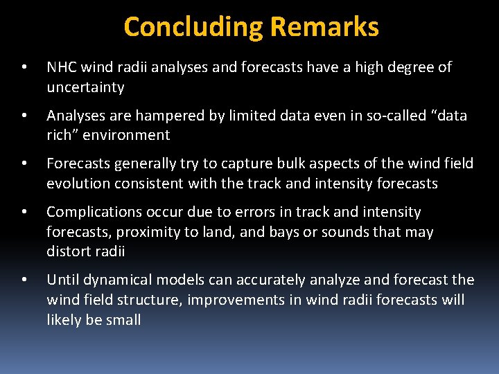
Concluding Remarks • NHC wind radii analyses and forecasts have a high degree of uncertainty • Analyses are hampered by limited data even in so-called “data rich” environment • Forecasts generally try to capture bulk aspects of the wind field evolution consistent with the track and intensity forecasts • Complications occur due to errors in track and intensity forecasts, proximity to land, and bays or sounds that may distort radii • Until dynamical models can accurately analyze and forecast the wind field structure, improvements in wind radii forecasts will likely be small