The next step in mastering LATITUDE and LONGITUDE


- Slides: 22

The next step in mastering LATITUDE and LONGITUDE

In this lesson you will… • recall what you know about latitude and longitude so far. • learn how to find a location on Earth by its coordinates, or latitude and longitude. • practice the skill.

NAME SECTION DATE DIRECTIONS: Let's take a trip around the world. Study the map on this page. Use the latitude and longitude coordinates for the cities listed below to find their locations. Then, label each city's approximate location on the map with a letter. Finally, connect the dots in order, A through J, with straight lines. For help, refer to atlas pages in your text or look at the classroom wall map. Latitude is always given first. It tells how far north or south of the equator you are. Longitude is always given second. It tells how far east or west of the prime meridian you are. You need a copy of this Study Sheet to complete this lesson. Latitude lines are called parallels because they are always the same distance apart. Longitude lines, also called meridians, meet at the poles so they are not always the same distance apart. The one going through Greenwich, England is the prime, or first, meridian. The prime meridian is at 0° longitude. The equator is at 0° latitude. A. New Orleans, Louisiana 30°N latitude, 90°W longitude B. Brasilia, Brazil 15°S latitude, 45°W longitude C. Dakar, Senegal 15°N latitude, 15°W longitude D. Stockholm, Sweden 60°N latitude, 15°E longitude E. Cairo, Egypt 30°N latitude, 30°E longitude F. Bangalore, India 15°N latitude, 75°E longitude G. Manila, Philippines 15°N latitude, 120°E longitude H. Sydney, Australia 27°S latitude, 150°E longitude I. Honolulu, Hawaii 20°N latitude, 155°W longitude J. Los Angeles, California 35°N latitude, 116°W longitude

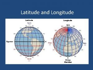
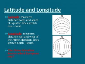
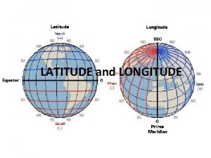
What is Latitude? Recall that latitude lines run around the globe in a/an ______ east-west direction. They really measure the distance from the ________. equator latitude numbers equator The boundary separating the northern and southern hemispheres is the ______.

What is Latitude? Another name for latitude lines is ________ parallels because they are always the same distance apart. Latitude tells how far _______ the equator you are. north or of south latitude numbers

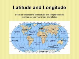
What is Longitude? Longitude lines, also called ______, meridians run in a north-south direction and meet at the poles. The one going through Greenwich, England is the first, or _______. prime meridian So, were you thinking of 15? longitude numbers Notice how the degrees count on this map. By 5 s, 10 s, 20 s, or what?

What is Longitude? The prime meridian divides the globe into two hemispheres. The on the left is the __________ western hemisphereand the on the right is the __________. eastern hemisphere WESTERN EASTERN west of the prime meridian you are. east or _____ Longitude tells how far ____

Put the Ideas Together The map below is in fourths, or quadrants. When coordinates are given, the latitude will be north or south of the equator by some number of degrees. It is given first. longitude numbers latitude numbers The longitude will be east or west of the prime meridian in degrees, and comes second.

Get ready to take a trip around the world. On your matching map, find and label with an “A” New Orleans, Louisiana 30°N latitude, 90°W longitude A. THINK: above the equator and left of the prime meridian

Next, on your matching map, find and label with a “B” Brasilia, Brazil 15°S latitude, 45°W longitude A. B. THINK: below the equator and left of the prime meridian

Next, on your matching map, find and label with a “C” Dakar, Senegal 15°N latitude, 15°W longitude A. C. B. THINK: above the equator and left of the prime meridian

Next, find and label with a “D” Stockholm, Sweden 60°N latitude, 15°E longitude D. A. C. B. THINK: above the equator and right of the prime meridian

Next, find and label with a “E” Cairo, Egypt 30°N latitude, 30°E longitude D. E. A. C. B. THINK: above the equator and right of the prime meridian

Next, find and label with a “F” Bangalore, India 15°N latitude, 75°E longitude D. E. A. C. F. B. What are you thinking? above the equator and to the right of the prime meridian

Next, find and label with a “G” Manila, Philippines 15°N latitude, 120°E longitude D. E. A. C. F. G. B. What are you thinking? above the equator and to the right of the prime meridian

Next, find and label with a “H” Sydney, Australia 27°S latitude, 150°E longitude D. E. A. C. F. G. B. H. Remember what you know when you have to estimate.

You’re Almost Finished Next, find and label with a “I” Honolulu, Hawaii 20°N latitude, 155°W longitude D. E. A. I. C. F. G. B. H. Be as precise as you can when estimating.

Last One Last, find and label with a “J” Los Angeles, California 35°N latitude, 116°W longitude D. J. E. A. I. C. F. G. B. H. Are you on the correct side of the lines?

Finally… Use a ruler to connect the dots in order, A through J with straight lines. Remember, however, that this is a flat map but that you went around the globe. D. J. E. A. I. C. F. G. B. H. Do NOT freehand, but use a ruler.

Your trip should resemble this. You can hold up your map to the Answer Key map and see if they agree. D. J. E. A. I. C. F. G. B. H.

Let’s Review and Check east/west direction. They • Latitude lines run around the globe in a/an ______ really measure the distance from the ________. equator • The boundary separating the northern and southern hemispheres is the equator ______. parallels • Another name for latitude lines is ________ because they are always the same distance apart. Latitude tells how far ______ or north south of the equator you are. _____ meridians run in a north-south direction • Longitude lines, also called ______, and meet at the poles. The one going through Greenwich, England is the prime meridian first, or _________. • The prime meridian divides the globe into two hemispheres. The on the western hemisphere and the on the right is the left is the ___________________. eastern hemisphere • Longitude tells how far ____ of the prime meridian you east or _____ west are. • When coordinates are given, the one that is always given first is latitude ______.

NAME SECTION DATE DIRECTIONS: Let's take a trip around the world. Study the map on this page. Use the latitude and longitude coordinates for the cities listed below to find their locations. Then, label each city's approximate location on the map with a letter. Finally, connect the dots in order, A through J, with straight lines. For help, refer to atlas pages in your text or look at the classroom wall map. Latitude is always given first. It tells how far north or south of the equator you are. Longitude is always given second. It tells how far east or west of the prime meridian you are. The prime meridian is at 0° longitude. The equator is at 0° latitude. A. New Orleans, Louisiana 30°N latitude, 90°W longitude B. Brasilia, Brazil 15°S latitude, 45°W longitude C. Dakar, Senegal 15°N latitude, 15°W longitude D. Stockholm, Sweden 60°N latitude, 15°E longitude E. Cairo, Egypt 30°N latitude, 30°E longitude F. Bangalore, India 15°N latitude, 75°E longitude G. Manila, Philippines 15°N latitude, 120°E longitude H. Sydney, Australia 27°S latitude, 150°E longitude I. Honolulu, Hawaii 20°N latitude, 155°W longitude J. Los Angeles, California 35°N latitude, 116°W longitude
 Step 1 step 2 step 3 step 4
 X.next = x.next.next
 Describe the lines of latitude.
 Highest point netherlands
 Map of the middle east with latitude and longitude lines
 Geographyalltheway
 Random longitude and latitude
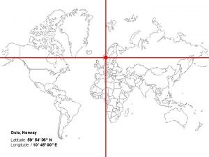
 What is the latitude and longitude of oslo norway
 Earth map latitude
 Longitude shape
 Draw a red line along the equator (0 degrees latitude)
 0° latitude
 How to read latitude and longitude
 What is the invisible line that runs from north to south
 What do lines of latitude and longitude combine to make
 Who invented latitude and longitude grid system
 Krakatoa latitude and longitude
 Latitude and longitude of india
 Lines of latitude run from
 Labeled latitude and longitude map
 Longitude
 Understanding latitude and longitude
 How are latitude and longitude measured


