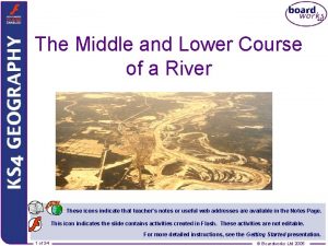
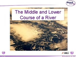
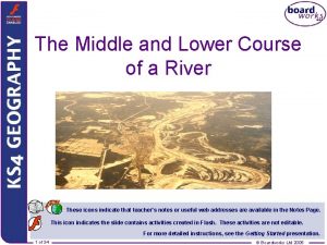
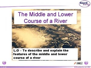
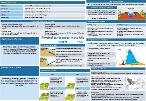
The Middle and Lower Course of a River


- Slides: 34

The Middle and Lower Course of a River These icons indicate that teacher’s notes or useful web addresses are available in the Notes Page. This icon indicates the slide contains activities created in Flash. These activities are not editable. For more detailed instructions, see the Getting Started presentation. 1 of 34 © Boardworks Ltd 2005

Learning objectives What are the main processes that operate in the middle and lower course of a river? What landforms are found in the middle and lower course of a river? How are these landforms created? 2 of 34 © Boardworks Ltd 2005

What are the main processes that operate in the middle Erosion is still an important process. Thelower river is nowcourse flowing over flatter land so the and of a river? dominant direction of erosion is lateral (from side to side). The river has a greater discharge and so has more energy to transport material. Material that is transported by a river is called its load. Deposition is also an important process and occurs when the velocity of the river decreases or if the discharge falls due to a dry spell of weather. Why do you think that a river in the middle and lower course has a higher discharge than near the source? 3 of 34 © Boardworks Ltd 2005

How is material transported downstream? 4 of 34 © Boardworks Ltd 2005

How is material transported downstream? Traction Boulders and pebbles are rolled along the river bed at times of high discharge. Saltation Sand sized particles are bounced along the river bed by the flow of water. Suspension Fine clay and sand particles are carried along within the water even at low discharges. Solution 5 of 34 Some minerals dissolve in water such as calcium carbonate. This requires very little energy. © Boardworks Ltd 2005

How is material transported downstream? 6 of 34 © Boardworks Ltd 2005

How is material transported downstream? 7 of 34 © Boardworks Ltd 2005

Do you know the difference between erosion and transport? 8 of 34 © Boardworks Ltd 2005

Deposition The River Conwy has deposited material in this section of its course. Suggest reasons why this happened. 9 of 34 © Boardworks Ltd 2005

Learning objectives What are the main processes that operate in the middle and lower course of a river? What landforms are found in the middle and lower course of a river? How are these landforms created? 10 of 34 © Boardworks Ltd 2005

What landforms are found in the middle and lower course? 1) Meanders 2) Oxbow Lakes 3) Flood plains and Leveés 4) Deltas 11 of 34 DEPOSITION and EROSION create these landforms DEPOSITION created these landforms © Boardworks Ltd 2005

Learning objectives What are the main processes that operate in the middle and lower course of a river? What landforms are found in the middle and lower course of a river? How are these landforms created? 12 of 34 © Boardworks Ltd 2005

Meander = a bend in a river 13 of 34 © Boardworks Ltd 2005

Meanders As the course of a river approaches its middle stages it flows over flatter land. Lateral erosion dominates as the river swings in large bends known as meanders. Meanders constantly change their shape and position. Water is pushed to the outer bend. This reduces friction with the bed and banks. So the river has more energy for transporting material which can erode the outside bank via abrasion. 14 of 34 © Boardworks Ltd 2005

Meanders Explain the following hypotheses: The fastest current is always on the outer bend. All meanders have river cliffs and slip-off slopes. 15 of 34 © Boardworks Ltd 2005

A cross section through a meander 16 of 34 © Boardworks Ltd 2005

A cross section through a meander 17 of 34 © Boardworks Ltd 2005

A cross section through a meander Meander bend on the River Conwy A B Explain why there is more deposition at ‘A’ rather than at ‘B’. 18 of 34 © Boardworks Ltd 2005

Oxbow lakes 19 of 34 © Boardworks Ltd 2005

Explain the formation of an oxbow lake new course of the river oxbow lake 20 of 34 When the river floods it breaks through the thin Meander neck meander neck and the becomes river takes thesmaller easier, straight course. This leaves the meander loop ‘cut off’ as an oxbow lake. Over time, the oxbow lake will become colonised by vegetation. © Boardworks Ltd 2005

Explain the formation of an oxbow lake 21 of 34 © Boardworks Ltd 2005

Floodplains 22 of 34 © Boardworks Ltd 2005

Floodplain formation Floodplains and leveés are formed by deposition in times of river flood. The river’s load is composed of different sized particles. When a river floods it deposits the heaviest of these particles first. The larger particles, often pebble-sized, form the leveés. The sands, silts and clays are similarly sorted with the sands being deposited next, then the silts and finally the lightest clays. Every time the river floods deposition builds up the floodplain. 23 of 34 © Boardworks Ltd 2005

Floodplain formation This is a cross section of a floodplain. Draw a simple sketch of the diagram and annotate with the following labels: leveés 24 of 34 sands clays and silts © Boardworks Ltd 2005

Delta formation Deltas are found at the mouth of a river, where the river meets the sea. At this point the river is carrying too much load for its velocity and so deposition occurs. The top of the delta is a fairly flat surface. This is where the coarsest river load is dropped. The finer particles are carried into deeper water. The silt is dropped to form a steep slope on the edge of the delta while the clay stays in suspension until it reaches the deeper water. 25 of 34 © Boardworks Ltd 2005

Delta formation 26 of 34 © Boardworks Ltd 2005

The mouth of the Rhône The ‘Grand Rhône’ 27 of 34 © Boardworks Ltd 2005

The Rhône’s delta – the Camargue The area of the Rhône’s delta is known as the Camargue. It is an example of an arcuate or fan delta. It has been created because of the vast amounts of sediment deposited over the years and the low tidal range of the Mediterranean. Draw and label a diagram of the Rhône delta and explain its formation. 28 of 34 © Boardworks Ltd 2005

Techniques – interpreting aerial photographs Name the river landform shown in this aerial photograph. What else can you identify? How can you tell that this is not the upper course of a river? 29 of 34 © Boardworks Ltd 2005

Examination question Study the photograph below: B A C Name the 3 features labelled A, B and C (3) Choose one of the features and explain its formation. You may use diagrams to help you. (6) 30 of 34 © Boardworks Ltd 2005

The landforms of a river Which landforms are missing? Why? 31 of 34 © Boardworks Ltd 2005

The landforms of a river Landforms are primarily caused by: processes of erosion processes of deposition a mixture of erosion and deposition Which of the following landforms are the result of a mixture of erosion and deposition? v-shaped valleys deltas waterfalls 32 of 34 rapids meanders oxbow lakes interlocking spurs floodplains leveés © Boardworks Ltd 2005

How much do you know about rivers? 33 of 34 © Boardworks Ltd 2005

Key ideas Processes of erosion, transport and deposition operate to create the landforms of the middle and lower course of a river. There are four types of transport: traction, saltation, suspension and solution. The main direction of erosion is lateral. Erosion and deposition contribute to the formation of meanders and ox-bow lakes. Deposition is the main process contributing to the formation of flood plains, leveés and deltas. 34 of 34 © Boardworks Ltd 2005
 Lower course of a river
 Journey of river
 Different bodys of water
 River cliff and slip off slope diagram
 Fluvial
 Middle course of a river
 Lower delaware national wild and scenic river
 Lower snake river compensation plan
 Lower snake river compensation plan
 I am the river and the river is me
 Course number and title
 Green river watershed
 Upper course river
 Upper course of a river
 Middle fork american river access
 Magothy river middle school
 T junction brick wall
 Course interne course externe
 Clements high school course selection
 Hát kết hợp bộ gõ cơ thể
 Slidetodoc
 Bổ thể
 Tỉ lệ cơ thể trẻ em
 Voi kéo gỗ như thế nào
 Thang điểm glasgow
 Chúa yêu trần thế alleluia
 Môn thể thao bắt đầu bằng từ chạy
 Thế nào là hệ số cao nhất
 Các châu lục và đại dương trên thế giới
 Công thức tiính động năng
 Trời xanh đây là của chúng ta thể thơ
 Mật thư tọa độ 5x5
 Làm thế nào để 102-1=99
 độ dài liên kết
 Các châu lục và đại dương trên thế giới
