The May 24 Shamrock cold front A King

- Slides: 20

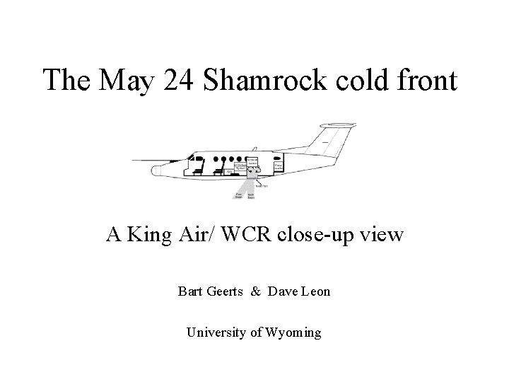
The May 24 Shamrock cold front A King Air/ WCR close-up view Bart Geerts & Dave Leon University of Wyoming

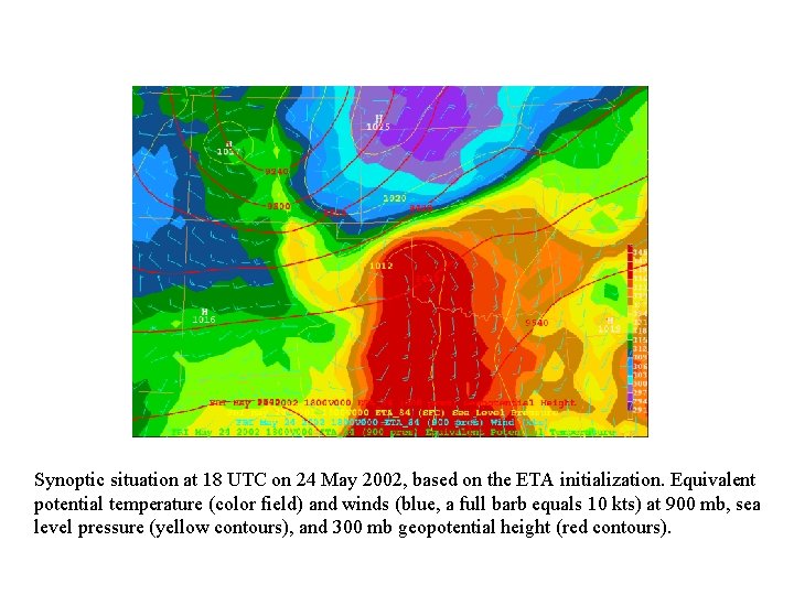
Synoptic situation at 18 UTC on 24 May 2002, based on the ETA initialization. Equivalent potential temperature (color field) and winds (blue, a full barb equals 10 kts) at 900 mb, sea level pressure (yellow contours), and 300 mb geopotential height (red contours).

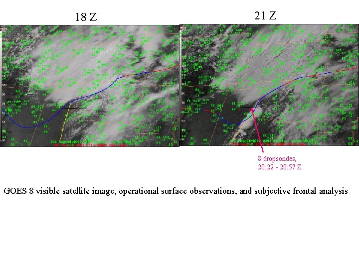
18 Z 21 Z 8 dropsondes, 20: 22 - 20: 57 Z GOES 8 visible satellite image, operational surface observations, and subjective frontal analysis

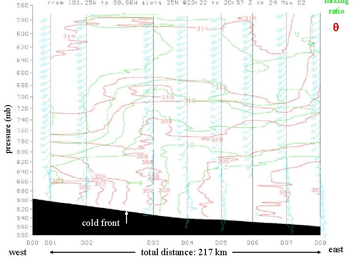
mixing ratio pressure (mb) q cold front west total distance: 217 km east

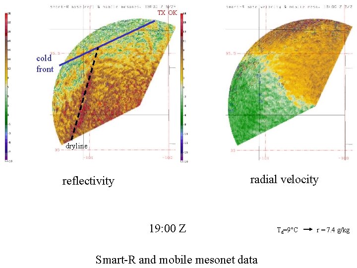
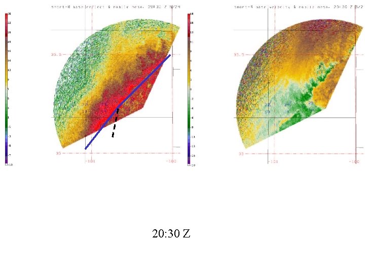
TX OK cold front dryline radial velocity reflectivity 19: 00 Z Smart-R and mobile mesonet data Td=9°C r = 7. 4 g/kg

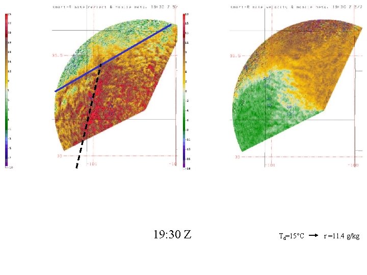
19: 30 Z Td=15°C r =11. 4 g/kg

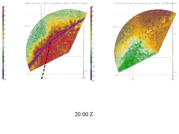
20: 00 Z

20: 30 Z

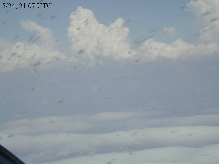
5/24, 21: 07 UTC

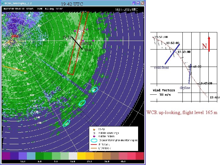
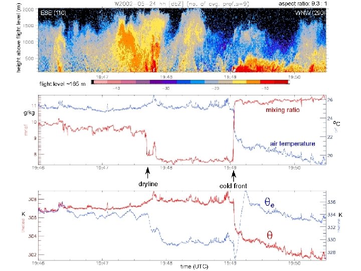
19: 42 UTC AMA 19: 52 UWKA N 19: 43 cold front dryline WCR up-looking, flight level 165 m


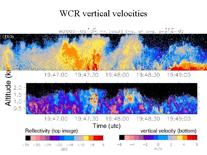
WCR vertical velocities dryline cold front

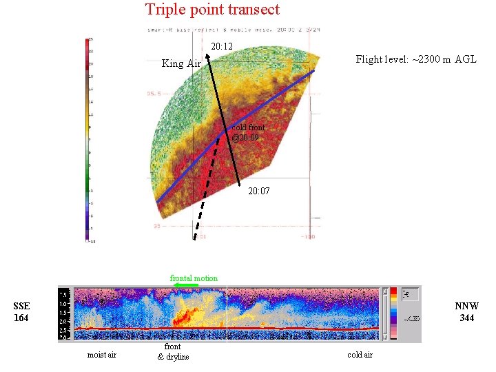
Triple point transect 20: 12 Flight level: ~2300 m AGL King Air cold front @20: 09 20: 07 frontal motion SSE 164 NNW 344 moist air front & dryline cold air

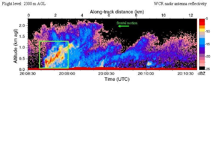
Flight level: 2300 m AGL WCR nadir antenna reflectivity frontal motion d. BZ

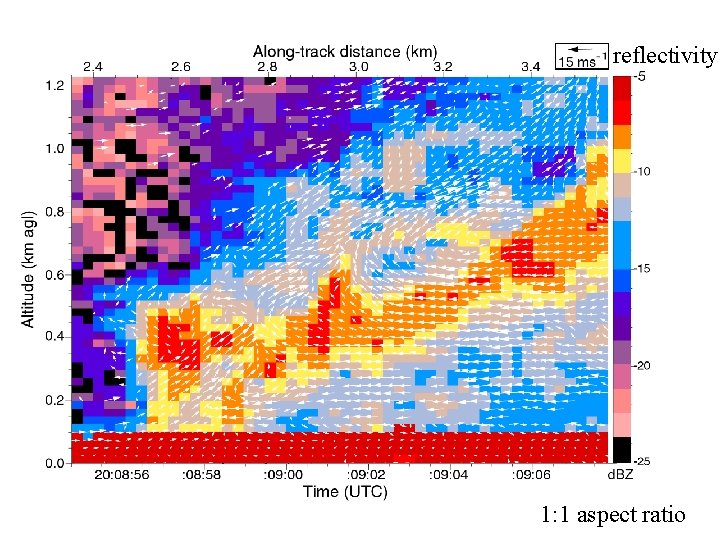
reflectivity 1: 1 aspect ratio


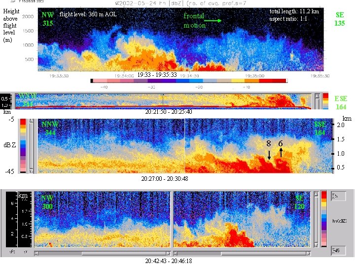
Height above flight level (m) NW flight level: 360 m AGL 315 possibly stratus clouds frontal motion total length: 11. 2 km aspect ratio: 1: 1 19: 33 - 19: 35: 33 frontal motion WNW 344 km ESE 164 20: 21: 50 - 20: 25: 40 -5 SE 135 NNW 344 SSE 164 8 6 d. BZ km 2. 0 1. 5 1. 0 0. 5 -45 20: 27: 00 - 20: 30: 48 km NW 300 SE 120 20: 42: 43 - 20: 46: 18

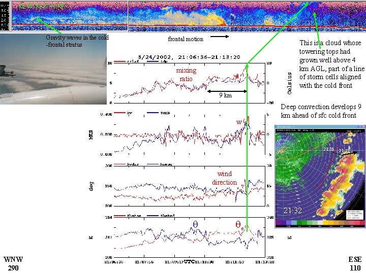
21: 06: 36 -21: 13: 20 Gravity waves in the cold -frontal stratus frontal motion This is a cloud whose towering tops had grown well above 4 km AGL, part of a line of storm cells aligned with the cold front mixing ratio 9 km w Deep convection develops 9 km ahead of sfc cold front 21: 05 21: 15 wind direction 21: 32 q WNW 290 qe ESE 110

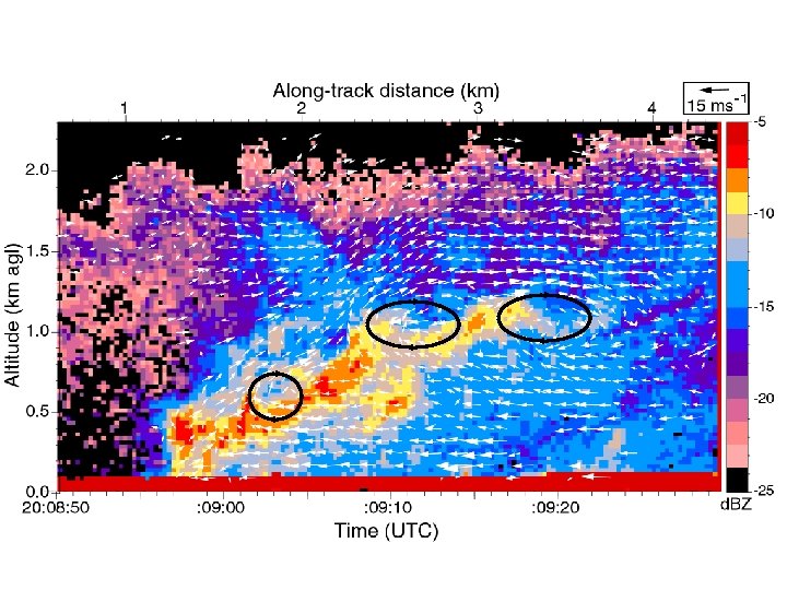
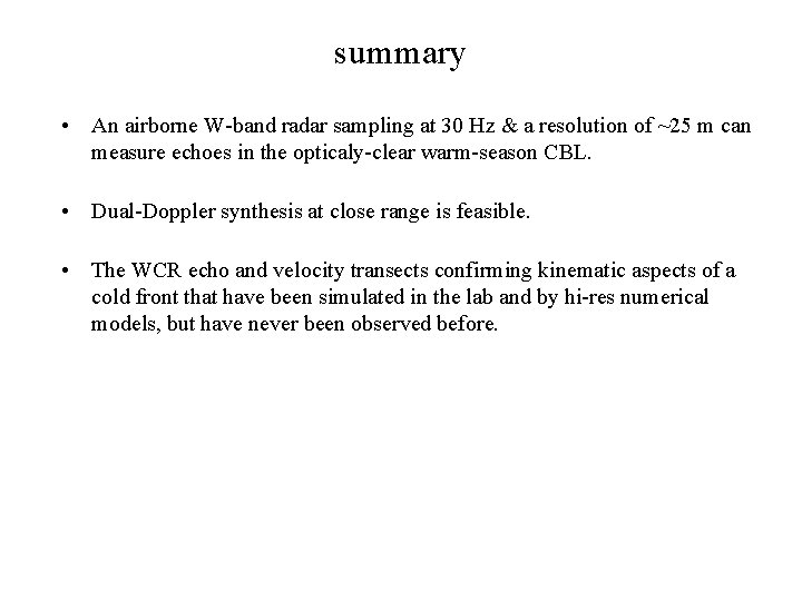
summary • An airborne W-band radar sampling at 30 Hz & a resolution of ~25 m can measure echoes in the opticaly-clear warm-season CBL. • Dual-Doppler synthesis at close range is feasible. • The WCR echo and velocity transects confirming kinematic aspects of a cold front that have been simulated in the lab and by hi-res numerical models, but have never been observed before.
