The LAPS hot start Initializing mesoscale forecast models
- Slides: 23

The LAPS “hot start” Initializing mesoscale forecast models with active cloud and precipitation processes Paul Schultz NOAA Forecast Systems Laboratory Local Analysis and Prediction Branch January 24, 2005

The LAPS team • • • John Mc. Ginley, branch chief, variational methods Paul Schultz, project manager, modeler, your speaker today Brent Shaw, most recent lead modeler Steve Albers, cloud analysis, temp/wind analysis Dan Birkenheuer, humidity analysis John Smart, everything January 24, 2005

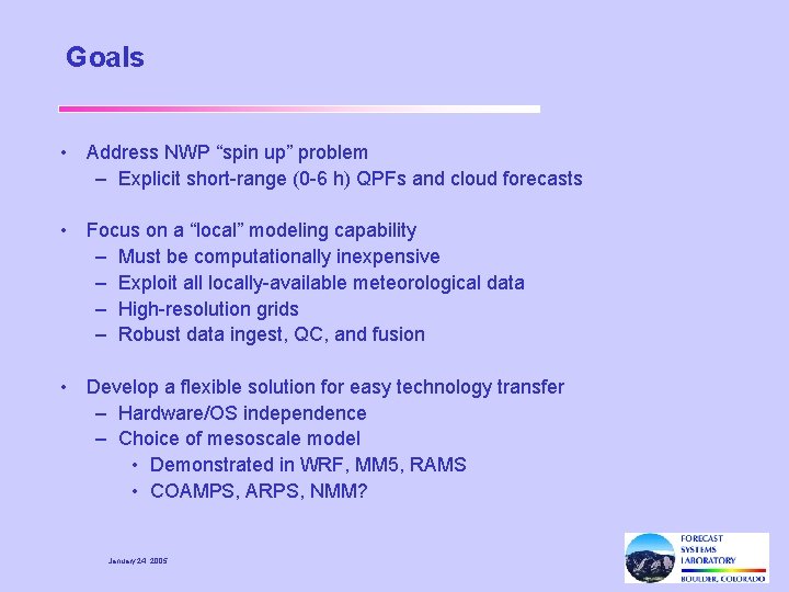
Goals • Address NWP “spin up” problem – Explicit short-range (0 -6 h) QPFs and cloud forecasts • Focus on a “local” modeling capability – Must be computationally inexpensive – Exploit all locally-available meteorological data – High-resolution grids – Robust data ingest, QC, and fusion • Develop a flexible solution for easy technology transfer – Hardware/OS independence – Choice of mesoscale model • Demonstrated in WRF, MM 5, RAMS • COAMPS, ARPS, NMM? January 24, 2005

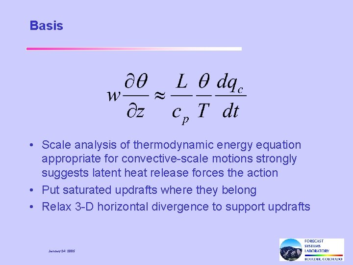
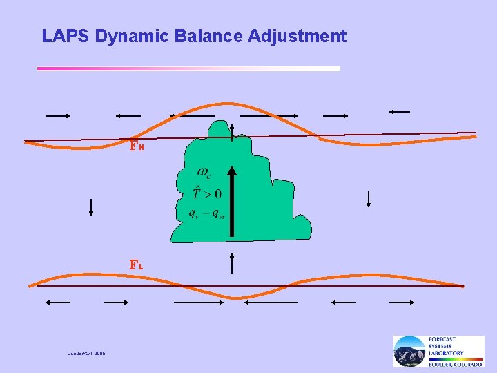
Basis • Scale analysis of thermodynamic energy equation appropriate for convective-scale motions strongly suggests latent heat release forces the action • Put saturated updrafts where they belong • Relax 3 -D horizontal divergence to support updrafts January 24, 2005

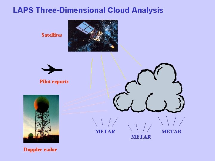
LAPS Three-Dimensional Cloud Analysis Satellites Pilot reports METAR Doppler radar METAR

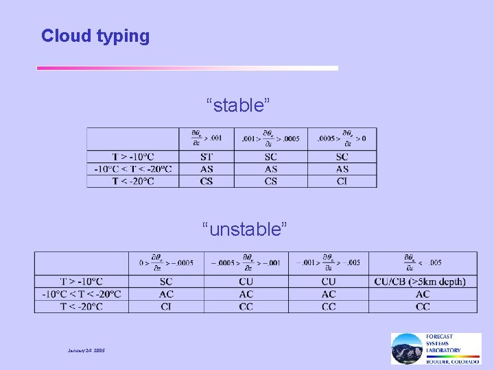
Cloud typing “stable” “unstable” January 24, 2005

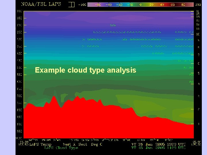
Example cloud type analysis January 24, 2005

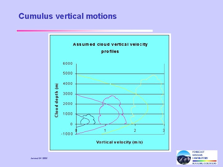
Cumulus vertical motions January 24, 2005

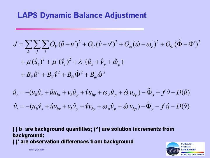
LAPS Dynamic Balance Adjustment ( ) b are background quantities; (^) are solution increments from background; ( )’ are observation differences from background January 24, 2005

LAPS Dynamic Balance Adjustment FH FL January 24, 2005

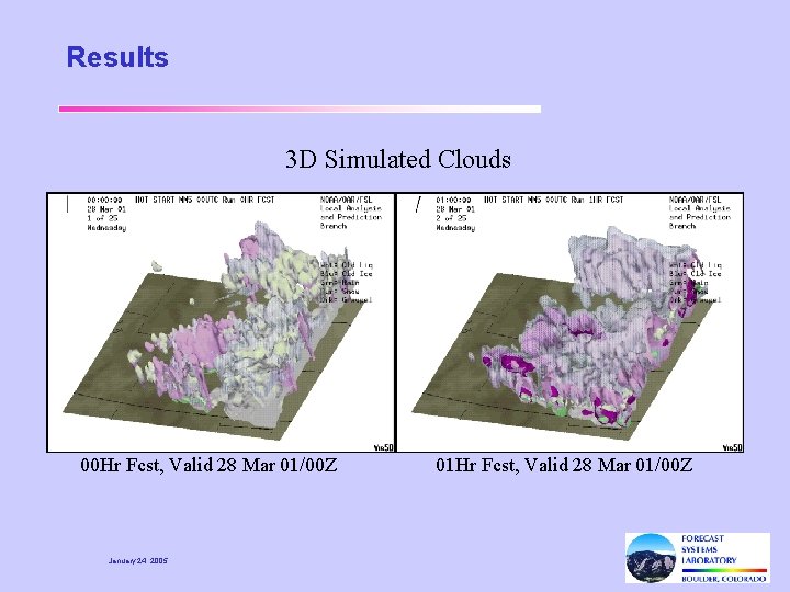
Results 3 D Simulated Clouds 00 Hr Fcst, Valid 28 Mar 01/00 Z January 24, 2005 01 Hr Fcst, Valid 28 Mar 01/00 Z

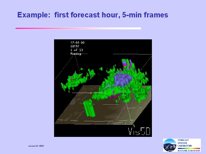
Example: first forecast hour, 5 -min frames January 24, 2005

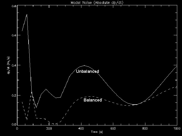
Unbalanced MODEL NOISE Balanced January 24, 2005 |dp/dt|

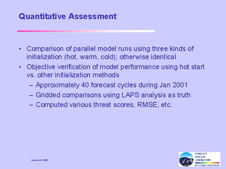
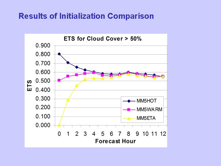
Quantitative Assessment • Comparison of parallel model runs using three kinds of initialization (hot, warm, cold); otherwise identical • Objective verification of model performance using hot start vs. other initialization methods – Approximately 40 forecast cycles during Jan 2001 – Gridded comparisons using LAPS analysis as truth – Computed various threat scores, RMSE, etc. January 24, 2005

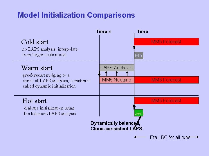
Model Initialization Comparisons Time-n Time Cold start MM 5 Forecast no LAPS analysis; interpolate from larger-scale model Warm start pre-forecast nudging to a series of LAPS analyses; sometimes called dynamic initialization Eta LAPS Analyses MM 5 Nudging MM 5 Forecast Hot start diabatic initialization using the balanced LAPS analysis MM 5 Forecast LAPS II Dynamically balanced, Cloud-consistent LAPS Eta LBC for all runs

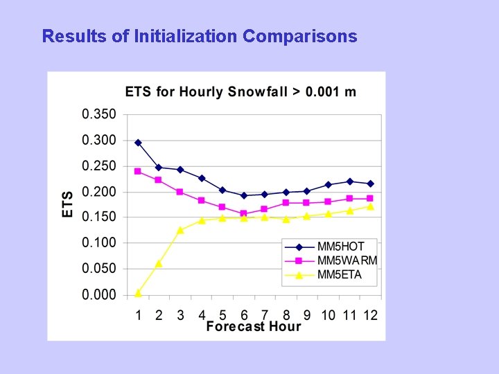
Results of Initialization Comparisons

Results of Initialization Comparison

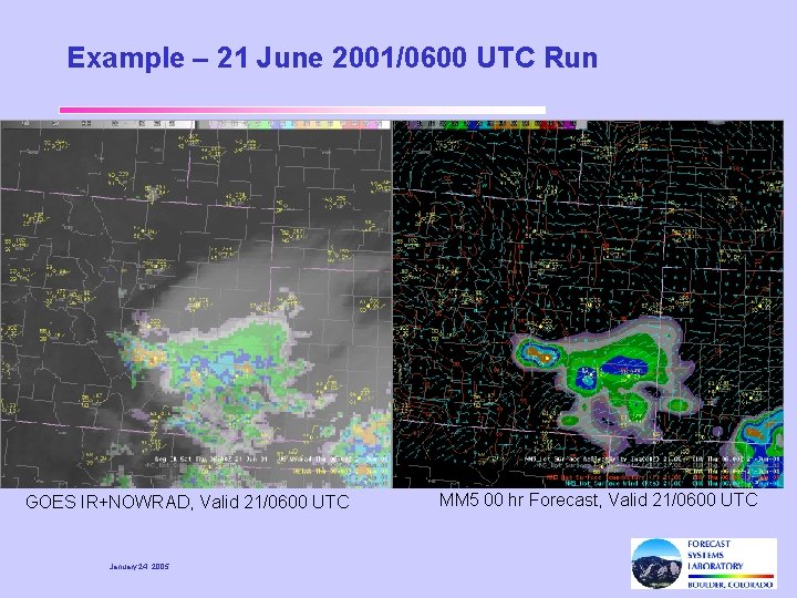
Example – 21 June 2001/0600 UTC Run GOES IR+NOWRAD, Valid 21/0600 UTC January 24, 2005 MM 5 00 hr Forecast, Valid 21/0600 UTC

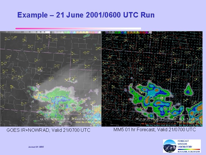
Example – 21 June 2001/0600 UTC Run GOES IR+NOWRAD, Valid 21/0700 UTC January 24, 2005 MM 5 01 hr Forecast, Valid 21/0700 UTC

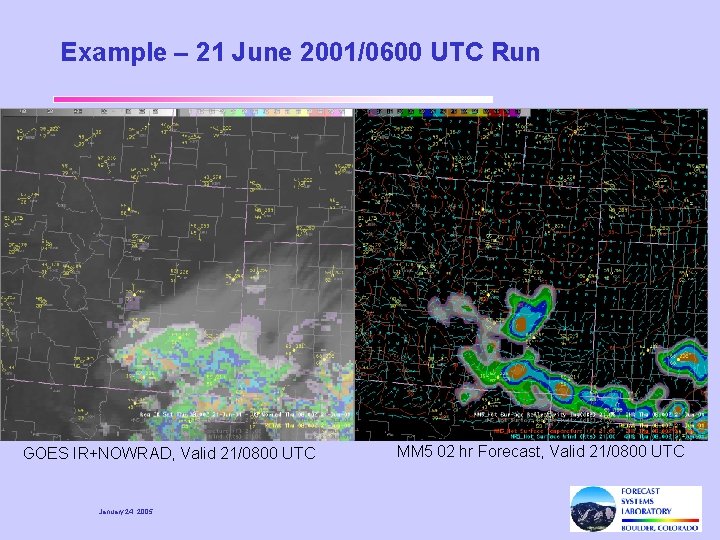
Example – 21 June 2001/0600 UTC Run GOES IR+NOWRAD, Valid 21/0800 UTC January 24, 2005 MM 5 02 hr Forecast, Valid 21/0800 UTC

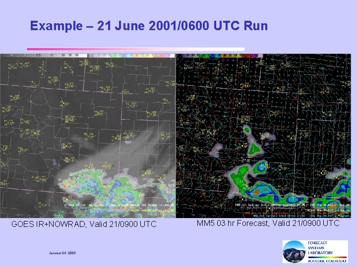
Example – 21 June 2001/0600 UTC Run GOES IR+NOWRAD, Valid 21/0900 UTC January 24, 2005 MM 5 03 hr Forecast, Valid 21/0900 UTC

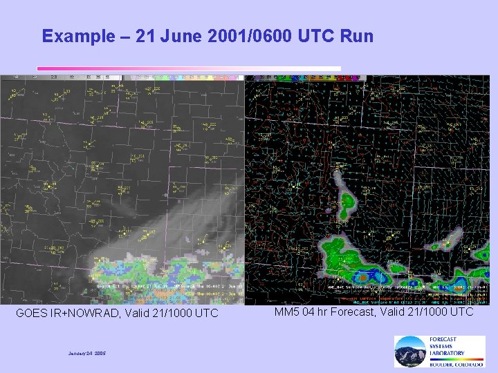
Example – 21 June 2001/0600 UTC Run GOES IR+NOWRAD, Valid 21/1000 UTC January 24, 2005 MM 5 04 hr Forecast, Valid 21/1000 UTC

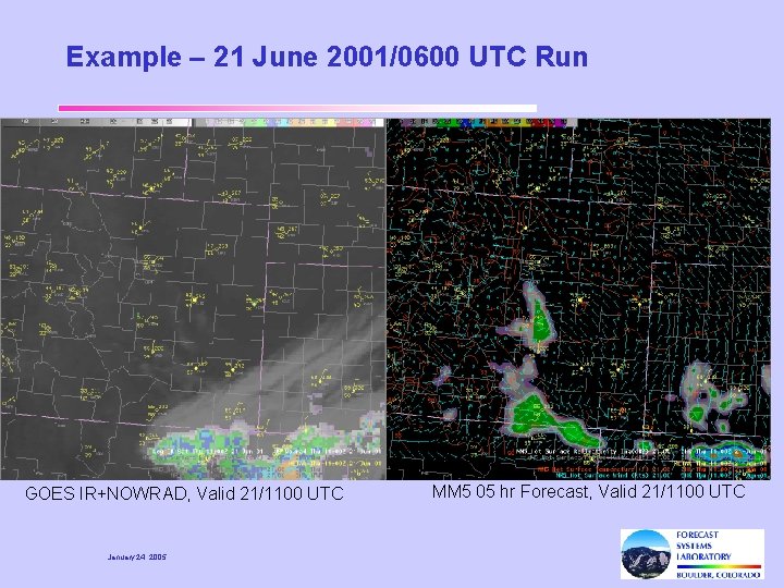
Example – 21 June 2001/0600 UTC Run GOES IR+NOWRAD, Valid 21/1100 UTC January 24, 2005 MM 5 05 hr Forecast, Valid 21/1100 UTC