The Indian River Lagoon covers 40 or 156


- Slides: 44

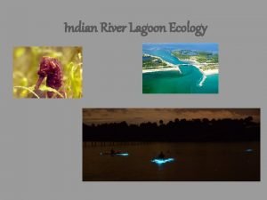
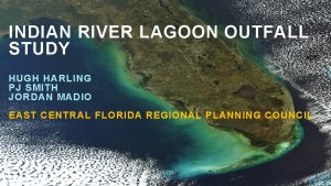
The Indian River Lagoon covers 40% (or 156 miles) of the Florida east coast Four areas make up this system: The Mosquito Lagoon The Banana River The Indian River The St. Lucie Estuary

The Indian River Lagoon covers 40% (or 156 miles) of the Florida east coast Four areas make up this system: The Mosquito Lagoon The Banana River The Indian River The St. Lucie Estuary

The Indian River Lagoon is an estuary This enclosed coastal body of water is a transitional environment between the land the ocean This system receives freshwater from a series of inland canals as well as saltwater from five inlets that connect to the ocean This creates a mix of both fresh and salt water.

The Indian River Lagoon is an estuary This enclosed coastal body of water is a transitional environment between the land the ocean This system receives freshwater from a series of inland canals As well as saltwater from five inlets that connect to the ocean This creates a mix of both fresh and salt water.

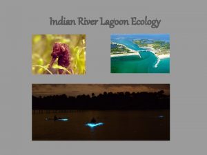
The Indian River Lagoon is one of the most biodiverse estuaries in North America. Due to its combined temperate and tropical climates, the lagoon has a unique variety of species and habitats. The watershed is home to 2, 200 animal species and 2, 100 plant species.

The Indian River Lagoon is one of the most biodiverse estuaries in North America. Due to its combined temperate and tropical climates, the lagoon has a unique variety of species and habitats. The watershed is home to 2, 200 animal species and 2, 100 plant species.

A healthy Indian River Lagoon means a healthy local economy! In 2016, its overall economic impact was estimated at $7. 6 billion per year… … and for every $1 invested in a healthy IRL, $33 are returned in benefits!

A healthy Indian River Lagoon means a healthy local economy! In 2016, its overall economic impact was estimated at $7. 6 billion per year… … and for every $1 invested in a healthy IRL, $33 are returned in benefits!

The Indian River Lagoon is an estuary in distress! Urbanization and changes in land use have led to extensive habitat loss for plants and animals. Excessive freshwater releases and increased nutrient loading from the watershed have led to harmful algal blooms and other negative impacts. These environmental stressors have contributed to water quality degradation as well as emerging diseases and decline in local wildlife populations.

The Indian River Lagoon is an estuary in distress! Urbanization and changes in land use have led to extensive habitat loss for plants and animals. Excessive freshwater releases and increased nutrient loading from the watershed have led to harmful algal blooms and other negative impacts. These environmental stressors have contributed to water quality degradation as well as emerging diseases and decline in local wildlife populations.

Researchers at FAU Harbor Branch are monitoring this ecosystem through an observation and prediction network called the Indian River Lagoon Observatory (IRLO) One of IRLO’s main components is its network of environmental sensors (IRLON). These stations transmit real-time water quality and weather data from an array of locations.

Researchers at FAU Harbor Branch are monitoring this ecosystem through an observation and prediction network called the Indian River Lagoon Observatory (IRLO) One of IRLO’s main components is its network of environmental sensors (IRLON). These stations transmit real-time water quality and weather data from an array of locations.

These stations are mounted to Coast Guard channel markers throughout the Lagoon Each IRLON unit is powered by a solar panel and transmits the collected data using a telemetry system. Most sites also include a weather station to monitor atmospheric conditions. Beneath the surface is an instrument called a LOBO (or Land Ocean Biogeochemical Observatory) unit which is made up of sensors that are used to measure water quality.

These stations are mounted to Coast Guard channel markers throughout the Lagoon Each IRLON unit is powered by a solar panel and transmits the collected data using a telemetry system. Most sites also include a weather station to monitor atmospheric conditions. Beneath the surface is an instrument called a LOBO (or Land Ocean Biogeochemical Observatory) unit which is made up of sensors that are used to measure water quality.

Current IRLON data can be used to plan ocean recreational activities and find good fishing spots! Past data can also be used to… Document harmful algal blooms and anoxic environments… …and see the impacts of storms and hurricanes IRLON data can be used by everyone to better understand this significant waterway and the plants and animals that live there!

Current IRLON data can be used to plan ocean recreational activities and find good fishing spots! Past data can also be used to… Document harmful algal blooms and anoxic environments… …and see the impacts of storms and hurricanes IRLON data can be used by everyone to better understand this significant waterway and the plants and animals that live there!

Water quality and weather parameters are measured every hour and transmitted to a website. http: //fau. loboviz. com LOBOviz displays real-time water quality and weather data collected from the IRLON sensors. These data are available to anyone with an internet connection! Using the touch screen to your right, click any site listed on the left… …and pull up the site’s most current weather or water quality data!

Water quality and weather parameters are measured every hour and transmitted to a website. http: //fau. loboviz. com LOBOviz displays real-time water quality and weather data collected from the IRLON sensors. These data are available to anyone with an internet connection! Using the touch screen to your right, click any site listed on the left… …and pull up the site’s most current weather or water quality data!

As you can see, every IRLON sensor measures many different factors that can affect water quality. Using these next few slides, follow along with the current data to learn more about these parameters!

As you can see, every IRLON sensor measures many different factors that can affect water quality. Using these next few slides, follow along with the current data to learn more about these parameters!

Row 1 Temperature measures how hot or cold the water is. Typical range: 55°F (13°C) to 90°F (32°C) over the year. The lagoon’s temperature is highly variable due to its shallow depth (avg. 4 feet), high mixing rate, and seasonal changes. Because of this, animals in the IRL must be tolerant to many different temperatures.

Row 1 Temperature measures how hot or cold the water is. Typical range: 55°F (13°C) to 90°F (32°C) over the year. The lagoon’s temperature is highly variable due to its shallow depth (avg. 4 feet), high mixing rate, and seasonal changes. Because of this, animals in the IRL must be tolerant to many different temperatures.

Row 2 Salinity measures how salty the water is. Salinity is measured in Practical Salinity Units (PSU), or grams of salt per 1000 grams of water. Range: Minimum: 0 (freshwater) Maximum: 36 (ocean water) Link Port (by HBOI) average: 28 PSU The lagoon’s salinity is constantly changing, depending on location, precipitation, runoff, and tides.

Row 2 Salinity measures how salty the water is. Salinity is measured in Practical Salinity Units (PSU), or grams of salt per 1000 grams of water. Range: Minimum: 0 (freshwater) Maximum: 36 (ocean water) Link Port (by HBOI) average: 28 PSU The lagoon’s salinity is constantly changing, depending on location, precipitation, runoff, and tides.

Row 3+4 Plants and animals need oxygen to breathe – even in the water! Dissolved oxygen (DO) is measured in milligrams per liter (mg/L), or percent saturation. DO less than 4. 0 mg/L = animals are stressed DO is 0 mg/L = anoxia (“dead zones”) High DO means water is cooler, well mixed, and more productive Long term anoxia leads to fish kills. Low DO means water is warmer, saltier, and less productive

Row 3+4 Plants and animals need oxygen to breathe – even in the water! Dissolved oxygen (DO) is measured in milligrams per liter (mg/L), or percent saturation. DO less than 4. 0 mg/L = animals are stressed DO is 0 mg/L = anoxia (“dead zones”) High DO means water is cooler, well mixed, and more productive Long term anoxia leads to fish kills. Low DO means water is warmer, saltier, and less productive

Turbidity indicates how cloudy the water is, and it measures water clarity. Turbidity is measured in Nephelometric Turbidity Row 5 Units (NTU). Lower NTU values indicate clearer water, and higher NTU values indicate cloudy water. Turbidity is important for seagrass health! High turbidity = low light reaching their habitat Turbidity is also important for underwater recreation! Low turbidity = high visibility

Turbidity indicates how cloudy the water is, and it measures water clarity. Turbidity is measured in Nephelometric Turbidity Row 5 Units (NTU). Lower NTU values indicate clearer water, and higher NTU values indicate cloudy water. Turbidity is important for seagrass health! High turbidity = low light reaching their habitat Turbidity is also important for underwater recreation! Low turbidity = high visibility

Row 6 Colored Dissolved Organic Matter (CDOM) indicates the color of the water. CDOM is measured in QSDE (Quinine Sulfate Dihydrate Equivalent). Low CDOM = blue color High CDOM = green, yellow, reddish brown color High CDOM concentrations are caused by tannins, which come from decaying vegetation. High color is a sign of high freshwater runoff.

Row 6 Colored Dissolved Organic Matter (CDOM) indicates the color of the water. CDOM is measured in QSDE (Quinine Sulfate Dihydrate Equivalent). Low CDOM = blue color High CDOM = green, yellow, reddish brown color High CDOM concentrations are caused by tannins, which come from decaying vegetation. High color is a sign of high freshwater runoff.

Row 7 Chlorophyll a is used by plants for photosynthesis. We can measure it to find out how much phytoplankton are in the water. Chlorophyll a is measured in micrograms per liter (µg/L) 10 µg/L or less = low phytoplankton concentrations. 20 -30 µg/L = high phytoplankton concentrations. This can sometimes be considered an “algal bloom”.

Row 7 Chlorophyll a is used by plants for photosynthesis. We can measure it to find out how much phytoplankton are in the water. Chlorophyll a is measured in micrograms per liter (µg/L) 10 µg/L or less = low phytoplankton concentrations. 20 -30 µg/L = high phytoplankton concentrations. This can sometimes be considered an “algal bloom”.

Row 8+9 Nitrates and Phosphates are nutrients that help plants (and algae) grow! These nutrient concentrations are measured in µM and mg/L. High concentrations indicate high nutrient loading due to pollution, runoff, or inflow from freshwater sources. All plants need nutrients to grow. BUT adding too many can result in blooms of algae, and it can eventually lead to a decrease in dissolved oxygen. This process is called eutrophication

Row 8+9 Nitrates and Phosphates are nutrients that help plants (and algae) grow! These nutrient concentrations are measured in µM and mg/L. High concentrations indicate high nutrient loading due to pollution, runoff, or inflow from freshwater sources. All plants need nutrients to grow. BUT adding too many can result in blooms of algae, and it can eventually lead to a decrease in dissolved oxygen. This process is called eutrophication

Row 2 11+1 Measuring the currents helps us understand how water is moving through the lagoon. The current’s direction is measured in degrees The current’s speed is measured in feet (or millimeters) per second The currents usually flow at a rate of 0 to 5 ft/s. Currents in the lagoon are influenced mostly by wind, but also by tides and density differences. Knowledge of the current’s speed and direction can be useful for fishing, boating, and SCUBA diving!

Row 2 11+1 Measuring the currents helps us understand how water is moving through the lagoon. The current’s direction is measured in degrees The current’s speed is measured in feet (or millimeters) per second The currents usually flow at a rate of 0 to 5 ft/s. Currents in the lagoon are influenced mostly by wind, but also by tides and density differences Knowledge of the current’s speed and direction can be useful for fishing, boating, and SCUBA diving!

For a more extended look at IRLON’s past and present data, click the “LOBOviz” tab at the top of the webpage to your right! You can use this feature to create graphs for parameters you’re curious about! Scientists use LOBOviz to keep track of how the Indian River Lagoon’s water quality is changing during certain events!

For a more extended look at IRLON’s past and present data, click the “LOBOviz” tab at the top of the webpage to your right! You can use this feature to create graphs for parameters you’re curious about! Scientists use LOBOviz to keep track of how the Indian River Lagoon’s water quality is changing during certain events!

Stories of the Indian River Lagoon Check out some of the events that IRLON and Harbor Branch have captured!

In the summer of 2016, the Indian River Lagoon faced several traumatic harmful algal blooms. This bloom was caused by high nutrient input, low salinity due to lots of rainfall during the dry season, and warmer temperatures. Toxic cyanobacteria bloomed in Lake Okeechobee, and its discharges brought the bloom to the St. Lucie Estuary Toxins found in these algae are harmful for aquatic organisms and even human health IRLON used LOBOviz graphs to predict that phosphates from the discharges and the watershed were fueling this bloom!

In the summer of 2016, the Indian River Lagoon faced several traumatic harmful algal blooms. This bloom was caused by high nutrient input, low salinity due to lots of rainfall during the dry season, and warmer temperatures. Toxic cyanobacteria bloomed in Lake Okeechobee, and its discharges brought the bloom to the St. Lucie Estuary Toxins found in these algae are harmful for aquatic organisms and even human health IRLON used LOBOviz graphs to predict that phosphates from the discharges and the watershed were fueling this bloom!

Even Hurricane Matthew was captured by IRLON! Scientists and locals could use IRLON’s data to track the storm on an hourly basis. Imagine having this information for a more severe storm! This LOBOviz graph shows the peak in wind speeds during the hurricane.

Even Hurricane Matthew was captured by IRLON! Scientists and locals could use IRLON’s data to track the storm on an hourly basis. Imagine having this information for a more severe storm! This LOBOviz graph shows the peak in wind speeds during the hurricane.

If you want to learn more about what IRLON has captured, visit the “observations” tab on the IRLO website! http: //fau. edu/hboi/irlo
 What is a lagoon
 The dog river watershed covers
 Tombolo
 Lagoon phosphorus removal
 Egg processing lagoon
 Rochford hospital beech ward
 Winter lagoon optimization
 Korle lagoon ecological restoration project
 Lagoon city map
 Lagoon
 The black lagoon toronto
 156 hangi yüzlüğe yuvarlanır
 Art 156 ctn
 Leadership assessment report
 How to find partical pressure
 Ley 24 156
 98 156 chia 4 63
 Artigo 156 cc
 156+232
 Leadership assessment report
 Database collection
 Scoala 156
 Diketahui panjang kawat suatu kerangka kubus 156 cm
 Factors of 156
 29cfr1910.156
 Indian river inlet dangerous
 Tukwila
 I am the river and the river is me
 đại từ thay thế
 Vẽ hình chiếu vuông góc của vật thể sau
 Cong thức tính động năng
 Tỉ lệ cơ thể trẻ em
 Thế nào là mạng điện lắp đặt kiểu nổi
 Hình ảnh bộ gõ cơ thể búng tay
 Lời thề hippocrates
 Các loại đột biến cấu trúc nhiễm sắc thể
 Vẽ hình chiếu đứng bằng cạnh của vật thể
 độ dài liên kết
 Quá trình desamine hóa có thể tạo ra
 Các môn thể thao bắt đầu bằng tiếng bóng
 Khi nào hổ con có thể sống độc lập
 điện thế nghỉ
 Thế nào là sự mỏi cơ
 Trời xanh đây là của chúng ta thể thơ
 Chó sói
