The Geographers Tools Maps and Globes n n

The Geographer’s Tools

Maps and Globes n n n A geographer’s tools include maps, globes, and data that can be displayed in a variety of ways. Oldest known map: Babylonian clay tablet, circa 500 B. C. A map’s function: to show locations of places, landforms, and bodies of water, and where they are in relation to other parts of the earth.
 of Earth • Most")
Two or Three Dimensions n Globe—a three-dimensional representation (a sphere) of Earth • Most accurate replication of Earth • Globes can show the "Great Circle Route" - the shortest distance between any two points on the earth's surface Map—a two-dimensional graphic representation of Earth’s surface

Cartography n Cartographers are mapmakers. They draw and create different types of map projections. • While maps are very useful in studying Geography, even the best drawn maps can be inaccurate. The actual size of countries and their distance from one another can be distorted. • What causes distortion?

Map Projection n n Cartographers attempt to transfer the earth- a round, spherical globeto flat paper. Areas, angles, directions, shapes and distances can become distorted when transferred from a curved surface to a flat plane

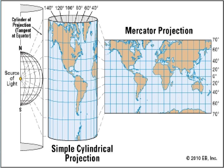
Mercator Projection n n The best know map projection is named for its inventor, Gerardus Mercator, who developed it in 1569 Primarily used by sailors for navigation.

Robinson Projection n n Was a compromise projection developed by Arthur Robinson, a leading educator in cartography This projection shows the whole earth uninterrupted with reasonable shapes

Conic Projection -comes from placing a cone over part of a globe. Conic projections are best suited for showing limited east–west areas that are not too far from the Equator. For these uses, a conic projection can indicate distances and directions fairly accurately. From
 2) 3) Physical")
Types of Maps There are three main types of maps: 1) 2) 3) Physical Map Political Map Thematic Map

Physical Maps Physical maps help you see the types of landforms and bodies of water found in specific area. Color, shading, or contour lines are used to indicate elevation or altitude.

NATURAL BOUNDARIES are formed by coastlines, rivers or mountain ranges ARTIFICIAL BOUNDARIES are manmade
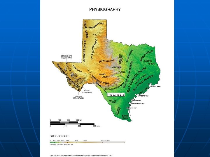
 PHYSICAL MAPS LANDFORMS & WATERWAYS Physical Map of Afghanistan Physical Map of Costa")
3) PHYSICAL MAPS LANDFORMS & WATERWAYS Physical Map of Afghanistan Physical Map of Costa Rica

Political Maps Political maps show political boundaries on earth’s surface that humans created. Included on a political map may be cities, states, provinces, territories, or countries.
 POLITICAL MAPS BOUNDARIES BETWEEN GOVERNMENTS (Formal Regions) Borders of South America 254 Counties")
3) POLITICAL MAPS BOUNDARIES BETWEEN GOVERNMENTS (Formal Regions) Borders of South America 254 Counties of Texas

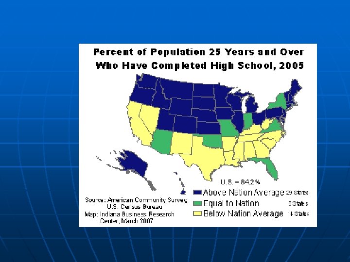
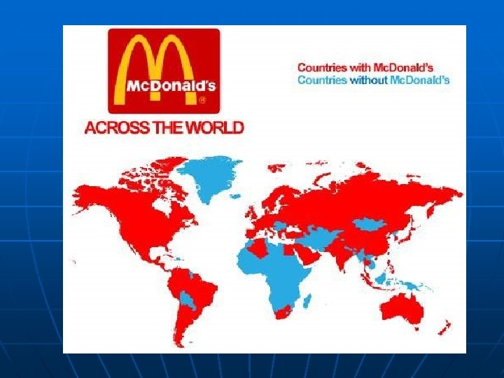
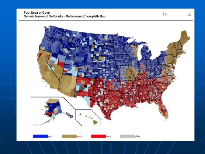
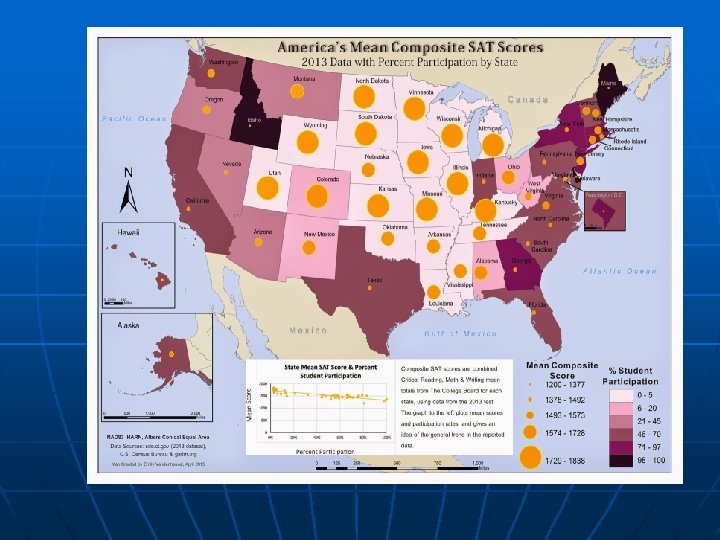
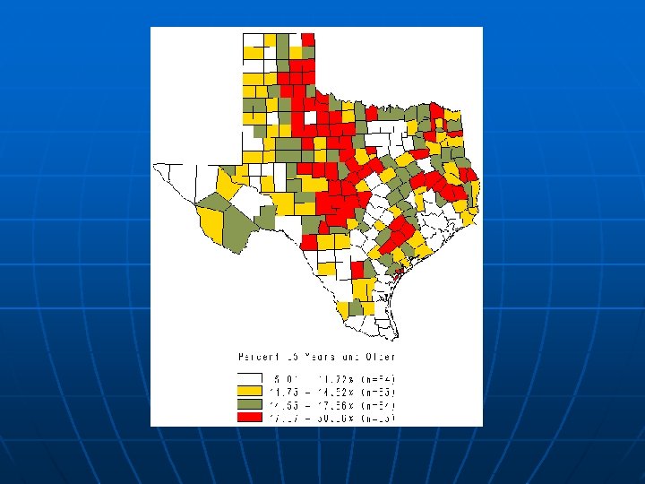
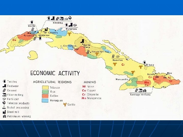
Thematic Maps Geographers also rely on thematic maps, which focus on specific types of information such as climate, vegetation, natural resources, population density, and economic activities.
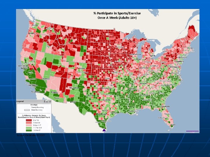
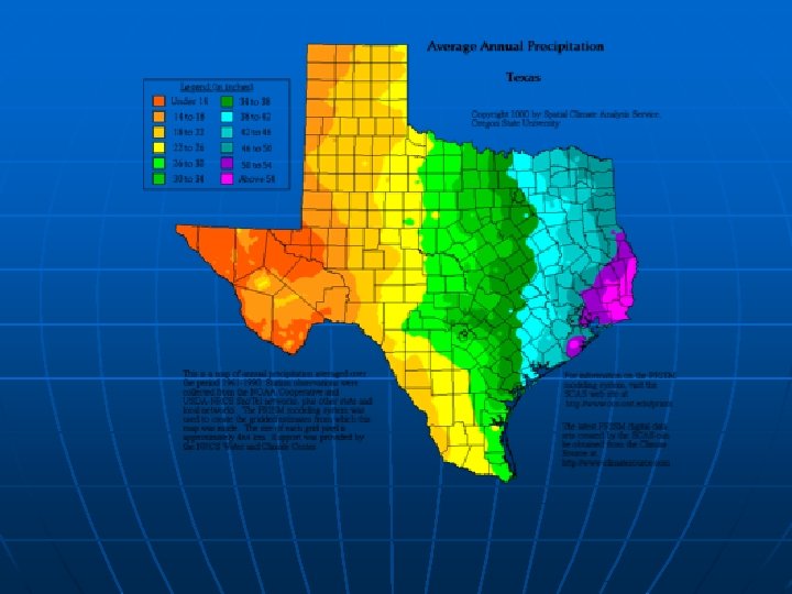

Other Thematic Maps Flow-Line Maps

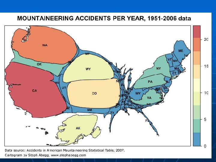
Cartogram: Some other factor is used instead of land size

Cool Website n https: //worldmapper. org/

Reading a Map • Title- The title explains the subject of the map and gives you an idea of what information the map conveys. • Compass Rose- The compass rose shows you the north (N), south (S), east (E), and west (W) directions on the map. • Labels- Labels are words or phrases that explain features on the map. • Legend- A legend or key lists and explains the symbols and use of color on the map. • Lines of Latitude- These are imaginary lines that measure distance north or south of the equator. (parallels) • Lines of Longitude- These are imaginary lines that measure distance east or west of the prime meridian. (meridians) • Scale- A scale shows the ratio between a unit of length on the map and a unit of distance on the earth. • Symbols- Symbols represent such items as capital cities, economic activities, or natural resources. • Colors- Colors represent a variety of information on a map. The map legend indicates what the colors mean.

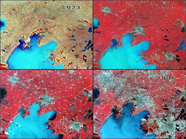
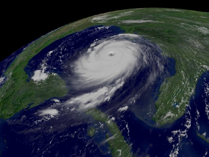
The Science of Mapmaking n n Surveyors observe, measure, record what they see in a specific area Remote sensing, gathering geographic data from a distance, includes: - aerial photography - satellite imaging
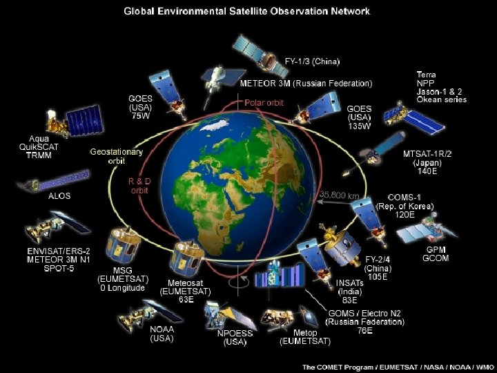

The Science of Mapmaking n n Best known satellites are Landsat and GOES Landsat is a series of satellites; can scan entire planet in 16 days
: - orbits in sync")
The Science of Mapmaking n Geostationary Operational Environment Satellite (GOES): - orbits in sync with Earth’s rotation - gathers images of atmospheric conditions
 is a digital geographic database")
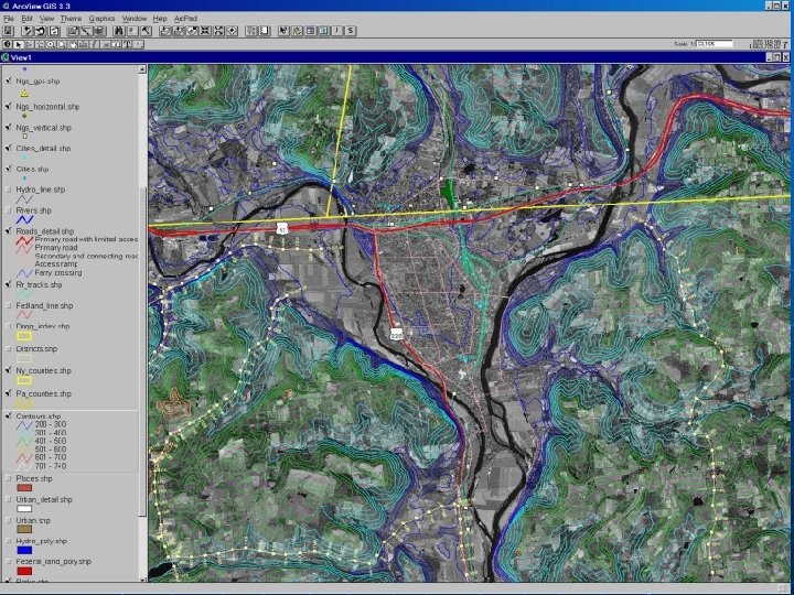
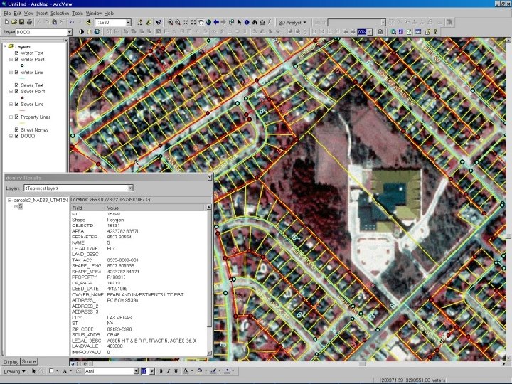
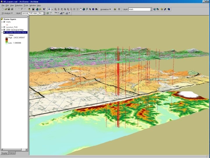
The Science of Mapmaking n Geographic Information Systems (GIS) is a digital geographic database - Combines and displays information from many sources
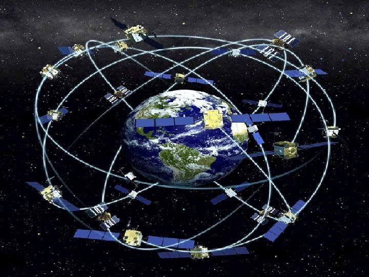
: Uses series of 24 Navstar satellites")
The Science of Mapmaking Global Positioning System (GPS): Uses series of 24 Navstar satellites to beam information to Earth - Hand-held GPS receivers on Earth display exact position - GPS used by explorers, sailors, drivers; also used to track animals
- Slides: 43