The Geographers Eye Latitude Longitude Essential How do


- Slides: 9

The Geographer’s Eye Latitude & Longitude

Essential ? ○ How do you use latitude and longitude to read map?

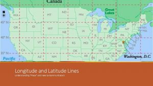
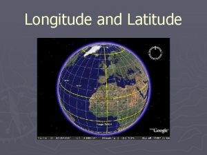
Vocabulary Map – flat representation of Earth, or a portion of it. Latitude – imaginary horizontal lines, running East & West, parallel to the equator, and measuring North & South of equator. Longitude – imaginary vertical lines, running North & South, measuring distances East & West of the Prime Meridian. Hemisphere – half a sphere or object.

Vocab. Continued Equator – measurement of 0* N/S, where the sun hits the Earth most directly. Tropic of Cancer/Capricorn – where colder air descends back to Earth Cancer – 23* N Capricorn – 23* S North/South Pole – farthest away from equator North pole – 90* N South pole – 90* S Prime Meridian – 0* E/W International Date Line – the opposite side of Earth from the Prime Meridian, measures at 180* E/W

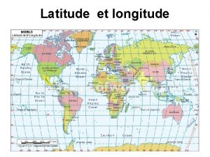
What is this? ? ? Where have you seen something like this before? Why would this graphic be helpful?

Assignment Here are some random cities, plot them. . Beijing 39 N 116 E Cairo 30 N 31 E Hong Kong 22 N 114 E Havana 23 N 82 W La Paz 16 S 68 W Manilla 14 N 120 E Mexico City 19 N 99 W Oslo 59 N 10 E Prague 50 N 14 E Rio de Janiero 22 S 43 W Vancouver 48 N 126 W

VIDEO EXPLANATION Vocabulary ❧ Globe – the most scaled model of ❧ Peters Projection – 1885, is a Earth, true to Earth’s. rectangular map projection that ❧ Size, Shape, Distance, & Direction maps all areas such that they have the correct sizes relative to each other. ❧ Mercator Projection – 1569, Used by Sailors, most accurate closest to the ❧ Robinson Projection – 1988, most widely equator & most distorted in polar used map projection, uses the best regions. characteristics while minimizing distortion.

Vocab. Continued Map Properties – size, shape, distance, or direction. Global Information System (GIS) – technological application allowing the user to create new maps, analyze patterns and spatial relationships, and predict possible trends. Global Positioning System (GPS) – utilizes data (Latitude, longitude, elevation, and time) are communicated via a device that receives data directly from satellites.

Class Discussion What is similar about the maps? What are the differences between the maps? Why is there distortion on all of the maps?
 Lat de santos
 Latitude and longitude guided notes
 Longitude latitude
 How to read latitude and longitude
 Countries northern hemisphere
 How are latitude and longitude measured
 Tropic of capricorn latitude and longitude
 Latitude and longitude of india
 Http //go.hrw.com/atlas/norm htm/world.htm
 Latitude and longitude
