
The Factors the Affect Climate L A C





- Slides: 36
The Factors the Affect Climate: L. A. C. E. M. O. P. S. Much of the information in this Power Point came from Linda Hammon.
Terms to Know Fold your paper in half 3 times to create 8 boxes necessary to record the information in this lesson. Use one side record each of these vocab terms & definitions. • Rotation/1 daytakes the earth 24 hours (1 day) to make one complete rotation on it’s AXIS. • Revolution/1 year. Takes the earth 365 ¼ days (1 year) to make one complete revolution around the SUN • Weather– The DAILY condition of the atmosphere. • Climate– Weather conditions over TIME. • Precipitation – Moisture that falls from the sky: rain, snow, sleet, & hail.
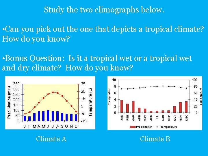
How to Read a Climograph Look at the title to see what location’s climate is being described by the graph. Line Graph = avg temperature for each month. Average precipitation by month. Months of the year.
Forces that create the climate of a certain location: LACEMOPS. Place one of each of these letters in your boxes created by folding the manilla paper. L A C E M O P S
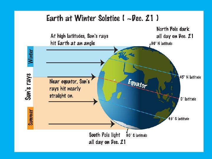
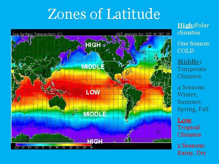
L = Latitude Distance from the equator is one of the most important factors in determining climate.
Zones of Latitude HIGH MIDDLE LOW MIDDLE HIGH High: Polar climates. One Season: COLD Middle: Temperate Climates 4 Seasons: Winter, Summer, Spring, Fall Low: Tropical Climates 2 Seasons: Rainy, Dry
Take a moment to compare the temperatures of Mangalore & Memphis. Which one do you think is closer to the equator? Why? Tropical Wet & Dry Location Humid Subtropical Location
Study the two climographs below. • Can you pick out the one that depicts a tropical climate? How do you know? • Bonus Question: Is it a tropical wet or a tropical wet and dry climate? How do you know? Climate A Climate B
A is for Air Masses
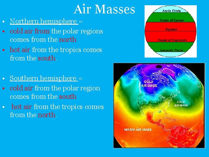
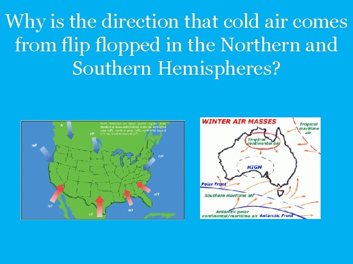
Air Masses • Northern hemisphere = • cold air from the polar regions comes from the north • hot air from the tropics comes from the south. • Southern hemisphere = • cold air from the polar region comes from the south • hot air from the tropics comes from the north.
Why is the direction that cold air comes from flip flopped in the Northern and Southern Hemispheres?
C is for Continentality
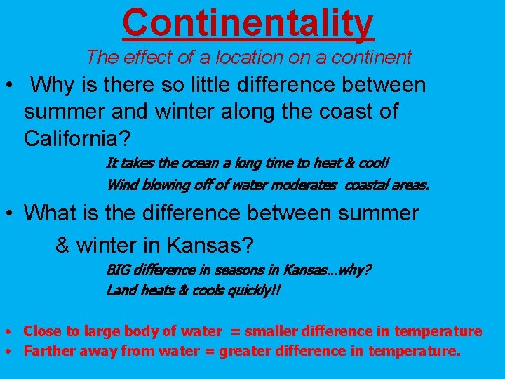
Continentality The effect of a location on a continent • Why is there so little difference between summer and winter along the coast of California? It takes the ocean a long time to heat & cool! Wind blowing off of water moderates coastal areas. • What is the difference between summer & winter in Kansas? BIG difference in seasons in Kansas…why? Land heats & cools quickly!! • Close to large body of water = smaller difference in temperature • Farther away from water = greater difference in temperature.
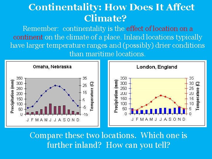
Continentality: How Does It Affect Climate? Remember: continentality is the effect of location on a continent on the climate of a place. Inland locations typically have larger temperature ranges and (possibly) drier conditions than maritime locations. Compare these two locations. Which one is further inland? How can you tell?
E is for Elevation
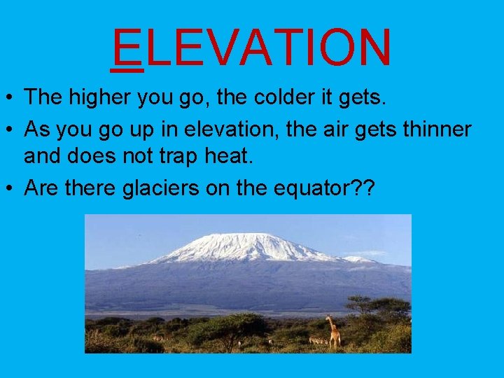
ELEVATION • The higher you go, the colder it gets. • As you go up in elevation, the air gets thinner and does not trap heat. • Are there glaciers on the equator? ?
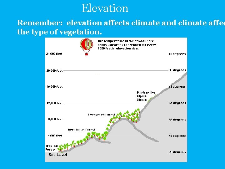
Elevation Remember: elevation affects climate and climate affec the type of vegetation.
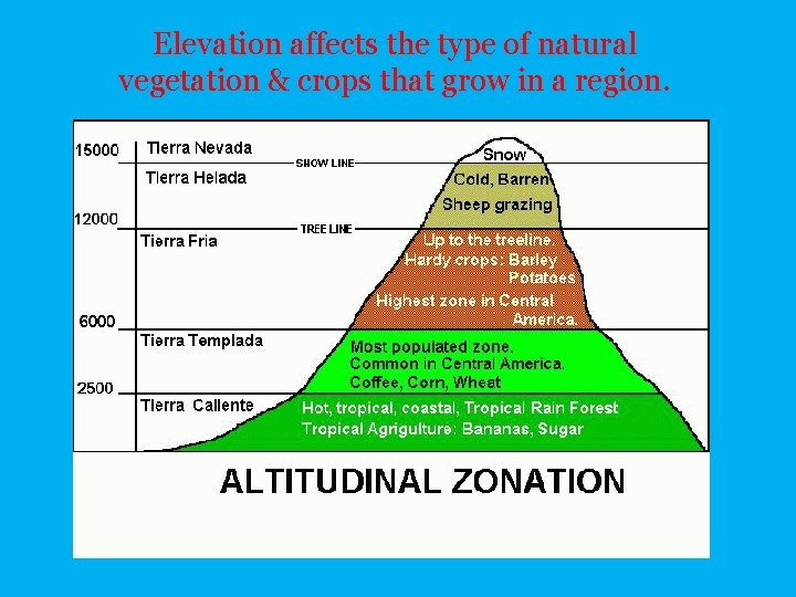
Elevation affects the type of natural vegetation & crops that grow in a region.
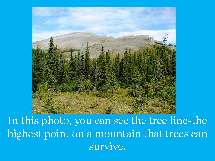
In this photo, you can see the tree line-the highest point on a mountain that trees can survive.
M is for Mountain Barriers
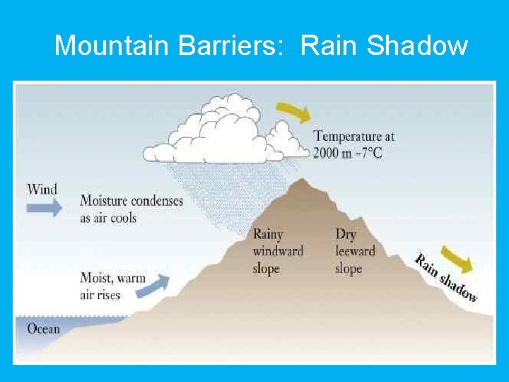
MOUNTAIN BARRIERS (aka the Orographic Effect or the Rain Shadow Effect) • Winds blow across the ocean & push moisture inland. • Moisture cloud reaches the mountains, gets “popped” by the mountain top & rains on the coastal side • By the time this cloud reaches the other side of the mountains, the air is dry. What very dry state do you find East of the Sierra Nevada Mts? ?
Mountain Barriers: Rain Shadow
O is for Ocean Currents
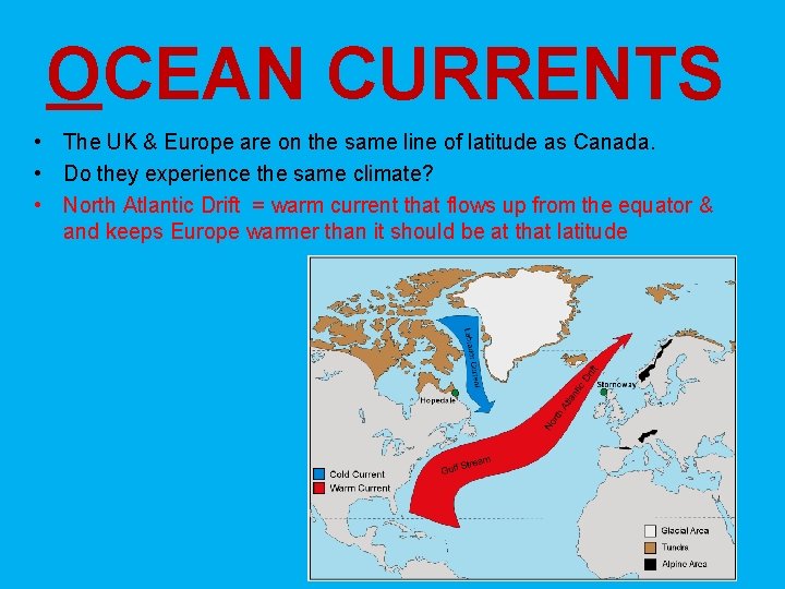
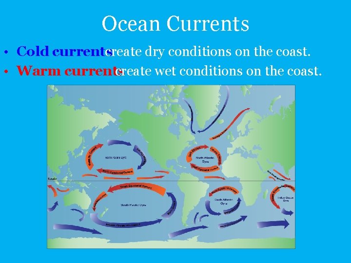
OCEAN CURRENTS • The UK & Europe are on the same line of latitude as Canada. • Do they experience the same climate? • North Atlantic Drift = warm current that flows up from the equator & and keeps Europe warmer than it should be at that latitude
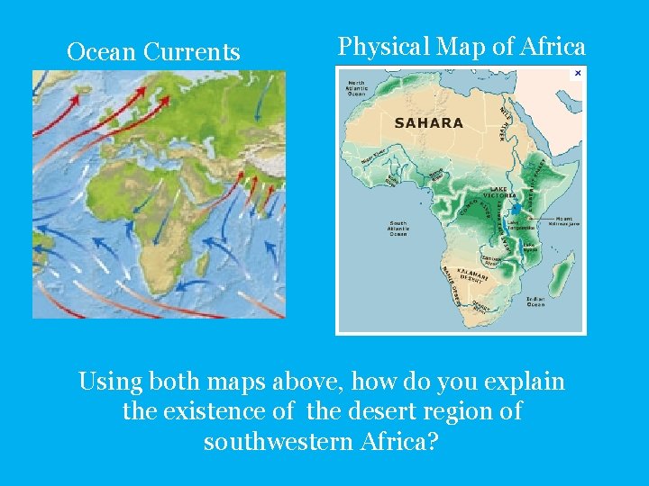
Ocean Currents • Cold currents create dry conditions on the coast. • Warm currents create wet conditions on the coast.
Ocean Currents Physical Map of Africa Using both maps above, how do you explain the existence of the desert region of southwestern Africa?
P is for Pressure and Prevailing Winds
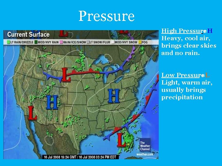
Pressure High Pressure =H Heavy, cool air, brings clear skies and no rain. Low Pressure =L Light, warm air, usually brings precipitation
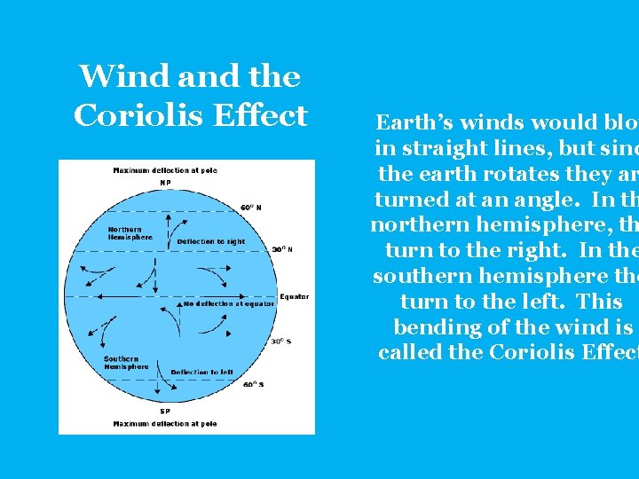
Wind and the Coriolis Effect Earth’s winds would blow in straight lines, but sinc the earth rotates they ar turned at an angle. In th northern hemisphere, th turn to the right. In the southern hemisphere the turn to the left. This bending of the wind is called the Coriolis Effect
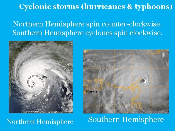
Cyclonic storms (hurricanes & typhoons) Northern Hemisphere spin counter-clockwise. Southern Hemisphere cyclones spin clockwise. Northern Hemisphere Southern Hemisphere
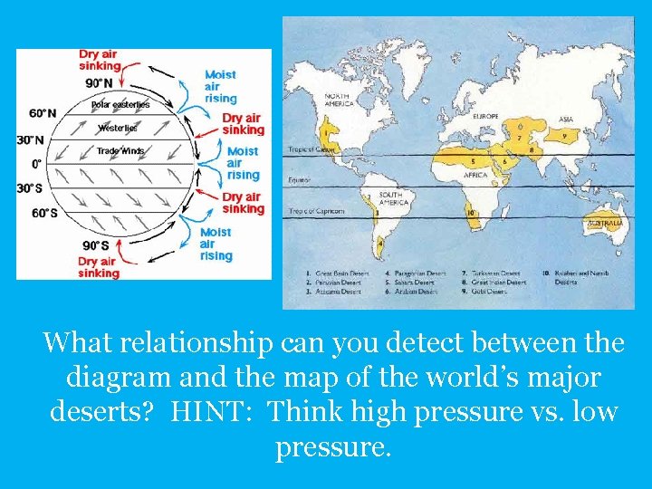
What relationship can you detect between the diagram and the map of the world’s major deserts? HINT: Think high pressure vs. low pressure.
S is for Storms
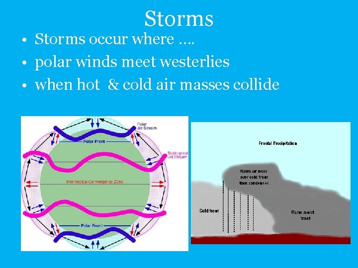
Storms • Storms occur where …. • polar winds meet westerlies • when hot & cold air masses collide
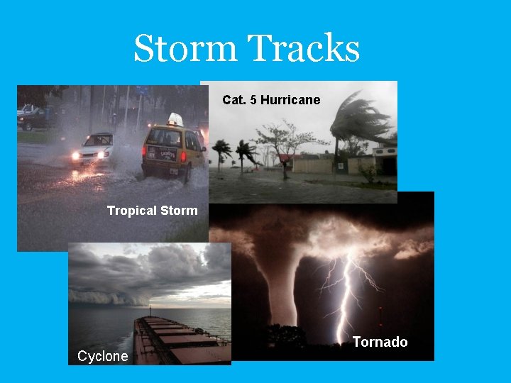
Storm Tracks Cat. 5 Hurricane Tropical Storm Cyclone Tornado
• L atitude • A ir Masses • C ontinentality • E levation • M ountain Barriers • O cean Currents • P ressure & Prevailing Winds • S torms This acronym was. introduced by: Dr. James Petersen – Texas State University – San Marcos, TX, 1990.