THE EUROPEANS NAVIGATIONAL TOOLS The following are tools


- Slides: 33

THE EUROPEANS

NAVIGATIONAL TOOLS The following are tools or instruments that were used by early European explorers: 1. MAP A pictorial or graphical representation of the earth or part of the earth that gives details.

NAVIGATIONAL TOOLS

NAVIGATIONAL TOOLS The following are tools or instruments that were used by early European explorers: 2. COMPASS An instrument whose magnetized metal needle aligns itself with the magnetic fields of the earth. This causes one end of the needle to point north. Mariners used this information to navigate the ship.

NAVIGATIONAL TOOLS

NAVIGATIONAL TOOLS The following are tools or instruments that were used by early European explorers: 3. CROSS STAFF An early sixteenth-century instrument for measuring the altitude of a heavenly body. It consists of a square shaft and a sliding cross-piece set at right angles to the shaft.

NAVIGATIONAL TOOLS The following are tools or instruments that were used by early European explorers: 3. CROSS STAFF The shaft end is held at the observer's eye and the cross-piece positioned to line up with the sun and the horizon. The crosspiece marks a point on the shaft that is referred to in a table of degrees and minutes.

NAVIGATIONAL TOOLS

NAVIGATIONAL TOOLS The following are tools or instruments that were used by early European explorers: 4. QUADRANT An early instrument for measuring altitude of celestial bodies, consisting of a 90° graduated arc with a movable radius for measuring angles.

NAVIGATIONAL TOOLS

NAVIGATIONAL TOOLS The following are tools or instruments that were used by early European explorers: 5. ASTROLABE This tool was once used to determine the altitude of the sun or other celestial bodies.

NAVIGATIONAL TOOLS

NAVIGATIONAL TOOLS The following are tools or instruments that were used by early European explorers: 6. SEXTANT A navigational instrument which replaced the astrolabe and was used for measuring the angle between the horizon and the sun or a star in order to find out the latitude (of a ship).

NAVIGATIONAL TOOLS

Grade: 9 Theme: The Europeans Topic: Factors motivating Europeans to explore and settle in the Caribbean up to the 17 th century Sub Topic: Wind Systems and Ocean Currents

WIND SYSTEMS AND OCEAN CURRENTS Apart from the use of navigational tools and weapons, wind systems and ocean currents influenced the life of early explorers.

WIND SYSTEMS AND OCEAN CURRENTS Major wind systems in the Caribbean that assisted with early European exploration include: 1. Trade Winds: - For about 300 days of the year the Trade Winds blow into the Caribbean. Their strength is consistent and never more than 14 knots.

WIND SYSTEMS AND OCEAN CURRENTS Major wind systems in the Caribbean that assisted with early European exploration include: (Cont’d) These Trade Winds include: a) North East Trade Winds that blows from the direction of Europe into the Caribbean. b) South East Trade Winds that blows from the direction of Africa into the Caribbean.

WIND SYSTEMS AND OCEAN CURRENTS Major wind systems in the Caribbean that assisted with early European exploration include: (Cont’d) 2. Westerlies: - North of the Caribbean; and they blow from West to East across the Atlantic.

WIND SYSTEMS AND OCEAN CURRENTS

WIND SYSTEMS AND OCEAN CURRENTS How did these wind systems assisted explorers to sail to the Caribbean? TRADE WINDS: Sailors knew them as ‘fair weather winds’. The winds gave the ships the direction and force they needed to arrive safely in the Caribbean from Europe.

WIND SYSTEMS AND OCEAN CURRENTS How did these wind systems assisted explorers to sail to the Caribbean? (Cont’d) WESTERLIES: They were the right winds to carry ships back to Europe from the New World.

WIND SYSTEMS AND OCEAN CURRENTS Major ocean currents in the Caribbean that assisted with early European exploration include: 1. South and North Equatorial Currents: These flow in from the Atlantic. They then merge at the Lesser Antilles to form the Caribbean Current. They move between 5 knots and 8 knots and circle the Caribbean in a clockwise direction.

WIND SYSTEMS AND OCEAN CURRENTS

WIND SYSTEMS AND OCEAN CURRENTS Major ocean currents in the Caribbean that assisted with early European exploration include: (Cont’d) 2. Gulf Stream: Flows out of the Caribbean between Florida and Cuba; warm current moving at between 5 and 8 knots.

WIND SYSTEMS AND OCEAN CURRENTS

WIND SYSTEMS AND OCEAN CURRENTS How did these ocean currents assisted explorers to sail to the Caribbean? NORTH AND SOUTH EQUATORIAL CURRENTS: These currents made east to west navigation of ships relatively easy.

WIND SYSTEMS AND OCEAN CURRENTS How did these ocean currents assisted explorers to sail to the Caribbean? (Cont’d) GULF STREAM CURRENTS: these assisted ships sailing back to Northern Europe from the Caribbean.

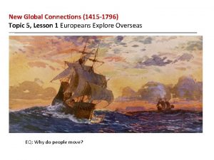
SHIPS FOR EARLY EXPLORATION Ships used for Early Exploration: Two types of ships were developed: small ships for exploration: caravels § a shallow draft to chart unknown waters § ability to sail to windward (lateen sails) § small crew § cargo space for voyages of up to a year larger ships for war and commerce: carracks § high platforms at front and back from which to fire at opponents § armed with cannons § square sails for more sail area § large payload

SHIPS FOR EARLY EXPLORATION

SHIPS FOR EARLY EXPLORATION

SHIPS FOR EARLY EXPLORATION Ships used for Early Exploration: Galleons also started using portholes to allow guns to be mounted lower in the hull and not just on deck. This made it possible to have more powerful guns which would not capsize the ship when fired. The Galleon was a sound multi-purpose design. War ships would have cannons on all decks whereas a merchant might have one gun deck and use the others for cargo.

SHIPS FOR EARLY EXPLORATION
 Antigentest åre
 Motivating forces for exploration
 Welcome
 Taking over navigational watch
 Navigational assistance service
 Navigational watchkeeping
 Navarea 4
 Europeans claim muslim lands
 Tava nama kim
 Europeans set sail
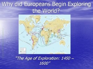
 Why did europeans begin to explore
 Clean energy for all europeans
 Topic 5 review questions new global connections answer key
 Sources us eu us europeans
 Lesson 1: europeans explore overseas
 Chapter 19 section 1 europeans explore the east
 Lesson 1 europeans explore overseas
 Europeans
 Why did europeans begin to explore?
 Europeans flood into america
 Chapter 20 section 2 european nations settle north america
 điện thế nghỉ
 Một số thể thơ truyền thống
 Thế nào là hệ số cao nhất
 Trời xanh đây là của chúng ta thể thơ
 Slidetodoc
 Số nguyên tố là
 đặc điểm cơ thể của người tối cổ
 Fecboak
 Các châu lục và đại dương trên thế giới
 Tư thế worm breton
 ưu thế lai là gì
 Hệ hô hấp
 Tư thế ngồi viết


