
The Essentials of Sabah SDI based on RIAM
The Essentials of Sabah SDI based on RIAM Analysis Doria Tai Yun Tyng Doria. tai@sabah. gov. my www. sgdc. sabah. gov. my Principal Assistant Director Geospatial Development and Management Section Lands and Surveys Department Sabah Malaysia Geospatial Forum 2012 Spatial Data Infrastructure. For E-Governanace Holiday Inn Melaka 6 -7 March 2012

Key Topics Background Sabah SDI Components RIAM Analysis Conclusion

Background

Background Sabah SDI State Remote Sensing Committee (SRSC) formed in 1990 SRSC revamped as Sabah Geographic Data Coordination Working Committee (SGDC) in 1998 SGDC is under Sabah IT Council Implemented SDI Project via My. GDI Sabah in 1998

Structure of SGDC Sabah IT Council Chair : Chief Minister of Sabah SGDC Working Committee Chair : State Secretary of Sabah SGDC Technical Committee Chair : Director of Lands & Surveys Data Infostructure Work Group Chair : Director of Lands & Surveys Data Commercialisation Work Group Chair : Permanent Secretary of Finance Framework Deploment Work Group Chair : Permanent Secretary of IT 5

Agencies chosen for Na. LIS Pilot Project in 1999 1. Lands and Surveys Department 2. Kota Kinabalu City Hall 3. Agricullture Department 4. Forestry Department 5. Public Works Department 6. Fishery Department 7. Drainage and Irrigation Department 8. Town & Regional Planning Department 9. Mineral & Geoscience Department 10. Statistics Department Agencies joined since 2008 as My. GDI Sabah Agencies 1. Sandakan Town Council 2. Water Department 3. Industrial Research & Development Department 4. Environment Protection Department 5. Sabah Parks 6. Sabah Topo and Mapping Department 6

Virtual Natural Resource Environmental Data Repository My. GDI Client An Overview My. GDI Gateway (NRE) Jabatan Kerja Raya Jabatan Perhutanan Internet Road Network Forest Jabatan Perangkaan Statistics Open. GIS Standard Jabatan Mineral & Geosains Geology Jabatan Perairan dan Saliran Coastal Profile Rivers SALIS ODBC Jabatan Tanah dan Ukur Jabatan Perikanan Fishery Assessment Property-based Tax Sabah. Net Administrator DIDR Industry Planning Factories EPD Environment Conservation ODBC Dewan Bandaraya Kota Kinabalu Sabah. Net Client Jabatan Pertanian Land Use Soil Capability Jabatan Perancang Bandar dan Wilayah Planning MPS Assessment Housing Sabah Parks facility Conservations Water Department Water Supply Network 7

Spatial Data Infrastructure for Sabah - The Vision Towards a holistic and sustainable geo-information infrastructure as the catalyst to elevate the quality of life 8

Spatial Data Infrastructure for Sabah - SGDC Mission Statement To develop a sustainable geo-spatial infostructure to facilitate Spatial Data Infrastructure (SDI) implementation for the State of Sabah via continuous collaborative activities: activities 1. in developing the Framework Data Sets, Metadata, Data Standards, Clearinghouse operations as well as the Institutional Framework by adopting a product -based approach; approach 2. To intensify data development to build-up comprehensive geospatial data sets as well as capacity building to maintain currency of the same; 9

Spatial Data Infrastructure for Sabah - SGDC Mission Statement To develop a sustainable geo-spatial infostructure to facilitate Spatial Data Infrastructure (GDI) implementation for the State of Sabah via continuous collaborative activities: activities 3. to promote and expedite the sharing, exchange, dissemination and use of spatial information, enabling geo-information for making informed decisions; decisions 4. for homogeneous development of Spatial Data Infrastructure (SDI) for Sabah through instilling and educate the significance of SDI for sustainable natural resource and environment management 10

Sabah SDI Components

Sabah SDI Components

Components of Sabah SDI 1) 2) 3) 1) 2) Framework Data sets provide information for analysis to make informed decision Standards ensure the uniformity in data structure/coding to allow data accessed and used easily by ALL USERS Metadata simply means data about data, which defines the “history” of particular spatial data set Clearinghouse is the common portal OR point of access to spatial information available, regardless of “who is the owner”. owner Institutional Framework concerns “policies to govern” the sharing, sharing pricing, pricing transfer and usage of spatial data, protection to custodians including data security, copyrights and liability of data usage, access over internet and so forth. 13
Components of Sabah SDI 6) People and Culture emphasise on the ability to enlist all stakeholders to utilise the infrastructure which includes the extent of political support, support the clarity of the business objective in SDI development, development the continuous funding support, the degree of sharing within the context of culture of the community it serves. a. People is liken to the heartbeat of the SDI implementation b. major deciding factor on the successful implementation of SDI 14
Rapid Impact Assessment Matrix (RIAM)
RIAM provides a basis of comparison of the impacts across all environments. RIAM was developed Mr Christopher Pastakia when he worked with "VKI, the Danish Water Quality Institute“. The concept of RIAM was developed by him in the late 1980's to demonstrate the degree of change impacting the various environments.
The RIAM criteria are placed in two groups: Group A Criteria that are of importance to the condition that can individually change the score obtained Group B Criteria that are of value to the situation that should not be capable of individually changing the score obtained

The RIAM criteria are: A 1. Importance of the condition (the spatial aspects of change) A 2. Magnitude of change/effect (the size/scale of change) B 1. Permanence B 2. Reversibility B 3. Cumulation
RIAM criteria are assessed using the The formulae: (A 1) x (A 2) = At (B 1)+(B 2)+(B 3) = Bt (At) x (Bt) = Score The scores are then converted into range bands that define the impact condition.
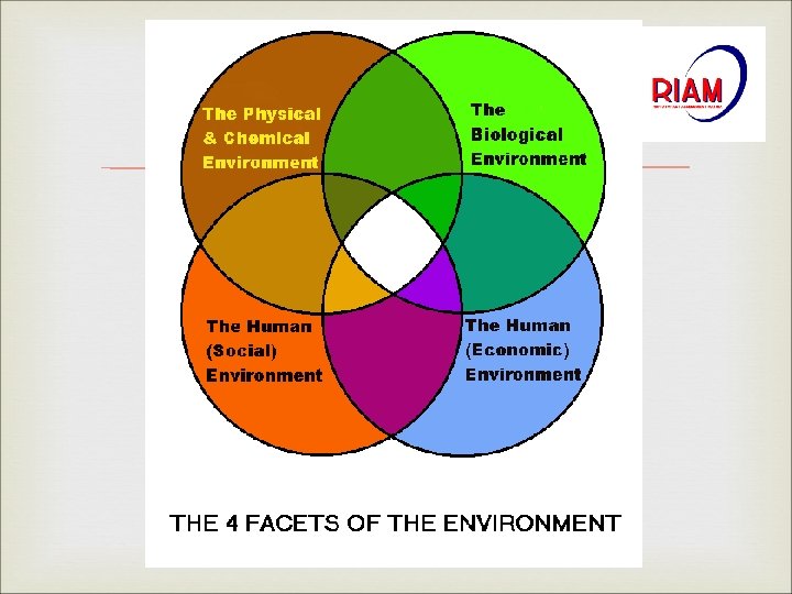
Impact Information List RIAM Components Considerations Physical / Chemical (PC) • Minimum damage to PC sphere of earth Biological / Ecological (BE) • • Minimise damage to BE Sustainable Development Sociological / Cultural (SC) • Improve yield, income & living Economic / Operational (EO) • • Ensure sufficient funding Ensure improved income
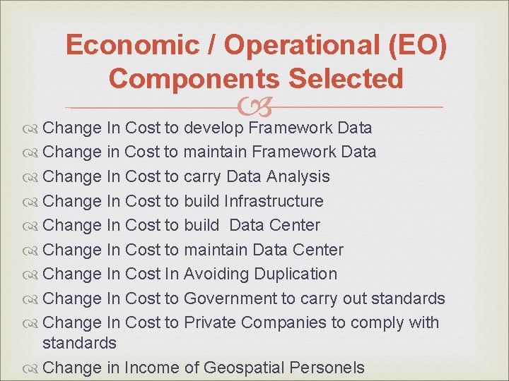
Economic / Operational (EO) Components Selected Change In Cost to develop Framework Data Change in Cost to maintain Framework Data Change In Cost to carry Data Analysis Change In Cost to build Infrastructure Change In Cost to build Data Center Change In Cost to maintain Data Center Change In Cost In Avoiding Duplication Change In Cost to Government to carry out standards Change In Cost to Private Companies to comply with standards Change in Income of Geospatial Personels
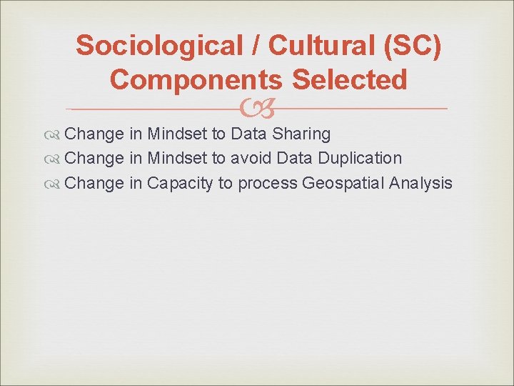
Sociological / Cultural (SC) Components Selected Change in Mindset to Data Sharing Change in Mindset to avoid Data Duplication Change in Capacity to process Geospatial Analysis
Biological / Ecological (BE) Components Selected Change in Carbon emission from Data Center
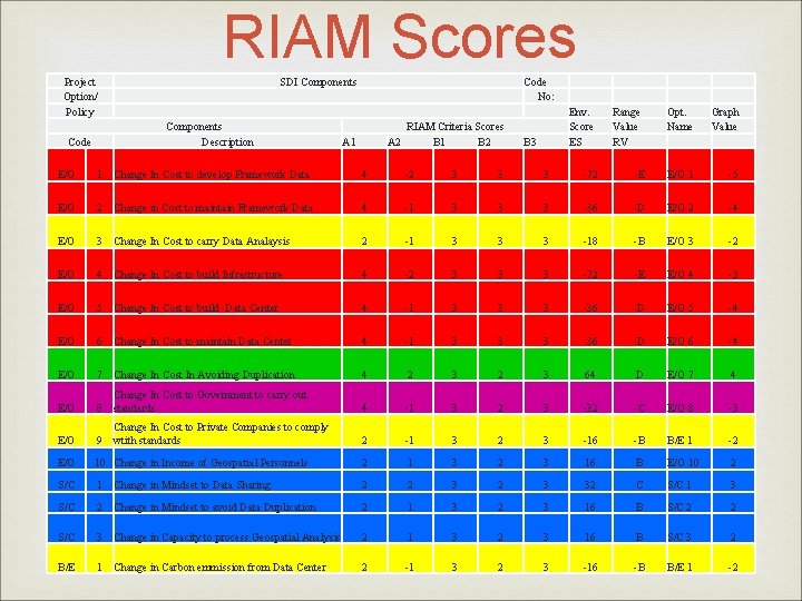
RIAM Scores Project Option/ Policy Code SDI Components Code No: Components Description A 1 E/O 1 Change In Cost to develop Framework Data 4 E/O 2 Change in Cost to maintain Framework Data E/O RIAM Criteria Scores B 1 B 2 A 2 B 3 Env. Score ES Range Value RV Opt. Name Graph Value -2 3 3 3 -72 -E E/O 1 -5 4 -1 3 3 3 -36 -D E/O 2 -4 3 Change In Cost to carry Data Analaysis 2 -1 3 3 3 -18 -B E/O 3 -2 E/O 4 Change In Cost to build Infrastructure 4 -2 3 3 3 -72 -E E/O 4 -5 E/O 5 Change In Cost to build Data Center 4 -1 3 3 3 -36 -D E/O 5 -4 E/O 6 Change In Cost to maintain Data Center 4 -1 3 3 3 -36 -D E/O 6 -4 E/O 7 Change In Cost In Avoiding Duplication 4 2 3 64 D E/O 7 4 E/O Change In Cost to Government to carry out 8 standards 4 -1 3 2 3 -32 -C E/O 8 -3 E/O Change In Cost to Private Companies to comply 9 wtith standards 2 -1 3 2 3 -16 -B B/E 1 -2 E/O 10 Change in Income of Geospatial Personnels 2 1 3 2 3 16 B E/O 10 2 S/C 1 Change in Mindset to Data Sharing 2 2 3 32 C S/C 1 3 S/C 2 Change in Mindset to avoid Data Duplication 2 1 3 2 3 16 B S/C 2 2 S/C 3 Change in Capacity to process Geospatial Analysis 2 1 3 2 3 16 B S/C 3 2 B/E 1 Change in Carbon emmission from Data Center 2 -1 3 2 3 -16 -B B/E 1 -2
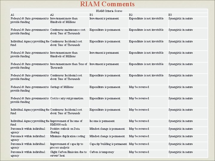
RIAM Comments RIAM Criteria Scores B 1 Investment is permanent B 2 Expenditure is not irrevisible B 3 Synergistic in nature Fedearal & State government to Continuous maintenance cost provide funding about Tens of Thousands Expenditure is permanent Expenditure is not irrevisible Synergistic in nature Individual Agency providing the Continuous Incidental cost fund about Tens of Thousands Expenditure is permanent Expenditure is not irrevisible Synergistic in nature Fedearal & State government to Investement more than provide funding Hundreds of Millions Investment is permanent Expenditure is not irrevisible Synergistic in nature Fedearal & State government to Investement more than Tens of Investment is permanent provide funding Thousands Expenditure is not irrevisible Synergistic in nature Fedearal & State government to Continuous Incidental cost provide funding about Tens of Thousands Expenditure is permanent Expenditure is not irrevisible Synergistic in nature Fedearal & State government to Savings of Millions provide funding Expenditure is permanent May be reversed Synergistic in nature Fedearal & State government to Cost to carry out promotion provide funding Expenditure is permanent May be reversed Synergistic in nature Individual Agency providing the Continuous Incidental cost fund about Tens of Thousands Expenditure is permanent May be reversed Synergistic in nature Individual Agency providing the Improvement of Income of fund RM 3000 each Personnels within individual Positive outlook on Data agency Sharing Personnels within individual Minimise duplication costing agency Personnels within individual Improvement of capacity to agency process analysis Personnels within individual Slight Carbon Emission due to agency servers' heat Income is permanent May be reversed Synergistic in nature Mindset change is permanent May be reversed Synergistic in nature Capacity building is permanent May be reversed Synergistic in nature Carbon is temporary Synergistic in nature A 1 A 2 Fedearal & State government to Investement more than provide funding Hundreds of Millions May be reversed
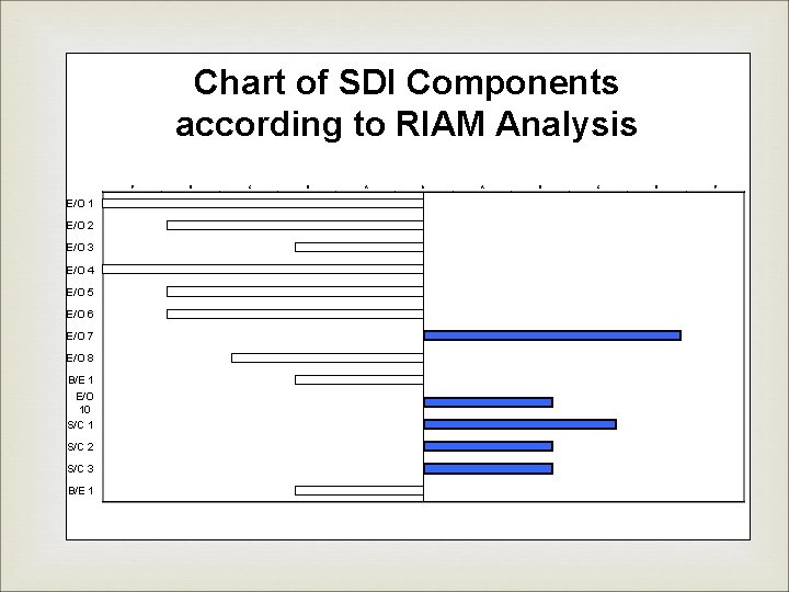
Chart of SDI Components according to RIAM Analysis -E E/O 1 E/O 2 E/O 3 E/O 4 E/O 5 E/O 6 E/O 7 E/O 8 B/E 1 E/O 10 S/C 1 S/C 2 S/C 3 B/E 1 -D -C -B -A N A B C D E
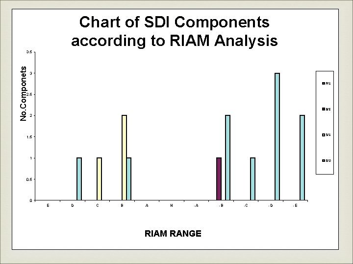
Chart of SDI Components according to RIAM Analysis No. Componets 3. 5 3 P/C 2. 5 B/E 2 S/C 1. 5 1 E/O 0. 5 0 E D C B A N -A RIAM RANGE -B -C -D -E
Save Cost from Avoiding Duplication Data Sharing Culture
Conclusion
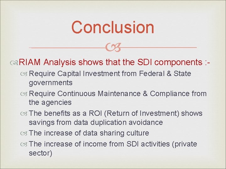
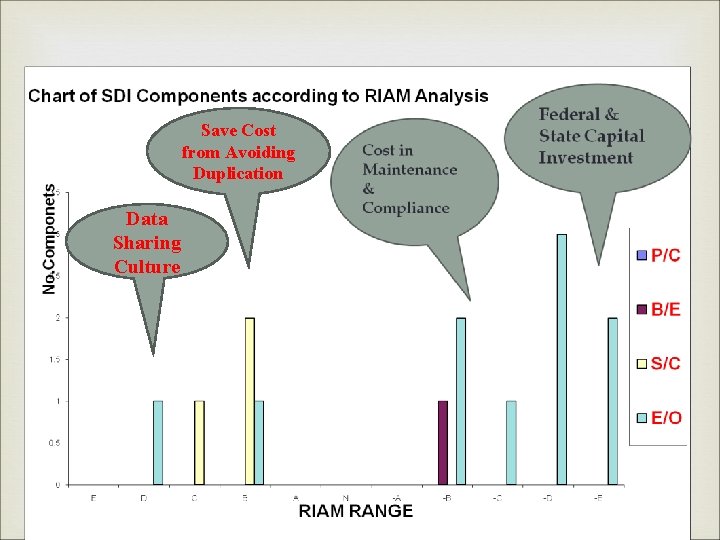
Conclusion RIAM Analysis shows that the SDI components : Require Capital Investment from Federal & State governments Require Continuous Maintenance & Compliance from the agencies The benefits as a ROI (Return of Investment) shows savings from data duplication avoidance The increase of data sharing culture The increase of income from SDI activities (private sector)
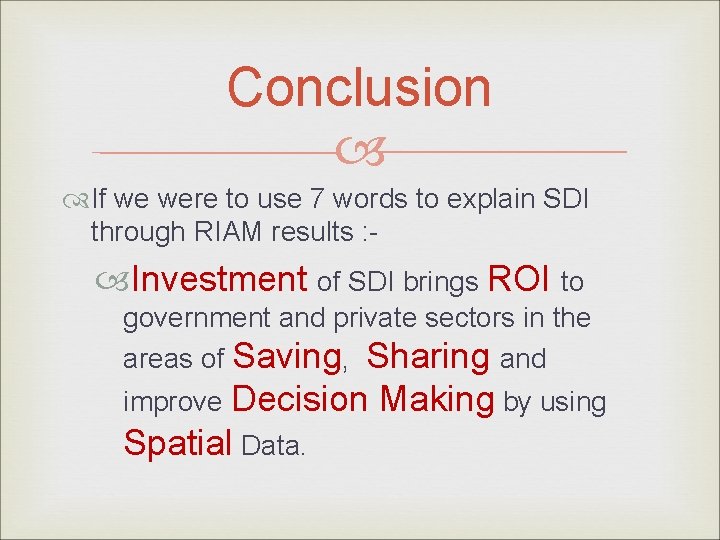
Conclusion If we were to use 7 words to explain SDI through RIAM results : - Investment of SDI brings ROI to government and private sectors in the areas of Saving, Sharing and improve Decision Spatial Data. Making by using
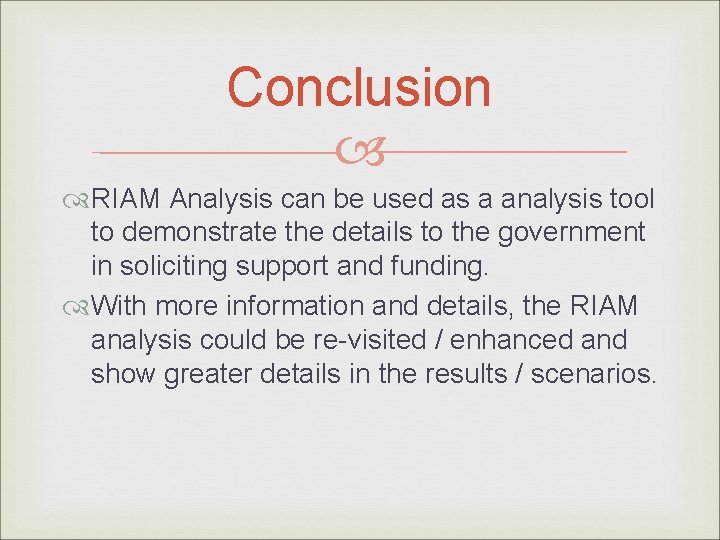
Conclusion RIAM Analysis can be used as a analysis tool to demonstrate the details to the government in soliciting support and funding. With more information and details, the RIAM analysis could be re-visited / enhanced and show greater details in the results / scenarios.

Thank You !
- Slides: 34