The ENSO Cycle Recent Evolution Current Status and
- Slides: 17

The ENSO Cycle: Recent Evolution, Current Status and Predictions Vernon E. Kousky Climate Prediction Center / NCEP

Outline • Overview • 2001 -2002 Developments • Current Conditions • El Niño Outlook • Typical U. S. Impacts and seasonal outlooks • Summary

Overview • A Pacific basin warm (El Niño) episode is in progress in the tropical Pacific. • Statistical and coupled model forecasts indicate that the El Niño will continue through the northern winter 20022003 and into the spring 2003. • All of the forecasts indicate that this El Niño will be considerably weaker than the 1997 -98 El Niño. • Impacts on the United States are expected during this fall and winter, but they should be generally weaker than those experienced during the very strong 1997 -98 El Niño.

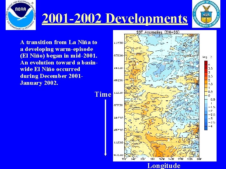
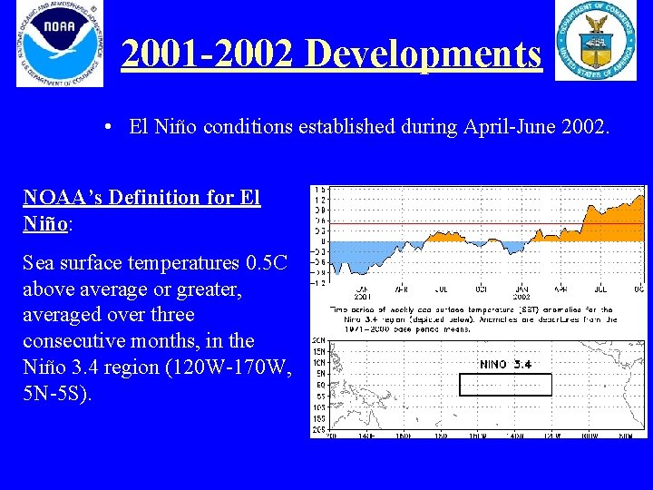
2001 -2002 Developments A transition from La Niña to a developing warm-episode (El Niño) began in mid-2001. An evolution toward a basinwide El Niño occurred during December 2001 January 2002. Time Longitude

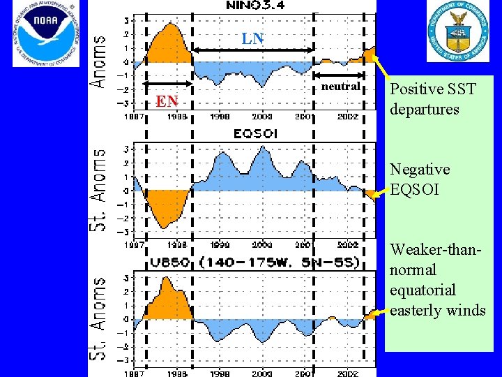
2001 -2002 Developments • Early El Niño impacts occurred along the coasts of Ecuador and northern Peru during February-April 2002. • During March-June 2002 the equatorial easterlies gradually weakened, while the Southern Oscillation Index (SOI) became persistently negative. These features indicated a developing El Niño.

LN Time Series: Nino neutral 3. 4, EN EQSOI, U 850 Positive SST departures Negative EQSOI Weaker-thannormal equatorial easterly winds

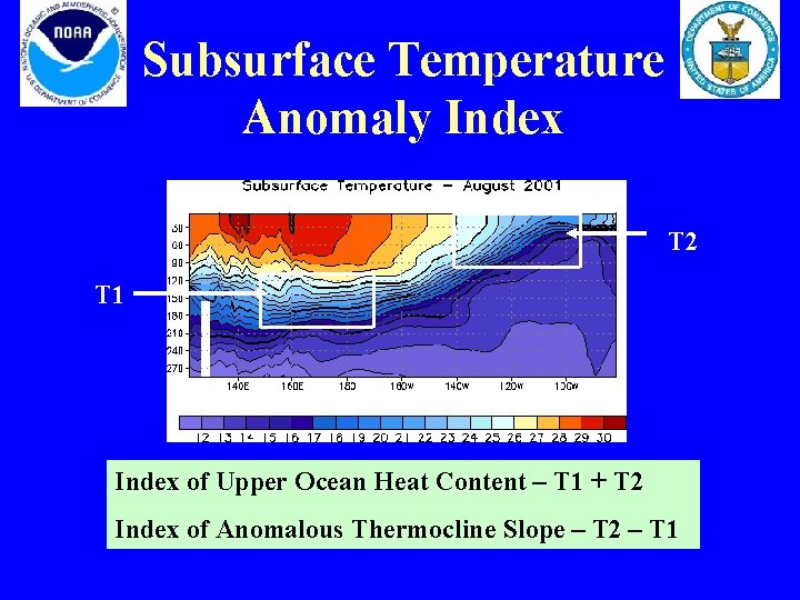
Subsurface Temperature Anomaly Index T 2 T 1 Index of Upper Ocean Heat Content – T 1 + T 2 Index of Anomalous Thermocline Slope – T 2 – T 1

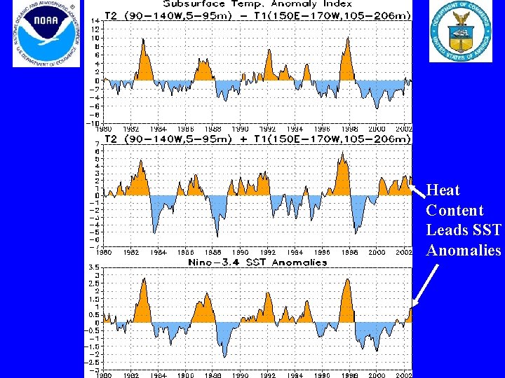
Heat Content Leads SST Anomalies

2001 -2002 Developments • El Niño conditions established during April-June 2002. NOAA’s Definition for El Niño: Sea surface temperatures 0. 5 C above average or greater, averaged over three consecutive months, in the Niño 3. 4 region (120 W-170 W, 5 N-5 S).

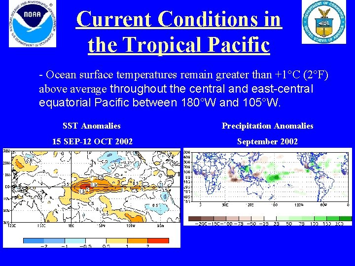
Current Conditions in the Tropical Pacific - Ocean surface temperatures remain greater than +1°C (2°F) above average throughout the central and east-central equatorial Pacific between 180°W and 105°W. SST Anomalies Precipitation Anomalies 15 SEP-12 OCT 2002 September 2002

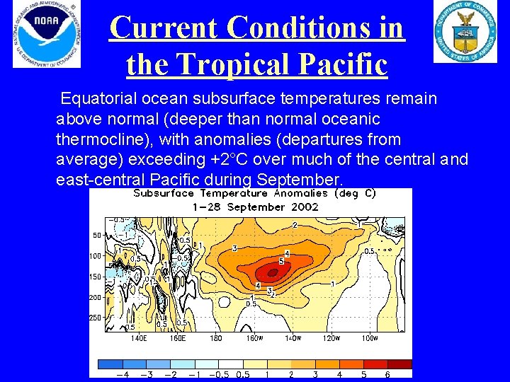
Current Conditions in the Tropical Pacific Equatorial ocean subsurface temperatures remain above normal (deeper than normal oceanic thermocline), with anomalies (departures from average) exceeding +2°C over much of the central and east-central Pacific during September.

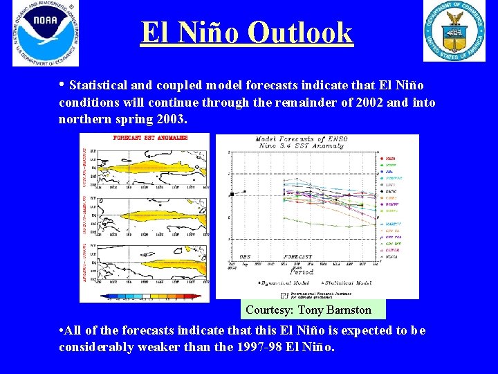
El Niño Outlook • Statistical and coupled model forecasts indicate that El Niño conditions will continue through the remainder of 2002 and into northern spring 2003. Courtesy: Tony Barnston • All of the forecasts indicate that this El Niño is expected to be considerably weaker than the 1997 -98 El Niño.

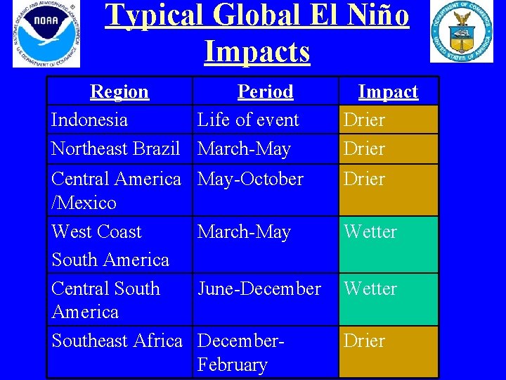
Typical Global El Niño Impacts Region Period Indonesia Life of event Northeast Brazil March-May Impact Drier Central America /Mexico West Coast South America Central South America Southeast Africa May-October Drier March-May Wetter June-December Wetter December. February Drier

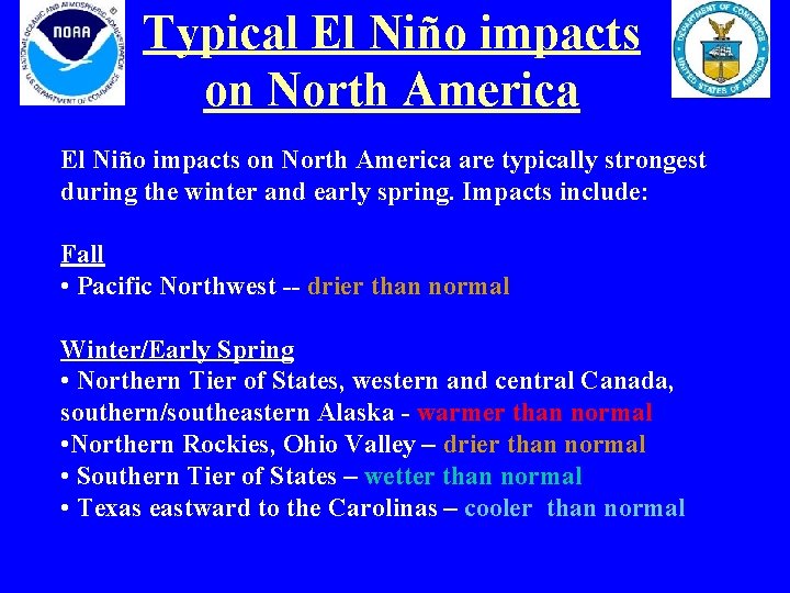
Typical El Niño impacts on North America are typically strongest during the winter and early spring. Impacts include: Fall • Pacific Northwest -- drier than normal Winter/Early Spring • Northern Tier of States, western and central Canada, southern/southeastern Alaska - warmer than normal • Northern Rockies, Ohio Valley – drier than normal • Southern Tier of States – wetter than normal • Texas eastward to the Carolinas – cooler than normal

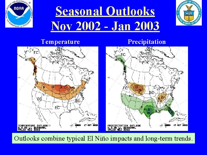
Seasonal Outlooks Nov 2002 - Jan 2003 Temperature Precipitation Outlooks combine typical El Niño impacts and long-term trends.

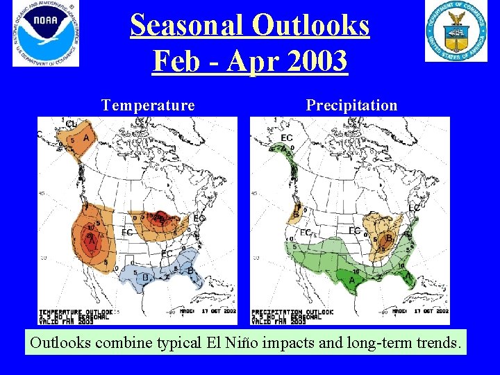
Seasonal Outlooks Feb - Apr 2003 Temperature Precipitation Outlooks combine typical El Niño impacts and long-term trends.

Summary • El Niño conditions are evident in the tropical Pacific. • Statistical and coupled model forecasts indicate that El Niño conditions will continue through the end of 2002 and into the first half of 2003. • Some impacts on the United States are expected, starting in the fall 2002, but they should generally be weaker than those during the very strong 1997 -98 El Niño.