The Dockum Aquifer West Texas Robert G Bradley

The Dockum Aquifer, West Texas Robert G. Bradley, P. G. Texas Water Development Board

Geologic Setting • Cooper Canyon – Reddish-brown to orange siltstone and mudstone with lenses of sandstone, and conglomerate • Trujillo – Gray, brown, greenish-gray, fine to coarse-grained sandstone and sandy conglomerate with thin gray and red shale interbeds • Tecovas – Variegated, sometimes sandy mudstone with interbedded fine to medium grained sandstones. • Santa Rosa – Red to reddish-brown sandstone and conglomerate.

North-South Cross Section

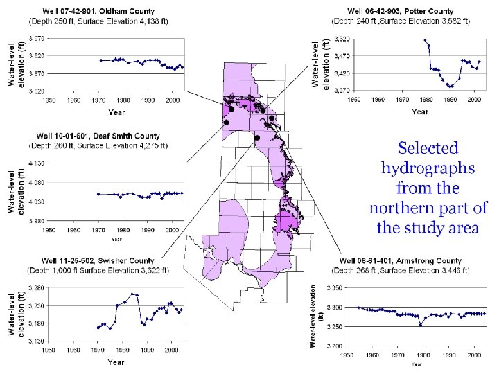
Northern Cross Section

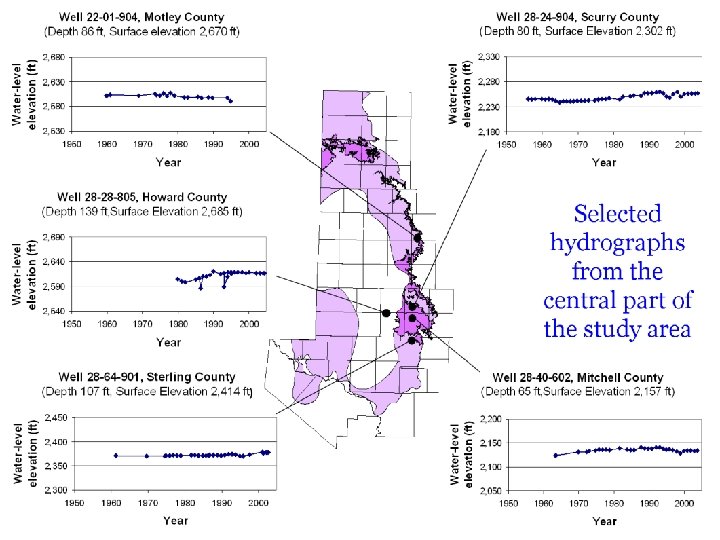
Central Cross Section

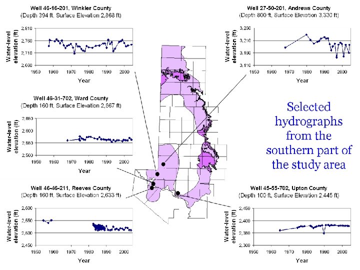
Southern Cross Section

Legend Contour interval = 200 feet Elevation in feet above sea level Approximate water-level elevations in the Dockum aquifer 1981 -1996

<5, 000 mg/l TDS >10, 000 mg/l TDS Distribution of Total Dissolved Solids 1985 - 1996 ! TDS sample collected in accordance with procedures in TWDB UM-51 (1991) D TDS sample not collected in accordance with procedures in TWDB UM-51 (1991)

Salinity hazard area Salinity hazard for areas overlying the Dockum aquifer

Historical water use from the Dockum aquifer

Conclusions • Recoverable water in sandstone/conglomerates • Locally important where sufficient sandstone thickness is present • Recharged by precipitation on outcrop and by leakage in confined areas • Regional flow to east and southeast • Poor quality (high TDS and Salinity)
- Slides: 15