The Clyde River project on northeastern Baffin Island

The Clyde River project, on northeastern Baffin Island 7 field seasons and 250 cosmogenic exposure ages: Laurentide Ice Sheet history and dynamics

4 Questions to consider: 1. Why can’t blockfields be used as evidence for LGM refugia? 2. Recall that we’re presently in the “Goldilocks Paradigm. ” How 3. is the Goldilocks model incorrect? 3. What are weathering zones really telling us? 4. What is potentially wrong with a story that is based on only a few 5. cosmogenic exposure ages?

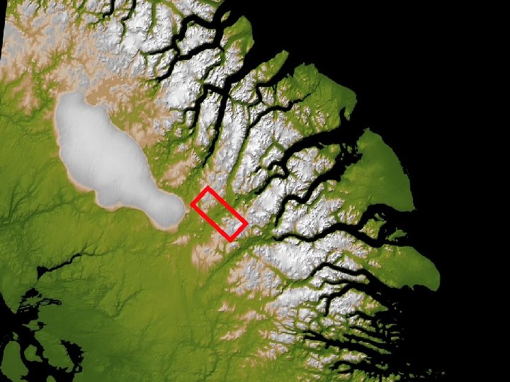
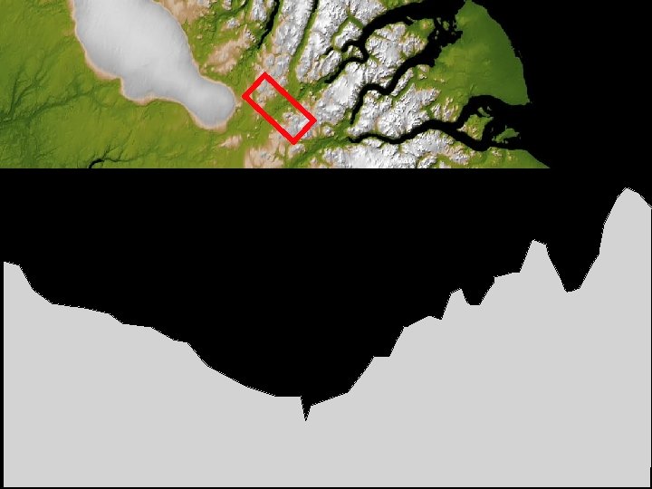
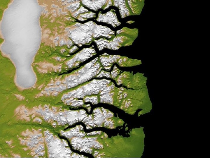
10 km Clyde Foreland N

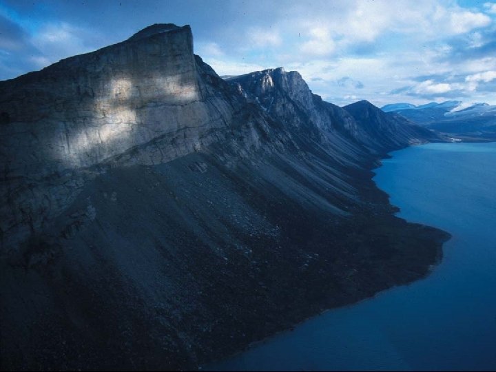
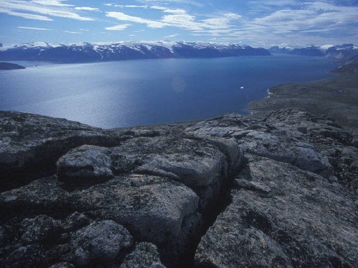
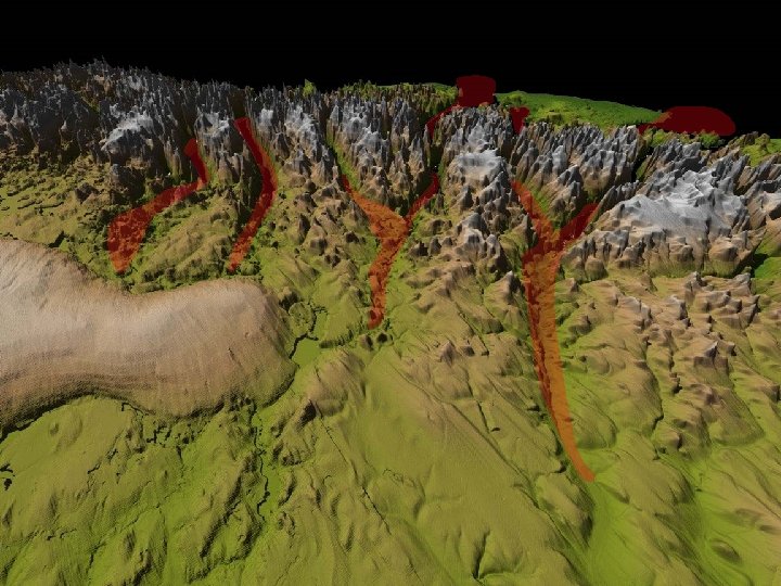
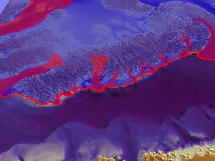
Differentially-weathered fiord landscapes
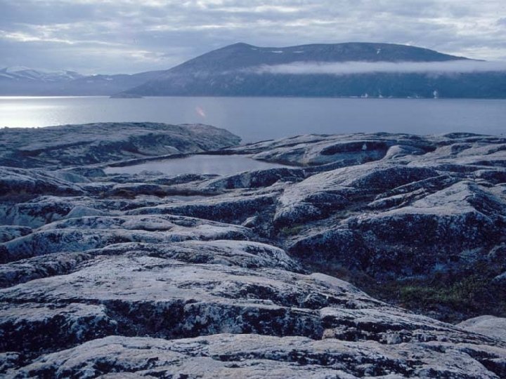

Extent of “fresh” zone indicates extent of LGM ice Future work. . .

Weathered uplands are covered, but not eroded, during the LGM
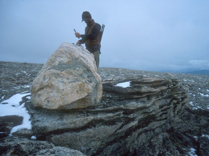
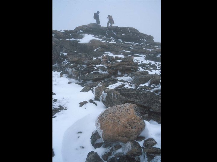

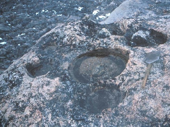
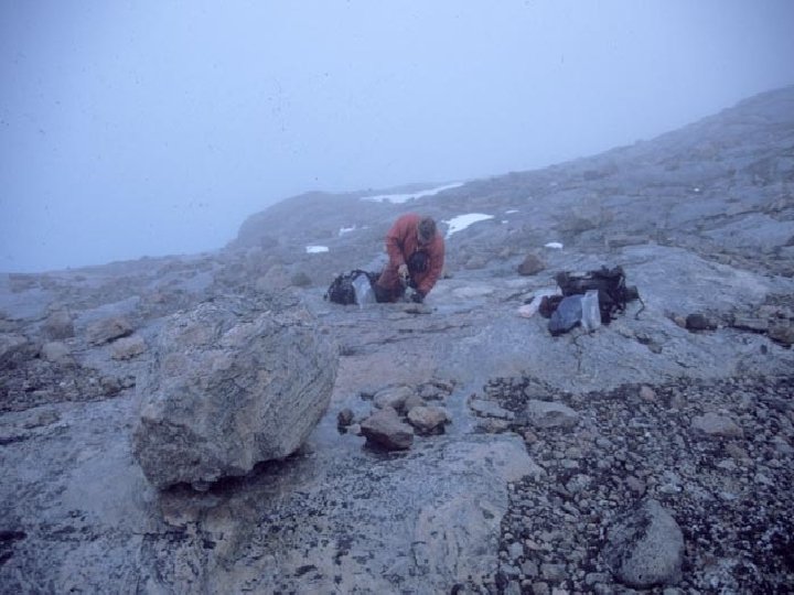
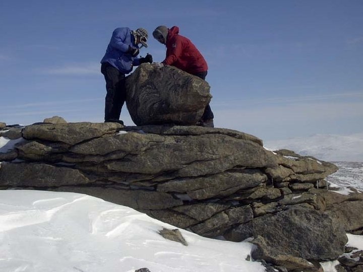
Boulder: 17. 5± 1. 9 ka Tor: ≥ 67. 5± 7. 2 ka
 14. 8± 1. 7 (Al) Boulder: 10. 2±")
Cobble: 11. 6± 0. 9 (Be) 14. 8± 1. 7 (Al) Boulder: 10. 2± 1. 1 Tor: ≥ 64. 1± 2. 2 (Be) ≥ 61. 4 ± 2. 7 (Al)

Future work. . .

Future work. . . Updated from Briner et al. , 2003, QSR

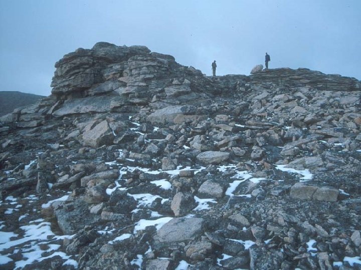
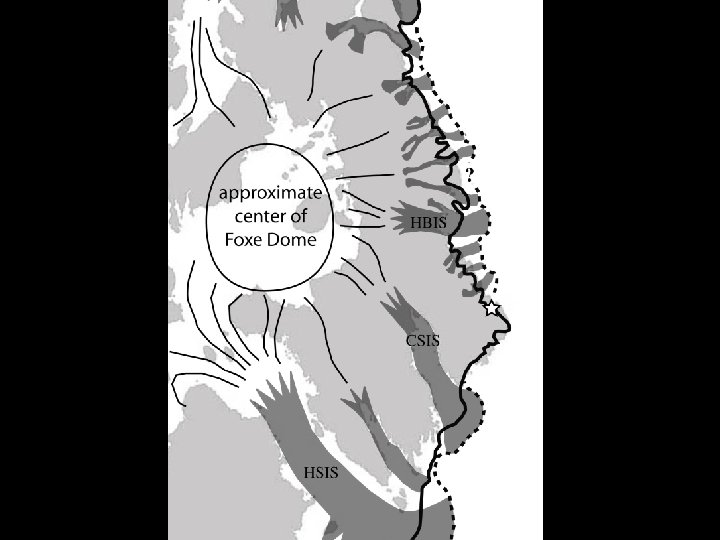
? ? Locations of “LGM” erratics 620 -690 m 520 -580 m ? 410 -610 m ? 380 -430 m

Shear zone warm-based Coldbased Ice Stream

Shear zone warm-based Coldbased Ice Stream

10 km North South N

South North

S N glacially scoured

S N no evidence of glacial erosion glacially scoured

S N no evidence of glacial erosion some evidence of glacial modification glacially scoured

Cosmogenic Exposure ages: Bedrock and Erratics 11. 4+0. 5 ka 11. 6+0. 3 ka 80. 0+3. 4 ka 22. 0+0. 7 ka 9. 5+0. 3 ka 23. 7+1. 0 ka 28. 3+0. 7 ka 32. 5+1. 1 ka 9. 5+0. 7 ka 23. 3+0. 7 ka 9. 4+0. 4 ka 10. 2+0. 5 ka 34. 2+0. 9 ka

highest areas: no observable glacial modification some glacial modification of upland bedrock erosive ice (<2 m of erosion) erosive ice (>2 m of erosion) 11. 4+0. 5 ka 11. 6+0. 3 ka 80. 0+3. 4 ka 22. 0+0. 7 ka 9. 5+0. 3 ka 23. 7+1. 0 ka 28. 3+0. 7 ka 32. 5+1. 1 ka 9. 5+0. 7 ka 23. 3+0. 7 ka 10. 2+0. 5 ka 34. 2+0. 9 ka 9. 4+0. 4 ka Clarke et al. , in prep.

Future work. . .

Future work. . .

Future work. . .

Future work. . .

What we’ve learned: 1. LGM ice at shelf break 2. Uplands covered by cold-based ice 3. WZs mark of basal thermal regimes 4. Ice streams occupied fiords weath e fresh red ? ? ?

10 km N

55. 8± 1. 3 30. 1± 0. 7 50. 0± 1. 2 5. 5± 0. 3 5. 1± 0. 3 4. 0± 0. 3 3. 9± 0. 3

55. 8± 1. 3 30. 1± 0. 7 50. 0± 1. 2 5. 5± 0. 3 5. 1± 0. 3 4. 0± 0. 3 3. 9± 0. 3 Al/Be burial age: ~430 ka

Byrd Glacier, Antarctica LANDSAT-1 image

Lambert Glacier: an Antarctic ICE STREAM JPL - RADARSAT AMP

ice-sheet scale patterns in basal thermal regime…

JPL - RADARSAT AMP

4 Questions to consider: 1. Why can’t blockfields be used as evidence for LGM refugia? 2. Recall that we’re presently in the “Goldilocks Paradigm. ” How 3. is the Goldilocks model incorrect? 3. What are weathering zones really telling us? 4. What is potentially wrong with a story that is based on only a few 5. cosmogenic exposure ages?

2 D numerical glacier model run in Mat. Lab Bob Anderson and Mark Kessler (University of Colorado) Published: Kessler et al. 2006


Erosion is deepest as it crosses the crest. Erosion accelerates through time

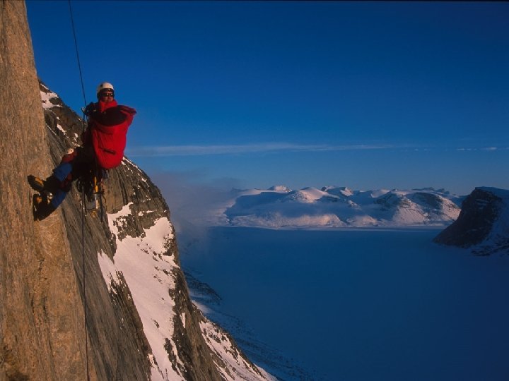
X-section of a typical Baffin Island Fjord > 2 km 100 km

Bob Anderson, Mark Kessler


- Slides: 57