The AsianAustralian Monsoon System Recent Evolution Current Status
- Slides: 13

The Asian-Australian Monsoon System: Recent Evolution, Current Status and Prediction Update prepared by Climate Prediction Center / NCEP March 19, 2018 For more information, visit: http: //www. cpc. ncep. noaa. gov/products/Global_Monsoons/Asian_Monsoons. shtml 1

Outline • Recent Rainfall and Current Conditions • Monsoon Prediction • Summary • Climatology 2

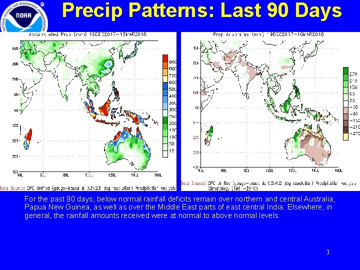
Precip Patterns: Last 90 Days For the past 90 days, below normal rainfall deficits remain over northern and central Australia, Papua New Guinea, as well as over the Middle East parts of east central India. Elsewhere, in general, the rainfall amounts received were at normal to above normal levels. 3

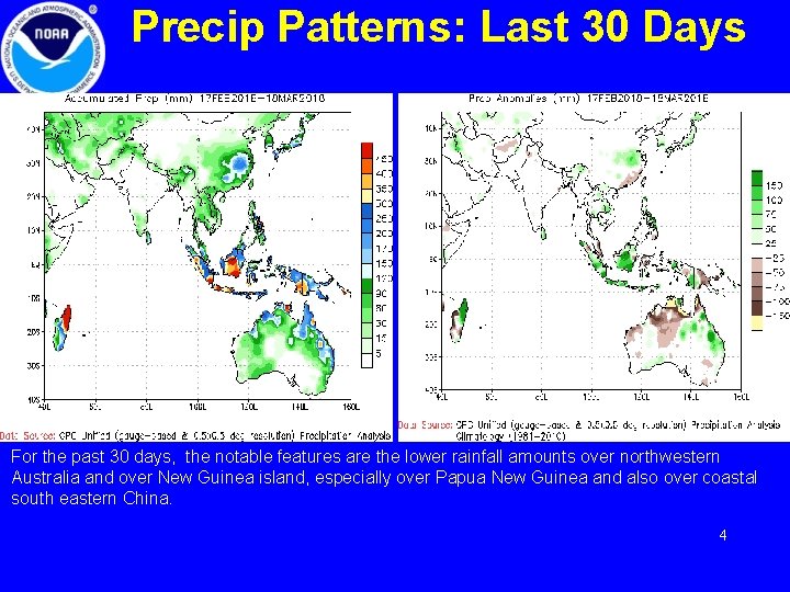
Precip Patterns: Last 30 Days For the past 30 days, the notable features are the lower rainfall amounts over northwestern Australia and over New Guinea island, especially over Papua New Guinea and also over coastal south eastern China. 4

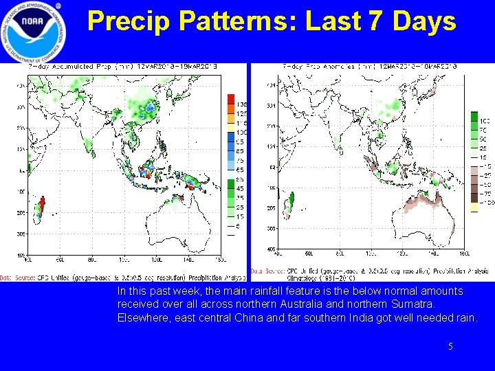
Precip Patterns: Last 7 Days In this past week, the main rainfall feature is the below normal amounts received over all across northern Australia and northern Sumatra. Elsewhere, east central China and far southern India got well needed rain. 5

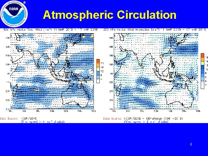
Atmospheric Circulation Generally these CDAS maps are two days behind. But sometimes, as it is today, due to technical issues, these maps are further behind. 6

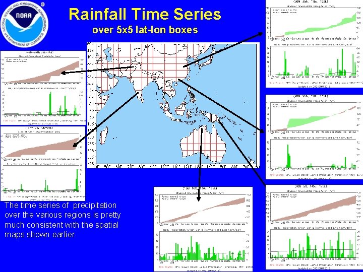
Rainfall Time Series over 5 x 5 lat-lon boxes The time series of precipitation over the various regions is pretty much consistent with the spatial maps shown earlier. 7

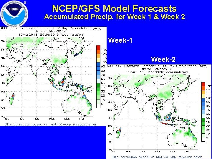
NCEP/GFS Model Forecasts Accumulated Precip. for Week 1 & Week 2 Week-1 Week-2 8

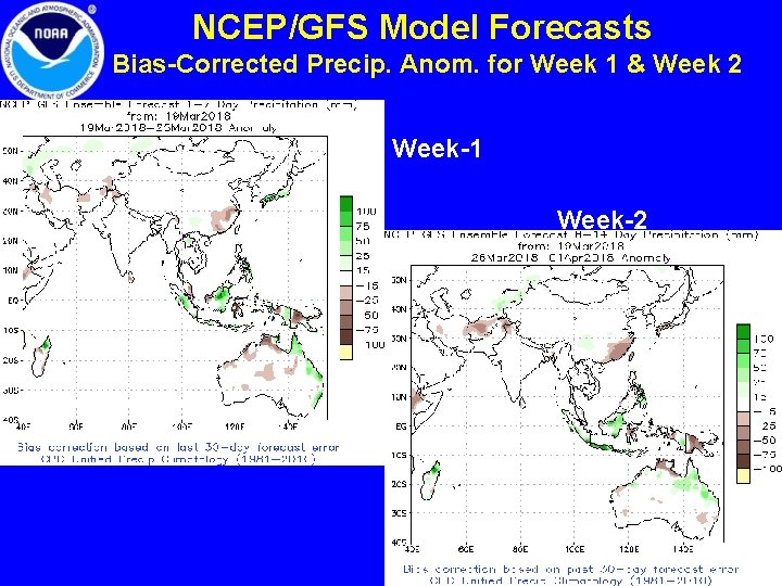
NCEP/GFS Model Forecasts Bias-Corrected Precip. Anom. for Week 1 & Week 2 Week-1 Week-2 9

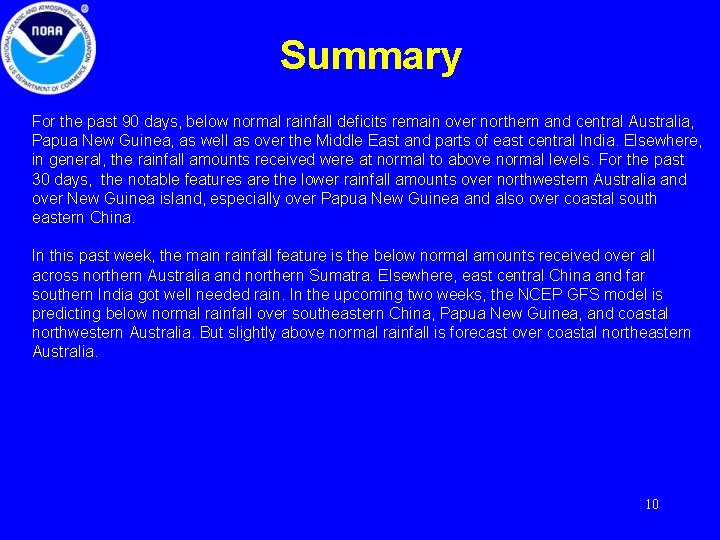
Summary For the past 90 days, below normal rainfall deficits remain over northern and central Australia, Papua New Guinea, as well as over the Middle East and parts of east central India. Elsewhere, in general, the rainfall amounts received were at normal to above normal levels. For the past 30 days, the notable features are the lower rainfall amounts over northwestern Australia and over New Guinea island, especially over Papua New Guinea and also over coastal south eastern China. In this past week, the main rainfall feature is the below normal amounts received over all across northern Australia and northern Sumatra. Elsewhere, east central China and far southern India got well needed rain. In the upcoming two weeks, the NCEP GFS model is predicting below normal rainfall over southeastern China, Papua New Guinea, and coastal northwestern Australia. But slightly above normal rainfall is forecast over coastal northeastern Australia. 10

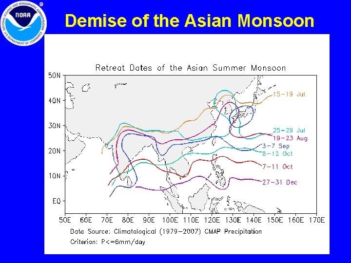
Demise of the Asian Monsoon 11

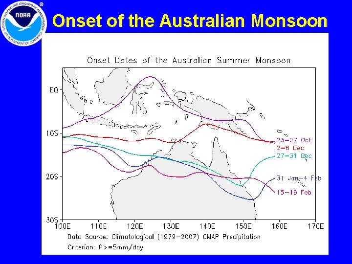
Onset of the Australian Monsoon 12

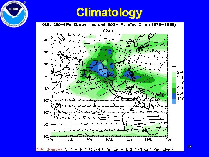
Climatology 13