TERRITORY States cannot exist without territory Territorial Morphology


 piece of territory that is part")


")


- Slides: 35
TERRITORY • States cannot exist without territory • Territorial Morphology – geographers study the size, shape and relative location of states? • How does the size and shape of a state give advantages or disadvantages? • 5 types of territorial morphologies
Most modern-day boundaries were drawn by whom?
COMPACT What are the advantages & disadvantages?
FRAGMENTED What are the advantages & disadvantages?
ELONGATED What are the advantages & disadvantages?
PRORUPT or PROTRUDED What are the advantages & disadvantages?
PERFORATED What are the advantages & disadvantages?
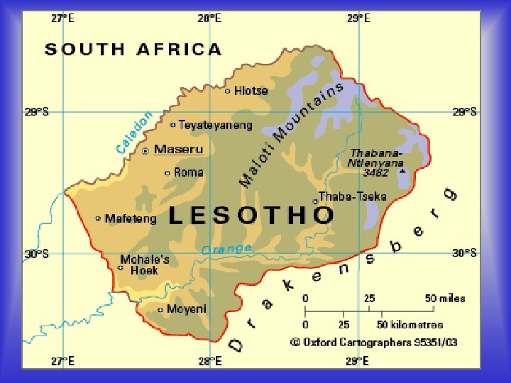
What territorial morphology is ITALY?
EXCLAVES & ENCLAVES • Exclave – bounded (non-island) piece of territory that is part of a state but lies separated from it by territory of another state. • Enclave – piece of territory that is surrounded by another political unit of which it is not a part (landlocked within the country which surrounds them.
EXCLAVE
ENCLAVE
‘Google’ Azerbaijan and Armenia maps and look what you get…
Talk about a strangely shaped states. . .
Shape is not a constant for political/economic stability or instability
Resource rich…but with many problems
Very few natural resources…but wealthy and stable
LANDLOCKED COUNTRIES • Isolation • At the mercy of neighbors • Need communication linkages (highways, airports, rivers, etc. ) • Have formed alliances with other countries to lessen isolation • Only LIECHTENSTEIN & UZBEKISTAN are both landlocked and surrounded by landlocked countries.
BOUNDARIES • Obviously mark the land surface (Refer to pp. 242 -244 in your text). • But, they also extend into airspace and the ground • What about natural resources? • What about air traffic? • What about sea traffic?
SETTING BOUNDARIES Stage One • DEFINITION – exact location established through legal agreement, treaty, etc. Can describe terrain feature or be measured by longitude and latitude.
SETTING BOUNDARIES Stage Two • DELIMITATION – putting the boundary on a map officially.
SETTING BOUNDARIES Stage Three • DEMARCATION – The final stage. Marking a boundary with fences, walls, posts, pillars, or other markers. Most of the world’s boundaries are not demarcated.
Four Types of Boundary Disputes • Definitional – center on legal issues • Locational – definitions not disputed – the interpretation is • Operational – parties differ on how boundary should function (how migration should occur) • Allocational – conflict over “stuff” – oil, gas, seafloor riches, water
Former Yugoslavia - p. 212 http: //www. montenet. org/home/yugoslav. jpg
FEDERAL STATES • A political-territorial system in which a central government represents the various entities (states, provinces, cantons) within a country (most often a nation-state) where they have common interests (defense, foreign affairs. . . ) but allows the various entities to retain their own identities and to have their own laws, policies & customs within designated spheres.
UNITARY STATES • Nation-states having a strong centralized government and administration that exercises power equally over all parts of the state.
Unitary States of the World in blue – Federal States in gray http: //commons. wikimedia. org/wiki/Image: Unitary_states. png
ADDENDUM: ITEMS OF INTEREST? Where do they fit?
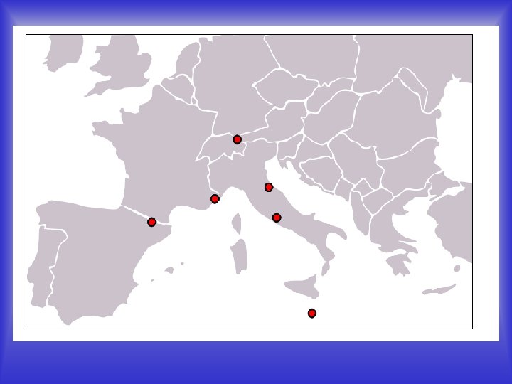
European Microstates Map
KURDISTAN – A Stateless Nation of People (in the mountains of Turkey, Iraq &Iran) KURDS
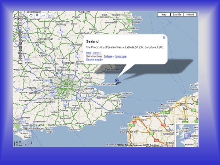
SEALAND – a country? principality?