Term Hor Line Hor PLane Elev Of A

 A B DE.")

 �������������������� �� 2 ���������� 1. ������")

 ���������� ������ � ���������� Vertical Plane")
 �������������� � 1����� 2. 2������� (Vertical")
 9/2/2021 14")
 9/2/2021 15")

 LEICA DNA 03 DNA 10 9/2/2021 17")
 LEICA DNA 03 DNA 10 9/2/2021 18")
 Eyepice Lens Objective Lens Focusing Knob Tubular Level")


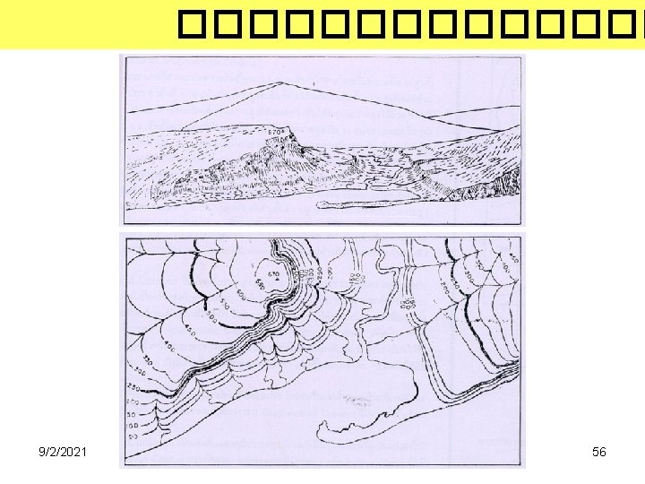
 � ������ (Spot Elevation) 9/2/2021 55")


- Slides: 72
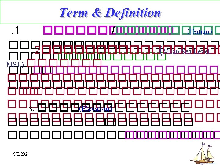
����� (Term & Hor. Line Hor. PLane Elev. Of A Definition) A B DE. Of AB Elev. Of B MSL Vert. Line To Center of the Earth 9/2/2021 3
P’ P 9/2/2021 5
Term & Definition 4. ������ (Bench Mark: BM) �������������������� �� 2 ���������� 1. ������ � (Vertical Control Mark) 2. ������ (Horizontal Control Mark) 9/2/2021 http: //www. geocaching. com/mark/ 6 http: //en. wikipedia. org/wiki/Benchmark_%28 surveying%29
BM ����� UTM 47 WGS 84 627469. 581 m. E 1851911. 146 m. N Elev. = 42. 122 m MSL 9/2/2021 UTM 47 WGS 84 627521. 843 m. E 1851839. 056 m. N Elev. = 41. 515 m MSL 7
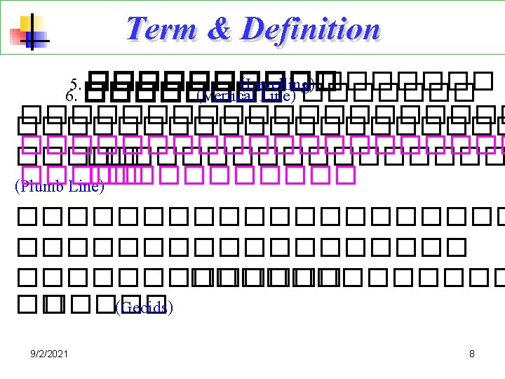
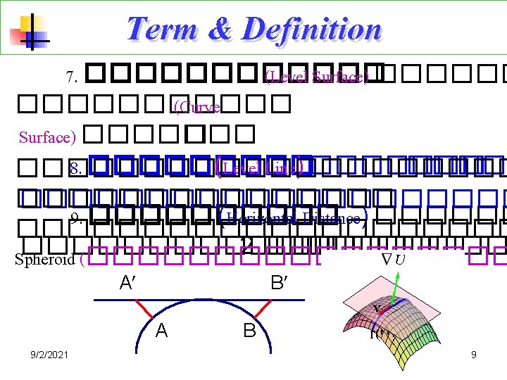
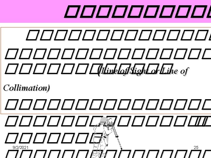
Term & Definition 1 0. ������� (Vertical Plane) ���������� ������ � ���������� Vertical Plane Earth Surface Vertical Line 9/2/2021 10
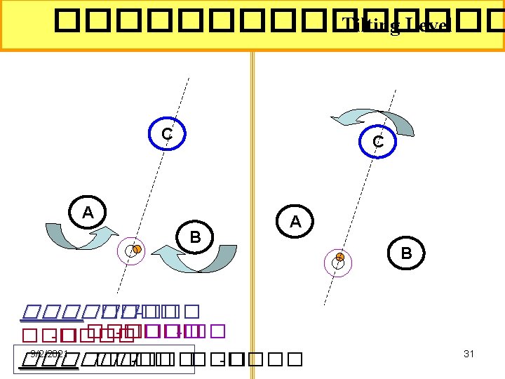
Term & Definition 1 1. ������ (Horizontal Angle) �������������� � 1����� 2. 2������� (Vertical Angle) ������� (Depression Angle) ����� (Elevate Angle) ����������� ������ Vertical Plane Horz. Plane Spherical Surface 9/2/2021 Vertical Line 11
3. �������� (Automatic level) 9/2/2021 14
3. �������� (Automatic level) 9/2/2021 15
Runner 20 Runner 24 2. 5 mm 2. 0 mm Standard deviation per km double-run levelling Telescope image Magnification Upright 20 x 24 x Clear objective aperture 36 mm Shortest focusing distance 0. 8 m Multiplication factor 100 Additive constant Specification RUNNER 20 RUNNER 24 0 Compensator Working range 15‘ Setting accuracy ’’ 0. 5 Sensitivity of circular level 2/’ 10 mm Horizontal circle (metal( ° 360 Graduation interval of Hz circle 9/2/2021 Weight (net( Operating temperature range 1 minute 2 kg ° 20–C to +50° C 16
5. ������� (Digital level) LEICA DNA 03 DNA 10 9/2/2021 17
5. ������� (Digital level) LEICA DNA 03 DNA 10 9/2/2021 18
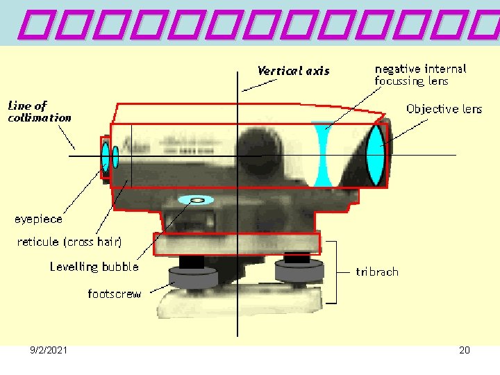
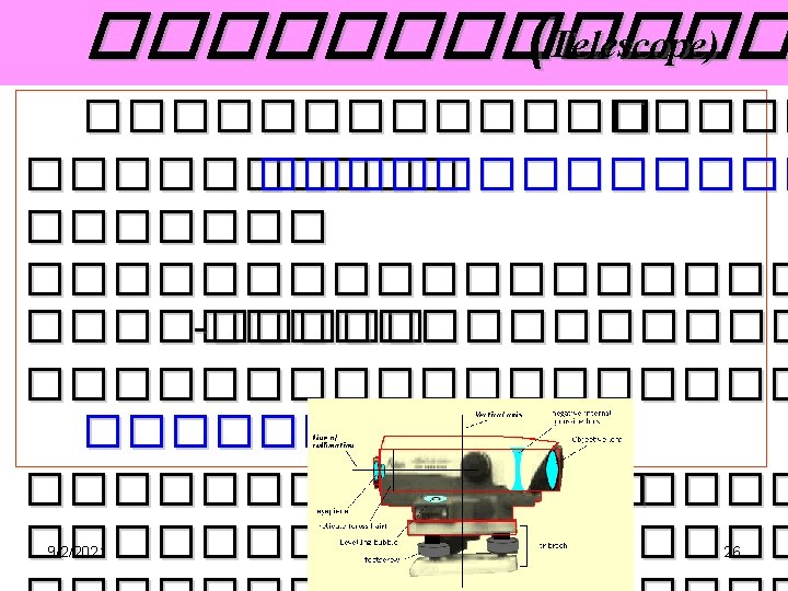
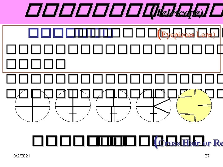
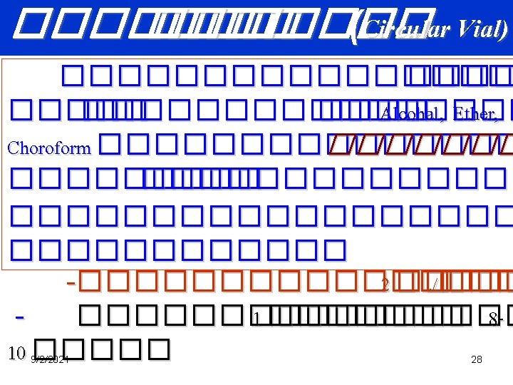
������� Telescope Sighting Knob (Open Sight) Eyepice Lens Objective Lens Focusing Knob Tubular Level Circular Vial 9/2/2021 Horizontal Drive Screw Foot Screw Tilting Screw Horizontal Circle Index for reading the circle Base Plate and Screw 19
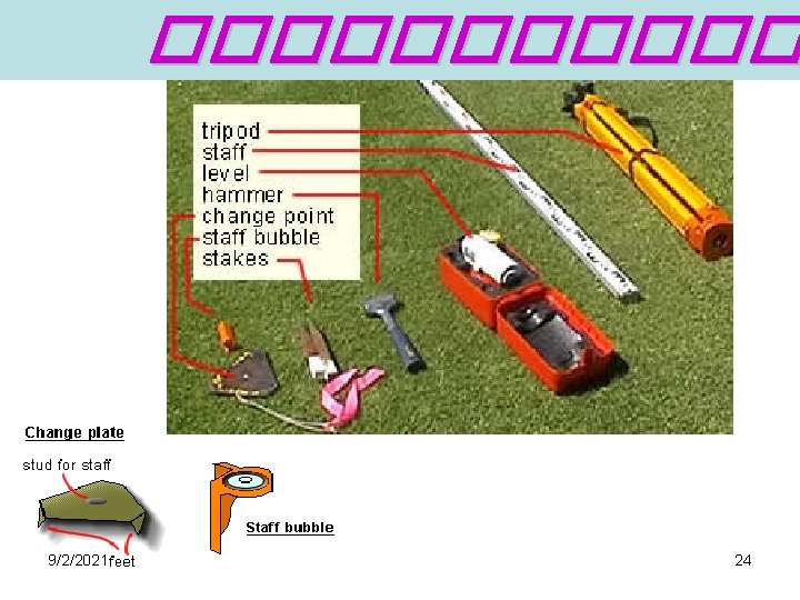
���� Staff or Leveling Rod SECO BIPOD - LEVELING ROD This new bipod features a special head to hold most popular rectangular rods. 9/2/2021 http: //www. chiefsupply. com/survey_levels_rods. phtml 21
Staff q q E type staff Invar Staff Digital Staff Wooden Hinged staff 9/2/2021 22
����� Tripod HEAVY-DUTY ALUMINUM TRIPOD ECONOMICAL FIBERGLASS TRIPOD 9/2/2021 23 http: //www. chiefsupply. com/survey_tripods_cst. phtml
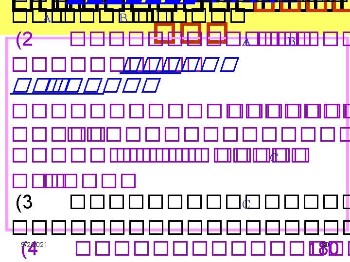
���� Leveling A ����� 1. 500 1. 700 ���� 451. 000 �. 1. 400 44 B ������ Elev. of B = Elev. of A – (1. 500+1. 700+1. 400 ) = 451. 000 - 4. 600 ���� = 446. 400 ���� 9/2/2021 33
���� Leveling 1. 000 0. 800 M ���� 500. 000 �. 2. 000 N 1. 500 Elev. of N = Elev. of M ± (- 0. 800 -1. 500+2. 000+1. 000 ) = 500. 000 + 0. 700 ���� = 500. 700 ���� 9/2/2021 34
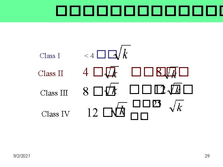
. 2�������� � 2. 1������� 0. 800 Elev = i – F. S i =1. 500 Elev = = = Elev. of B = = = A = 100. 000 m 9/2/2021 F. S. = 0. 800 B i – F. S. 1. 500 – 0. 800 0. 700 Elev. of A + Elev. 100. 000 + 0. 700 100. 700 �. 35
. 2�������� � 2. 2����� B. S. = 2. 300 1. 600 Elev = B. S - i B? i =1. 600 A = 100. 000 m Elev = B. S. - i = 2. 300 – 1. 600 = 0. 700 Elev. of B = Elev. of A + Elev. = 100. 000 + 0. 700 = 100. 700 �. 9/2/2021 36
������� BS BM. 1 9/2/2021 FS BS T. P. 2 FS X 37
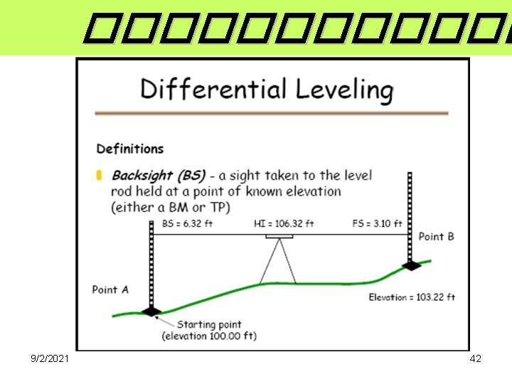
������� Differential Leveling 9/2/2021 38 http: //www. ce. memphis. edu/1101/notes/surveying_levling. pdf
9/2/2021 39
�������� Differential Leveling ��������� (The Heig Method or Height of Instrument: HI( Sta. BS. BM A B C D 1. 620 1. 750 1. 836 0. 200 BS = 5. 406 FS = 4. 580 0. 826 = 9/2/2021 HI. 11. 620 12. 040 12. 776 12. 926 FS. Elev. 1. 330 1. 100 0. 050 2. 100 10. 000 10. 290 10. 940 12. 726 10. 826 Reks ������� Assu me Elev. FS = 4. 580 ����� check 10. 000 – 10. 826 = 45
The Height of Collimation Method or Height of Instrument: HI 9/2/2021 46 http: //www. ce. memphis. edu/1101/notes/surveying_levling. pdf
The Height of Collimation Method or Height of Instrument: HI 9/2/2021 47
The Height of Collimation Method or Height of Instrument: HI 9/2/2021 48
The Height of Collimation Method or Height of Instrument: HI 9/2/2021 49
The Height of Collimation Method or Height of Instrument: HI 9/2/2021 50
The Height of Collimation Method or Height of Instrument: HI 9/2/2021 51
The Height of Collimation Method or Height of Instrument: HI 9/2/2021 52
The Height of Collimation Method or Height of Instrument: HI 9/2/2021 Change in Elevation 53
Area Leveling ������� 9/2/2021 54
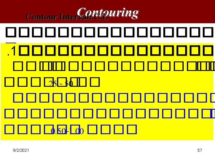
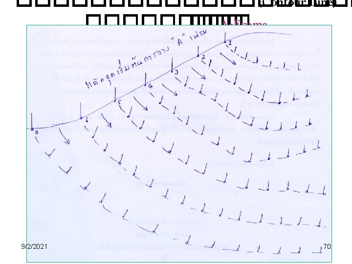
Contouring �������� �������� (Interpolation) � ������ (Spot Elevation) 9/2/2021 55
Point A = 0 ft Point D ~ 25 ft. Point B = 10 ft. Point E ~ 8 ft. Point C ~ 15 ft. 9/2/2021 59 http: //raider. muc. edu/~mcnaugma/Topographic%20 Maps/contour. htm
Point C ~ 770 m. 9/2/2021 60 http: //raider. muc. edu/~mcnaugma/Topographic%20 Maps/contour. htm
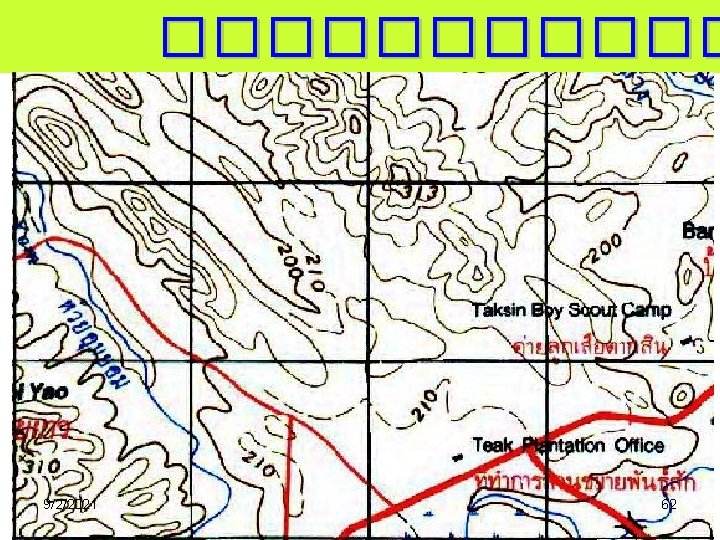
9/2/2021 Points between contour lines. 61
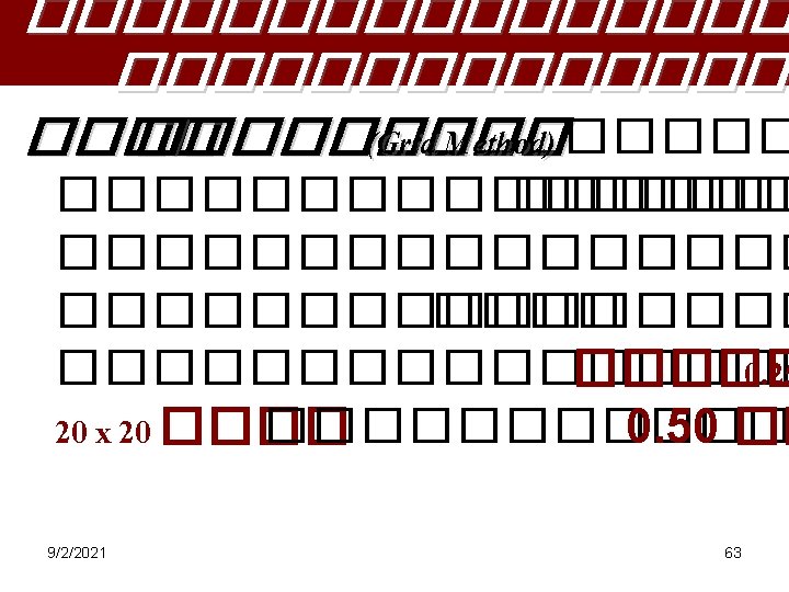
Volumes From Spot Heights - Grid Levelling Rectangular Base Method 9/2/2021 64
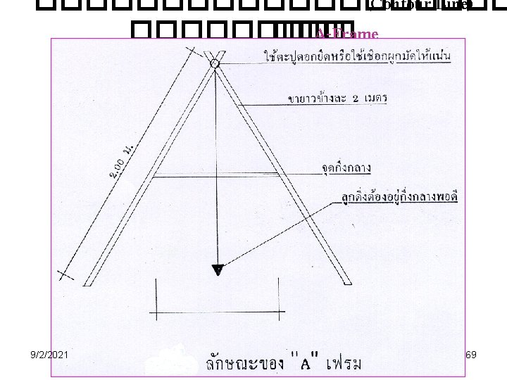
�������� Borrow Pit Leveling 9/2/2021 65
9/2/2021 71 http: //benson. byu. edu/Publication/Lessons/Images/L 1/Water/fp/1712 e. jpg
9/2/2021 72 http: //farm 1. static. flickr. com/228/459917425_9 cd 46463 f 1_o. gif