
TE A M I CL ATIN N O
- Slides: 11
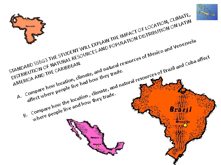
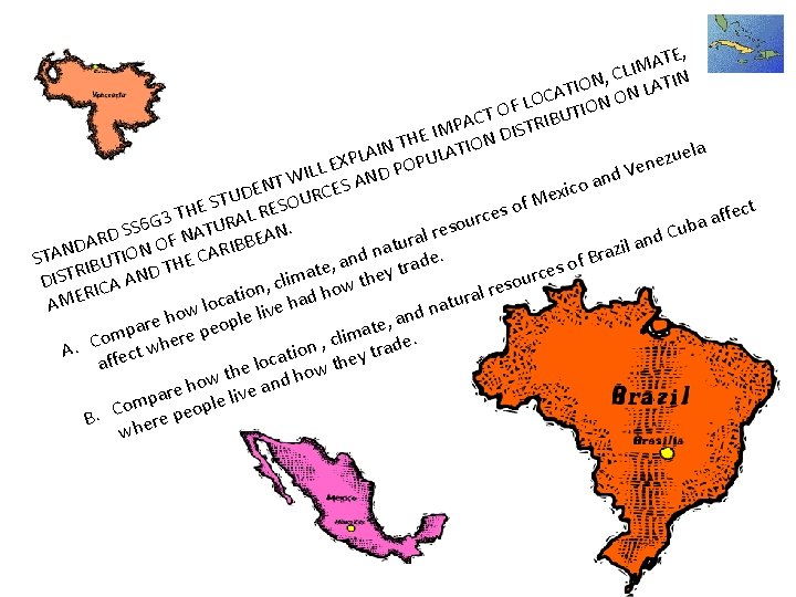
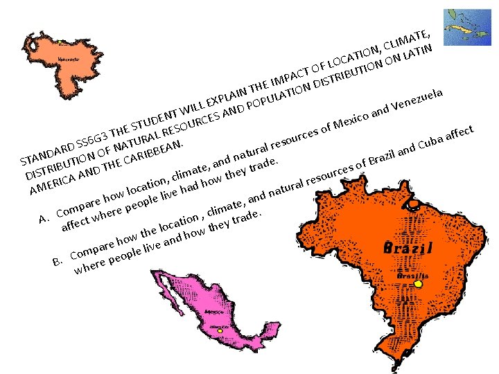
TE, A M I , CL ATIN N O I CAT N ON L O L IO OF T T U C B I PA TR S M I I D E N TH LATION la I e A u L z P U e Ven LL EX ND POP I d n W oa NT RCES A c E i x D e U f. M o E ST L RESOU s H e fect T f c r 3 a A u G a R ub TU EAN. eso SS 6 r C A l D d N a R r n DA ON OF IBB il a atu z R N n a A A r. d I T C B e n S of , a rad BUT D THE e s I t t e R y a c T e r DIS ICA AN clim how th sou , e n r o l R i tura ocat live had AME a l n w ho le and , e p r e o a t e lima de. omp here p c C , . A tw ation they tra c o l affec the d how w o re h e live an a p om peopl C. B re wh e
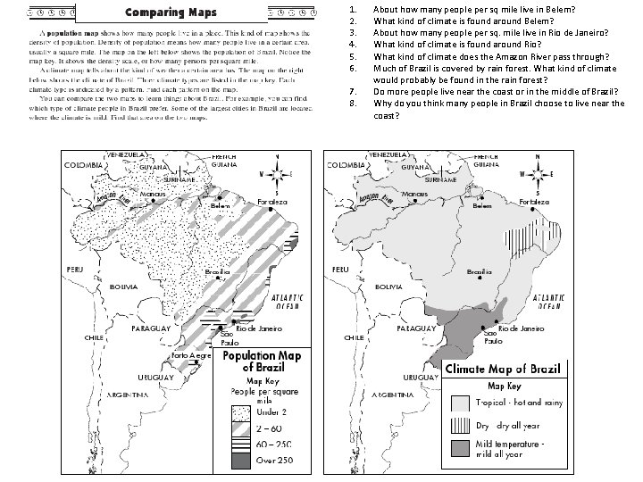
1. 2. 3. 4. 5. 6. 7. 8. About how many people per sq mile live in Belem? What kind of climate is found around Belem? About how many people per sq. mile live in Rio de Janeiro? What kind of climate is found around Rio? What kind of climate does the Amazon River pass through? Much of Brazil is covered by rain forest. What kind of climate would probably be found in the rain forest? Do more people live near the coast or in the middle of Brazil? Why do you think many people in Brazil choose to live near the coast?
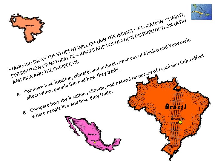
TE, A M I , CL ATIN N O I CAT N ON L O L IO OF T T U C B I PA TR S M I I D E N TH LATION la I e A u L z P U e Ven LL EX ND POP I d n W oa NT RCES A c E i x D e U f. M o E ST L RESOU s H e fect T f c r 3 a A u G a R ub TU EAN. eso SS 6 r C A l D d N a R r n DA ON OF IBB il a atu z R N n a A A r. d I T C B e n S of , a rad BUT D THE e s I t t e R y a c T e r DIS ICA AN clim how th sou , e n r o l R i tura ocat live had AME a l n w ho le and , e p r e o a t e lima de. omp here p c C , . A tw ation they tra c o l affec the d how w o re h e live an a p om peopl C. B re wh e
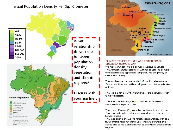
Brazil Population Density Per Sq. Kilometer What relationship do you see between population density, vegetation, and climate regions? Discuss with your partner. CLIMATE, TEMPERATURES AND RAIN IN BRAZILIAN CLIMATE MAP We may consider five big climatic regions in Brazil: The Amazon Basin region (1), with an equatorial climate characterized by agreeable temperatures but plenty of rain and humidity. The Northeastern Coastlands (2) from Fortaleza to the Bahian south coast, with an all year round travel climate pattern. The Rio de Janeiro, Vitoria and Sao Paulo coast (3), with a hybrid pattern. The South States Region (4), with a temperate four season climate pattern; and The Inland Plateau (5), from the northeast inland to the Pantanal, with a hard dry season and more extreme temperatures. The map above shows the rough configuration of these five climatic regions. Obviously, there are transitional zones and some significant variations within each climate region.
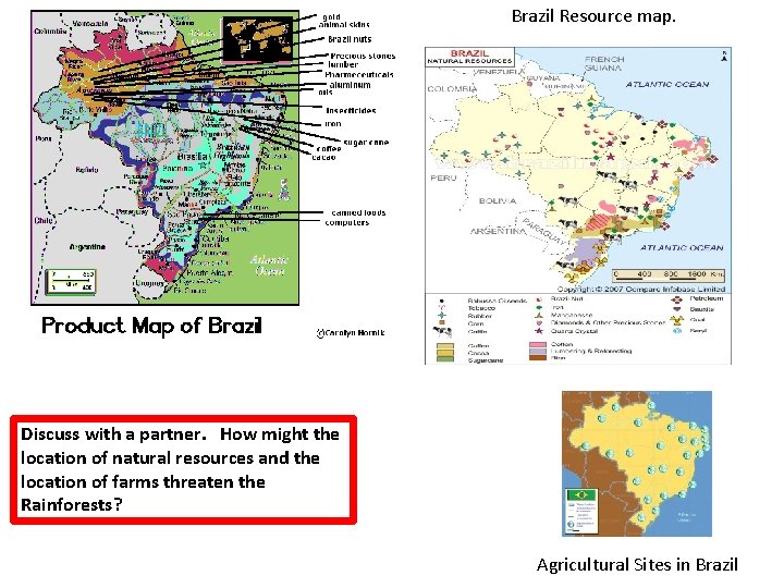
Brazil Resource map. Discuss with a partner. How might the location of natural resources and the location of farms threaten the Rainforests? Agricultural Sites in Brazil
TE, A M I , CL ATIN N O I CAT N ON L O L IO OF T T U C B I PA TR S M I I D E N TH LATION la I e A u L z P U e Ven LL EX ND POP I d n W oa NT RCES A c E i x D e U f. M o E ST L RESOU s H e fect T f c r 3 a A u G a R ub TU EAN. eso SS 6 r C A l D d N a R r n DA ON OF IBB il a atu z R N n a A A r. d I T C B e n S of , a rad BUT D THE e s I t t e R y a c T e r DIS ICA AN clim how th sou , e n r o l R i tura ocat live had AME a l n w ho le and , e p r e o a t e lima de. omp here p c C , . A tw ation they tra c o l affec the d how w o re h e live an a p om peopl C. B re wh e
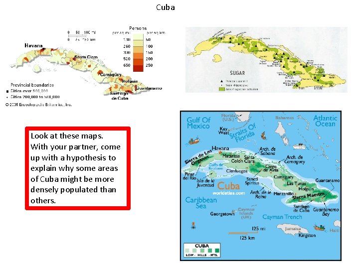
Cuba Look at these maps. With your partner, come up with a hypothesis to explain why some areas of Cuba might be more densely populated than others.
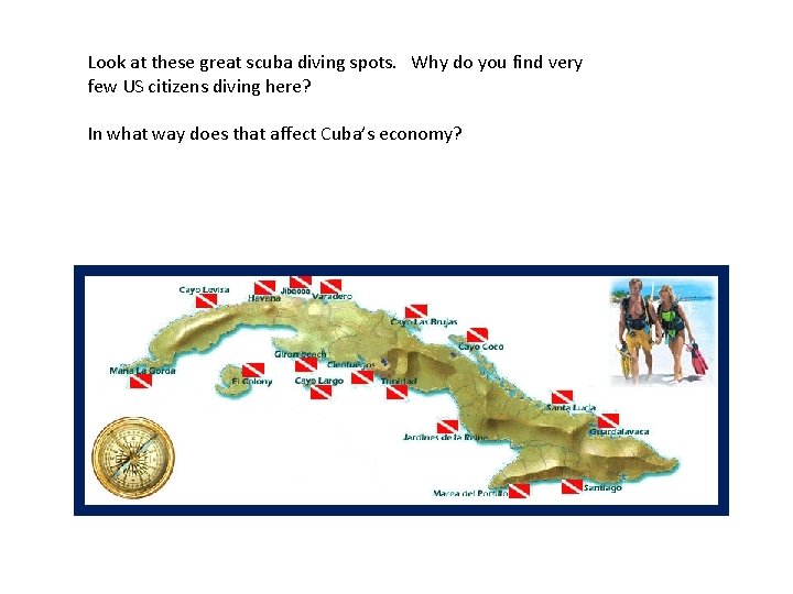
Look at these great scuba diving spots. Why do you find very few US citizens diving here? In what way does that affect Cuba’s economy?
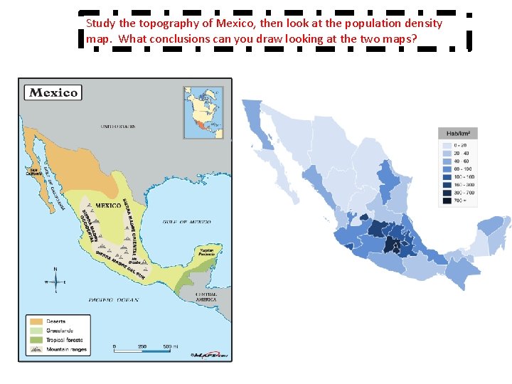
Study the topography of Mexico, then look at the population density map. What conclusions can you draw looking at the two maps?
TE, A M I , CL ATIN N O I CAT N ON L O L IO OF T T U C B I PA TR S M I I D E N TH LATION la I e A u L z P U e Ven LL EX ND POP I d n W oa NT RCES A c E i x D e U f. M o E ST L RESOU s H e fect T f c r 3 a A u G a R ub TU EAN. eso SS 6 r C A l D d N a R r n DA ON OF IBB il a atu z R N n a A A r. d I T C B e n S of , a rad BUT D THE e s I t t e R y a c T e r DIS ICA AN clim how th sou , e n r o l R i tura ocat live had AME a l n w ho le and , e p r e o a t e lima de. omp here p c C , . A tw ation they tra c o l affec the d how w o re h e live an a p om peopl C. B re wh e
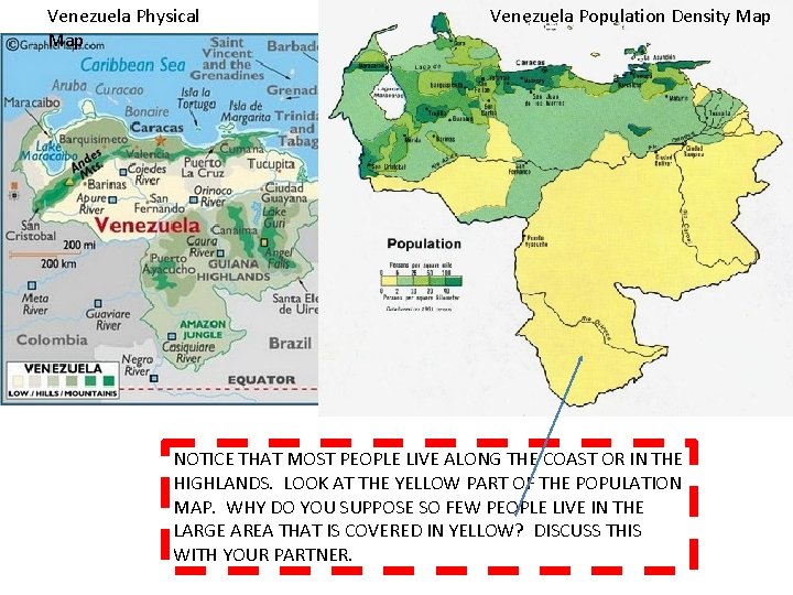
Venezuela Physical Map Venezuela Population Density Map NOTICE THAT MOST PEOPLE LIVE ALONG THE COAST OR IN THE HIGHLANDS. LOOK AT THE YELLOW PART OF THE POPULATION MAP. WHY DO YOU SUPPOSE SO FEW PEOPLE LIVE IN THE LARGE AREA THAT IS COVERED IN YELLOW? DISCUSS THIS WITH YOUR PARTNER.