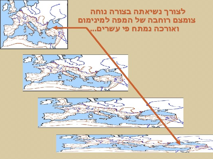
Tabula Peutingeriana or Peutinger map medieval copy of
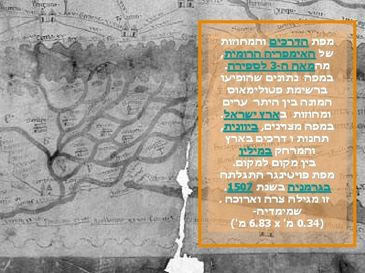

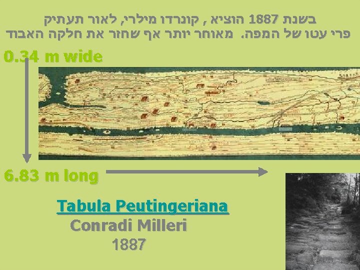
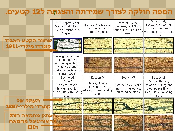
Tabula Peutingeriana or Peutinger map medieval copy of an ancient Roman map, an invaluably important source for the study of ancient topography. 0. 34 m wide 6. 83 m long M a n u s c r i p t u m o r i g i n a l e c a. 1 2 0 0

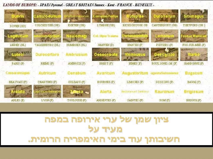
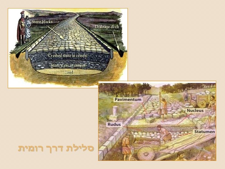
Roman road of the Fuenfría valley, in the Sierra de Guadarrama , Spain. XVI נקודות שתי בין מרחק רומיים במיילים

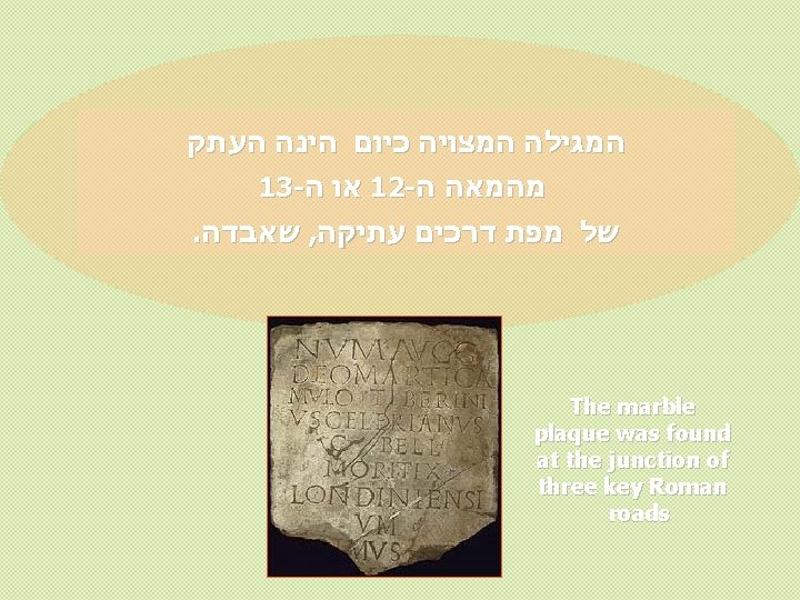
Roman milestone. From St Margarethen, Austria. 201 A. D. Dedication to Emperor Septimius Severus(ruled 193 - 212 A. D).

E d i t i o n 1 5 9 8 ורסלו מרקי בידי שוב המפה הועתקה 1598 בשנת Sheet VIII, detail: Petra, the Sinai Desert and the Nile Delta

Fragmenta Tabulae antiquae 18 in quis aliquot per Romanas prouincias Itinera: Ex Peutingerorum bibliotheca / Edente [et] explicante Marco Velsero. - Venetiis: Aldus, 1598

Map of the Roman Empire based on Image: Blank. Map-Europe-v 3. png , displayed in the map: Red = Roman republic 510 BC-40 BC Purple = Roman Empire 20 AD-360 AD Blue = Western Roman Empire 405 AD-480 AD Yellow = Eastern Roman Empire 405 AD-480 AD A version including the Byzantine Empire is at Image: Roman Empire map. gif . השנים במשך הרומית האימפריה התפתחות משנת וממשיכיה הרומית האימפריה של בשינויים ולצפות להמתין נא ) ( לספירה 1453 עד הספירה לפני 510

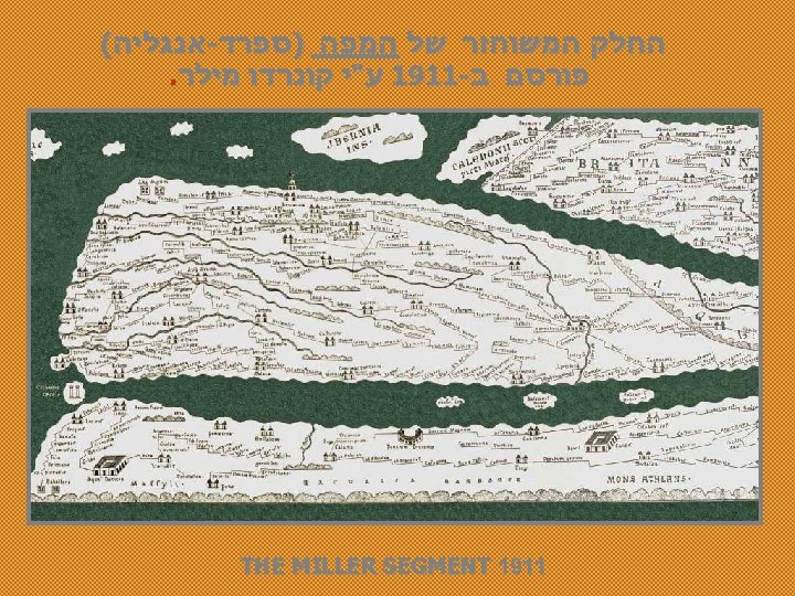
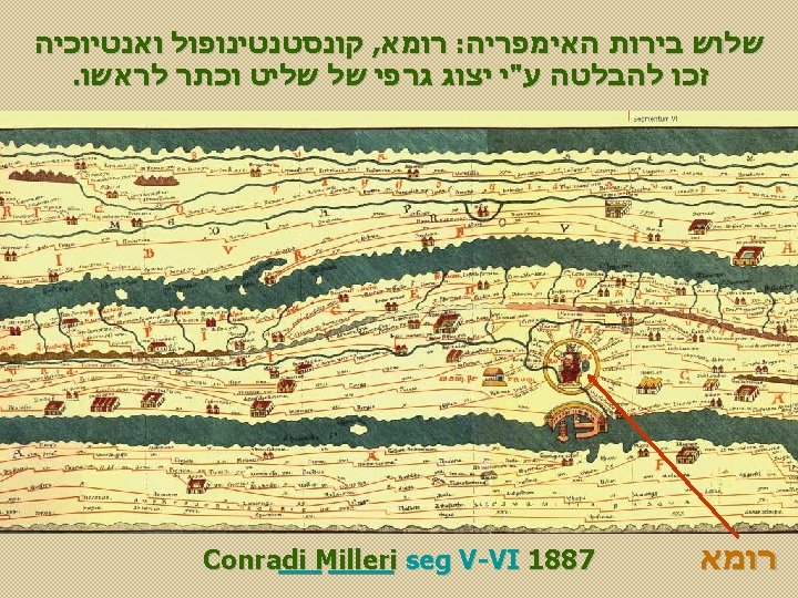
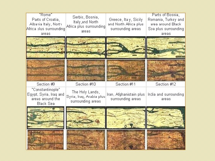
. 1887 - ו 1598 בשנים העתקים שני נעשו 1200 משנת מההעתק Tabula Peutingeriana ca. 1200 Tabula Peutingeriana Marci Velseri, 1598 Tabula Peutingeriana Conradi Milleri 1887

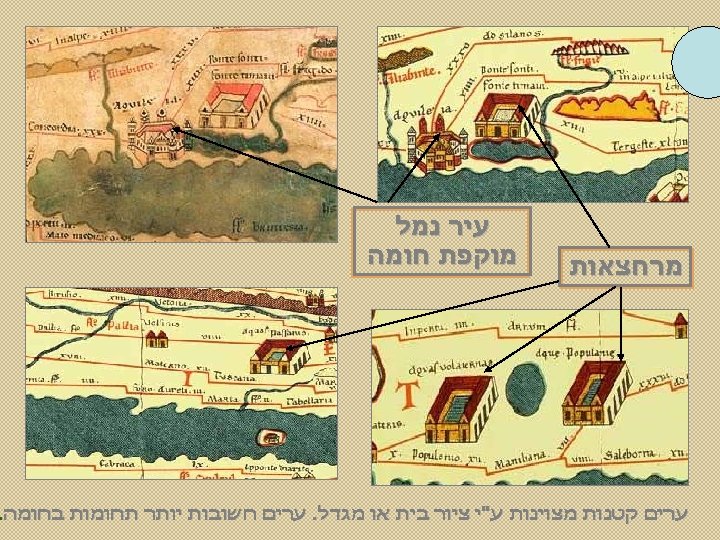
Via Flaminia Via Latina Via Aurelia Detail of the sixteenth-century edition of the Peutinger map; Rome, St Peter's basilica, and the port of Ostia Via Apia

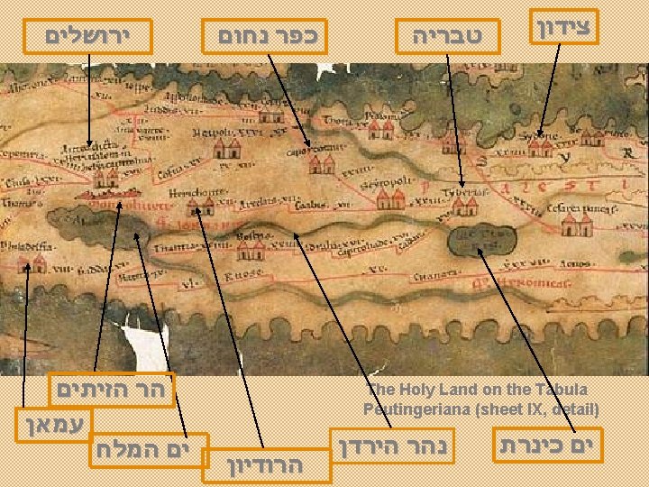
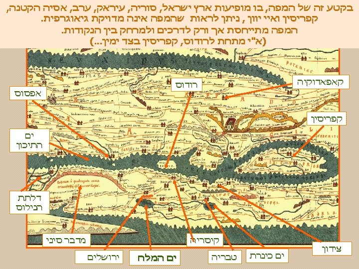
Sheet IX, detail: Constantinopolis Sheet IX, detail: Antioch in Syria

Via Apia

M a n u s c r i p t u m o r i g i n a l e c a. 1 2 0 0 S e g m e n t u m I I Gallia Africa
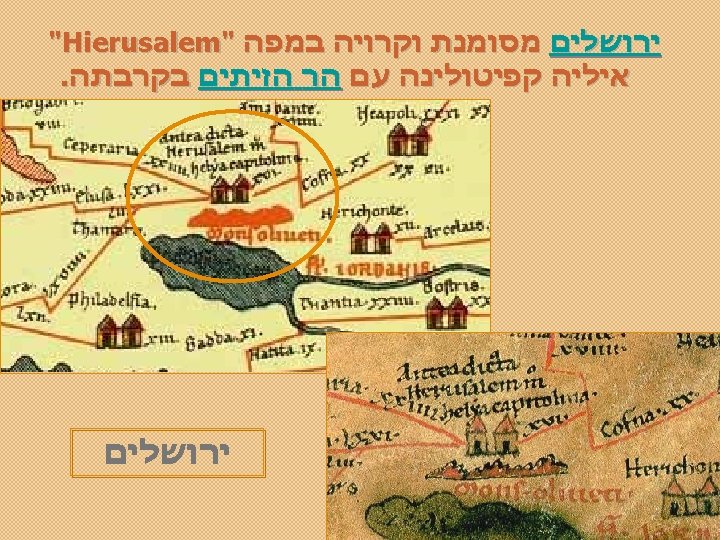

M a n u s c r i p t u m o r i g i n a l e c a. 1 2 0 0 Sheet VIII, detail: Petra, the Sinai Desert and the Nile Delta. (copy from a 12 th century MS 1598)

Road Construction on Trajan's Column.

Engineering corps traian’s column river crossing

The nearby archeological sites include the remnants of Roman Emperor Trajan's bridge , one of many Traian’s tables, remnants of Trajan's road through the Danube's Iron Gates , and the Roman fortress Diana. Tabula Traiana over Roman road.
![Tile of the Leg(io) X G[emina], from Vienna Coin showing the tenth legion's](http://slidetodoc.com/presentation_image_h/27a3a71114b042392e819d3d616288cd/image-34.jpg "Tile of the Leg(io) X G[emina], from Vienna Coin showing the tenth legion's")
Tile of the Leg(io) X G[emina], from Vienna Coin showing the tenth legion's emblem, a bull Roof tile with the sign [L[egio] X F[retensis] from Jerusalem

Corse Sardaigne Etna פומפיי

http: //en. wikipedia. org/wiki/Tabula_Peutingeriana Wikipedia http: //www. fh-augsburg. de/~harsch/Chronologia/Lspost 03/Tabula/tab_intr. html וההסברים המפות מקור B I B L I O T H E C A A U G U S T A N A ( )בלטינית http: //www. livius. org/pen-pg/peutinger/map. html. השונות המפות ועל פאוטינגר על Konrad Peutinger http: //terra. antiqua. free. fr/table_peutinger. html של וצילומים מקומות לפי האוריגינלית המפה של שונים קטעים של מובחרים צילומים . מילר של ההעתק http htm. index/tabula/es. rediris. traianus//: בשלמותו מילר קונרדו של ההעתק http html. Weber. Peutingeriana/articles/mad/ofm/www 1/198. 62. 75. 1//: . המפה על מאמר http html. 120 mono/Ancient%20 Web%20 Pages/MAPS/com. davis-henry. www//: . בנושא מאמר עוד http: //www. romansites. com/carta_dell'impero. htm ואפרים קלריטה chefetze@netvision. net. il
- Slides: 36