Surveying What is surveying Surveying may be defined


Surveying • What is surveying? Surveying may be defined as the science of determining the position, in three dimensions, of natural and man-made features on or beneath the surface of the Earth. These features may then be represented in analog form as a contoured map, plan or chart, or in digital form as a three dimensional mathematical model stored in the computer.

Objective of course • To understand the basic concept of surveying • Apply the surveying concept and equipments in real life • You should be able to use a set of tools to solve the problems in an optimal way • You should be able to understand the pitfalls (sources of error) to avoid them

Application of surveying in civil Engineering • The planning and design of all Civil Engineering projects such as construction of highways, bridges, tunnels, dams etc are based upon surveying measurements. • Project of any magnitude is constructed along the lines and points established by surveying. Thus, surveying is a basic requirement for all Civil Engineering projects. • Other principal works in which surveying is primarily utilized are • • to fix the national and state boundaries; • • to chart coastlines, navigable streams and lakes; • • to establish control points • • to execute hydrographic and oceanographic charting and mapping; and • • to prepare topographic map of land surface of the earth.

Instruments… Tilting Levelling Staff Dumpy Level ØTelescope is fixed cannot be tilted or moved Digital level ØTelescope can be tilted slightly about its horizontal axis with the help of tilting screw. ØThe line of collimation is made horizontal for each observation with the help of tilting screw ØInstrument can be levelled automatically within a certain tilt range

Levelling staff

• Classification of surveying: Based on function Primary division based on shape of the earth – Geodic survey: if the area surveyed is more than 1000 km 2 geodic surveying must be employed – Plane survey • Classification based on function of survey – Control surveying: establishing the horizontal and vertical positions of widely spaced control points using geodic method. – Land surveying: to determine the boundaries and areas of parcel of land. – City surveying: urban planning – Topographic surveys: depiction of topography of a region. Including natural and man made features – Engineering survey: for laying out engineering projects. – Route survey: planning designing and execution of highways, railways, canals, pipelines etc. – Construction surveys: required to establish points lines, grades and for staking out engineering works after the plans have been prepared and the structural design has n=been done.

Classification of surveying: Based on function – Astronomic survey: are conducted for the determination of latitudes, longitudes, azimuths, local time etc. for various places by observing heavenly bodies such as suns and stars. – Geological survey: to determine the strata of the earth’s crust for geological studies. – Archaeological surveys: unearthing relics of antiquity – Mine surveys: exploration of mineral deposits, and to guide tunnelling and other operations associated with mining. – Satellite surveys: to establish intercontinental, interdatum and interisland geodic ties over the world by making satellite observations. – Military surveys: conducted for military purpose.

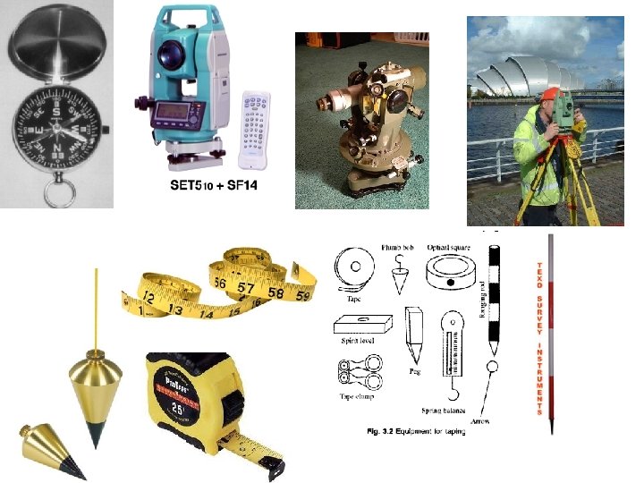
Classification of surveying: Based on instruments • Chain survey: only linear measurements are made with chain or tape no angular measurements are taken • Compass survey: horizontal angles are measured with the help of magnetic compass • Plane table survey: The map is prepared in the field itself by determining the directions of various lines making linear measurements, and plotting the details on paper using a plane table • Levelling survey: this type of survey is used to determine the elevations and relative heights of the points with the help of instrument known as level. • Theodolite survey: theodolite survey is primarily used in traversing and triangulation for providing controls. The horizontal and vertical angles are measured with the help of theodolite. • Tacheometric survey: a special type of theodolite known as tacheometer, is used to determine horizontal and vertical distances directly. • Photogrammetric survey: measurements are made with help photograph. • EDM Survey: linear measurements are made with the help of EDM instruments.

Principles of surveying • Fixing the points in relation to points already fixed http: //nptel. iitm. ac. in/courses/Webcoursecontents/IITROORKEE/SURVEYING/modules/module 1/htm lpage/9. htm#

Principle of surveying • Working from whole to part: • to localize the errors and • to control the accumulation of errors. – Establish primary control points with high precision – Establish secondary and tertiary control points within the system boundary and form triangle/rectangle may be with less precision. – This will help in localizing the error and to control the propagation of error.

Working from whole to part

Types of Chains and Tapes • Before the ability to make steel rods and bands, sticks were cut into lengths of 16. 5’ (Rod) and they were laid end to measure. • Gunter’s Chain – 66’ long with 100 link w/each link being 7. 92 inches or 66 feet long – Developed by Edmund Gunter in 1600’s in England made with individual wires with a loop at each end connected – Chain had between 600 -800 wearing surfaces which with hard use would wear and cause chain to elongate – Measurements were recorded in chains and links – 7 ch 94. 5 lk = 7. 945 ch = 7. 945 X 66’/ch = 524. 37’ – 1 chain = 4 rods; 80 chains = 1 mile

Types of Chains and Tapes • Engineer’s Chain – Same construction as Gunter’s Chain, but each link is 1. 0’ long and was used for engineering projects • Surveyor’s and Engineer’s Tapes – Made of ¼” to 3/8” wide steel tapes in 100’; 200’; 300’ lengths – Multiple types of marking and graduation: • Available in chains, feet, and metric • Graduated: – Throughout – feet and tenths marked the entire length – Extra foot – feet marked the length of the tape with additional foot at the 0 end graduated in tenths and hundreds of the foot

Types of Chains and Tapes • Invar Tapes – Made of special nickel steel to reduce length variations due to temperature changes – The tapes are extremely brittle and expensive – Used most of the time for standard comparison of tapes • Cloth, Fiberglass, and PVC Tapes: – Lower accuracy and stored on reels. Used for measurement of 0. 1’ accuracy requirements 1. 2. 3. 4. Accessories Chaining Pins – set of 11, used to mark the tape lengths Hand Level – used to determine required plumbing height Plumb Bob – used to transfer the mark from the tape to ground Tension Handle – used to maintain correct tension on tape
 1. The line to be taped should be marked at both")
Taping (Field Process) 1. The line to be taped should be marked at both ends – – – Keeps measurement on line Rear chain person should keep the head chain person on line 1’ of line error/100’ = 0. 01’ error in length 2. Applying Tension – Rear chainman is anchor and should hold 100’ mark over point • • Tension is applied by head chain person – normally 12 to 30 pounds of pull Tapes are standardized at 12 lbs. , but greater is utilized to compensate for sag
 3. Plumbing – One end of tape is raised to maintain")
Taping (Field Process) 3. Plumbing – One end of tape is raised to maintain a horizontal measuring plane. ONLY one end is elevated • • This allows measurements to be made on uneven ground If a high spot exists in center, “break” tape by measuring to the top and then move forward to complete the distance

Slope Measurements: • Generally, measurements are made horizontally, but on even, often man-made slopes the distance can be measured directly on the slope, but the vertical or zenith angle must be obtained. – Horizontal Distance = sin Zenith Angle X Slope Distance – Horizontal Distance = cos Vertical Angle X Slope Distance

Stationing: • Starting point is 0+00 and each 100’ is one station 700’ from starting point is Station 7+00 • If distance is 857. 23’ from starting point, it is expressed as Station 8+57. 23

Taping Error: 1. 2. 3. Instrumental Error – a tape may have different length due to defect in manufacture or repair or as the result of links Natural Error – length of tape varies from normal due to temperature, wind and weight of tape (sag) Personal Error – tape person may be careless in setting pins, reading the tape, or manipulating the equipment ► Instrumental and natural error can be corrected mathematically, but personal error can only be corrected by remeasure. ► When a tape is obtained, it should either be standardized or checked against a standard. • Tapes standardized at National Bureau of Standards in Maryland ► Standardized at 68 degrees F and 12 lbs. tension fully supported.
 Measuring between two existing points: 1) If a tape is")
Tape Error Correction: 1) Measuring between two existing points: 1) If a tape is long, the distance will be short, thus any correction must be added 2) If tape is short, the distance will be long, thus any correction must be subtracted 3) If you are setting or establishing a point, the above rule is reversed. Generally can correct for tape length, temperature, tension, and sag, but tension and sag are negated by increasing tension to approximately 25 – 30 lbs.

Error in Taping: • Tape Length: Correction per foot = Error in 100’/100’ – If tape was assumed to be 100. 00’ but when standardized was found to be 100. 02’ after distance measured at 565. 75’ – then: Correction =(100. 02 -100. 00)/100. 00 = 0. 0002’ error/ft – 565. 75’ X. 0002’/’ = 0. 11’ correction and based upon rule, must be added, thus true distance = 565. 86’ – If tape had been 99. 98’ then correction would be subtracted and true distance would be 565. 64’

Error in Taping: • Temperature – Tapes in U. S. are standardized at 68 F; the temperature difference above or below that will change the length of the tape – Tapes have a relatively constant coefficient of expansion of 0. 0000065 per unit length per F – CT = 0. 0000065(Temp ( F)-68) Length – Example: Assume a distance was measured when temperature was 30°F using a 100’ tape was 872. 54’ (68 – 30) X 0. 00000645 X 872. 54’ = 0. 21’ error tape is short, thus distance is long, error must be subtracted and thus 872. 54’ – 0. 21’ = 872. 33’ (note: temperature difference is absolute difference)

Taping: Corrections Once a line is being measured, it is necessary to convert the measured length into a horizontal length. Series corrections have to be applied. Five possible corrections have to be considered. These are • • • Erroneous Tape Length Slope Tension Temperature Sag 25

Taping: Corrections l For synthetic tapes, only Erroneous Tape Length and slope corrections will be applied l The best accuracy that can be achieved is the order of 1: 1000 l When using steel tapes, if only Erroneous Tape Length and slope corrections are considered, the best possible accuracy that can be obtained in the range 1: 5000 If tension and temperature added into consideration, accuracy can be increased to better than 1: 10000 ~ 1: 20000 l Sag only applies if tape is supported only at ends 26

Erroneous Tape Length • tape has a nominal length under certain conditions, a tape stretches with time. • standardisation needs to be carried out frequently by using reference tape or baseline. standardisation length (actual tape length) nominal length (assumed tape length) 27

For a 30 m Nominal Length Tape used When comparing to a standard tape, the tape used indeed has a length 30 m + ∆l For every 30 m measurement, the small elongated amount should be added for correction.

Slope Correction • All plan distances are always quoted as horizontal distances L, therefore any distance not measured on the horizontal will need to be corrected for slope. Slope correction must ALWAYS be considered, and either eliminated in the field or mathematically compensated. Angle may be measured by Theodolites 29

Tension Correction • A tape is a given length when pulled with a certain tension. If the tension changes then so does the tape length. Standardisation tension Tension applied Cross section Modulus of Elasticity Area of tape material For steel, E = 200, 000 N/mm 2 30

Temperature Correction • Most materials expand contract with temperature change, and this effects taped distances. If a tape has stretched due to heat it will read shorter than it would at its normal (or standard) temperature. Length error due to Temperature change Measured length Coefficient of linear expansion Temperature change 31

Sag Correction • If the tape cannot be supported for its length then it will hang freely under the influence of gravity. The shape of the tape will take is known as (sag) and can be determined mathematically. Weight of tape per unit length Angle of slope Tension applied to the ends 32

Combined Errors Actual length is: Steel Taping: Examples 33

horizontal length AB = 29. 872 -0. 0050+0. 0139 -0. 0022 -0. 0611+0. 0052 34 = 29. 823 m

A steel tape of nominal length 30 m was used to measure a line AB by suspending it between supports. The following measurements were recorded Line AB Length Measured Slope Angle Mean Temp. Tension 29. 872 m 3 o 40’ 5 o. C 120 N The standardisation length of the tape against a reference tape was known to be 30. 014 m at 20 o. C and 50 N. If the tape weighs 0. 17 N/m and has a cross sectional area of 2 mm 2, calculate the horizontal length of AB. 35
- Slides: 35