Surveying I Lecture 1 Sz Rzsa Surveying I


- Slides: 38

Surveying I. Lecture 1. Sz. Rózsa: Surveying I. – Lecture 1

Outline Introduction Historical Surveying - Science and Profession Methods of height determination Levelling The surveyors’ level Sz. Rózsa: Surveying I. – Lecture 1

Introduction Lecturers: Lectures Dr. Szabolcs Rózsa Department of Geodesy and Surveying, K. building groundfloor 27. Practicals Dr. Tamás Tuchband Department of Geodesy and Surveying K. building groundfloor 27. Mr Bence Ambrus Department of Geodesy and Surveying K. building groundfloor 27. Sz. Rózsa: Surveying I. – Lecture 1

Introduction Course details: • First part of a two-semester-course • 3 hours/week (1 lecture + 2 practicals) Communication: • Activities involve lectures, practicals, tutorials and a field practice • Lectures - provide theoretical background of the topics • Practicals - practical sessions, in which You’ll carry out measurements and process them. • Tutorials - if there’s a need for additional guidance in the preparation for assessments. Please note that You have to arrange an appointment in due time. • Field practice - a 9 -day-long intensive course after the course Surveying II. Sz. Rózsa: Surveying I. – Lecture 1

Introduction Attendance: • Please attend all scheduled lectures, seminars and practicals • Please note: attendance falling below 70% may lead to failing the course irrespective of the academic performance. Sz. Rózsa: Surveying I. – Lecture 1

Introduction Classroom tests: • Altogether 3 classroom assessments: • Practicals 1 -4 (10 points) – no minimum req. • Using a theodolite – must pass • Final Test (involving the topics of the lectures, practicals) – 50 points – min 25 pts. Course Evaluation: Sz. Rózsa: Surveying I. – Lecture 1

Introduction Learning resources: • The slides are available for download on the educational portal of the faculty: http: //edu. epito. bme. hu • However You shall write own notes during the lectures, too. • You’ll be suplied with computational sheets, field notes etc. during the course. • Textbook: A. Bannister - S. Raymond - R. Baker: Surveying (Seventh Edition, Prentice Hall, 1998) Another electronic textbook under preparation, see the edu portal! Sz. Rózsa: Surveying I. – Lecture 1

Outline Introduction Historical Surveying - Science and Profession Methods of height determination Levelling The surveyors’ level Sz. Rózsa: Surveying I. – Lecture 1

Historical Surveying What is Surveying? The art of making measurements of the relative positions of natural and man-made features on the Earth’s surface, and the presentation of this information either graphically or numerically. Since when? The first surveying works date back to the antiquity, the Greek provided the first account of surveying techniques. Euclid founded theoretical background for surveying by the development of his geometry. Sz. Rózsa: Surveying I. – Lecture 1

Historical Surveying Sz. Rózsa: Surveying I. – Lecture 1

Outline Introduction Historical Surveying - Science and Profession Methods of height determination Levelling The surveyors’ level Sz. Rózsa: Surveying I. – Lecture 1

Surveying - Science and Profession Surveying vs. Geodesy • in most languages there are no distinctions between the terms • in English (according to Vanicek - Krakiwsky): • Surveying: the practice of positioning • Geodesy: theoretical foundation of surveying Geodesy is the scientific background of Surveying as a profession. Sz. Rózsa: Surveying I. – Lecture 1

Surveying - Science and Profession Surveying: The art of making measurements of the relative positions of natural and man-made features on the Earth’s surface, and the presentation of this information either graphically or numerically. Geodesy: Geodesy is the discipline that deals with the measurements and representation of the Earth, including its gravity field, in a three-dimensional time varying space. Geodesy focus on the Earth and neglect any man-made features on it (e. g. buildings, public utilities, etc. ), while surveying use the results of geodesy for positioning and mapping of these features. Sz. Rózsa: Surveying I. – Lecture 1

Historical Surveying What is the shape of the Earth? Sz. Rózsa: Surveying I. – Lecture 1

Historical Surveying Eratosthenes (ca. 250 BC) „Spherical Earth” Sz. Rózsa: Surveying I. – Lecture 1

Geodesy as a science The gravity field

Geodesy as a science Equipotential surfaces and plumb lines (direction of the vertical) of the gravity field

Geodesy as a science Equipotential surfaces and plumb lines of the gravity field (solution)

Geodesy as a science Equipotential surfaces and plumb lines of the gravity field (solution)

The shape of the Earth The physical shape (true) of Earth: surface formed by the continents and the surface of the oceans The mathematical (theoretical) shape of Earth the shape of the open surface of liquid ocean, when only the gravity field affects it → geoid

Positioning in geodesy/surveying Coordinate system - Coordinates systems are established on reference surfaces (ellipsoid, sphere, plane)

Positioning in Geodesy/Surveying

Outline Introduction Historical Surveying - Science and Profession Methods of height determination Levelling The surveyors’ level Sz. Rózsa: Surveying I. – Lecture 1

Methods of height determination Question 1: What does the height (elevation) of a point mean? Question 2: What does it mean, when point B is at a higher elevation than point A? Answer 1: The height of a point represents its energy level above a reference level. Answer 2: For example water flows from point B to point A. Sz. Rózsa: Surveying I. – Lecture 1

The definition of heights? What does it express? Does water flow from A->B or B->A?

Solution: the water flows from A to B Heights must reflect the potential of the gravity field at the point: Thus: [m 2/s 2] Definition of Heights: [m]

Methods of height determination Definition of height systems: • The potential energy of a point should be represented by the height of a point. Hence water should flow from the higher elevation towards the lower elevation. • Should have metric unit. What should be the reference of height determination? What is the 0 level? • Since the height systems should represent the potential energy level, we need a reference surface, which is an equipotential surface of Earth’s gravity field. • The surface of calm water forms an equipotential surface • Mean Sea Level – Kronstadt (Baltic Sea) is used in Hungary (formerly Triest, Adriatic Sea). Sz. Rózsa: Surveying I. – Lecture 1

The definition of the ellipsoidal height / geoidal height h=N+H → N the distance between the geoid and the ellipsoid (one of the focus area of geodesy) → H the height above the geoid (sea level)

Methods of height determination 1 D position determination - determining the height We can not determine absolute heights above the reference level Relative height determination - determining the height differences Levelling benchmarks are needed - control points for which the elevation is known. Reference level Sz. Rózsa: Surveying I. – Lecture 1

Methods of height determination How can we determine the height difference? Three solutions: • setting a horizontal plane, and measuring the offset from this plane • measuring the slope and slope distance between the points • physical methods of height determination (e. g. air pressure observation) Levelling Trigonometrical height determination Reference level Sz. Rózsa: Surveying I. – Lecture 1

Outline Introduction Historical Surveying - Science and Profession Methods of height determination Levelling The surveyors’ level Sz. Rózsa: Surveying I. – Lecture 1

Levelling Sz. Rózsa: Surveying I. – Lecture 1

The principle of levelling Line of sight d. A (l. A) d. B l. A equipo tential surfac e A l. B (l. B) DHAB aphy B DHAB=l. A-l. B=(l. A)-d. A-(l. B)+d. B topogr When d. A=d. B (spherical approximation, equal distance to A and B) DHAB=(l. A)-(l. B) Sz. Rózsa: Surveying I. – Lecture 2

The Surveyor’s level Tilting level Bubble tube Diaphragm Tilting screw Tilting axis Circular bubble Levelling head Clamping screw - to fix the telescope in one vertical plane Tangent screw (slow motion screw) - to finely rotate the telescope along a vertical axis Sz. Rózsa: Surveying I. – Lecture 2

The structure of the tilting level – bubble tube/circular bubble

The tilting level

The tilting level

Levelling staff Reading: 1663
 Rzsa
Rzsa Rise and fall method
 Rzsa
Rzsa 01:640:244 lecture notes - lecture 15: plat, idah, farad
 Measurement of distance in surveying
 Undercut gauge surveyor
 Surveying instruments ppt
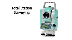
 Components of total station
 Hypotenusal allowance in surveying
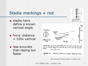
 Stadia hairs in surveying
 Introduction to surveying
 Miguel morayta rizal
 Methods of establishing control points in surveying
 Magnetic compass principle
 Tie line in surveying
 Pacing formula(surveying)
 Tacheometry
 Linear measurement in surveying
 Types of planimeter
 Vertical distance measurement in surveying
 Bench mark (bm)
 Hypotenusal allowance
 Surveying merit badge worksheet
 Least square method in surveying
 Consecutive coordinates and independent coordinates
 Legal and general surveyors natwest
 What is reiteration method in surveying
 Rapid static gps surveying
 Hypotenusal allowance
 What is dotting on in quantity surveying
 Tacheometry surveying
 Vishal manghnani
 Repetition method in theodolite surveying
 Basics of surveying
 Steps in triangulation surveying
 Direct method of distance measurement
 Hk 1980 grid
 Rl surveying term
 Uesi surveying & geomatics conference
