Subsidence Mapping in Harris County Texas Taryn Tigges

Subsidence Mapping in Harris County, Texas Taryn Tigges CE 394 K – GIS in Water Resources Fall 2012

Project Background
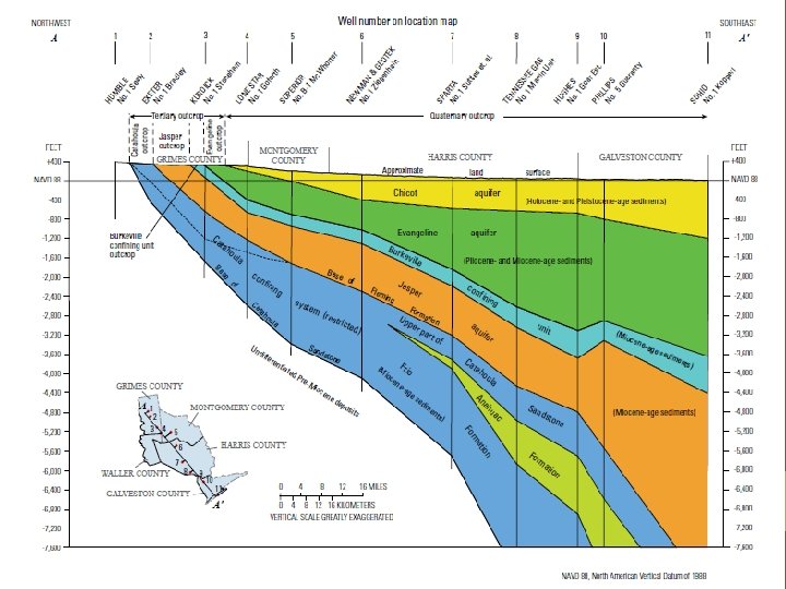

Compaction

Methods: Water Level Mapping Create geodatabase Import wells and water level measurements Distinguish well types Assign Hydro. IDs Create transient data feature set Create Graphs of Transient Clay Compaction Measurements Create Time Series Statistics for Specific Time Intervals Interpolate water levels to create rasters Create animation of water level rasters Obtain and format data

Data Sources Water Levels Groundwater Database Reports were obtained from the Texas Water Development Board website. These tables contain data on the GIS coordinates of the wells and the water levels recorded in each well as far back as 1921. Base Maps The shapefile for the counties of Texas was obtained from Geospatial Data Gateway, which contains county shapefiles under NRCS Counties by State. Shapefiles of the major aquifers of Texas, including the Gulf Coast Aquifer, can be found at the Texas Water Development Board website.

Model

Well Types Code M O P R S T W Well Type Mine Observation Oil or Gas Recharge Spring Test hole Withdrawal

Frequency of Water Level Meaurements


Water Levels in Harris County 1980 - 2011

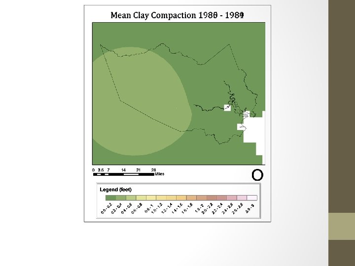
Methods: Clay Compaction Mapping Obtain and format data Create geodatabase Import monitoring points and clay compaction measurements Create transient data feature set Create Graphs of Transient Clay Compaction Measurements Create Time Series Statistics for Specific Time Intervals Interpolate Clay Compaction Measurements to create rasters

Data Sources Clay Compaction Measurements 11 extensometer measurements are from the USGS and the Harris Galveston Subsidence district Latitude and longitude of each site can be found at on the USGS website by going to the Groundwater Watch page

Frequency of Clay Compaction Meaurements


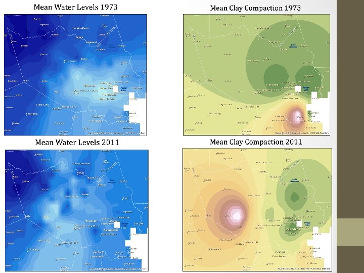

Summary • Water management has helped Houston increase groundwater levels since 1973 • Subsidence has increased in Harris County since 1973 • More monitoring points exist for water level measurements than for clay compaction measurements • Groundwater levels and subsidence are related
- Slides: 20