Streams Transport to the Oceans Chapter 18 Streams

 Rivers -- those “bigger” bodies of")


")

 depends on")

")


- Slides: 46
Streams: Transport to the Oceans Chapter 18
Streams-- all bodies of flowing water, “bayous”(? ) Rivers -- those “bigger” bodies of flowing water, e. g. Mississippi River
STREAM FLOW Why is it dangerous to row across the Mississippi? shearing ~100 feet
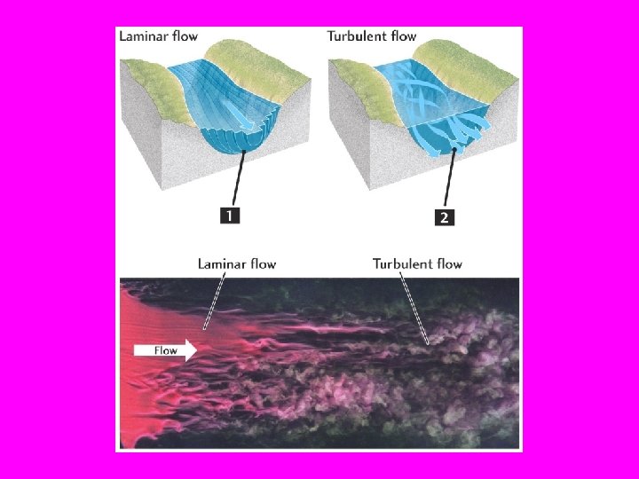
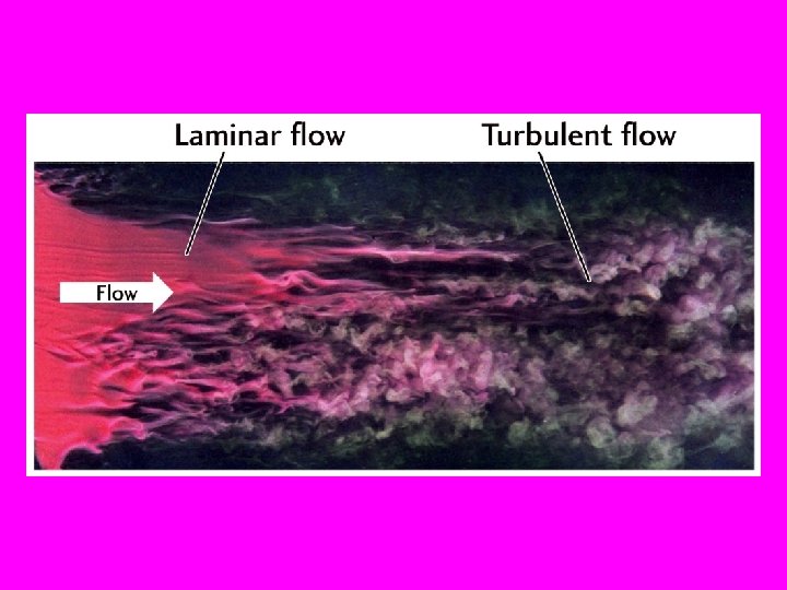
Turbulent Flow • Particles have paths that are no longer straight or gently curved (laminar flow) • Particle paths cross each other Turbulence occurs best when the fluid is of low viscosity and fast moving
In water, turbulence begins when the velocity becomes too high Shallow, slow FASTER laminar flow Away from the edges, where is the water more turbulent along the surface of river? Where is the velocity highest?
What are the consequences of Turbulent vs. Laminar Flow in Earth Science? ? Laminar flow can lift and carry only the smallest and lightest of clay particles, that are not stuck together. Turbulent flow: • can move clay, pebbles and cobble stones • can pick up a sand particle for a little way and then drop it (saltation)
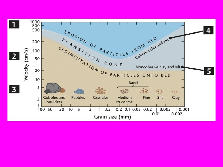
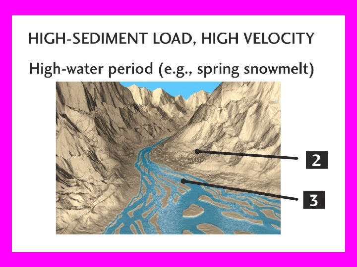
A stream can transport 2 types of sedimentary load depending on water speed: • Bed Load-- Sand, Gravel, Boulders, sliding and rolling along the bottom • Suspended Load--Clay, mainly within the water
Speed of water and erodability 1 cm/s =. 01 m/s x 3600 s per hour = 36 m/hour Boulders are moved at speeds in excess of 500 cm/s, 500 cm/s = 5 m/s x 3600 s per hour = 18, 000 m/hr or 18 km/hr In the Mississippi River in front of Baton Rouge At 8 km/hr we have a speed of 800, 000 cm per 3, 600 s, that is 222 cm/s
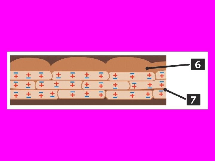
Rebellious Attraction by Clay!! Q. Clay particles disobey our intuition. Why? A. Because clay particles become sticky as a result of: • electrical attraction between clay particles and • water tension between clay particles
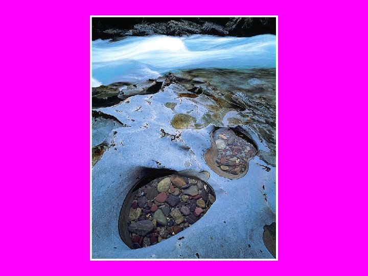
STREAM EROSION How can streams erode a hard rocky bottom? By ABRASION: “sandblasting” or by the impact of particles against the rock bed e. g. , potholes
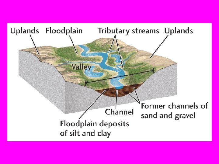
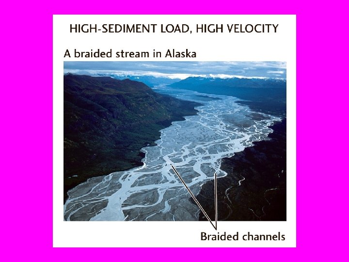
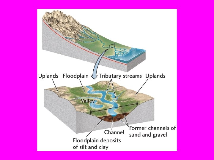
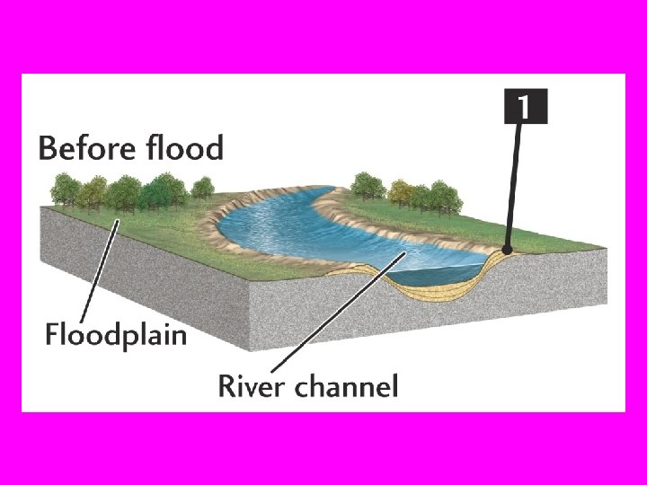
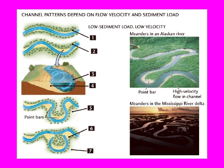
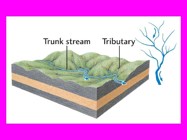
STREAM VALLEY ANATOMY Channels and Floodplains Braided Channels: In periods of low stream flow, the stream consists of many small channels. Water easily erodes the banks to form the small channels. Meandering Channels: (Between floods), the water flows along snakelike curves
(Rogers, 2005)
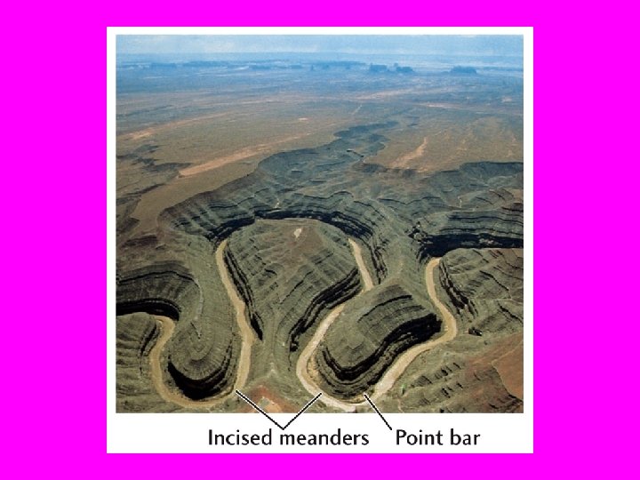
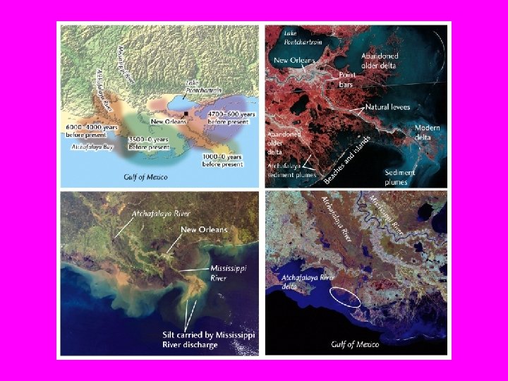
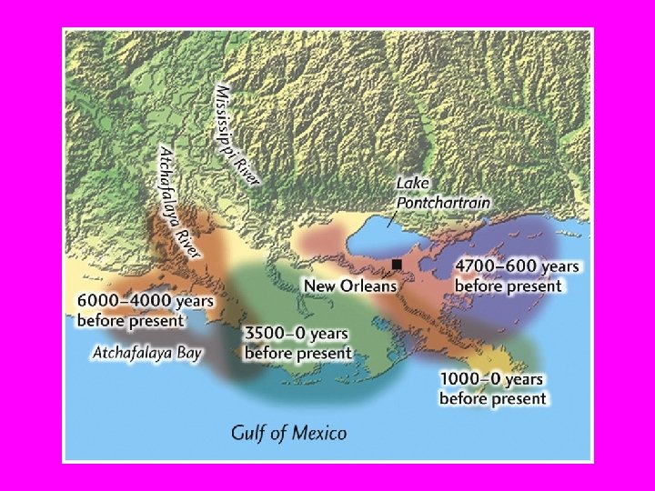
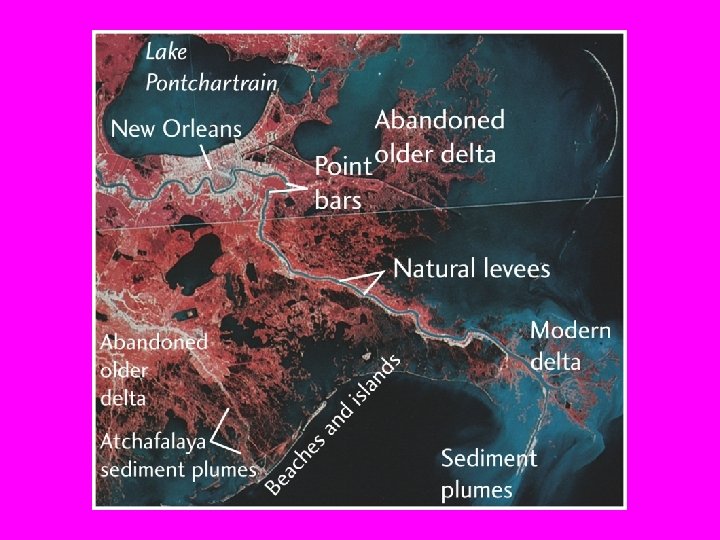
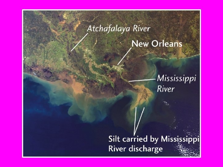
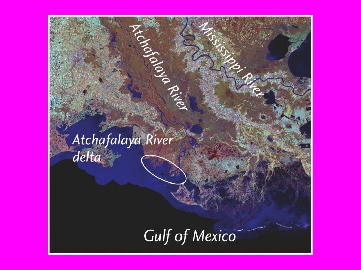
RIVER MEANDERS Some of the best studied meanders in the world are from Louisiana
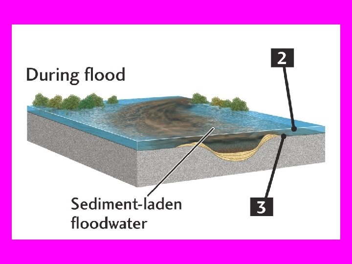
Competence of the water (ability to carry grains of a certain size) depends on the speed of the water • As fast water leaves the river and enters the flood plain the same volume of water must spread out over a larger area. At that point the speed of the water drops. • As the speed of the water drops the competence of the water is reduced and the relatively larger particles that may be in turbulent suspension drop out.
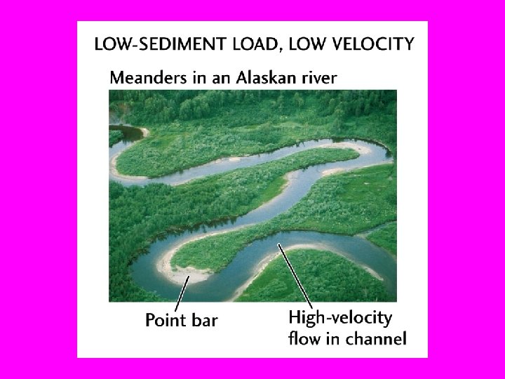
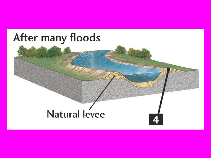
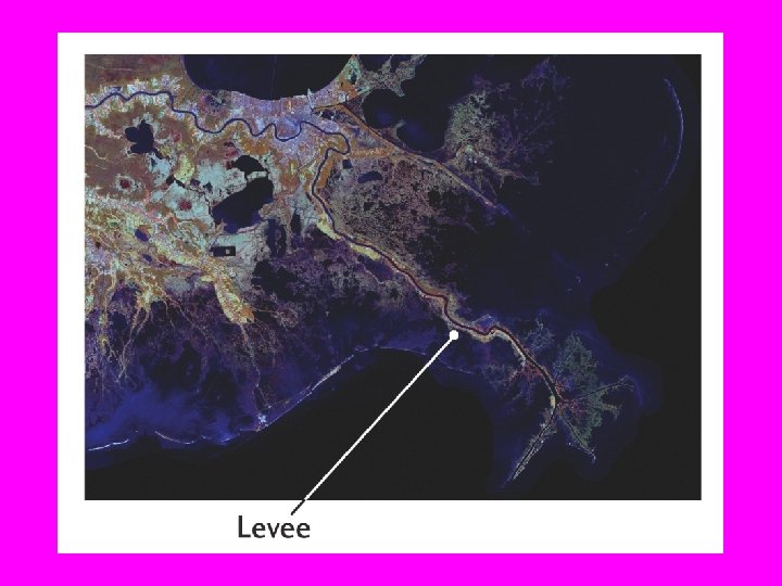
Types of river forms • levees form from repeated floods • point bars form on the slow, inside bend of the meander • oxbow lakes form when a meander neck is cut-off
(Rogers, 2005)
How can we lessen the effects flooding? Let’s discuss the feasibility of: • Not building on the floodplain • Creating artificial levees • Shortening the river (e. g. USACE has shortened Mississippi river by ~243 km)
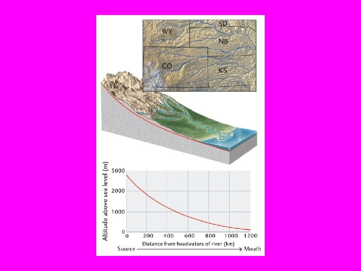
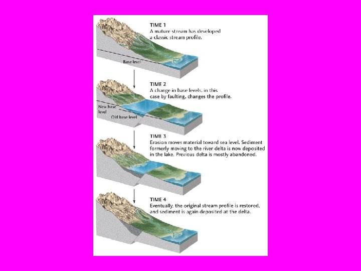
Longitudinal Profile In general, river valleys tend to develop smooth crosssections which are concave-upward. • The profile (longitudinal profile) is steepest in the uplands portion where erosion is strong. At its lower reaches the slope is lesser and there is more sedimentation. • If sea-level drops the lower reaches of the river are steepened and in order to regain a “normal” longitudinal profile the river begins to erode from the lower reaches to the uplands (headward erosion) • When an “equilibirum” or steady-state, non-changing profile is regained, we also say that the stream is a “graded” stream.
In Louisiana, many of our former flood plains have been incised or cut. That is the former floodplains are now higher with respect to the present-day river. We call these areas terraces.