STRATIGRAPHIC SEQUENCES IN THE CAROLINA COASTAL PLAIN DELINEATED
- Slides: 10
STRATIGRAPHIC SEQUENCES IN THE CAROLINA COASTAL PLAIN DELINEATED FROM WELL DATA Rick Diecchio George Mason University
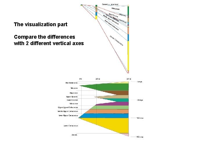
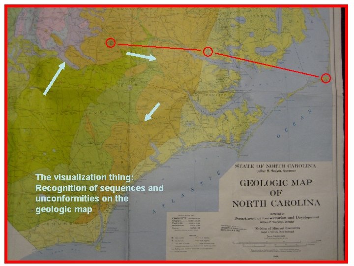
OBJECTIVES • Visualization in 4 -dimensions • Comparison of stratigraphy with respect to thickness and time • Recognition of stratigraphic information on a geologic map
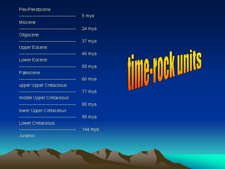
Plio-Pleistocene -------------------Miocene -------------------Oligocene -------------------Upper Eocene -------------------Lower Eocene -------------------Paleocene -------------------upper Upper Cretaceous -------------------middle Upper Cretaceous -------------------lower Upper Cretaceous -------------------Lower Cretaceous -------------------Jurassic 5 mya 24 mya 37 mya 46 mya 58 mya 66 mya 77 mya 88 mya 98 mya 144 mya
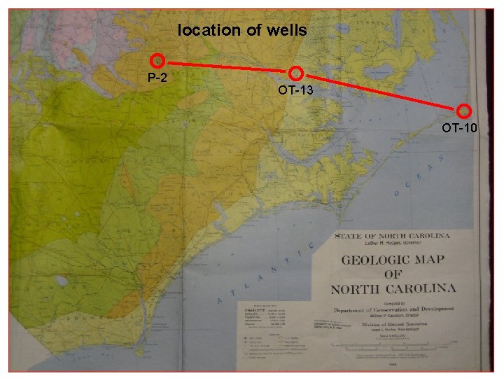
location of wells P-2 OT-13 OT-10
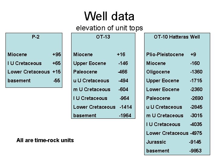
Well data elevation of unit tops P-2 OT-13 OT-10 Hatteras Well Miocene +95 Miocene +16 Plio-Pleistocene +9 l U Cretaceous +65 Upper Eocene -146 Miocene -160 Lower Cretaceous +15 Paleocene -466 Oligocene -1360 basement u U Cretaceous -494 Upper Eocene -1715 m U Cretaceous -604 Lower Eocene -2360 l U Cretaceous -964 Paleocene -2690 Lower Cretaceous -1414 u U Cretaceous -2845 basement m U Cretaceous -3015 l U Cretaceous -4035 -55 -1964 Lower Cretaceous -4975 All are time-rock units Jurassic -9145 basement -9853
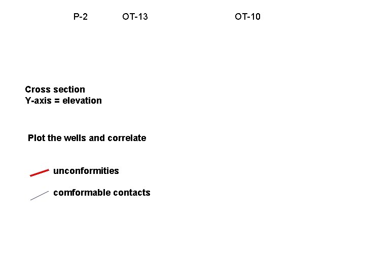
P-2 OT-13 Cross section Y-axis = elevation Plot the wells and correlate unconformities comformable contacts OT-10
Correlation diagram Vertical axis = time Must be consistent with cross-section
The visualization part Compare the differences with 2 different vertical axes
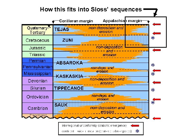
How this fits into Sloss’ sequences
The visualization thing: Recognition of sequences and unconformities on the geologic map