Strategic Ranchlands at Risk in the Rocky Mountain


- Slides: 24
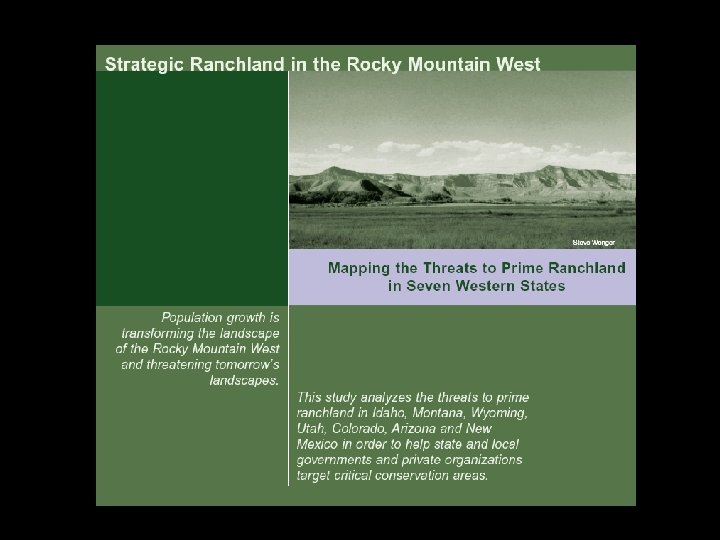
Strategic Ranchlands at Risk in the Rocky Mountain West
Strategic Ranchlands at Risk in the Rocky Mountain West Mapping Threats to Prime Ranchland in Seven Western States
Urban Areas - Urban - Suburban - Exurban Federal Lands
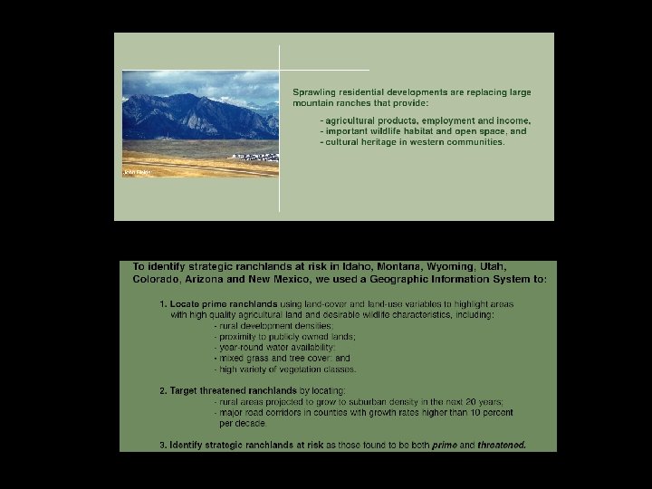
Vegetation Classes Derived from Satellite Remote Sensing Data
Vegetative Variety Count of Landscape Scale Vegetative and Land Cover Classes
Productive Habitat Forest-Grassland Mosaic
Private Lands in Vicinity of Federal Land
Perennial Streams Areas in vicinity of major perennial streams
Prime Ranchland • • Vegetative Diversity Productive Habitat Perennial Streams Proximity to Public Land
Population Density And Growth Rate Distributions Counties with High Growth Rates
Roadways Areas in the Vicinity of Major Roadways
Counties with High Growth Rates Major Roadways Growth Corridors
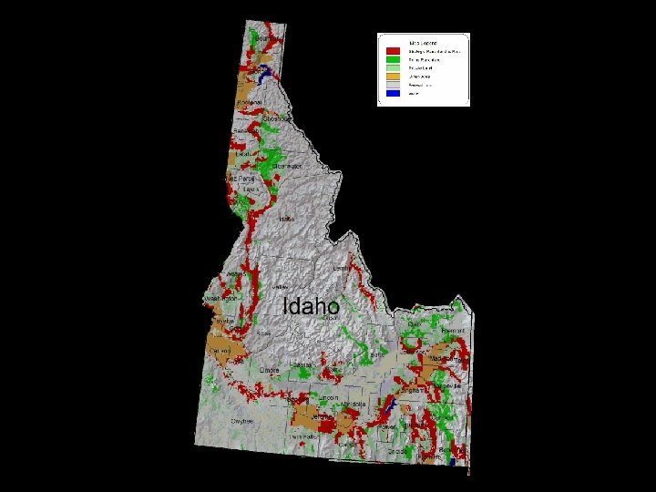
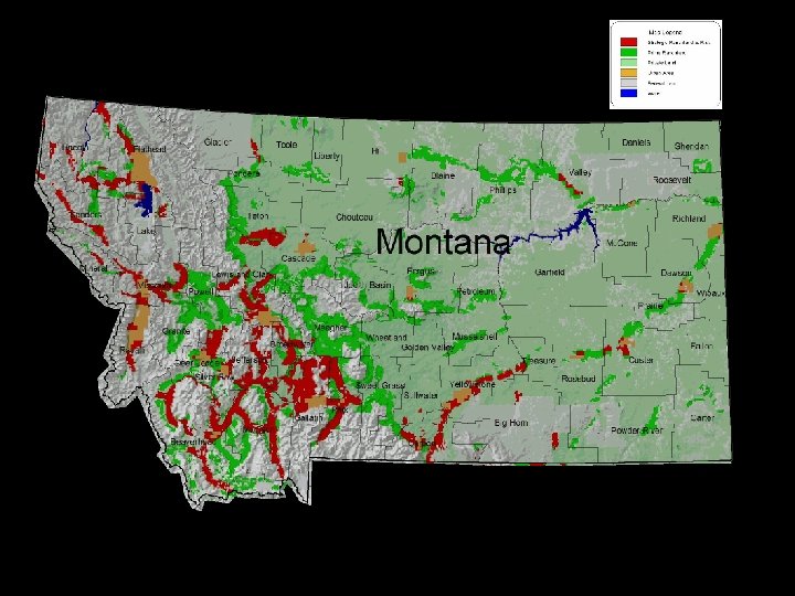
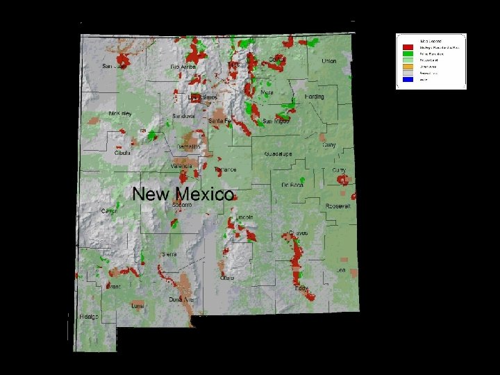
Strategic Ranchlands at Risk in the Rocky Mountain West Strategic Ranchland At Risk
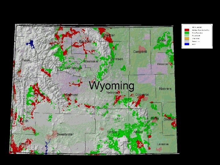
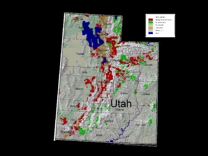
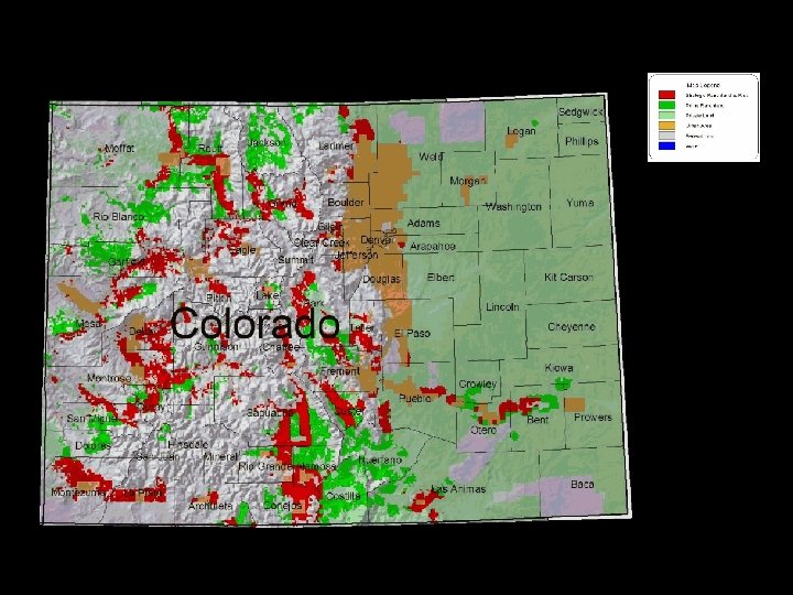
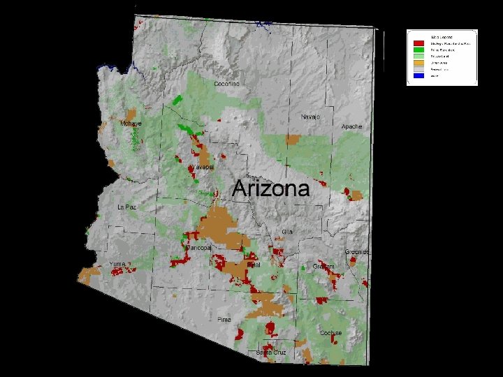
Total Acres of Strategic Ranchland at Risk by State
Strategic Ranchland at Risk in 25 Rocky Mountain Counties, 1 2000 -2020 1 Top 25 of 263 counties in the seven-state area. 2 Ranking based on total prime ranchland area found to be threatened.