Storm Surge Definitions STORM SURGE is the increase

 DUNE LOW TIDE")


- Slides: 21
Storm Surge Definitions: • STORM SURGE is the increase in water level due to a storm (hurricane) • STORM TIDE is the total water level measured above a reference datum during a storm (the combination of astronomical tide and storm surge). • EXTRATROPICAL STORM SURGE is the storm surge due to a storm that forms outside of the tropics. A typical example would be a “Nor’Easter”. 2
Tide with Storm Surge STORM SURGE HIGH TIDE MEAN TIDE (MSL) DUNE LOW TIDE
DEEP WATER a. Top view of Sea Surface A B b. Side view of Cross Section “ABC” C Wind Eye A B 0’ 5 O’ 100’ 150’ 200’ Current C MSL
LANDFALL a. Top view of Sea Surface and Land A B C b. Side view of Cross Section “ABC” Sand Dunes on Barrier Wind Island STORM SURGE Wind Eye MSL 0’ A 5 O’ B Current 100’ 150’ 200’ Mainland Barrier Island Continental Shelf C
Sub-grid elements: Individual Grid • 1 dimensional flow for rivers and streams Barrier • Barriers • Cuts between barriers Water Surface above a square • Channel flow with chokes and expansions Transport Points Stair Step Rise • Increased friction for trees and mangroves Water Depth above a square Surge Points DATUM
9
12
13
14
15
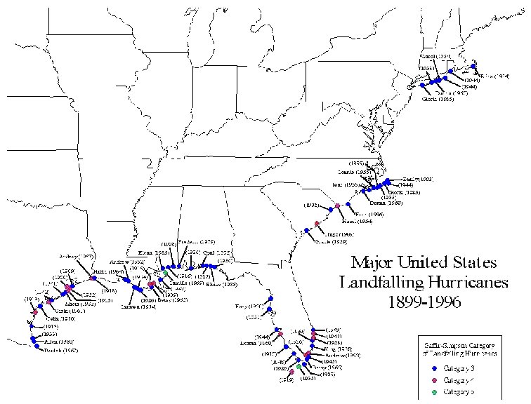
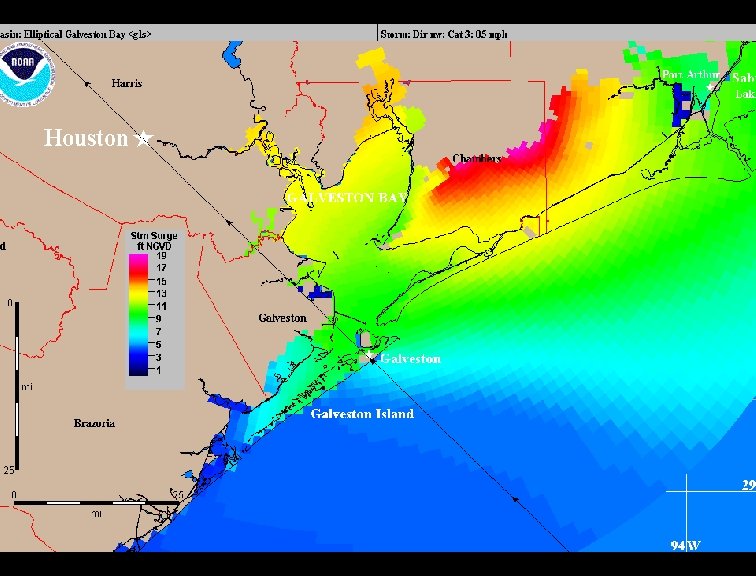
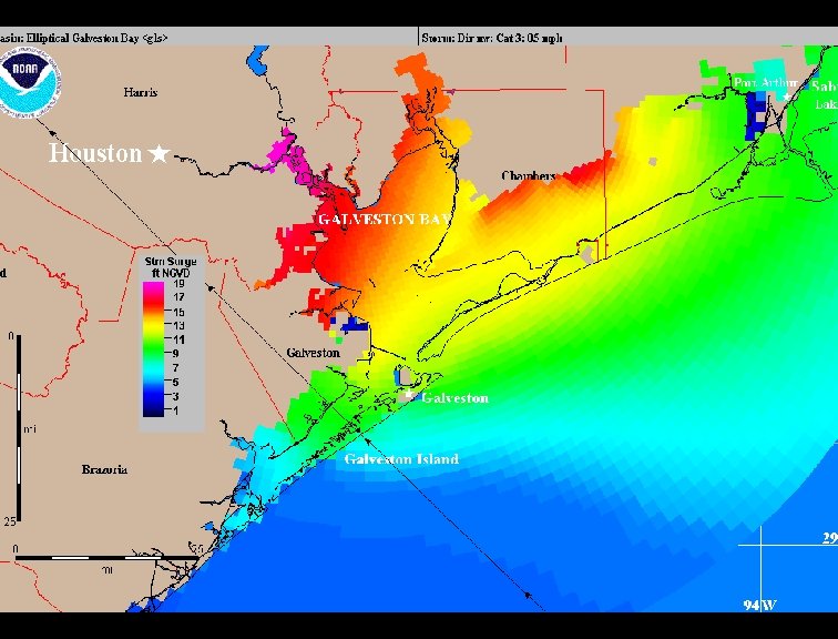
SLOSH Basins 17
Wind Input To SLOSH • Embedded parametric hurricane wind model requires: – TRACK Positions - Latitude & Longitude – INTENSITY of the Storm - (change in pressure) (not observed wind speed) – SIZE of the Storm - Radius of maximum wind • Wind Model solves a differential equation for wind speed and direction • Forward speed is incorporated into asymmetry. • Advantages: – Universal (not “calibrated” to location) – Utilizes “forecastable” hurricane parameters (Does have errors) – Tested on many past hurricanes 18
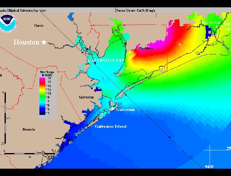
SLOSH Model runs and creates a rexfile and an “envelope of high water”. The “Envelope” is the highest the water got in a particular grid cell during the Model run. Designed for use with hurricane evacuation planning – MEOW: Maximum Envelope of Water • Highest water due to a family of parallel tracks with same direction, speed and intensity – MOM: Maximum of MEOWs • Highest water due to a set of MEOWs. • Rex File: Enables us to start to use it for real-time storm surge forecasting. (only used about 12 hours before projected landfall) – FEMA HLT (Hurricane Liaison Team) – Intent is for first response and recovery – Convert envelope in real time to ESRI Arc. GIS. shp files • Used as input to hydrology’s DWOPER river model • Historical hurricane runs 19