Storm Prediction Center Severe Weather Outlooks Tools Verification
- Slides: 27

Storm Prediction Center Severe Weather Outlooks, Tools, & Verification Greg Carbin, Warning Coordination Meteorologist NOAA/National Weather Service Storm Prediction Center Workshop on Severe Convection and Climate – Int’l Research Institute for Climate and Society, The Lamont-Doherty Earth Observatory – Mar. 14 -15, 2013

SPC Mission Statement “SPC exists to protect life and property of the American people through the issuance of timely and accurate watch and forecast products dealing with tornadoes and other mesoscale hazardous weather. ” Workshop on Severe Convection and Climate – Int’l Research Institute for Climate and Society, The Lamont-Doherty Earth Observatory – Mar. 14 -15, 2013

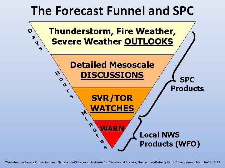
The Forecast Funnel and SPC D a y s Thunderstorm, Fire Weather, Severe Weather OUTLOOKS H o Detailed Mesoscale DISCUSSIONS u r s M i SVR/TOR WATCHES n u t WARN e s SPC Products Local NWS Products (WFO) Workshop on Severe Convection and Climate – Int’l Research Institute for Climate and Society, The Lamont-Doherty Earth Observatory – Mar. 14 -15, 2013

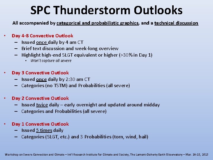
SPC Thunderstorm Outlooks All accompanied by categorical and probabilistic graphics, and a technical discussion • Day 4 -8 Convective Outlook – Issued once daily by 4 am CT – Brief text discussion and week-long overview – Highlight high-end SLGT equivalent or higher (>30% in Day 1) • Won’t capture all severe • Day 3 Convective Outlook – Issued once daily by 2: 30 am CT – Categories (no TSTM) and Probabilities (all severe) • Day 2 Convective Outlook – Issued twice daily – early overnight and updated around midday – Categories and Probabilities (all severe) • Day 1 Convective Outlook – Issued 5 times daily – Categories (SLGT, etc. ) and 3 Probabilities (torn, wind, hail) Workshop on Severe Convection and Climate – Int’l Research Institute for Climate and Society, The Lamont-Doherty Earth Observatory – Mar. 14 -15, 2013

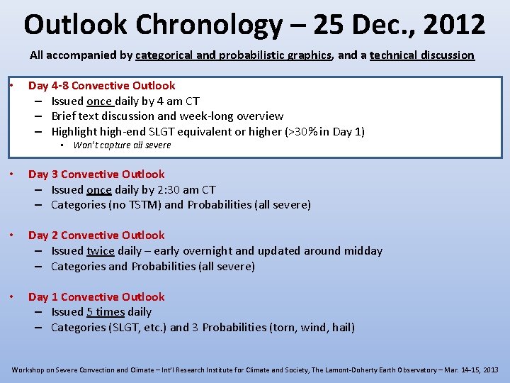
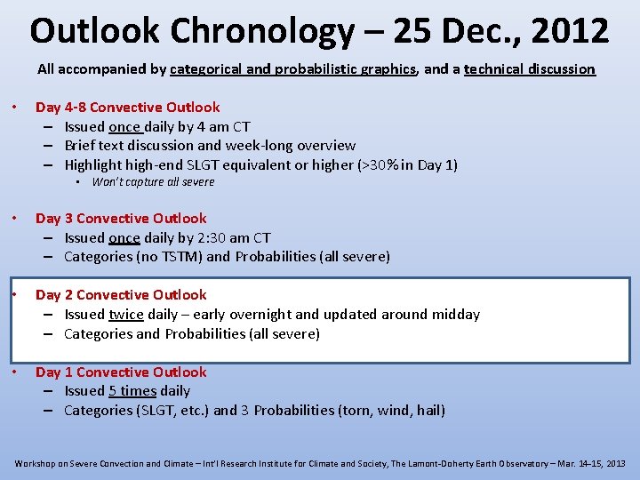
Outlook Chronology – 25 Dec. , 2012 All accompanied by categorical and probabilistic graphics, and a technical discussion • Day 4 -8 Convective Outlook – Issued once daily by 4 am CT – Brief text discussion and week-long overview – Highlight high-end SLGT equivalent or higher (>30% in Day 1) • Won’t capture all severe • Day 3 Convective Outlook – Issued once daily by 2: 30 am CT – Categories (no TSTM) and Probabilities (all severe) • Day 2 Convective Outlook – Issued twice daily – early overnight and updated around midday – Categories and Probabilities (all severe) • Day 1 Convective Outlook – Issued 5 times daily – Categories (SLGT, etc. ) and 3 Probabilities (torn, wind, hail) Workshop on Severe Convection and Climate – Int’l Research Institute for Climate and Society, The Lamont-Doherty Earth Observatory – Mar. 14 -15, 2013

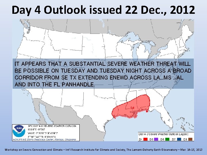
Day 4 Outlook issued 22 Dec. , 2012 IT APPEARS THAT A SUBSTANTIAL SEVERE WEATHER THREAT WILL BE POSSIBLE ON TUESDAY AND TUESDAY NIGHT ACROSS A BROAD CORRIDOR FROM SE TX EXTENDING ENEWD ACROSS LA. . . MS. . . AL AND INTO THE FL PANHANDLE. Workshop on Severe Convection and Climate – Int’l Research Institute for Climate and Society, The Lamont-Doherty Earth Observatory – Mar. 14 -15, 2013

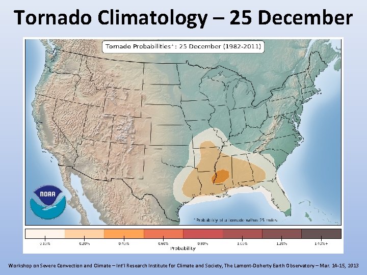
Tornado Climatology – 25 December Workshop on Severe Convection and Climate – Int’l Research Institute for Climate and Society, The Lamont-Doherty Earth Observatory – Mar. 14 -15, 2013

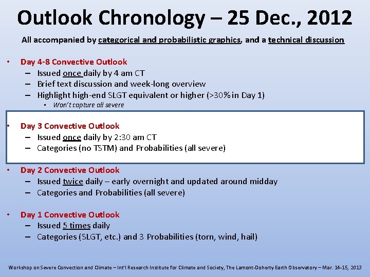
Outlook Chronology – 25 Dec. , 2012 All accompanied by categorical and probabilistic graphics, and a technical discussion • Day 4 -8 Convective Outlook – Issued once daily by 4 am CT – Brief text discussion and week-long overview – Highlight high-end SLGT equivalent or higher (>30% in Day 1) • Won’t capture all severe • Day 3 Convective Outlook – Issued once daily by 2: 30 am CT – Categories (no TSTM) and Probabilities (all severe) • Day 2 Convective Outlook – Issued twice daily – early overnight and updated around midday – Categories and Probabilities (all severe) • Day 1 Convective Outlook – Issued 5 times daily – Categories (SLGT, etc. ) and 3 Probabilities (torn, wind, hail) Workshop on Severe Convection and Climate – Int’l Research Institute for Climate and Society, The Lamont-Doherty Earth Observatory – Mar. 14 -15, 2013

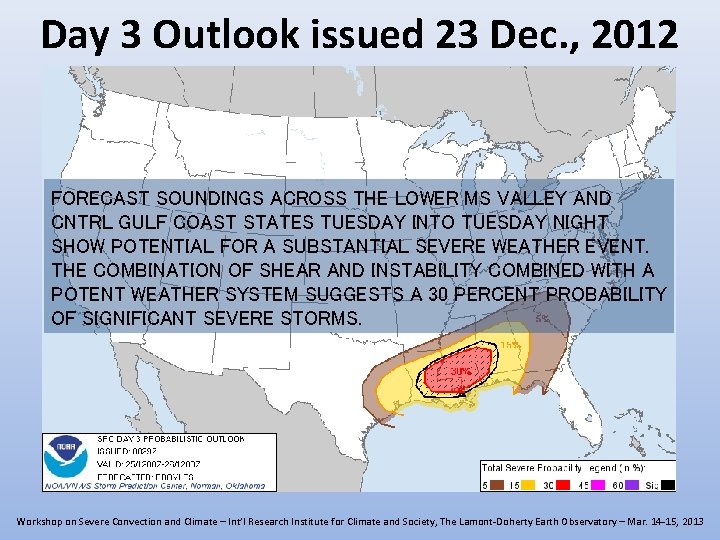
Day 3 Outlook issued 23 Dec. , 2012 FORECAST SOUNDINGS ACROSS THE LOWER MS VALLEY AND CNTRL GULF COAST STATES TUESDAY INTO TUESDAY NIGHT SHOW POTENTIAL FOR A SUBSTANTIAL SEVERE WEATHER EVENT. THE COMBINATION OF SHEAR AND INSTABILITY COMBINED WITH A POTENT WEATHER SYSTEM SUGGESTS A 30 PERCENT PROBABILITY OF SIGNIFICANT SEVERE STORMS. Workshop on Severe Convection and Climate – Int’l Research Institute for Climate and Society, The Lamont-Doherty Earth Observatory – Mar. 14 -15, 2013

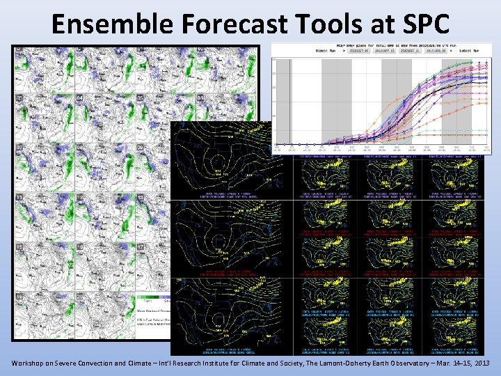
Ensemble Forecast Tools at SPC Workshop on Severe Convection and Climate – Int’l Research Institute for Climate and Society, The Lamont-Doherty Earth Observatory – Mar. 14 -15, 2013

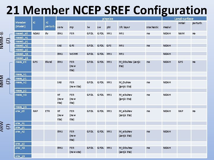
ARW (7) NMM-B (7) 21 Member NCEP SREF Configuration Member (Model) IC nmmb_ctl nmmb_n 1 nmmb_p 1 nmmb_n 2 nmmb_p 2 nmmb_n 3 nmmb_p 3 nmm_ctl NDAS physics IC perturb. conv mp lw sw BV BMJ FER GFDL SAS GFS BMJ Sfc layer stochastic model GFDL MYJ no NOAH GFDL GFS MYJ no NOAH WSM 6 GFDL MYJ BMJ FER (new Eta) GFDL MYJ M_Obuhov (Janjic Eta) no NOAH SAS FER (new Eta) GFDL MYJ M_Ouhov (janjic Eta) no NOAH KF (new Eta) FER (new Eta) GFDL MYJ M_obuhov (Janjic Eta) no NOAH arw_n 1 arw_p 1 arw_n 2 BMJ FER (new Eta) GFDL MYJ M_obuhov (Janjic Eta) no NOAH arw_p 2 arw_n 3 BMJ FER (new eta) GFDL MYJ M_Obuhov (Janjic Eta) no NOAH GFS Blend nmm_n 1 nmm_p 1 nmm_n 2 nmm_p 2 nmm_n 3 nmm_p 3 arw_ctl arw_p 3 RAP ETR pbl Land surface initial perturb. NAM no GFS no RAP no NOAH

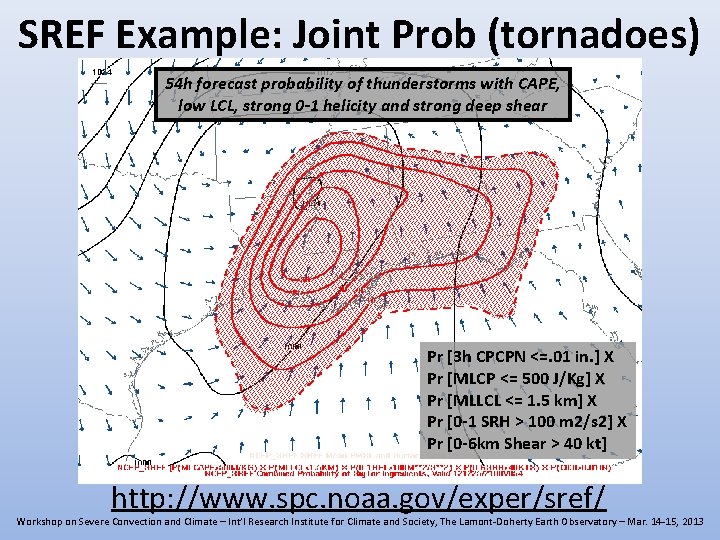
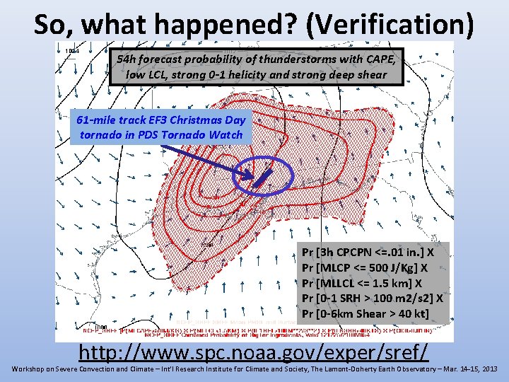
SREF Example: Joint Prob (tornadoes) 54 h forecast probability of thunderstorms with CAPE, low LCL, strong 0 -1 helicity and strong deep shear Pr [3 h CPCPN <=. 01 in. ] X Pr [MLCP <= 500 J/Kg] X Pr [MLLCL <= 1. 5 km] X Pr [0 -1 SRH > 100 m 2/s 2] X Pr [0 -6 km Shear > 40 kt] http: //www. spc. noaa. gov/exper/sref/ Workshop on Severe Convection and Climate – Int’l Research Institute for Climate and Society, The Lamont-Doherty Earth Observatory – Mar. 14 -15, 2013

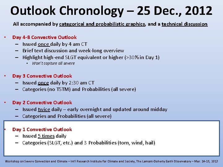
Outlook Chronology – 25 Dec. , 2012 All accompanied by categorical and probabilistic graphics, and a technical discussion • Day 4 -8 Convective Outlook – Issued once daily by 4 am CT – Brief text discussion and week-long overview – Highlight high-end SLGT equivalent or higher (>30% in Day 1) • Won’t capture all severe • Day 3 Convective Outlook – Issued once daily by 2: 30 am CT – Categories (no TSTM) and Probabilities (all severe) • Day 2 Convective Outlook – Issued twice daily – early overnight and updated around midday – Categories and Probabilities (all severe) • Day 1 Convective Outlook – Issued 5 times daily – Categories (SLGT, etc. ) and 3 Probabilities (torn, wind, hail) Workshop on Severe Convection and Climate – Int’l Research Institute for Climate and Society, The Lamont-Doherty Earth Observatory – Mar. 14 -15, 2013

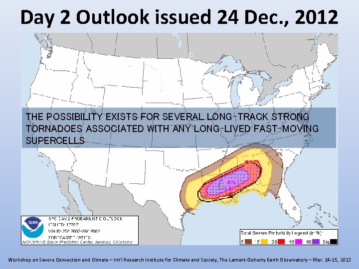
Day 2 Outlook issued 24 Dec. , 2012 THE POSSIBILITY EXISTS FOR SEVERAL LONG-TRACK STRONG TORNADOES ASSOCIATED WITH ANY LONG-LIVED FAST-MOVING SUPERCELLS Workshop on Severe Convection and Climate – Int’l Research Institute for Climate and Society, The Lamont-Doherty Earth Observatory – Mar. 14 -15, 2013

Outlook Chronology – 25 Dec. , 2012 All accompanied by categorical and probabilistic graphics, and a technical discussion • Day 4 -8 Convective Outlook – Issued once daily by 4 am CT – Brief text discussion and week-long overview – Highlight high-end SLGT equivalent or higher (>30% in Day 1) • Won’t capture all severe • Day 3 Convective Outlook – Issued once daily by 2: 30 am CT – Categories (no TSTM) and Probabilities (all severe) • Day 2 Convective Outlook – Issued twice daily – early overnight and updated around midday – Categories and Probabilities (all severe) • Day 1 Convective Outlook – Issued 5 times daily – Categories (SLGT, etc. ) and 3 Probabilities (torn, wind, hail) Workshop on Severe Convection and Climate – Int’l Research Institute for Climate and Society, The Lamont-Doherty Earth Observatory – Mar. 14 -15, 2013

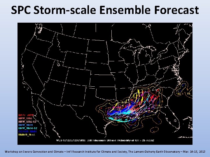
SPC Storm-scale Ensemble Forecast Workshop on Severe Convection and Climate – Int’l Research Institute for Climate and Society, The Lamont-Doherty Earth Observatory – Mar. 14 -15, 2013

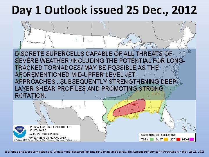
Day 1 Outlook issued 25 Dec. , 2012 DISCRETE SUPERCELLS CAPABLE OF ALL THREATS OF SEVERE WEATHER /INCLUDING THE POTENTIAL FOR LONGTRACKED TORNADOES/ MAY BE POSSIBLE AS THE AFOREMENTIONED MID-UPPER LEVEL JET APPROACHES. . . SUBSEQUENTLY STRENGTHENING DEEP LAYER SHEAR PROFILES AND PROMOTING STRONG ROTATION. Workshop on Severe Convection and Climate – Int’l Research Institute for Climate and Society, The Lamont-Doherty Earth Observatory – Mar. 14 -15, 2013

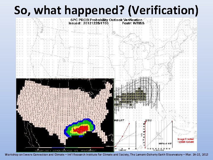
So, what happened? (Verification) Workshop on Severe Convection and Climate – Int’l Research Institute for Climate and Society, The Lamont-Doherty Earth Observatory – Mar. 14 -15, 2013

So, what happened? (Verification) 54 h forecast probability of thunderstorms with CAPE, low LCL, strong 0 -1 helicity and strong deep shear 61 -mile track EF 3 Christmas Day tornado in PDS Tornado Watch Pr [3 h CPCPN <=. 01 in. ] X Pr [MLCP <= 500 J/Kg] X Pr [MLLCL <= 1. 5 km] X Pr [0 -1 SRH > 100 m 2/s 2] X Pr [0 -6 km Shear > 40 kt] http: //www. spc. noaa. gov/exper/sref/ Workshop on Severe Convection and Climate – Int’l Research Institute for Climate and Society, The Lamont-Doherty Earth Observatory – Mar. 14 -15, 2013

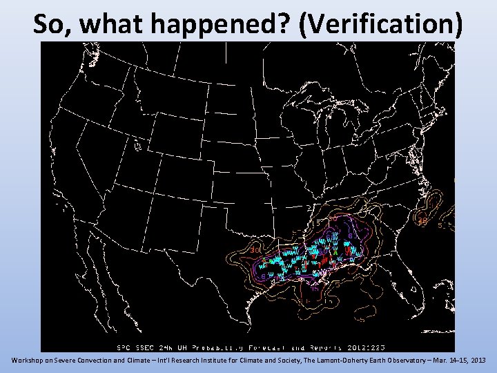
So, what happened? (Verification) Workshop on Severe Convection and Climate – Int’l Research Institute for Climate and Society, The Lamont-Doherty Earth Observatory – Mar. 14 -15, 2013

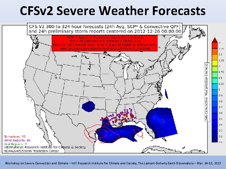
CFSv 2 Severe Weather Forecasts Workshop on Severe Convection and Climate – Int’l Research Institute for Climate and Society, The Lamont-Doherty Earth Observatory – Mar. 14 -15, 2013

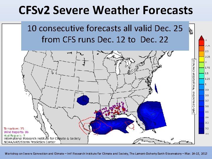
CFSv 2 Severe Weather Forecasts 10 consecutive forecasts all valid Dec. 25 from CFS runs Dec. 12 to Dec. 22 Workshop on Severe Convection and Climate – Int’l Research Institute for Climate and Society, The Lamont-Doherty Earth Observatory – Mar. 14 -15, 2013

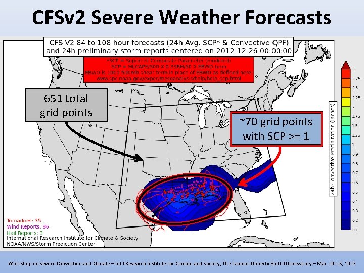
CFSv 2 Severe Weather Forecasts 651 total grid points ~70 grid points with SCP >= 1 Workshop on Severe Convection and Climate – Int’l Research Institute for Climate and Society, The Lamont-Doherty Earth Observatory – Mar. 14 -15, 2013

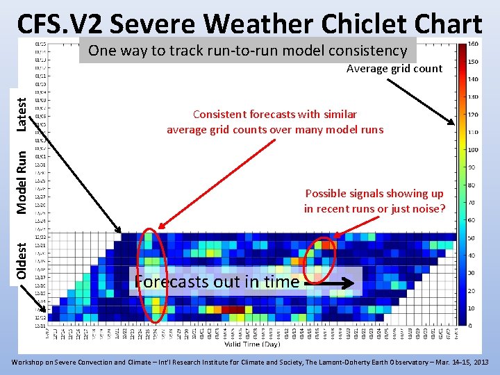
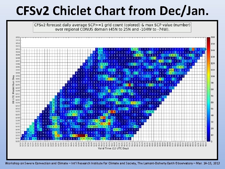
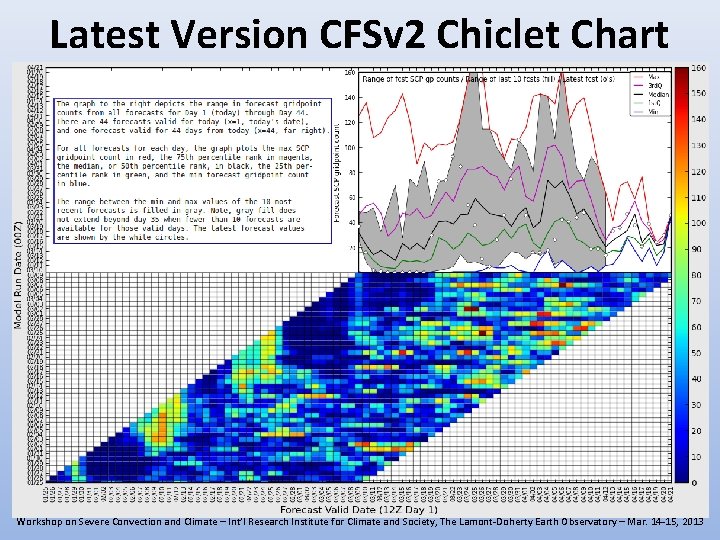
CFS. V 2 Severe Weather Chiclet Chart One way to track run-to-run model consistency Consistent forecasts with similar average grid counts over many model runs Oldest Model Run Latest Average grid count Possible signals showing up in recent runs or just noise? Forecasts out in time Workshop on Severe Convection and Climate – Int’l Research Institute for Climate and Society, The Lamont-Doherty Earth Observatory – Mar. 14 -15, 2013

CFSv 2 Chiclet Chart from Dec/Jan. Workshop on Severe Convection and Climate – Int’l Research Institute for Climate and Society, The Lamont-Doherty Earth Observatory – Mar. 14 -15, 2013

Latest Version CFSv 2 Chiclet Chart Workshop on Severe Convection and Climate – Int’l Research Institute for Climate and Society, The Lamont-Doherty Earth Observatory – Mar. 14 -15, 2013

Questions? Greg Carbin, Warning Coordination Meteorologist Gregory. Carbin@noaa. gov NOAA/National Weather Service Storm Prediction Center Workshop on Severe Convection and Climate – Int’l Research Institute for Climate and Society, The Lamont-Doherty Earth Observatory – Mar. 14 -15, 2013