
Status of the Regional OSSE for SpaceBased LIDAR
Status of the Regional OSSE for Space-Based LIDAR Winds – Feb 01 John Mc. Ginley Adrian Marroquin John Smart Linda Wharton NOAA/Forecast Systems Lab 10/16/2021 1

Goal of OSSE n Assess impact of space-borne LIDAR winds on regional weather forecasts n Compare to the Global LIDAR OSSE 10/16/2021 2
Collaborators n NOAA/ETL n LIDAR Simulation/ Data n NOAA/NWS/NCEP n n 10/16/2021 Background grids Advice 3
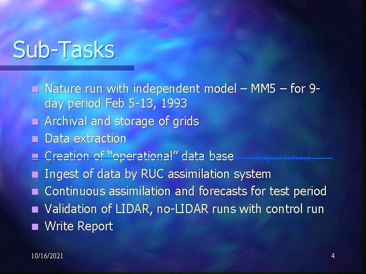
Sub-Tasks n n n n Nature run with independent model – MM 5 – for 9 day period Feb 5 -13, 1993 Archival and storage of grids Data extraction Creation of “operational” data base (progress to here) Ingest of data by RUC assimilation system Continuous assimilation and forecasts for test period Validation of LIDAR, no-LIDAR runs with control run Write Report 10/16/2021 4
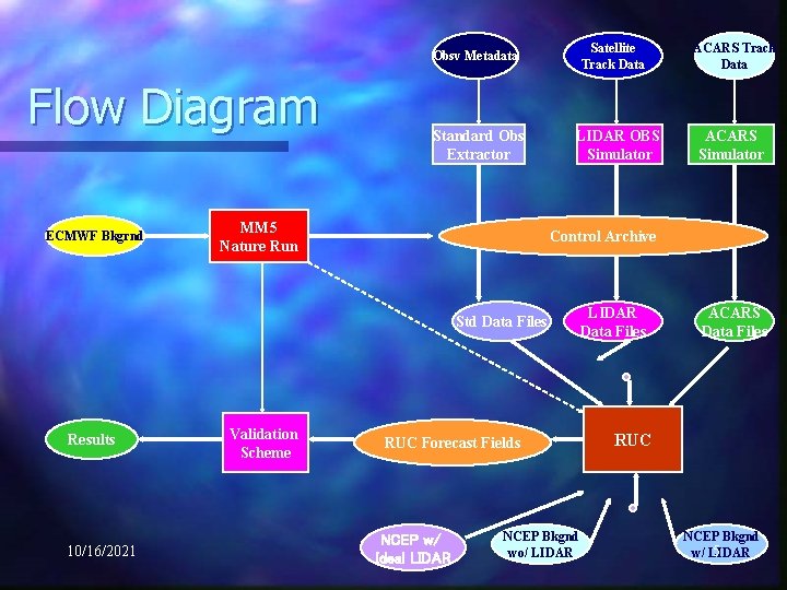
Satellite Track Data Obsv Metadata Flow Diagram ECMWF Bkgrnd Standard Obs Extractor MM 5 Nature Run LIDAR OBS Simulator 10/16/2021 Validation Scheme ACARS Simulator Control Archive Std Data Files Results ACARS Track Data RUC Forecast Fields NCEP w/ Ideal LIDAR NCEP Bkgnd wo/ LIDAR Data Files ACARS Data Files RUC NCEP Bkgnd 5 w/ LIDAR
Nature Run n n n n Case 5 -15 Feb 1993 MM 5 Model version 3. 0 n Non-Hydrostatic, complete cloud microphysics, radiation, surface processes 740 x 520 x 31 – 10 km grid – 13 variables Output every 15 minutes – 874 MB: 115 GB/day (flat files) Computer: JET - HPTi MPP (256 processor – 42 are used) Integration time: ~ 0. 8 forecast time 5 -9 Feb 1993 – Spin-up 10 -15 Feb – Output and archive every 15 -min 10/16/2021 6
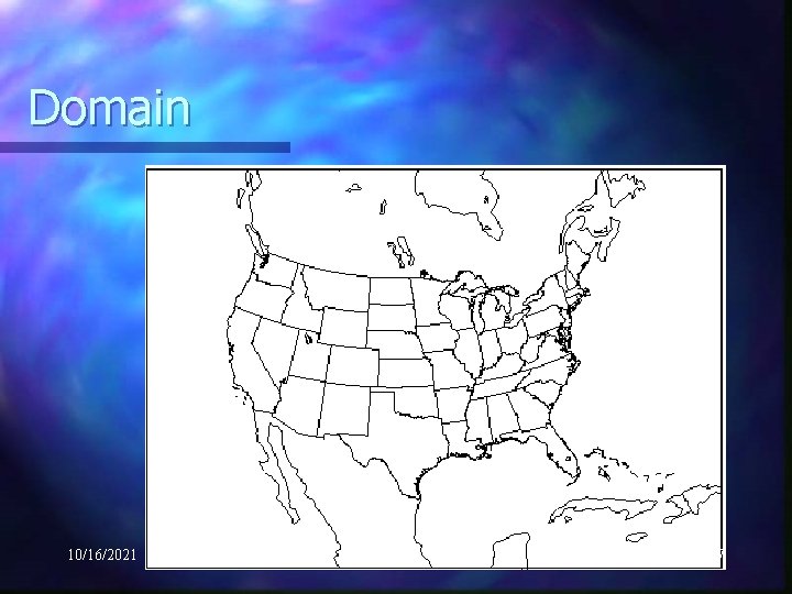
Domain 10/16/2021 7

Nature run on 9 Feb – at 5 km Satellite vis at 9/18 Z 10/16/2021 8
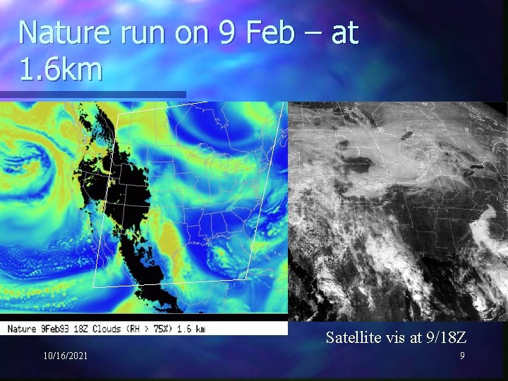
Nature run on 9 Feb – at 1. 6 km Satellite vis at 9/18 Z 10/16/2021 9
Observation Extraction Fixed Site: RAOB, Surface, Wind Profiler, Radar VAD n utilize obs generators from 1996 OSSE for KSC and VDB n Mobile Platforms: ACARS, LIDAR n Specify aircraft tracks time and space n Specify 8 -position sampling beam in time and space n Provide wind components, cloud species, droplet spectra n Modeled Error n Random instrument error n Correlated meteorological noise n n n Mean and Spatial Variance Data Files n net. CDF – identical to FSL database 10/16/2021 10
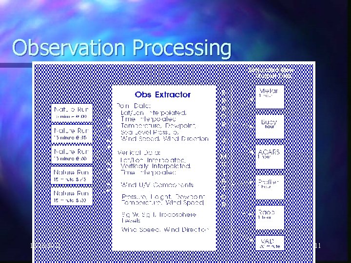
Observation Processing 10/16/2021 11
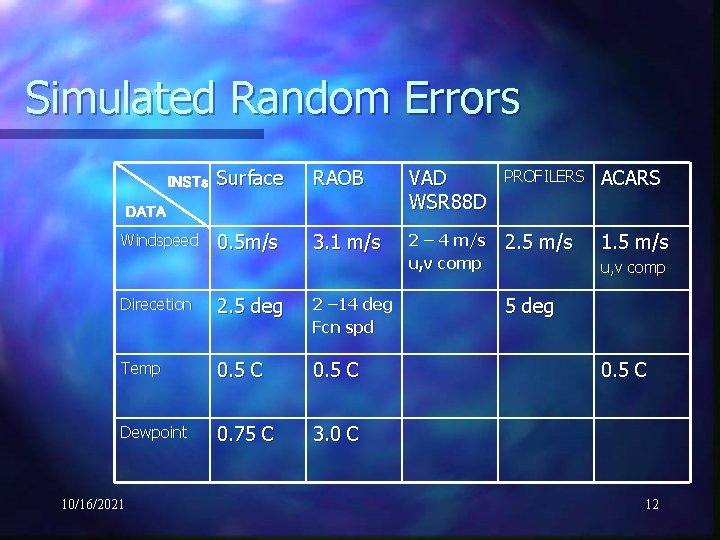
Simulated Random Errors INSTs Surface RAOB VAD WSR 88 D PROFILERS ACARS 0. 5 m/s 3. 1 m/s 2 – 4 m/s u, v comp 2. 5 m/s 1. 5 m/s DATA Windspeed Direcetion 2. 5 deg 2 – 14 deg Fcn spd Temp 0. 5 C Dewpoint 0. 75 C 3. 0 C 10/16/2021 u, v comp 5 deg 0. 5 C 12
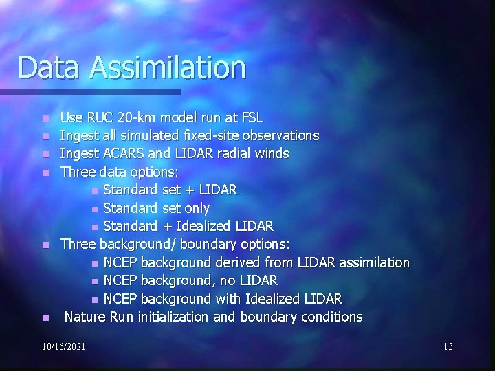
Data Assimilation n n n Use RUC 20 -km model run at FSL Ingest all simulated fixed-site observations Ingest ACARS and LIDAR radial winds Three data options: n Standard set + LIDAR n Standard set only n Standard + Idealized LIDAR Three background/ boundary options: n NCEP background derived from LIDAR assimilation n NCEP background, no LIDAR n NCEP background with Idealized LIDAR Nature Run initialization and boundary conditions 10/16/2021 13
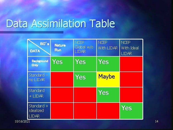
Data Assimilation Table BC’s DATA Background Only Standard – no LIDAR Standard + idealized LIDAR 10/16/2021 Nature Run Yes NCEP Global w/o LIDAR NCEP With LIDAR With Ideal LIDAR Yes Yes Maybe Yes 14
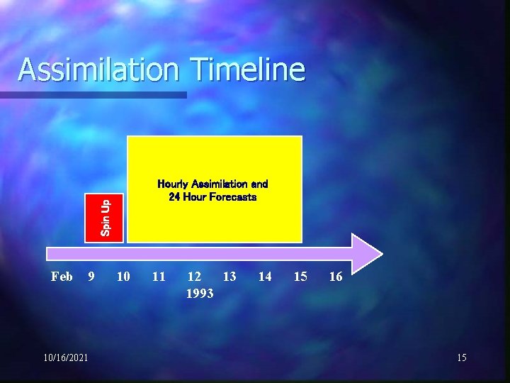
Assimilation Timeline Spin Up Hourly Assimilation and 24 Hour Forecasts Feb 9 10/16/2021 10 11 12 13 1993 14 15 16 15
Validation Procedures Compare RUC Forecasts to Nature Run Compute errors in state variables Assess precipitation skill 10/16/2021 16
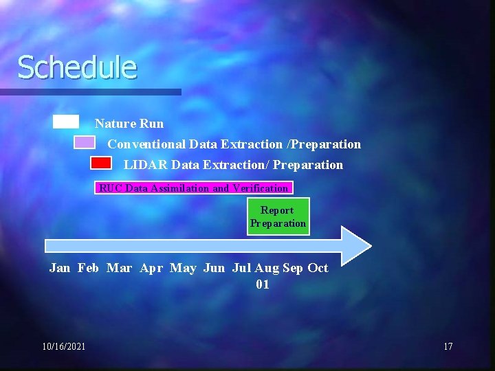
Schedule Nature Run Conventional Data Extraction /Preparation LIDAR Data Extraction/ Preparation RUC Data Assimilation and Verification Report Preparation Jan Feb Mar Apr May Jun Jul Aug Sep Oct 01 10/16/2021 17
Current Status and Accomplishments n Nature Runs and Database n Prepared ECMWF Background – Gaussian to lat/lon n Converted to MM 5 from RAMS n Set up MM 5 v 3. 0 on Jet n Completed 48 -hour run for 5 -6 Feb 1993 for data extraction n n n Provided to FSL, ETL, and Simpson Weather Associates Coordinated format for LIDAR beam position with ETL Coordinated model parameters needed for simulating LIDAR obs Modified MM 5 to compute mean and variance of all LIDAR fields – tested with convective case 28 Jun 1999 Archived representative ACARS tracks Completed Nature Run for 5 -15 Feb 1993 10/16/2021 18
Immediate goals (next few weeks) n n n Complete Standard Observation Processing Obtain Satellite Tracks from ETL Pass Data to ETL for LIDAR simulation Run RUC forced by Nature Run only Run RUC with all “no-LIDAR” Scenarios 10/16/2021 19
Problems n Control Runs and Database n Had to convert to MM 5 from RAMS – RAMS not runnable on Jet (DEC-Alpha environment) n Had to develop code for estimating mean and variance of LIDAR-measured quantities and convince ourselves that grid point variance could be related to spatial variability n Early Jan – Found ECMWF Background had incorrect u, v components – 2 day and 11 -day simulations had to be rerun 10/16/2021 20
Ongoing Issues and Concerns n Global Nature Run low resolution n Nature Run clouds and climatology 10/16/2021 21
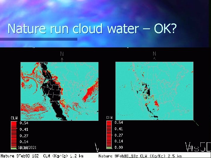
Nature run cloud water – OK? 10/16/2021 22
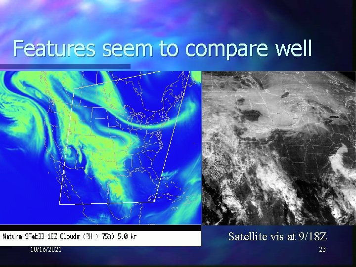
Features seem to compare well Satellite vis at 9/18 Z 10/16/2021 23

Summary q Nature Run completed q Conventional data files being prepared (50% finished) q Data assimilation experiments to begin in Feb. 10/16/2021 24
- Slides: 24