
Status of MODIS DSR and PAR MCD 18
- Slides: 1
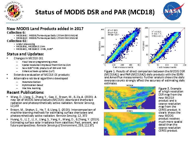
Status of MODIS DSR and PAR (MCD 18) New MODIS Land Products added in 2017 Collection 6: • MCD 18 A 1: MODIS/Terra+Aqua Daily L 3 5 km DSR SIN Grid • MCD 18 A 2: MODIS/Terra+Aqua Daily L 3 5 km PAR SIN Grid Collection 61: • Under processing • MCD 18 A 1, MCD 18 A 2: 1 km • MCD 18 C 1, MCD 18 C 2: CMG, 0. 05° Status and Updates: • Changes in MCD 18 C 61 – – • • Fixed known programming errors Spatial resolution improved from 5 km to 1 km New 0. 05° CMG products of DSR and PAR Enhanced look-up tables (LUT) Extensive evaluation of MCD 18 C 6 products Alternative retrieval algorithms developed – – – Parameterization Optimization-based Machine learning Recent Publications: • Wang, D. , Liang, S. , Zhang, Y. , Gao, X. , Brown, M. , & Jia, A. (2020). A new set of MODIS land products (MCD 18): downward shortwave radiation and photosynthetically active radiation. Remote Sensing, 12, 168 • Brown, M. , Skakun, S. , He, T. & Liang, S. (2020). Intercomparison of machine-learning methods for estimating surface shortwave and photosynthetically active radiation. Remote Sensing, 12, 372 • Huang, G. , Li, Z. , Li, X. , Liang, S. , Yang, K. , Wang, D. , & Zhang, Y. (2019). Estimating surface solar irradiance from satellites: Past, present, and future perspectives. Remote Sensing of Environment, 233, 111371 Figure 1. Results of direct comparison between the MODIS DSR (MCD 18 A 1) and PAR (MCD 18 A 2) daily products with the BSRN and Ameri. Flux measurements. Further analysis shows the daily overpass counts strongly affect the accuracy of estimating daily estimates. Figure 2. Example of a high resolution DSR map from the new MCD 18 product and a coarse resolution map from the CERES product. It clearly shows the new MODIS product resolves much more spatial detail than the coarse resolution CERES product.